|
List Of Schools In Calderdale
This is a list of schools in Calderdale in the English county of West Yorkshire. State-funded schools Primary schools * Abbey Park Academy, Illingworth * All Saints' CE Junior and Infant School, Halifax * Ash Green Community Primary School, Mixenden * Bailiffe Bridge Junior and Infant School, Bailiff Bridge * Barkisland CE Primary School, Barkisland * Beech Hill School, Halifax * Bolton Brow Primary Academy, Sowerby Bridge * Bowling Green Academy, Stainland * Bradshaw Primary School, Bradshaw * Burnley Road Academy, Mytholmroyd * Calder Primary School, Mytholmroyd * Carr Green Primary School, Rastrick * Castle Hill Primary School, Todmorden * Central Street Infant School, Hebden Bridge * Christ Church CE Junior School, Sowerby Bridge * Christ Church CE Primary School, Pellon * Cliffe Hill Community Primary School, Lightcliffe * Colden Junior and Infant School, Colden * Copley Primary School, Copley * Cornholme Junior and Infant School, Cornholme * Cross Lane Prima ... [...More Info...] [...Related Items...] OR: [Wikipedia] [Google] [Baidu] |
Calderdale
Calderdale is a metropolitan borough of West Yorkshire, England, whose population in 2020 was 211,439. It takes its name from the River Calder, and dale, a word for valley. The name Calderdale usually refers to the borough through which the upper river flows, while the actual landform is known as the Calder Valley. Several small valleys contain tributaries of the River Calder. Calderdale covers part of the South Pennines, and the Calder Valley is the southernmost of the Yorkshire Dales, though it is not part of the Yorkshire Dales National Park. The borough was formed in 1974 by the merger of six local government districts, from east to west Brighouse, Elland, Halifax, Sowerby Bridge, Hebden Bridge and Todmorden. Mytholmroyd, together with Hebden Bridge, forms Hebden Royd. Halifax is the commercial, cultural and administrative centre of the borough. Calderdale is served by Calderdale Council, which is headquartered in Halifax, with some functions based in Todmorden. History ... [...More Info...] [...Related Items...] OR: [Wikipedia] [Google] [Baidu] |
Lightcliffe
Lightcliffe is a village in the Calderdale district in West Yorkshire, England. Historically part of the West Riding of Yorkshire, it is situated approximately three miles east of Halifax and two miles north west of Brighouse. Lightcliffe was a separate parish in 1846 in the West Riding of Yorkshire."Lightcliffe" Online Visual Archive of Calderdale History (calderdale.gov.uk). Retrieved 7 December 2011. Lightcliffe is a dormitory village for people working in Halifax, Brighouse, and Bradford, and commuting to , |
Norland, West Yorkshire
Norland is a dispersed village south of Sowerby Bridge in the metropolitan borough of Calderdale in West Yorkshire, England. History Historically part of the West Riding of Yorkshire, the settlement dates back to the 13th century when it consisted of timber-framed farmhouses on the hillsides above the valleys of the Calder and Ryburn rivers. They were replaced by stone houses in the 17th and 18th centuries and housed workers in the woollen industry that developed at this time. As the industry thrived, some houses built by yeoman farmers were substantial such as Lower Old Hall (dated 1634) and Fallingworth Hall (dated 1642). Norland Hall, lower down on the hillside near Milner Royd, was typical of an older timber-framed building encased in stone in the late 17th century. In 1911 it was struck by lightning and dismantled in 1914. The American newspaper magnate William Randolph Hearst bought the stones in 1922 with the intention of re-building the hall in the USA ... [...More Info...] [...Related Items...] OR: [Wikipedia] [Google] [Baidu] |
Midgley
Midgley () is a hill-top village in Calderdale, West Yorkshire, England. It is situated approximately east from Burnley and west-north-west of Halifax, and just north of the A646 road. Nearby villages are Mytholmroyd to the west-south-west, and Hebden Bridge to the west-north-west. The village is part of the Luddendenfoot ward of the Metropolitan borough of Calderdale, part of the Metropolitan county of West Yorkshire. Midgley has a social committee to arrange events such as open gardens, village fetes, parties, quiz nights and wine tasting. A previous Co-op store has been refurbished to become a shop and community room staffed by volunteers; it opened in February 2010. Local primary education is provided by Midgley School. See also *Listed buildings in Luddendenfoot References External links *"Midgley West Riding" ''A Vision of Britain Through Time The Great Britain Historical GIS (or GBHGIS) is a spatially enabled database that documents and visualises the changi ... [...More Info...] [...Related Items...] OR: [Wikipedia] [Google] [Baidu] |
Luddendenfoot
Luddendenfoot or Luddenden Foot is a community in Calderdale, West Yorkshire, England. The population of Luddendenfoot is 2,547, with the wider Calderdale Ward (of the same name) at the 2011 Census as 10,653. It lies along the Upper Calder Valley below the village of Luddenden, between Sowerby Bridge and Mytholmroyd History The settlement grew up around the confluence of Luddenden Brook and the River Calder and the existence of the woollen textile industry. The industrial growth facilitated by the opening of the Rochdale Canal in 1804 and the opening of the Manchester and Leeds Railway in 1840. There were several mills including Boy Mill, Luddendenfoot Mill, Delph Mill and Denholme Mill. None of these mills remain in their original use. Between 1840 and 1962 the village was served by Luddendenfoot railway station. Luddendenfoot grew up around the industry along the river and brook, then later the canal; then the railway and then the A646 Burnley Road. In the late part of the ... [...More Info...] [...Related Items...] OR: [Wikipedia] [Google] [Baidu] |
Lee Mount
Lee may refer to: Name Given name * Lee (given name), a given name in English Surname * Chinese surnames romanized as Li or Lee: ** Li (surname 李) or Lee (Hanzi ), a common Chinese surname ** Li (surname 利) or Lee (Hanzi ), a Chinese surname * Lý (Vietnamese surname) or Lí (李), a common Vietnamese surname * Lee (Korean surname) or Rhee or Yi (Hanja , Hangul or ), a common Korean surname * Lee (English surname), a common English surname * List of people with surname Lee **List of people with surname Li ** List of people with the Korean family name Lee Geography United Kingdom * Lee, Devon * Lee, Hampshire * Lee, London * Lee, Mull, a location in Argyll and Bute * Lee, Northumberland, a location * Lee, Shropshire, a location * Lee-on-the-Solent, Hampshire * Lee District (Metropolis) * The Lee, Buckinghamshire, parish and village name, formally known as Lee * River Lee - alternative name for River Lea United States * Lee, California * Lee, Florida * Lee, Il ... [...More Info...] [...Related Items...] OR: [Wikipedia] [Google] [Baidu] |
Holywell Green
Holywell Green is a village in Calderdale, West Yorkshire, England. The village is situated approximately south-west of Elland, south of Halifax and north-west of Huddersfield. Holywell Green is part of the Greetland and Stainland Ward of Calderdale Council. History Holywell Green was recorded in the ''Domesday book'' as being "a small hamlet within the township of Stainland." It gets its name from St Helen's Well which was known within the area during medieval times. The original location of this well is uncertain. Geography Holywell Green is the name given to the east side of Stainland. It is based around Stainland Road and Station Road, and built on an east-facing hill. Since West View and Bradley View were built, Stainland and Holywell Green have been conjoined. Landmarks Shaw Park Shaw Park is the largest park in the area. The main entrance is located off Station Road. The park was the garden of Brooklands House until the house's demolition in 1930. In 1955, Raymon ... [...More Info...] [...Related Items...] OR: [Wikipedia] [Google] [Baidu] |
Heptonstall
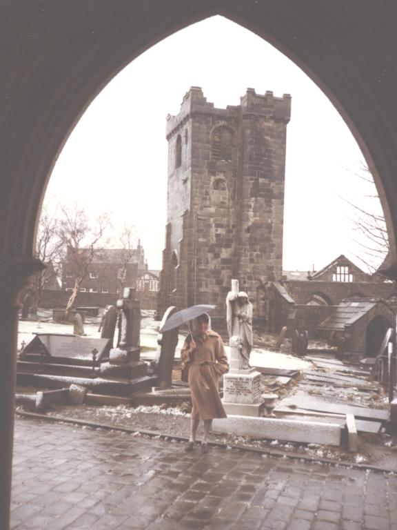
Heptonstall is a small village and civil parish within the Calderdale borough of West Yorkshire, England, historically part of the West Riding of Yorkshire. The population of Heptonstall, including the hamlets of Colden and Slack Top, is 1,448, increasing to 1,470 at the 2011 Census. The town of Hebden Bridge lies directly to the south-east. Although Heptonstall is part of Hebden Bridge as a post town, it is not within the Hebden Royd town boundaries. The village is on the route of the Calderdale Way, a circular walk around the hills and valleys of Calderdale. History Heptonstall is mentioned in the Domesday book in 1087. The place-name 'Heptonstall' is first recorded as ''Heptonstall'' in the 1274 Wakefield Court Rolls, and in 1316 in the ''Feudal Aids''. The name means "the stall or stable in Hebden". The name 'Hebden' means " rose-hip dene or valley". Heptonstall initially formed part of the manor of Halifax-cum-Heptonstall, itself subinfeudatory to the manor of Wake ... [...More Info...] [...Related Items...] OR: [Wikipedia] [Google] [Baidu] |
The Halifax Academy
The Halifax Academy (formerly Halifax High) is a mixed all-through school located in Halifax, West Yorkshire, England. The school is predominantly made up of children from a South Asian background. History The school's name derives from the original The Halifax High School, a school in a town centre Victorian building off Huddersfield Road. The school was relocated to The former Wellesley Barracks in 2005. The Duke of Wellington's regiment regimental depot was based at the barracks until 1958. Halifax High was formed in 1992 following the amalgamation of the Clare Hall and Haugh Shaw Schools. By 2003 the school was the tenth most improved in England according to government performance tables, and in 2007 was judged as 'outstanding' by Ofsted. It received a visit from the Queen in May 2004. The school was converted to academy status on 1 November 2013 and was renamed The Halifax Academy. Previously a secondary school for pupils aged 11 to 16, in September 2014 the school o ... [...More Info...] [...Related Items...] OR: [Wikipedia] [Google] [Baidu] |
Greetland
Greetland is a small village in the metropolitan borough of Calderdale in West Yorkshire, England. The appropriate Calderdale Ward is called Greetland and Stainland. The population of this ward at the 2011 Census was 11,389. It is located west of Elland and south of Halifax. In 1870–72, John Marius Wilson's ''Imperial Gazetteer of England and Wales'' described Greetland like this: "Greetland, a village and a chapelry in Halifax parish, W. R. Yorkshire. The village stands 1 mile W of Elland r. station, and 3 SSW of Halifax; and has a post office under Halifax. The chapelry is part of the township of Elland-cum-Greetland. Pop. 2, 584. There are stone quarries, and several large woollen, worsted, and cotton mills." History The village of Greetland may have been the site of a Roman settlement named ''Cambodunum''. A Roman altar stone dated to 208 AD was found in 1597 at Bank Top, Greetland. The village was served by the Greetland railway station from 1844 to 1962. On ... [...More Info...] [...Related Items...] OR: [Wikipedia] [Google] [Baidu] |
Ovenden
Ovenden is a village in West Yorkshire, England, next to Boothtown and Illingworth about a mile from Halifax town centre. It is also a Calderdale Ward whose population at the 2011 Census was 12,351. Ovenden railway station on the Halifax and Ovenden Junction Railway Line closed in 1955 to passengers but the line remained open until 1960 to allow freight train to access St Paul's station on the west side of Halifax. Ovenden rugby league club competed in the National Conference League up until 2015 before having to withdraw due to a lack of players and finance. Similarly, Ovenden West Riding football team folded in August 2016 for the same reason of not having enough players to field a team. The Ridings School in Ovenden gained national notoriety as one of the worst schools in the UK. It closed in 2009 and parts of it have been converted into a doctors surgery and sports centre with rest of the school leased to a not-for-profit organisation, Threeways, who plan to open a commu ... [...More Info...] [...Related Items...] OR: [Wikipedia] [Google] [Baidu] |
Elland
Elland is a market town in Calderdale, in the county of West Yorkshire, England. It is situated south of Halifax, by the River Calder and the Calder and Hebble Navigation. Elland was recorded as ''Elant'' in the Domesday Book of 1086. It had a population in 2001 of 14,554, with the ward being measured at 11,676 in the 2011 Census. Etymology The name of Elland is attested in the 1086 Domesday Book as ''Elant''. The name comes from the Old English words ''ēa'' ('river') and ''land'' ('land'); the name relates to the settlement's location on the south bank of the Calder.Harry Parkin, ''Your City's Place-Names: Leeds'', English Place-Name Society City-Names Series, 3 (Nottingham: English Place-Names Society, 2017). History Elland retained continuity of tenure from before the Norman Conquest into the Middle Ages, as the Elland family were descended from Anglo-Saxon thegns. The Manor of Elland, with Greetland and Southowram, formed an exclave of the Honour of Pontefract in ... [...More Info...] [...Related Items...] OR: [Wikipedia] [Google] [Baidu] |


