|
List Of Roman-to-modern Scheduled Monuments In Pembrokeshire
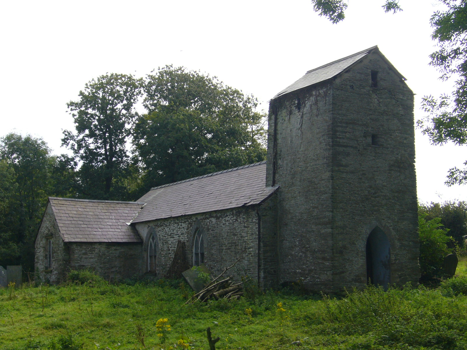
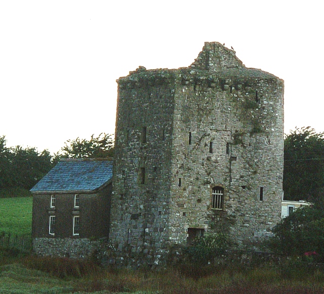
Pembrokeshire is the fifth-largest county in Wales, but has more scheduled monuments (526) than any other local authority area except Powys. This gives it an extremely high density of monuments, with 33.4 per 100km2. (Only the urban authority areas of Newport and Merthyr Tydfil have a higher density). With three-quarters of its boundary being coastline, Pembrokeshire occupies the western end of the West Wales peninsular, terminating with the tiny cathedral city of St David's. It is a historic county in its own right but between 1975 and 1996 it joined with Carmarthenshire and Cardiganshire to form Dyfed. Over two-thirds of Pembrokeshire's scheduled monuments (346) date to pre-historic times. Even this is too many entries to conveniently show in one list, so the list is subdivided into three, with all the Roman to modern entries on this list, and subdividing the prehistoric sites along the lines of the former local districts of Preseli Pembrokeshire, (the northern half) and Sou ... [...More Info...] [...Related Items...] OR: [Wikipedia] [Google] [Baidu] |
Pembrokeshire
Pembrokeshire ( ; cy, Sir Benfro ) is a Local government in Wales#Principal areas, county in the South West Wales, south-west of Wales. It is bordered by Carmarthenshire to the east, Ceredigion to the northeast, and the rest by sea. The county is home to Pembrokeshire Coast National Park. The Park occupies more than a third of the area of the county and includes the Preseli Hills in the north as well as the Pembrokeshire Coast Path. Historically, mining and fishing were important activities, while industry nowadays is focused on agriculture (86 per cent of land use), oil and gas, and tourism; Pembrokeshire's beaches have won many awards. The county has a diverse geography with a wide range of geological features, habitats and wildlife. Its prehistory and modern history have been extensively studied, from tribal occupation, through Roman times, to Welsh, Irish, Norman, English, Scandinavian and Flemish influences. Pembrokeshire County Council's headquarters are in the county ... [...More Info...] [...Related Items...] OR: [Wikipedia] [Google] [Baidu] |
Ambleston
Ambleston ( cy, Treamlod) is a village, parish, and community in Pembrokeshire, Wales, lying seven miles (11 km) north-north-east of Haverfordwest. The parish includes the hamlets of Wallis and Woodstock ( cy, Wstog). Name The English and Welsh placenames both mean "Amlot's farm", Amlot being a Norman-French personal name. Location and demographics The northern border of the parish is an ancient trackway leading towards St David's, which crosses through a Roman Roman or Romans most often refers to: *Rome, the capital city of Italy *Ancient Rome, Roman civilization from 8th century BC to 5th century AD *Roman people, the people of ancient Rome *'' Epistle to the Romans'', shortened to ''Romans'', a lette ... farmstead called "Castell Fflemish". This line is also the northern boundary of the cantref of Daugleddau, and was described by George Owen in 1602 as the language frontier, placing Ambleston in Little England beyond Wales. Ambleston was one of the parishes Owen ... [...More Info...] [...Related Items...] OR: [Wikipedia] [Google] [Baidu] |
Boncath
Boncath is a village, community and postal district in north Pembrokeshire, Wales, about west of Newcastle Emlyn. The village stands at a cross-roads linking the nearby settlements of Newchapel (''Capelnewydd''), Eglwyswrw, Blaenffos and Bwlchygroes. Formerly a hamlet around an inn, the village developed after the coming of the railway in 1885. History The name of the village comes from the Welsh word for buzzard, ''bwncath''. It was recorded on a pre-1850 historical parish map as in the parish of Llanfihangel Penbedw (St Michael) in the Hundred of Cilgerran. Llanfihangel Penbedw parish church, which dates from 1325 or earlier, was restored in 1859 but fell into disuse in the 1970s. Part of the village lies in Capel Colman parish. The Boncath Inn (formerly Tavern) has stood at the crossroads at least since 1862 when Thomas Rees, publican, farmer, and grocer, was listed as bankrupt in October 1862 and discharged in the December. Despite the coming of the railway, in 1890 Dav ... [...More Info...] [...Related Items...] OR: [Wikipedia] [Google] [Baidu] |
Celtic Inscribed Stone
Celtic inscribed stones are stone monuments dating from 400 to 1000 AD which have inscriptions in Celtic languages, Celtic or Latin text. These can be written in Ogham inscription, Ogham or Latin script, Roman letters. Some stones have both Ogham and Roman inscriptions. The stones are found in Ireland, Scotland, Wales, Brittany, the Isle of Man, and parts of western England (mainly Cornwall, Devon, and Lundy). Most seem to be grave-markers or memorials to a dead individual. The Celtic Inscribed Stones Project database records over 1,200 such inscriptions, excluding Runic ones. It maintains an online database of them. They relate to other standing stones with images, such as the Pictish stones of Scotland, or abstract decoration, such as the much earlier Irish Turoe Stone and Castlestrange Stone. Cornwall East Cornwall The Tristan Stone, perhaps of c. 550, is near Fowey, having been moved from just above the harbour at Polkerris. It has a Tau cross on one face, and on anothe ... [...More Info...] [...Related Items...] OR: [Wikipedia] [Google] [Baidu] |
Angle, Pembrokeshire
Angle ( cy, Angl) is a village, parish and community on the southern side of the entrance to the Milford Haven Waterway in Pembrokeshire, Wales. The village school has closed, as have one of the two pubs, the village shop (with a post office) and St Mary's church. There is a bus link to Pembroke railway station. The Sailors' Chapel, a Grade I listed building, is in the church graveyard.The Benefice Rev. Jones, accessed 30 August 2008 At Castle Farm, there is a and above Castle Bay there are the remains of an fort. On the headland there are visible remains of [...More Info...] [...Related Items...] OR: [Wikipedia] [Google] [Baidu] |
Cemetery
A cemetery, burial ground, gravesite or graveyard is a place where the remains of dead people are buried or otherwise interred. The word ''cemetery'' (from Greek , "sleeping place") implies that the land is specifically designated as a burial ground and originally applied to the Roman catacombs. The term ''graveyard'' is often used interchangeably with cemetery, but a graveyard primarily refers to a burial ground within a churchyard. The intact or cremated remains of people may be interred in a grave, commonly referred to as burial, or in a tomb, an "above-ground grave" (resembling a sarcophagus), a mausoleum, columbarium, niche, or other edifice. In Western cultures, funeral ceremonies are often observed in cemeteries. These ceremonies or rites of passage differ according to cultural practices and religious beliefs. Modern cemeteries often include crematoria, and some grounds previously used for both, continue as crematoria as a principal use long after the interment ... [...More Info...] [...Related Items...] OR: [Wikipedia] [Google] [Baidu] |
Stone Lined Graves - Geograph
In geology, rock (or stone) is any naturally occurring solid mass or aggregate of minerals or mineraloid matter. It is categorized by the minerals included, its chemical composition, and the way in which it is formed. Rocks form the Earth's outer solid layer, the crust, and most of its interior, except for the liquid outer core and pockets of magma in the asthenosphere. The study of rocks involves multiple subdisciplines of geology, including petrology and mineralogy. It may be limited to rocks found on Earth, or it may include planetary geology that studies the rocks of other celestial objects. Rocks are usually grouped into three main groups: igneous rocks, sedimentary rocks and metamorphic rocks. Igneous rocks are formed when magma cools in the Earth's crust, or lava cools on the ground surface or the seabed. Sedimentary rocks are formed by diagenesis and lithification of sediments, which in turn are formed by the weathering, transport, and deposition of existing rocks. M ... [...More Info...] [...Related Items...] OR: [Wikipedia] [Google] [Baidu] |
Marloes And St Brides
Marloes and St. Brides (Welsh: ''Marloes a Sain Ffraid'') is a community in the West Wales county of Pembrokeshire. The main settlements are the villages of Marloes and St Brides. Both villages lie on the southern shore of St Brides Bay The islands of Gateholm, Grassholm, Middleholm, Skomer, Skokholm and The Smalls The Smalls are a Canadian hard rock/metal band formed in 1989 in Edmonton, Alberta, Canada. They were influenced by jazz, hardcore punk, speed metal and country music. They were one of the most prominent Alberta bands in the second wave of per ... lie in the community. The community population taken at the 2011 census was 305. References External links Contact details for Marloes and St Brides Community Council Communities in Pembrokeshire {{Pembrokeshire-geo-stub ... [...More Info...] [...Related Items...] OR: [Wikipedia] [Google] [Baidu] |
Gateholm
Gateholm or Gateholm Island is a small tidal island off the south west coast of Pembrokeshire, in the community of Marloes and St Brides, in the south west side of Wales, in the west of the UK, and about 8 miles (13 km) west of the port of Milford Haven. It is known for its Romano-British remains. Gateholm is owned by the National Trust as part of their Marloes Sands and Mere estate. Name The name, recorded as ''Goteholme'' in 1480, derives from Old Norse for "goat island" or "street peninsula". Geography Gateholm is at the western end of Marloes Sands, and is accessible only at low tide. Gateholm rises to a small plateau 40 metres (131 feet) high, and with an area of about .John Buxton, Ronald Mathias Lockley, (1950), ''Island of Skomer:a preliminary survey of the natural history of Skomer Island, Pembrokeshire'', page 16. Staples Press The island consists of steeply-dipping Old Red Sandstone. The rock strata date from the Prídolí Epoch of the Silurian; the exceptiona ... [...More Info...] [...Related Items...] OR: [Wikipedia] [Google] [Baidu] |
Gateholm From Marloes
Gateholm or Gateholm Island is a small tidal island off the south west coast of Pembrokeshire, in the community of Marloes and St Brides, in the south west side of Wales, in the west of the UK, and about 8 miles (13 km) west of the port of Milford Haven. It is known for its Romano-British remains. Gateholm is owned by the National Trust as part of their Marloes Sands and Mere estate. Name The name, recorded as ''Goteholme'' in 1480, derives from Old Norse for "goat island" or "street peninsula". Geography Gateholm is at the western end of Marloes Sands, and is accessible only at low tide. Gateholm rises to a small plateau 40 metres (131 feet) high, and with an area of about .John Buxton, Ronald Mathias Lockley, (1950), ''Island of Skomer:a preliminary survey of the natural history of Skomer Island, Pembrokeshire'', page 16. Staples Press The island consists of steeply-dipping Old Red Sandstone. The rock strata date from the Prídolí Epoch of the Silurian; the exceptiona ... [...More Info...] [...Related Items...] OR: [Wikipedia] [Google] [Baidu] |
Llanddewi Velfrey
Llanddewi Velfrey or Llandewi Velfrey (also Llan-ddewi-vel-vre) ( cy, Llanddewi Efelffre) is a village, parish and Community (Wales), community of Pembrokeshire in West Wales. Historically it was in the Narberth Hundred. The village is in Lampeter Vale, northeast of Narberth, Pembrokeshire, Narbeth along the A40 road, A40. In 1831 it had a population of 710 people. In 2011 the population was 393. The village is situated in a rich and fertile vale, watered by the river Tâf, which separates the parish from that of Llangain in the county of Carmarthen. The lands are wholly enclosed and in a good state of cultivation, and the soil is eminently fertile. Landmarks St. David's Church and related buildings The church, dedicated to St. David, is remarkable for the simplicity of its architecture, and displays evident features of a very remote antiquity: an elegant mural tablet of white marble, to the memory of the late David Lewis, Esq., of Hênllan and his youngest daughter, which were p ... [...More Info...] [...Related Items...] OR: [Wikipedia] [Google] [Baidu] |


