|
List Of Rivers Of Israel
This is a list of rivers of Israel. This list is arranged by drainage basin, with respective tributaries indented under each larger stream's name. Nahal (Hebrew) and Wadi (Arabic) commonly translate to Stream, more seldom River. Streams entirely on the West Bank are not listed here. Mediterranean Sea Rivers emptying into the Mediterranean Sea, listed from north to south. * Nahal Betzet (Arabic: Wadi Karkara) *Nahal Kziv (Arabic: Wadi al-Qarn) *Ga'aton River *Na'aman River (Hebrew: Nahal Na'aman, Arabic: Nahr al-Na'mein), ancient Belus River *Kishon River ** (Arabic: Wadi Abu Alhiya), formerly Nahal Nahash * Nahal Taninim (Arabic: Wadi az-Zarqa) *Hadera Stream (Arabic: Nahr Akhdar) * Nahal Alexander * Nahal Poleg (Arabic: Wadi al-Faliq) *Yarkon River **Wadi Qana or Qanah (Hebrew: Nahal Qanah) ** Ayalon River (Arabic: Wadi Musrara) ** (Arabic: Wadi Amuriya) *Nahal Sorek (Arabic: Wadi al-Sarar) *Lakhish River (Arabic: Wadi Suqrir) * or Shiqma (Arabic: Wadi el-Hesi), location of an i ... [...More Info...] [...Related Items...] OR: [Wikipedia] [Google] [Baidu] |
Mediterranean Sea
The Mediterranean Sea is a sea connected to the Atlantic Ocean, surrounded by the Mediterranean Basin and almost completely enclosed by land: on the north by Western and Southern Europe and Anatolia, on the south by North Africa, and on the east by the Levant. The Sea has played a central role in the history of Western civilization. Geological evidence indicates that around 5.9 million years ago, the Mediterranean was cut off from the Atlantic and was partly or completely desiccated over a period of some 600,000 years during the Messinian salinity crisis before being refilled by the Zanclean flood about 5.3 million years ago. The Mediterranean Sea covers an area of about , representing 0.7% of the global ocean surface, but its connection to the Atlantic via the Strait of Gibraltar—the narrow strait that connects the Atlantic Ocean to the Mediterranean Sea and separates the Iberian Peninsula in Europe from Morocco in Africa—is only wide. The Mediterranean Sea e ... [...More Info...] [...Related Items...] OR: [Wikipedia] [Google] [Baidu] |
HaBesor Stream
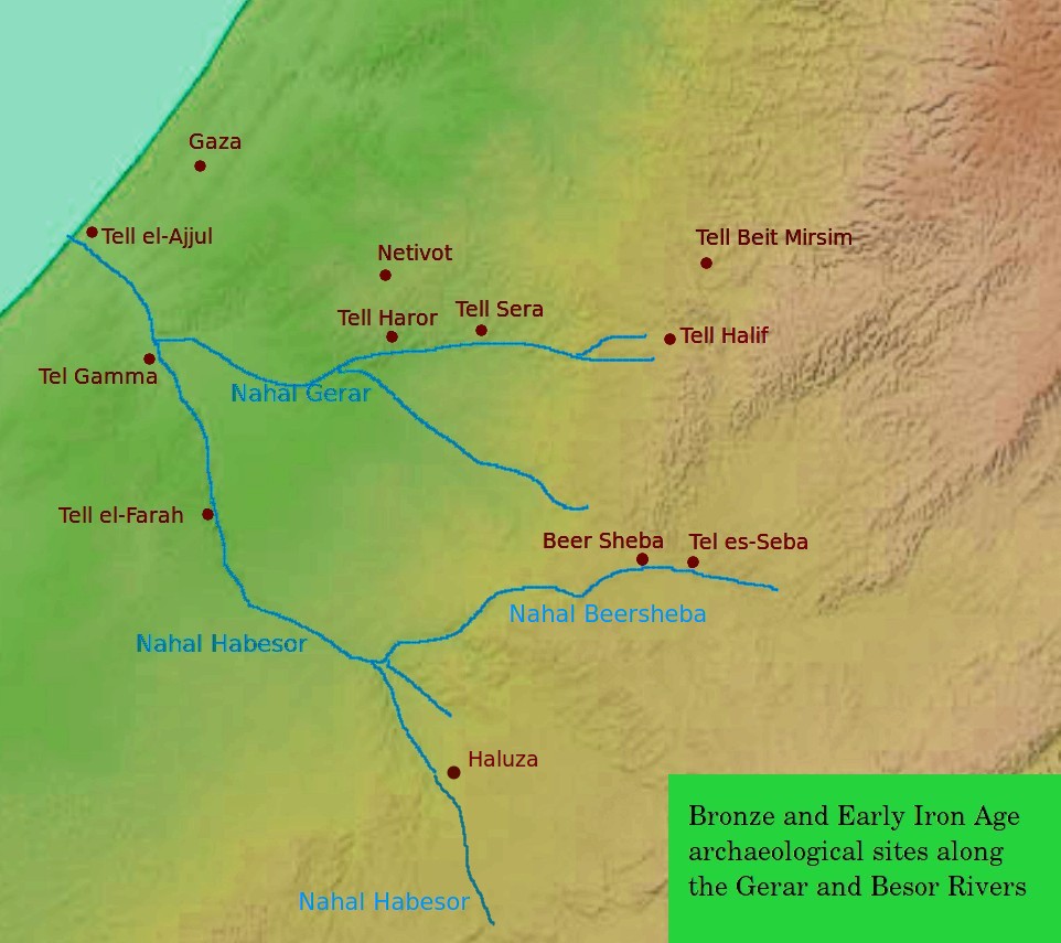
The Besor ( he, נחל הבשור, ''Nahal HaBesor'') is a wadi in southern Israel. The stream begins at Mount Boker (near Sde Boker), and spills into the Mediterranean Sea near Al-Zahra in the Gaza Strip, where it is called Wadi Gaza ( ar, وادي غزة, Wadi Ghazzeh), also spelled Wadi Ghazza or Wadi 'Azza. Further upstream it is marked as Wadi esh-Shallaleh on the 1878 Survey of Western Palestine map. There are several important archaeological sites located in this area. The stream is the largest in the northern Negev, and together with its largest tributaries, the Nahal Gerar, and the Beersheba stream, reaches as far east into the desert as Sde Boker, Yeruham, Dimona and Arad/Tel Arad. The Gaza section of the Coastal Aquifer is the only significant source of water in the Gaza Strip. The Wadi Gaza runs through a wetland, the Gaza Valley, and as of 2012 it is used as a wastewater dump. History In the Old Testament Besor was a ravine or brook in the extreme south-west of Ju ... [...More Info...] [...Related Items...] OR: [Wikipedia] [Google] [Baidu] |
Nahal Tavor
Nahal Tavor ( he, נחל תבור; ar, وادي البيره, ''Wadi al-Bireh''), ''lit.'' Tabor Stream, is an intermittent stream in the Lower Galilee, Israel. Geography The stream starts in the hills of Nazareth, east of the city, and runs east and south of Mount Tabor, where it turns east and then empties into the Jordan River between Gesher and Belvoir Fortress. Three springs feed the stream within the boundaries of the Nahal Tavor Nature Reserve: Ein Rechesh, Ein Ze'ev, and Ein Shachal. Ein Rechesh is near Tel Rekhesh, an archaeological tell thought to be Anaharath, a town mentioned in the description of one of Thutmose III's campaigns, and also in , describing the allotment of the Tribe of Issachar. Near Kibbutz Gazit, the stream runs through a basalt canyon. Nature reserve The Tabor Stream received nature reserve status in 1974. The nature reserve encompasses the stream from the area near Kfar Kish up to Highway 90. Flora includes Tamarix, Willow, ''Ziziphus spin ... [...More Info...] [...Related Items...] OR: [Wikipedia] [Google] [Baidu] |
Yarmouk River
The Yarmuk River ( ar, نهر اليرموك, translit=Nahr al-Yarmūk, ; Greek: Ἱερομύκης, ; la, Hieromyces or ''Heromicas''; sometimes spelled Yarmouk), is the largest tributary of the Jordan River. It runs in Jordan, Syria and Israel, and drains much of the Hauran plateau. Its main tributaries are the wadis of 'Allan and Ruqqad from the north, Ehreir and Zeizun from the east. Although it is narrow and shallow throughout its course, at its mouth it is nearly as wide as the Jordan, measuring thirty feet in breadth and five in depth. The once celebrated Matthew Bridge used to cross the Yarmuk at its confluence with the Jordan. History Yarmuk forms a natural border between the plains to the north - Hauran, Bashan and Golan - and the Gilead mountains to the south. Thus it has often served as boundary line between political entities. Neolithic The Yarmukian is a Pottery Neolithic culture that inhabited parts of Palestine and Jordan. Its type site is at Sha'ar HaGolan, on ... [...More Info...] [...Related Items...] OR: [Wikipedia] [Google] [Baidu] |
Nahal Amud
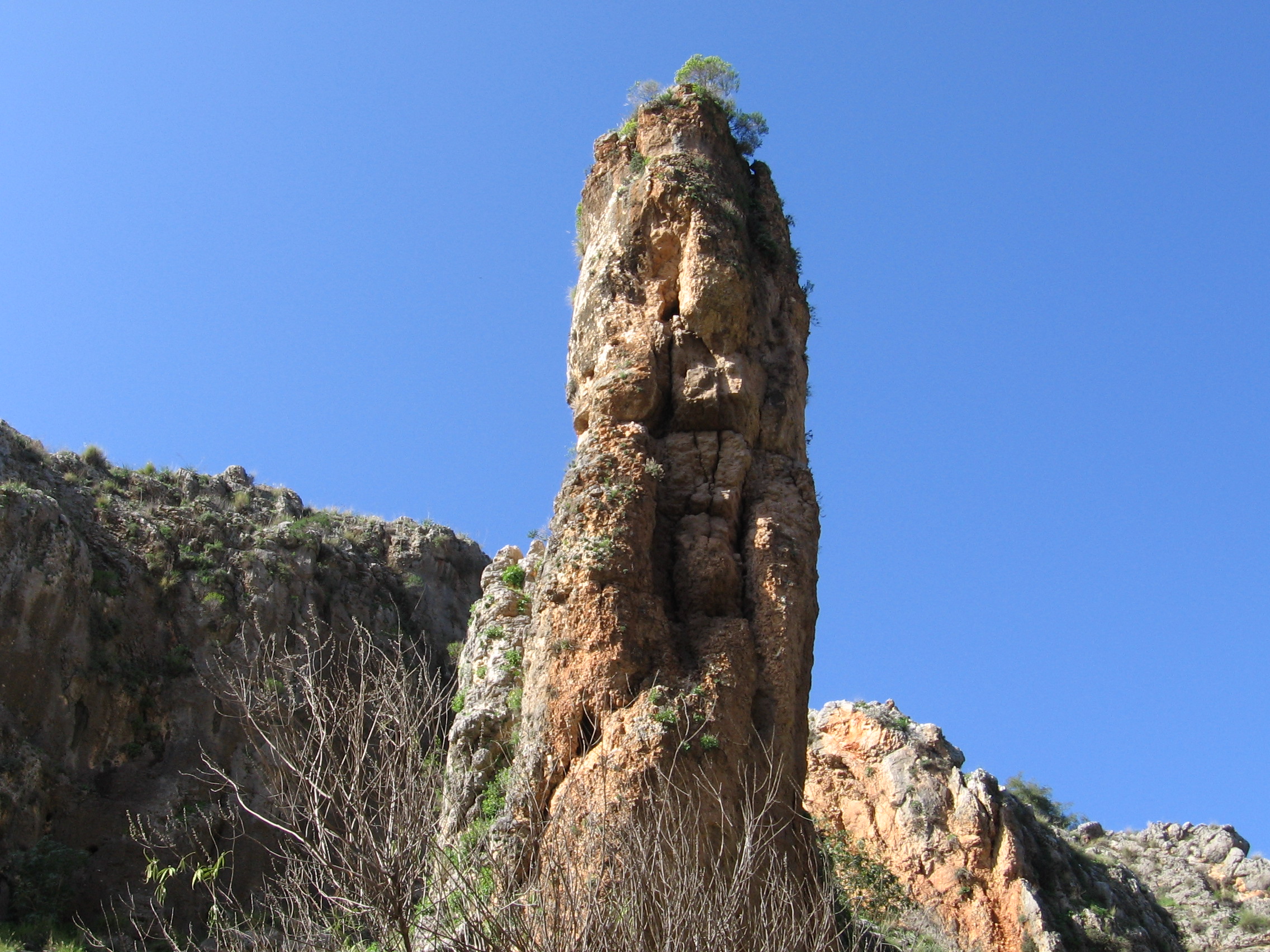
Nahal Amud ( he, נחל עמוד), also known as the Wadi al-Amud, is a stream in the Upper Galilee region of Israel that flows into the Sea of Galilee. History The source of the stream, Ramat Dalton, is located 800 meters above sea level. Its drainage basin includes the peaks of Birya Fortress, Mount Canaan (955 meters) and Mount Meron (1,204 meters) and flows south through eastern Galilee to the northwest part of the Sea of Galilee – a height of less than 200 meters below sea level. The stream is named after a Column, pillar that rises high above ground and is located near a channel of the stream near Kibbutz Hukok. The gorge that forms the channel at this point holds many caves once inhabited by ''Homo heidelbergensis'' and later by Neanderthal Man such as the cave at Zuttiyeh and the Amud cave. They were the object of the first Paleoanthropology, paleoanthropological excavations in Mandatory Palestine in 1925–1926. The caves contained hominin remains as well as Mousterian ... [...More Info...] [...Related Items...] OR: [Wikipedia] [Google] [Baidu] |
Nahal Korazim
Nahal ( he, נח"ל) (acronym of ''Noar Halutzi Lohem'', lit. Fighting Pioneer Youth) is a program that combines military service with mostly social welfare and informal education projects such as youth movement activities, as well as training in entrepreneurship in urban development areas. Prior to the 1990s it was a paramilitary Israel Defense Forces program that combined military service and the establishment of agricultural settlements, often in peripheral areas. The Nahal groups of soldiers formed the core of the Nahal Infantry Brigade. History In 1948, a ''gar'in'' (core group) of Jewish pioneers wrote to Prime Minister David Ben-Gurion requesting that members be allowed to do their military service as a group rather than being split up into different units at random. In response to this letter, Ben-Gurion created the Nahal program, which combined military service and farming. Some 108 kibbutzim and agricultural settlements were established by the Nahal, many of them on ... [...More Info...] [...Related Items...] OR: [Wikipedia] [Google] [Baidu] |
Nahal Dishon
The Dishon Stream ( he, נחל דישון, Nahal Dishon) is an intermittent stream/''wadi'' in Upper Galilee, Israel. It ins of 26 miles long, starts on the eastern slope of Mount Meron and drains into the Jordan River in the area of the drained . It is one of the largest streams in East Upper Galilee. Its name is a modification of the name of the depopulated Palestinian village of Dayshum. mindat.org reports the following Arabic names associated with the stream: Wadi 'Uba (Ouadi Ouba), Wadi Fara, Wādi Hindāj, Wadi Nab' el Balat, Wadi Nasir. Parts of the Israel National Trail run through the Dishon valley. Parts of the stream are in the Nahal Dishon Reserve (the central part of the stream) and the Reserve (parts of the slopes of the valley). Major tributaries: :he:נחל אביב, :he:נחל גוש חלב, :he:נחל צבעון. Route 886 runs along the Dishon Stream for the whole length of the Dishon Stream Reserve. It used to be marked for SUV A sport utili ... [...More Info...] [...Related Items...] OR: [Wikipedia] [Google] [Baidu] |
Nahal Ayun
Nahal Ayun ( he, נחל עיון, ''lit.'' Ayun Stream), sometimes spelled Nahal Iyyon, in ar, براغيث ''Bureighit'', or in full Nahr Bareighit, is a perennial stream and a tributary of the Jordan River. The stream originates from two springs in the Marjayoun (Merj 'Ayun) valley in southern Lebanon, runs southward for seven kilometers through various irrigation ditches, then flows into Israel near Metulla, where it continues through the Hula Valley in the Galilee Panhandle until emptying in the Hasbani River just before it reaches the Jordan River. Names Arabic The Arabic name is most often transliterated as "Dardara" for the upper course and "Bareighit" or "Bureighith" for the lower one. The "Memoirs of the Survey of Western Palestine", published in 1881 in connection with the maps resulting from the 1870s Survey, use a slightly different spelling; the "very large spring" of a 'Ain ed Derdarah, ''lit.'' "the spring of the ''derdârah'' (elm) tree", from the village of El ... [...More Info...] [...Related Items...] OR: [Wikipedia] [Google] [Baidu] |
Hasbani River
The Hasbani River ( ar, الحاصباني / ALA-LC: ''al-Ḥāṣbānī''; he, חצבני ''Ḥatzbaní'') or Snir Stream ( he, נחל שניר / ''Nahal Sənir''), is the major tributary of the Jordan River. Local natives in the mid-19th century knew the river as the Upper Jordan. The Hasbani River derives most of its discharge from two springs in Lebanon, the Wazzani and the Haqzbieh, the latter being a group of springs on the uppermost Hasbani. The Hasbani runs for in Lebanon before crossing the border at Ghajar and shortly after joining with the Banias and Dan Rivers at a point in northern Israel, to form the River Jordan. For about downstream of Ghajar, the Hasbani forms the border between Lebanon and the Golan Heights. The Wazzani's and the Haqzbieh's combined discharge averages 138 million m³ per year. About 20% of the Hasbani flow emerges from the Wazzani Spring at Ghajar, close to the Lebanese-Golan Heights border, about west of the base of Mount Hermon. The ... [...More Info...] [...Related Items...] OR: [Wikipedia] [Google] [Baidu] |
Dan River (Israel)
The Dan River ( he, דן ''Dan'', ar, اللدان ''Leddan'') is a tributary of the Jordan River. The sources of the river are multiple springs emerging from Tel Dan along underground fault lines. The river is so named after the Israelite city of Dan, which was captured by the Tribe of Dan during the Judges period. The tribe of Dan conquered the city, then named Laish and then occupied by Canaanites. Although the Dan River itself is only about 20 km (12 miles) long, its flow provides up to 238 million cubic meters of water annually to the Hulah Valley. In 1966, this was a cause of dispute between Israeli water planners and conservationists, with the latter prevailing after three years of court appeals and adjudication. The result was a conservation project of about at the source of the river called the Tel Dan Nature Reserve Dan ( he, דן) is an ancient city mentioned in the Hebrew Bible, described as the northernmost city of the Kingdom of Israel, and belonging to ... [...More Info...] [...Related Items...] OR: [Wikipedia] [Google] [Baidu] |
Banias River
Banias River ( ar, نهر بانياس Nahr Baniyas; he, נחל חרמון Nahal Hermon) is a river in the Golan Heights. It is the easternmost of the three main northern tributaries of the Jordan River; together with the Dan River and the Snir Stream, it forms the Jordan River's upper catchment (UCJR). Israel has included the stream in the Hermon nature reserve. Course and streamflow The main source of the Banias River is the Banias spring, located at the southern base of the Hermon mountain range and contributing a discharge of 67·million m3 annually. From there the stream flows south for nine kilometers before draining into the Dan River. Along the way, it drains the Guvta Stream (right), the Sa'ar Stream (left), the Pera' Stream (left), and the Sion (Ar.: el-'Asl) Stream (right), with a total drainage area of 158 km2. The total annual streamflow of the river comes to 106 million m3. Flora and fauna The banks of the river abound in willow trees, oriental planes, silver-l ... [...More Info...] [...Related Items...] OR: [Wikipedia] [Google] [Baidu] |
Jordan River
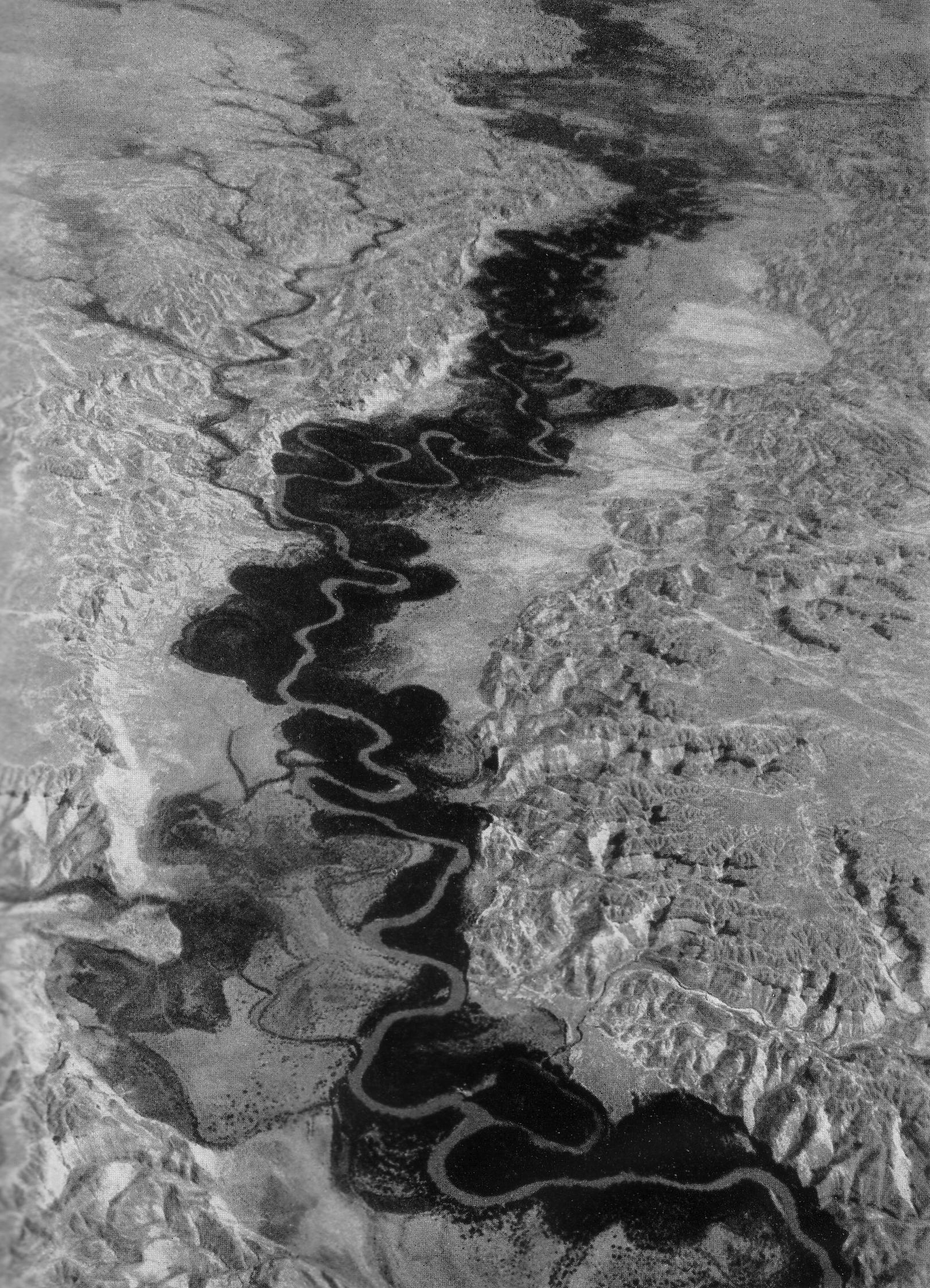
The Jordan River or River Jordan ( ar, نَهْر الْأُرْدُنّ, ''Nahr al-ʾUrdunn'', he, נְהַר הַיַּרְדֵּן, ''Nəhar hayYardēn''; syc, ܢܗܪܐ ܕܝܘܪܕܢܢ ''Nahrāʾ Yurdnan''), also known as ''Nahr Al-Sharieat'' ( ar, نهر الشريعة), is a river in the Middle East that flows roughly north to south through the Sea of Galilee (Hebrew: כנרת Kinneret, Arabic: Bohayrat Tabaraya, meaning Lake of Tiberias) and on to the Dead Sea. Jordan and the Golan Heights border the river to the east, while the West Bank and Israel lie to its west. Both Jordan and the West Bank take their names from the river. The river holds major significance in Judaism and Christianity. According to the Bible, the Israelites crossed it into the Promised Land and Jesus of Nazareth was baptized by John the Baptist in it. Geography The Jordan River has an upper course from its sources to the Sea of Galilee (via the Bethsaida Valley), and a lower course south of ... [...More Info...] [...Related Items...] OR: [Wikipedia] [Google] [Baidu] |


%2C_Lower_Galilee%2C_Israel_(2).jpg)


