|
List Of Protected Areas Of Quebec
This list of protected areas of Quebec includes federally, provincially and municipally administered parks and wildlife reserves in Quebec, the largest province in Canada. National Parks Note that both federally and provincially administered parks in Quebec are labelled ''"parc national"'' (national park). Federal national parks are distinguished by the addition of "of Canada" in their official name. Parks Canada The following parks are managed by Parks Canada: * Forillon National Park of Canada * La Mauricie National Park of Canada * Mingan Archipelago National Park Reserve of Canada * Saguenay–St. Lawrence Marine Park, a National Marine Conservation Area (jointly with Sépaq) Sépaq In Quebec, provincial parks are called "national parks", and are managed by the ''Société des établissements de plein air du Québec'', also known as Sépaq. Aquatic, Biodiversity, and Ecological Reserves of Quebec The ecological reserves, [...More Info...] [...Related Items...] OR: [Wikipedia] [Google] [Baidu] |
Sainte-Praxède, Quebec
Sainte-Praxède is a parish municipality located in Les Appalaches Regional County Municipality in the Chaudière-Appalaches region of Quebec, Canada. Its population was 363 as of the Canada 2011 Census. It was named after Catholic saint Praxedes. Demographics In the 2021 Census of Population conducted by Statistics Canada Statistics Canada (StatCan; french: Statistique Canada), formed in 1971, is the agency of the Government of Canada commissioned with producing statistics to help better understand Canada, its population, resources, economy, society, and cultur ..., Sainte-Praxède had a population of living in of its total private dwellings, a change of from its 2016 population of . With a land area of , it had a population density of in 2021. References Commission de toponymie du Québec [...More Info...] [...Related Items...] OR: [Wikipedia] [Google] [Baidu] |
Lambton, Quebec
Lambton is a municipality of about 1600 people in Le Granit Regional County Municipality in the Estrie region of Quebec Quebec ( ; )According to the Canadian government, ''Québec'' (with the acute accent) is the official name in Canadian French and ''Quebec'' (without the accent) is the province's official name in Canadian English is one of the thirte ..., Canada. Lambton is mostly rural and agricultural area with some business on the two main roads in town. Transportation The main roads connecting Lambton are Route 108 and Route 263. References External links * Municipalities in Quebec Incorporated places in Estrie Le Granit Regional County Municipality {{Estrie-geo-stub ... [...More Info...] [...Related Items...] OR: [Wikipedia] [Google] [Baidu] |
Adstock, Quebec
Adstock is a municipality in the Les Appalaches Regional County Municipality in the Chaudière-Appalaches region of Quebec, Canada. Its population in the Canada 2016 Census was 2,806. Adstock was created on February 14, 2001, after the amalgamation of Saint-Méthode-de-Frontenac, Quebec, Saint-Méthode-de-Frontenac and Sacré-Coeur-de-Marie-Partie-Sud, Quebec, Sacré-Coeur-de-Marie-Partie-Sud. On October 24, 2001, Sainte-Anne-du-Lac, Chaudière-Appalaches, Quebec, Sainte-Anne-du-Lac joined the new municipality. Adstock was named after the township in which the former municipality of Saint-Méthode-de-Frontenac lies. The township was itself named after the village of Adstock in Buckinghamshire, England. References External links * {{authority control Municipalities in Quebec Incorporated places in Chaudière-Appalaches ... [...More Info...] [...Related Items...] OR: [Wikipedia] [Google] [Baidu] |
Frontenac National Park
Frontenac National Park (french: Parc national de Frontenac) is a 156.5 km2 provincial park in southeastern Quebec, Canada, created in 1987 and governed by Société des établissements de plein air du Québec. The park is located along Lac Saint-François roughly halfway between Quebec City and Sherbrooke. The nearest city is Thetford Mines. See also * National Parks of Canada * List of National Parks of Canada *List of Quebec national parks This list of protected areas of Quebec includes federally, provincially and municipally administered parks and wildlife reserves in Quebec, the largest province in Canada. National Parks Note that both federally and provincially adminis ... References External linksOfficial site National parks of Quebec Protected areas of Chaudière-Appalaches Protected areas of Estrie Protected areas established in 1987 1987 establishments in Quebec {{Canada-protected-area-stub ... [...More Info...] [...Related Items...] OR: [Wikipedia] [Google] [Baidu] |
Saint-Fabien, Quebec
Saint-Fabien is a parish municipality in the Canadian province of Quebec, located in the Rimouski-Neigette Regional County Municipality. Demographics In the 2021 Census of Population conducted by Statistics Canada, Saint-Fabien had a population of living in of its total private dwellings, a change of from its 2016 population of . With a land area of , it had a population density of in 2021. See also * List of parish municipalities in Quebec This is a list of municipalities that have the Quebec municipal type of parish municipality (''paroisse'', code=P), an administrative division defined by the Ministry of Municipal Affairs, Regions and Land Occupancy. The ''Commission de toponymi ... References External links * Parish municipalities in Quebec Incorporated places in Bas-Saint-Laurent {{BasSaintLaurent-geo-stub ... [...More Info...] [...Related Items...] OR: [Wikipedia] [Google] [Baidu] |
Rimouski
Rimouski ( ) is a city in Quebec, Canada. Rimouski is located in the Bas-Saint-Laurent region, at the mouth of the Rimouski River. It has a population of 48,935 (as of 2021). Rimouski is the site of Université du Québec à Rimouski (UQAR), the Cégep de Rimouski (which includes the Institut maritime du Québec) and the Music Conservatory. It is also the home of some ocean sciences research centres ( see below). History The city was founded by Sir René Lepage de Ste-Claire in 1696. Originally from Ouanne in the Burgundy region, he exchanged property he owned on the Île d'Orléans with Augustin Rouer de la Cardonnière for the Seigneurie of Rimouski, which extended along the St. Lawrence River from the Hâtée River at Le Bic to the Métis River. De la Cardonnière had been the owner of Rimouski since 1688, but had never lived there. René Lepage moved his family to Rimouski, where it held the seigneurie until 1790, when it was sold to the Quebec City businessman Joseph Drapeau. ... [...More Info...] [...Related Items...] OR: [Wikipedia] [Google] [Baidu] |
Bic National Park
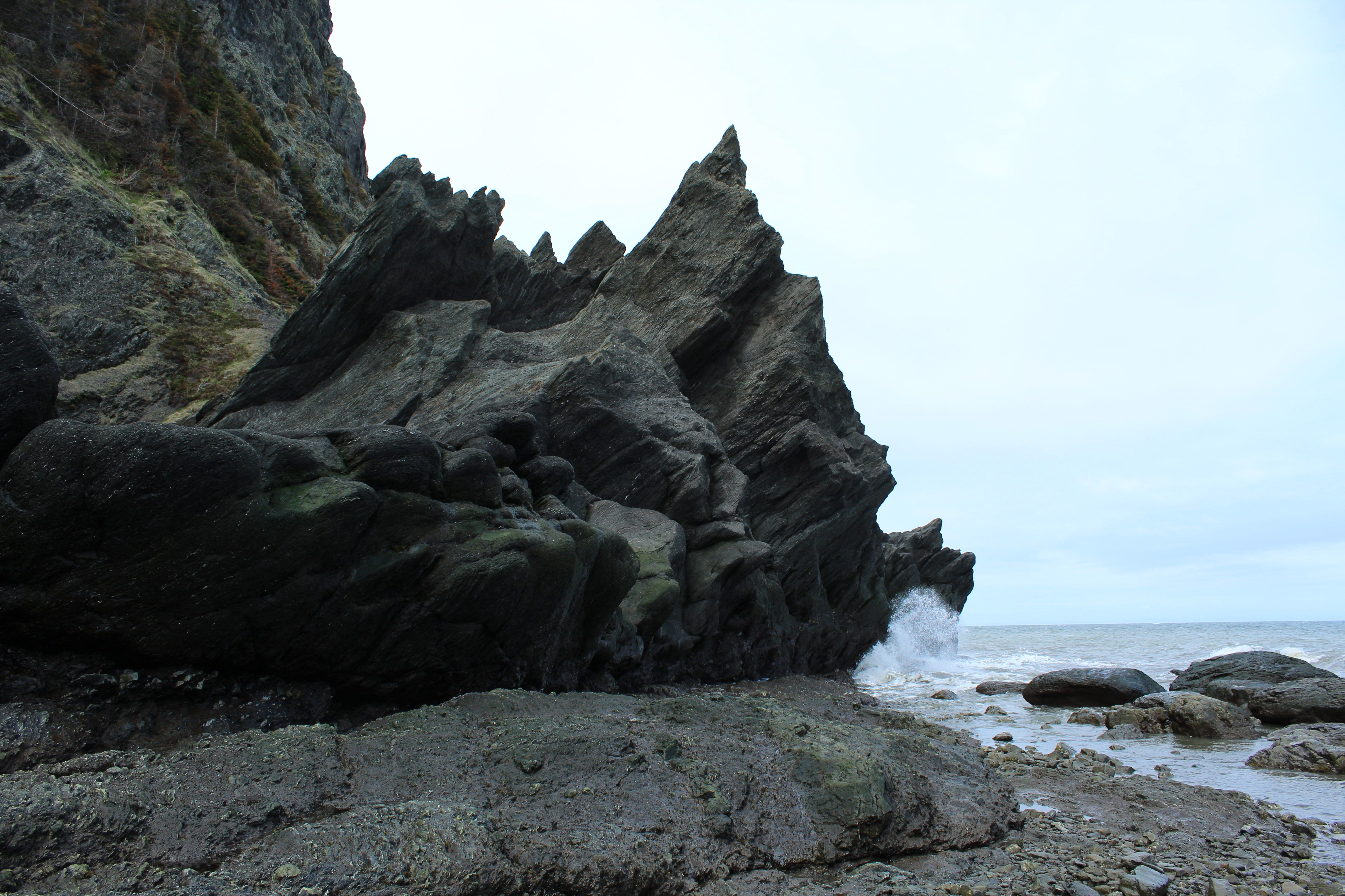
Bic National Park is an national park of Quebec, Canada, located on the south shore of the St. Lawrence River, near the villages of Le Bic and Saint-Fabien, southwest of Rimouski. It was founded on October 17, 1984, and is home to large populations of harbour seals and grey seals. Its highest point is Pic Champlain at . Slightly less than half of the park is a coastal marine environment. The park is owned by the Ministry of Sustainable Development, Environment and Parks of Quebec. It is managed by the Société des établissements de plein air du Québec (SÉPAQ). Bic National Park is typical of the southern coast of the Gulf of St. Lawrence, containing several characteristics of this region: * Low-flow rivers (la rivière du Sud-Ouest) * Salt marshes (the marsh at Pointe-au-Spruce) * Rocky hills with a very steep northern slope and a relatively gentle southern slope (Pic Champlain, Citadelle, Cap-l'Original, etc.) History Human occupation of Bic dates back almost 7,000 year ... [...More Info...] [...Related Items...] OR: [Wikipedia] [Google] [Baidu] |

