|
List Of Hindu Temples In Pakistan
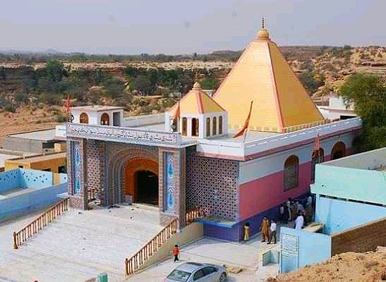
The major Hindu temples in Pakistan are Shri Hinglaj Mata temple (whose annual Hinglaj Yatra is the largest Hindu pilgrimage in Pakistan, which is participated by more than 250,000 pilgrims), Shri Ramdev Pir temple (whose annual Ramdevpir Mela in the temple is the second largest Hindu pilgrimage in Pakistan, Umarkot Shiv Mandir (famous for its annual Shivrathri festival, which is one of the biggest religious festivals in Pakistan, and the Churrio Jabal Durga Mata Temple (famous for Shivrathri celebrations which is attended by 200,000 pilgrims). Pakistan administrated Jammu and Kashmir Bhimber District * Shiv Temple at Barnala Kotli District * Banganga Temple at Khuiratta * Hindu Temples at Kotli City Mirpur District * Baba Balaji Temple at Ratta, Dadyal * Raghunath Temple at Mangla Dam Lake [...More Info...] [...Related Items...] OR: [Wikipedia] [Google] [Baidu] |
Guru Balpuri Ashram
Guru ( sa, गुरु, International Alphabet of Sanskrit Transliteration, IAST: ''guru;'' Pali'': garu'') is a Sanskrit term for a "mentor, guide, expert, or master" of certain knowledge or field. In pan-Indian religions, Indian traditions, a guru is more than a teacher: traditionally, the guru is a reverential figure to the disciple (or ''wikt:शिष्य, shisya'' in Sanskrit, literally ''seeker [of knowledge or truth'']) or student, with the guru serving as a "counselor, who helps mold values, shares experiential knowledge as much as Knowledge#Hinduism, literal knowledge, an Role model, exemplar in life, an inspirational source and who helps in the spiritual evolution of a student". Whatever language it is written in, Judith Simmer-Brown explains that a tantra, tantric spiritual text is often codified in an obscure twilight language so that it cannot be understood by anyone without the verbal explanation of a qualified teacher, the guru. A guru is also one's spiritual gui ... [...More Info...] [...Related Items...] OR: [Wikipedia] [Google] [Baidu] |
Mangla Dam
The Mangla Dam ( ur, ) is a multipurpose dam situated on the Jhelum River in the Mirpur District of Azad Kashmir. It is the sixth-largest dam in the world. The village of Mangla, which sits at the mouth of the dam, serves as its namesake. In November 1961, the project's selected contractors were revealed; it was announced that ''Binnie & Partners'', a British engineering firm, was going to serve as the lead designers, engineers, and inspectors for the construction of the dam (led by Geoffrey Binnie). The project was undertaken by a consortium known as the Mangla Dam Contractors, which consisted of eight American construction firms sponsored by the ''Guy F. Atkinson Company'' based in South San Francisco, California. Background As part of the Indus Waters Treaty signed in 1960, India gained rights to the waters of the Ravi, Sutlej and Beas rivers, while Pakistan, in addition to the waters of the aforementioned three rivers' sections within Pakistani territory and some mone ... [...More Info...] [...Related Items...] OR: [Wikipedia] [Google] [Baidu] |
Hingol National Park
Hingol National Park or Hungol National Park ( ur, ) is the largest national park in Pakistan, located in the Makran coastal region. The park covers an area of about and is located 190 km from Karachi in the three districts of Gwadar, Lasbela and Awaran in Balochistan. Hingol was declared a national park in 1988. The park is named after the southern part of the Hangul River which flows along the shores of the Arabian Sea and is home to large numbers of waterfowl and a wealth of marine life. Hangul National Park contains six distinct ecosystems as well as both desert and plains regions, making it unique among the national parks of Pakistan. The park is bordered by a dense forest to the north, a barren mountain range to the south, and the Hangul River tributary, which is home to thousands of migratory birds and marsh crocodiles. The Gulf of Oman and the Arabian Sea are also to the south. The park’s unique rock formations have been attracting tourists from all over the ... [...More Info...] [...Related Items...] OR: [Wikipedia] [Google] [Baidu] |
Lasbela District
Lasbela District (Urdu and bal, , Sindhi Lasi: لسبيلو) is a coastal district of Balochistan province of Pakistan. It is also called Sassi-Punnu Garh () among localites. History Alexander the Great passed through Lasbela on his way back to Babylon after conquering Northwestern India. In 711 CE, the Arab general. Muhammad bin Qasim passed through Lasbela on his way to Sindh. The area of the district was formerly a princely state of British India, which later merged with Pakistan. The name is derived from the words Las which signifies a plain the greater part of the area being a flat plain, and Bela which means "jungle" and is also the name of the principal town of this district. State of Las Bela has an area of 18,254 km². Capital: Las Bela. Languages: Balochi and Sindhu. 1742, Las Bela State refounded Las Bela (Area: 15,472 km) accedes to Pakistan joins Balochistan States Union state stinguished, 17 Mar 1948, Las Bela (Area: 15,472 km) accedes to Pakistan 03 ... [...More Info...] [...Related Items...] OR: [Wikipedia] [Google] [Baidu] |
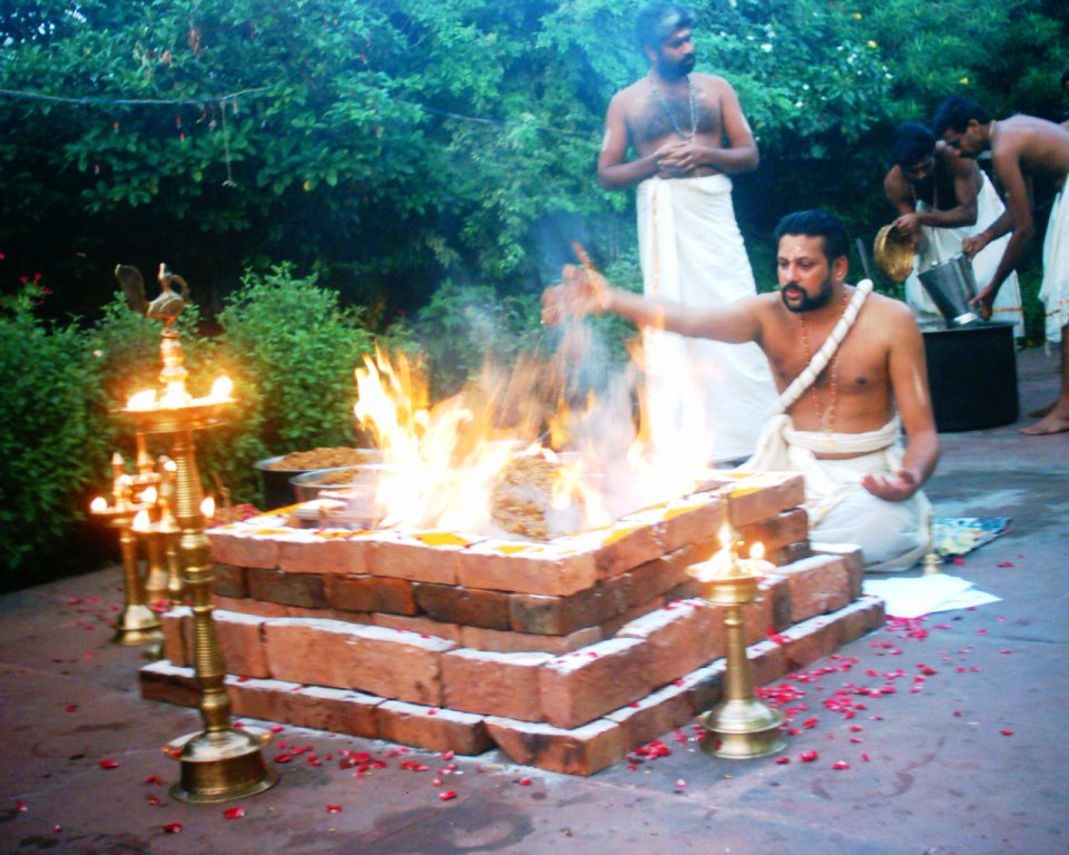
Hawan At Hinglaj Mata (Rani Ki Mandir) During Yanglaj Yatra 2017 Photo By Aliraza Khatri
Yajna ( sa, यज्ञ, yajña, translit-std=IAST, sacrifice, devotion, worship, offering) refers in Hinduism to any ritual done in front of a sacred fire, often with mantras.SG Nigal (1986), Axiological Approach to the Vedas, Northern Book, , pages 80–81 Yajna has been a Vedic tradition, described in a layer of Vedic literature called Brahmanas, as well as Yajurveda. The tradition has evolved from offering oblations and libations into sacred fire to symbolic offerings in the presence of sacred fire (Agni). Yajna rituals-related texts have been called the ''Karma-kanda'' (ritual works) portion of the Vedic literature, in contrast to ''Jnana-kanda'' (knowledge) portion contained in the Vedic Upanishads. The proper completion of Yajna-like rituals was the focus of Mimansa school of Hindu philosophy. Yajna have continued to play a central role in a Hindu's rites of passage, such as weddings. Modern major Hindu temple ceremonies, Hindu community celebrations, or monastic ini ... [...More Info...] [...Related Items...] OR: [Wikipedia] [Google] [Baidu] |
Poonch District, Pakistan
The Poonch District ( ur, ) is one of the 10 districts of Pakistan's dependent territory of Azad Kashmir. The Poonch District is bounded on the north by the Bagh District, on the north-east by the Haveli District, on the south-east by the Poonch District of Indian-administered Jammu and Kashmir, on the south by the Sudhanoti District and the Kotli District, and on the west by the Rawalpindi District of Pakistan's Punjab Province. The Poonch District is part of the greater Kashmir dispute between India and Pakistan. The district headquarters is the city of Rawalakot. It is the 3rd most populus district of Azad Kashmir. The main language is Pahari ("Punchi"), native to an estimated 95% of the population, but there are also speakers of Gujari, while Urdu has official status. History 17th Century to 1946 From the end of seventeenth century up to 1837 CE, Poonch was ruled by the Muslim rajas of Loran in Haveli Tehsil. It then fell into the hands of Raja Faiztalab of the Pu ... [...More Info...] [...Related Items...] OR: [Wikipedia] [Google] [Baidu] |
Sharda, Azad Kashmir
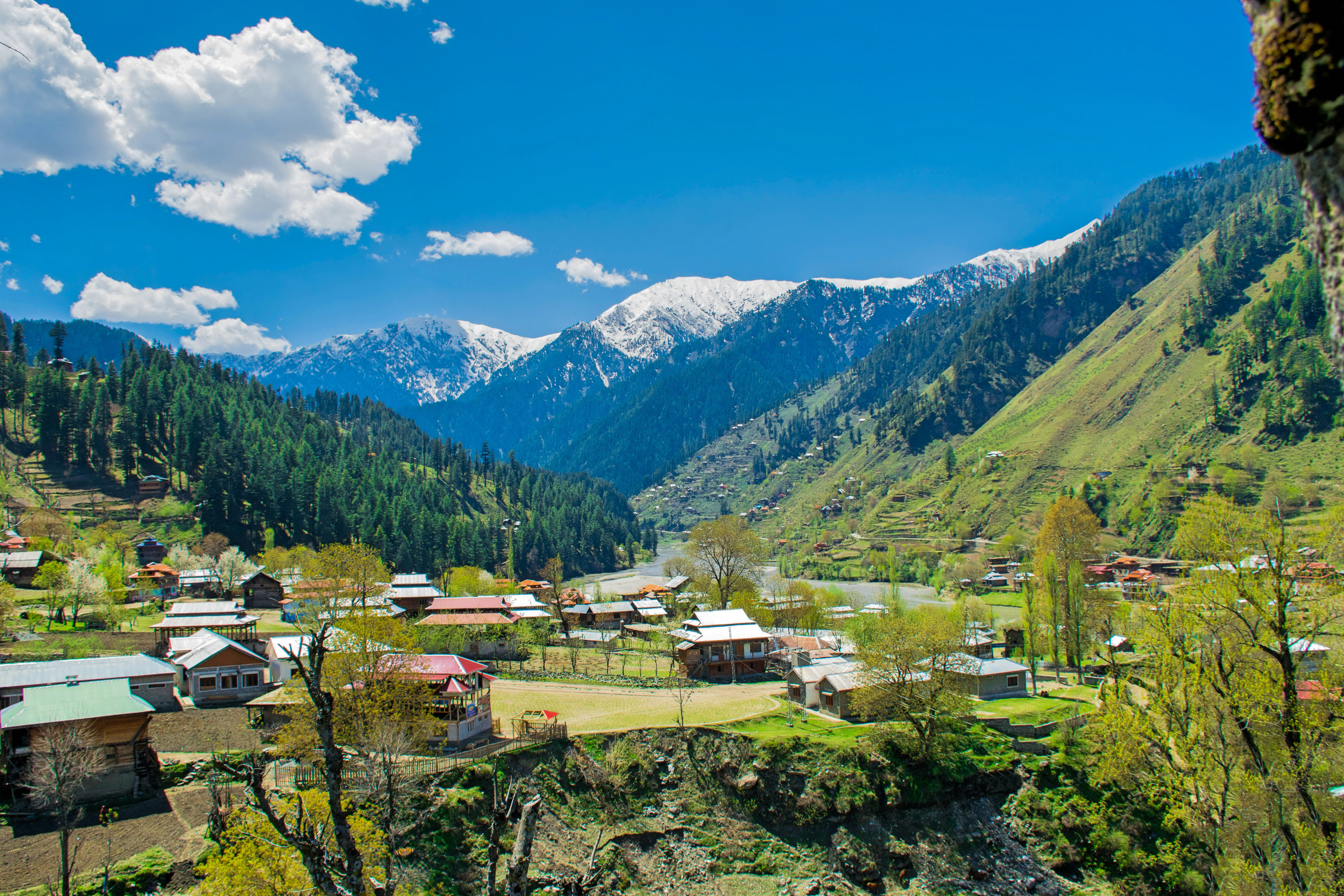
Sharda ( ur, ), also known as Shardi, is a small Tehsil in Neelam District in Azad Kashmir, Pakistan. It is one of the two ''tehsils'' of Neelum district, and is located on the banks of the Neelum river at an altitude of . Etymology and historical sites "Sharda" is another name of the Hindu goddess of knowledge, Saraswati, and is known for being the site of the ruins of the famous temple and Hindu pilgrimage site Sharada Peeth, dedicated to the goddess Sharada. Sharada Peeth Between the 6th and 12th centuries CE, Sharada Peeth was among the most prominent temple universities in the Indian subcontinent. Known in particular for its library, it was associated with Buddhist scholars such as Kumārajīva, Thonmi Sambhota, Rinchen Zangpo, as well as Kalhana Pandit and Adi Shankara. It played a key role in the development and popularisation of the Sharada script in North India, resulting in the script being named after it, and Kashmir acquiring the moniker "''Sharada Desh"'', meani ... [...More Info...] [...Related Items...] OR: [Wikipedia] [Google] [Baidu] |
Sharada Peeth
Sharada Peeth is a ruined Hindu temple and ancient centre of learning located in the Neelum Valley of Pakistani-administered Kashmir. Between the 6th and 12th centuries CE, it was among the most prominent temple universities in the Indian subcontinent. Known in particular for its library, stories recount scholars travelling long distances to access its texts. It played a key role in the development and popularisation of the Sharada script in North India, causing the script to be named after it, and Kashmir to acquire the moniker "''Sharada Desh"'', meaning "country of Sharada". As one of the ''Maha Shakti Peethas'', Hindus believe that it represents the spiritual location of the goddess Sati's fallen right hand. Sharada Peeth is one of the three holiest sites of pilgrimage for Kashmiri Pandits, alongside the Martand Sun Temple and the Amarnath Temple. Sharada Peeth is located approximately from Muzaffarabad, the capital of Pakistani-administered Azad Kashmir, and from ... [...More Info...] [...Related Items...] OR: [Wikipedia] [Google] [Baidu] |
Neelum District
The district of Neelum (spelt also ''Neelam''; ur, ) is the northernmost of 10 districts located within the Pakistani-administered territory of Azad Kashmir. Taking up the larger part of the Neelam Valley, the district has a population of around people (as of 2017). It was among the worst-hit areas of Pakistan during the 2005 Kashmir earthquake. Location The district is bordered on the north and north-east by the Diamer District, the Astore District, and the Skardu District of Gilgit-Baltistan, on the south by the Kupwara District and the Bandipora District of Indian-administered Jammu and Kashmir, on the south-west by the Muzaffarabad District, and by the west by the Mansehra District of Pakistan's Khyber Pakhtunkhwa Province. The Neelum Valley was known before the partition as ''Kishanganga'' and was subsequently renamed for the village of Neelam. It flows from the Gurez Valley in Indian-administered Jammu and Kashmir and roughly follows first a western and then a so ... [...More Info...] [...Related Items...] OR: [Wikipedia] [Google] [Baidu] |
Muzaffarabad
Muzaffarabad (; ur, ) is the capital and largest city of Azad Kashmir, and the 60th largest in Pakistan. The city is located in Muzaffarabad District, near the confluence of the Jhelum and Neelum rivers. The district is bounded by the Pakistani province of Khyber Pakhtunkhwa in the west, the Kupwara and Baramulla districts of Indian-administered Jammu and Kashmir in the east, and the Neelum District in the north. History Muzaffarabad was founded in 1646 by Sultan Muzaffar Khan, chief of the Bomba tribe who ruled Kashmir. Khan also constructed the Red Fort that same year for the purpose of warding off incursions from the Mughal Empire. 2005 earthquake The city was near the epicenter of the 2005 Kashmir earthquake, which had a magnitude of 7.6 Mw. The earthquake destroyed about 50% of the buildings in the city (including most government buildings) and is estimated to have killed up to 80,000 people in the Pakistani-controlled areas. , the Pakistani government's offi ... [...More Info...] [...Related Items...] OR: [Wikipedia] [Google] [Baidu] |
Muzaffarabad District
The Muzaffarabad District ( ur, ) is one of the 10 districts of Pakistan's dependent territory of Azad Kashmir. The district is located on the banks of the Jhelum River, Jhelum and Neelum River, Neelum rivers and is very hilly. The total area of the Muzaffarabad District is . The district is part of the Muzaffarabad Division, and the city of Muzaffarabad serves as the capital of Azad Kashmir. The district is bounded on the north-east by the Neelum District and the Kupwara District of Indian-administered Jammu and Kashmir, on the south-east by the Hattian Bala District, on the south by the Bagh District, and on the west by the Mansehra District and the Abbottabad District of Pakistan's Khyber Pakhtunkhwa Province. Population and languages The total population of the district according to the 2017 census is 650,370. The main language of the district, spoken by about half of its inhabitants, is generally considered to be a variety of Pahari (Pothwari), Pahari. Though occasionall ... [...More Info...] [...Related Items...] OR: [Wikipedia] [Google] [Baidu] |


