|
List Of FIPS Region Codes (D–F)
This is a list of FIPS 10-4 region codes from D-F, using a standardized name format, and cross-linking to articles. On September 2, 2008, FIPS 10-4 was one of ten standards withdrawn by NIST as a Federal Information Processing Standard.Federal Register, September 2, 2008 (Volume 73, Number 170), page 51276 The list here is the last version of codes. For earlier versions, see link below. DA: Denmark DJ: Djibouti DO: Dominica DR: Dominican Republic EC: Ecuador EG: Egypt EI: Ireland EK: Equatorial Guinea EN: Estonia ER: Eritrea ES: El Salvador ET: Ethiopia EZ: Czech Republic FI: Finland FJ: Fiji FM: Federated States of Micronesia FR: France See also * List of FIPS region codes (A-C) * List of FIPS region codes (G-I) * List of FIPS region codes (J-L) * List of FIPS region codes (M-O) * List of FIPS region codes (P-R) * List of FIPS region codes (S-U) This is a list of FIPS 10-4 region codes, using a standardized ... [...More Info...] [...Related Items...] OR: [Wikipedia] [Google] [Baidu] |
FIPS 10-4
The FIPS 10-4 standard, ''Countries, Dependencies, Areas of Special Sovereignty, and Their Principal Administrative Divisions'', was a list of two-letter country codes that were used by the U.S. Government for geographical data processing in many publications, such as the '' CIA World Factbook''. The standard was also known as DAFIF 0413 ed 7 Amdt. No. 3 (November 2003) and as DIA 65-18 (Defense Intelligence Agency, 1994, "Geopolitical Data Elements and Related Features"). The FIPS 10-4 codes are similar to (but sometimes incompatible with) the ISO 3166-1 alpha-2 country codes. The standard also includes codes for the top-level subdivision of the countries, similar to but usually incompatible with the ISO 3166-2 standard. History On September 2, 2008, FIPS 10-4 was one of ten standards withdrawn by NIST as a Federal Information Processing Standard. The National Geospatial-Intelligence Agency continued to maintain the FIPS 10-4 codes in an informal document titled "Geopolitica ... [...More Info...] [...Related Items...] OR: [Wikipedia] [Google] [Baidu] |
Saint David Parish, Dominica
Saint David is one of Dominica's ten administrative parishes, located on the eastern side of the island. It is bordered by St. Andrew to the north; St. Joseph, St. Paul and St. George to the west; and St. Patrick to the south. It has an area of 131.6 km² (50.8 mi²),Figures provided by the Lands and Surveys Division of the Ministry of Agriculture, Cork Street, Roseau, Dominica. and has a population of 6,789.Commonwealth of Dominica, ''Population and Housing Census – 2001.'' Roseau, Dominica: Central Statistical Office, Ministry of Finance and Planning, Kennedy Avenue, 2001. Settlements Its largest settlement is Castle Bruce, with a population of 1,653. It includes the Indigenous community of the *Carib Territory. (Kalinago Territory) which has a population of about 3000 spread across 7 hamlets. Other villages include: *Grand Fond * Rosalie * Good Hope * Petit Soufrière * Riviere Cyrique *Morne Jaune * San Sauveur *Carib Territory *Atkinson * Antrizle Areas of interes ... [...More Info...] [...Related Items...] OR: [Wikipedia] [Google] [Baidu] |
Dajabón Province
Dajabón () is a northwestern province which currently comprises one of the 32 provinces of the Dominican Republic. It is divided into 5 municipalities and its capital city with the same name. It is bordered by the provinces of Monte Cristi to the north, Santiago Rodríguez to the south, Elías Piña to the south and the Nord-Est department of Haiti to the west. It was split from Monte Cristi in 1938, and was called ''Libertador'' until 1961. Location It is located in the northwestern part of the country, and is surrounded by the provinces Monte Cristi (north), Santiago Rodríguez (east) and Elías Piña (south). To the west, Dajabón borders the Republic of Haiti. Origin of name The province takes its name from the Taíno name of the region, Dahaboon; it was also the name of the main river of the region (the Dajabón River). Municipalities and municipal districts The province as of June 20, 2006 is divided into the following municipalities (''municipios'') and munic ... [...More Info...] [...Related Items...] OR: [Wikipedia] [Google] [Baidu] |
Barahona Province
Barahona () is a province of the Dominican Republic. The Barahona Coast is located on the southwestern part of the Dominican Republic approximately three hours drive from Santo Domingo the capital of the Dominican Republic. In 2019, volunteers from Amigos de las Americas visited to facilitate projects within the various municipalities of Barahona. Municipalities and municipal districts The province as of June 20, 2006 is divided into the following municipalities (''municipios'') and municipal districts (''distrito municipal'' - D.M.) within them: * Cabral * El Peñón *Enriquillo **Arroyo Dulce (D.M.) *Fundación ** Pescadería (D.M.) *Jaquimeyes **Palo Alto (D.M.) * La Ciénaga **Bahoruco (D.M.) * Las Salinas * Paraíso ** Los Patos (D.M.) * Polo *Santa Cruz de Barahona ** El Cachón (D.M.) **La Guázara (D.M.) *Vicente Noble **Canoa (D.M.) **Fondo Negro (D.M.) **Quita Coraza (D.M.) The following is a sortable table of the municipalities and municipal districts with popul ... [...More Info...] [...Related Items...] OR: [Wikipedia] [Google] [Baidu] |
Baoruco Province
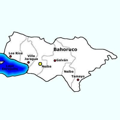
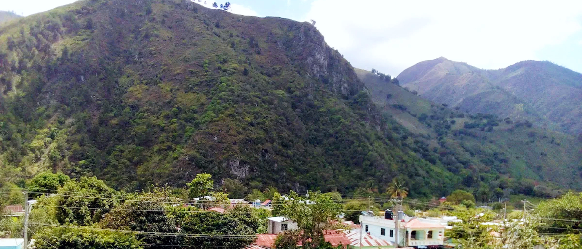
Baoruco, alternatively spelt Bahoruco (), is a province of the Dominican Republic located in the southwest of the country, part of the Enriquillo Region, along with the provinces of Barahona, Independencia and Pedernales. Before 1952 it included what is now Independencia Province. Important features are the Sierra de Neiba mountain range and Lake Enriquillo. Municipalities and municipal districts The province is divided into the following municipalities (''municipios'') and municipal districts (''distrito municipal'' - D.M.) within them: * Galván * Los Ríos ** Las Clavellinas city (D.M.) *Neiba ** El Palmar (D.M.) * Tamayo **Cabeza de Toro (D.M.) **Montserrat (D.M.) **Santana (D.M.) ** Uvilla (D.M.) *Villa Jaragua The following is a sortable table of the municipalities and municipal districts with population figures as of the 2014 estimate. Urban population are those living in the seats (''cabeceras'' literally heads) of municipalities or of municipal districts. Rural popula ... [...More Info...] [...Related Items...] OR: [Wikipedia] [Google] [Baidu] |
Azua Province
Azua () is a province which is collectively one of the thirty-two provinces of the Dominican Republic. It is divided into 10 municipalities (the same as Santiago) and its capital city is Azua de Compostela. It is bordered by the provinces of La Vega to the north-east, San José de Ocoa and Peravia to the east, Barahona and Baoruco to the west and San Juan to the north-west. To the south, Azua has a significant coastline of the Caribbean Sea. Azua is known for diverse geography and climate, with the southern part of the province having an arid climate that is not the typical tropical-like that is found in other parts of the Caribbean. Geography The southern part of the province is located in the Llanura or Llano de Azua (also known as the "Plena de Azua"), a coastal plain surrounded by mountains that act as barriers to the water-laden winds so that the lower parts of the province are very arid. Azua had the Sierra de Ocoa, which is the southern end of the Cordillera Central, ... [...More Info...] [...Related Items...] OR: [Wikipedia] [Google] [Baidu] |
Dominican Republic
The Dominican Republic ( ; es, República Dominicana, ) is a country located on the island of Hispaniola in the Greater Antilles archipelago of the Caribbean region. It occupies the eastern five-eighths of the island, which it shares with Haiti, making Hispaniola one of only two Caribbean islands, along with Saint Martin, that is shared by two sovereign states. The Dominican Republic is the second-largest nation in the Antilles by area (after Cuba) at , and third-largest by population, with approximately 10.7 million people (2022 est.), down from 10.8 million in 2020, of whom approximately 3.3 million live in the metropolitan area of Santo Domingo, the capital city. The official language of the country is Spanish. The native Taíno people had inhabited Hispaniola before the arrival of Europeans, dividing it into five chiefdoms. They had constructed an advanced farming and hunting society, and were in the process of becoming an organized civilization. The Taínos also in ... [...More Info...] [...Related Items...] OR: [Wikipedia] [Google] [Baidu] |
Saint Peter Parish, Dominica
Saint Peter is one of Dominica's 10 administrative parishes. It is bordered by St. John to the north, St. Joseph to the south, and St. Andrew to the east. It has an area of 27.7 km² (10.74 mi²), and has a population of 1,452, the least populous parish of Dominica. at GeoHive. Retrieved July 21, 2006. Colihaut
Colihaut is a coastal village in northern Dominica within Saint Peter Parish midway between the towns of Roseau and Portsmouth. It has a population of 773 people.Commonwealth of Dominica, ''Population and Housing Census — 2001''. Roseau, Domini ... (the largest village), [...More Info...] [...Related Items...] OR: [Wikipedia] [Google] [Baidu] |
Saint Paul Parish, Dominica
Saint Paul is one of Dominica's 10 administrative parishes. It is bordered by St. Joseph to the north, St. David to the east, and St. George to the south. It has an area of 67.4 km² (26.02 mi²), and a population of 8,397. at GeoHive. Retrieved July 21, 2006. The largest settlements are (where the island's second airport is located) and Mahaut. Another village in the parish, |
Saint Patrick Parish, Dominica
Saint Patrick is one of Dominica's 10 administrative parishes. It is bordered by St. George, St. Luke and St. Mark to the west, and St. David to the north. It has an area of 84.4 km² (32.59 mi²), and has a population of 8,383. at GeoHive. Retrieved July 21, 2006. Grand Bay (also known as Berekua) and La Plaine are the largest settlements in the parish. Other villages include: * |
Saint Mark Parish, Dominica
Saint Mark is one of Dominica's ten administrative parishes (Dominica is in the Lesser Antilles). It is bordered by St. Luke (to the north) and St. Patrick (to the east). With an area of 9.9 km² (2 mi²),Figures provided by the Lands and Surveys Division of the Ministry of Agriculture, Cork Street, Roseau, Dominica. it is the smallest in the island. It had a population of 1,834 people at the Population Census of 2011. The main settlements in the parish are Soufrière and Scotts Head (near which the only tombolo in the West Indies can be found). Another village in the parish is Galion Galion is a city in Crawford, Morrow, and Richland counties in the U.S. state of Ohio. The population was 10,453 at the 2020 census. Galion is the second-largest city in Crawford County after Bucyrus. The Crawford County portion of Galion is .... References External links * Parishes of Dominica Tombolos {{Dominica-geo-stub ... [...More Info...] [...Related Items...] OR: [Wikipedia] [Google] [Baidu] |
Saint Luke Parish, Dominica
Saint Luke is one of Dominica's 10 administrative parishes. It is bordered by St. George (to the north), St. Mark (to the south), and St. Patrick (to the east). The parish is one of Dominica's smallest in area and population. 1,668 peopleCommonwealth of Dominica, ''Population and Housing Census – 2001''. Roseau, Dominica: Central Statistical Office, Ministry of Finance and Planning, Kennedy Avenue, 2001. live in its 7.77 km² (3 mi²)Figures provided by the Lands and Surveys Division of the Ministry of Agriculture, Cork Street, Roseau, Dominica. of area. Pointe Michel (La Pointe) is its only settlement. Its shape resembles a wedge A wedge is a triangular shaped tool, and is a portable inclined plane, and one of the six simple machines. It can be used to separate two objects or portions of an object, lift up an object, or hold an object in place. It functions by converti ... pointing right, with the top part cut off. References External links * Parishe ... [...More Info...] [...Related Items...] OR: [Wikipedia] [Google] [Baidu] |


