|
List Of Earthquakes 2011–2020
The following is a list of significant earthquakes for the period 2011–2020, listing earthquakes of magnitude 7 and above, or which caused fatalities. Deaths due to earthquake-caused tsunamis are included. For lists of earthquakes by country, which may include smaller and less destructive events than those listed here, see Lists of earthquakes by country. 2011 2012 2013 2014 2015 2016 2017 2018 2019 2020 All times are UTC, ''unless otherwise stated'' ML = Richter magnitude scale Mw = Moment magnitude Mb = Body wave magnitude HRV = Harvard UniversityGlobal CMT USGS = United States Geological Survey See also * List of earthquakes 2001–2010 * List of earthquakes 2021–2030 The following is a list of significant earthquakes from 2021–2030, listing earthquakes of magnitude 7 and above, or which caused human fatalities. Deaths due to earthquake-caused tsunamis are included. For lists of earthquakes by country, whic ... References {{ ... [...More Info...] [...Related Items...] OR: [Wikipedia] [Google] [Baidu] |
2011 Tōhoku Earthquake And Tsunami
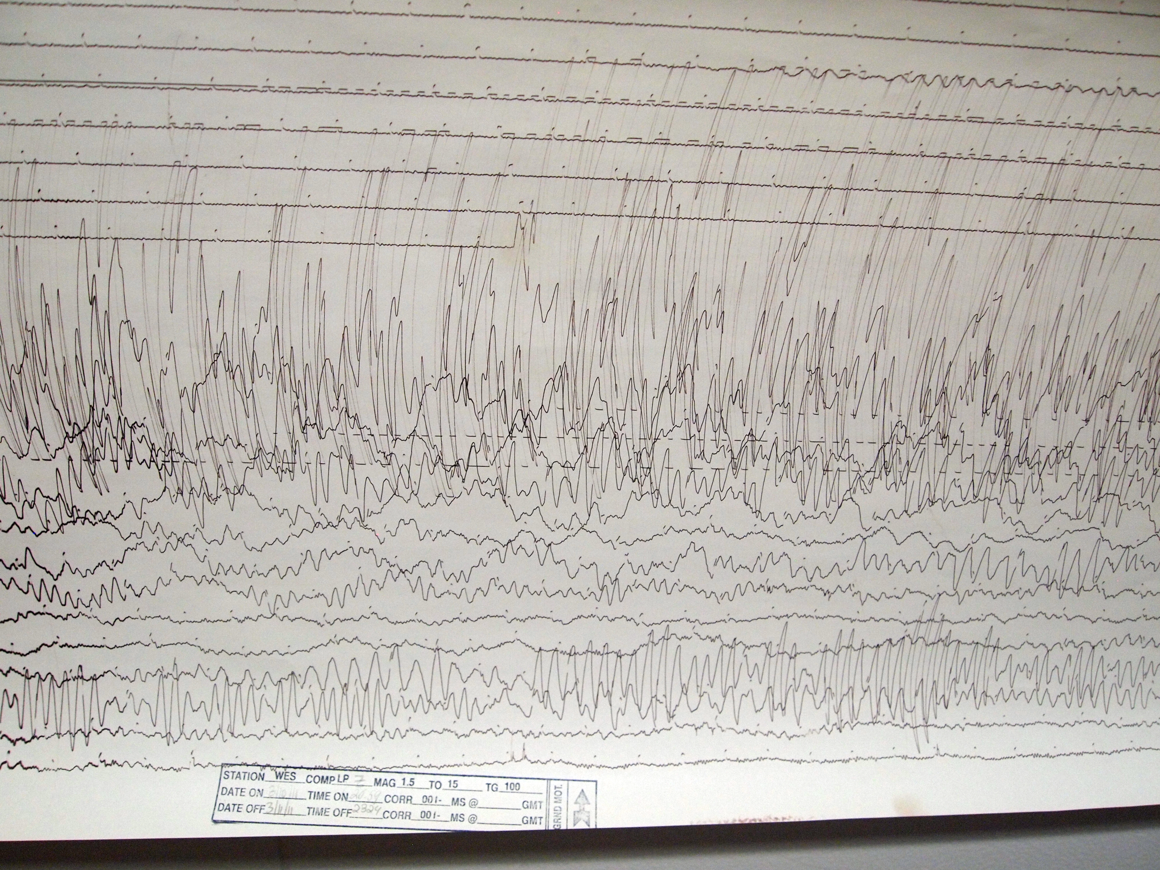
The occurred at 14:46 JST (05:46 UTC) on 11 March. The magnitude 9.0–9.1 (M) undersea megathrust earthquake had an epicenter in the Pacific Ocean, east of the Oshika Peninsula of the Tōhoku region, and lasted approximately six minutes, causing a tsunami. It is sometimes known in Japan as the , among other names. The disaster is often referred to in both Japanese and English as simply 3.11 (read in Japanese). It was the most powerful earthquake ever recorded in Japan, and the fourth most powerful earthquake in the world since modern record-keeping began in 1900. The earthquake triggered powerful tsunami waves that may have reached heights of up to in Miyako in Tōhoku's Iwate Prefecture,Yomiuri Shimbun evening edition 2-11-04-15 page 15, nearby Aneyoshi fishery port (姉吉漁港)(Google map E39 31 57.8, N 142 3 7.6) 2011-04-15大震災の津波、宮古で38.9 m…明治三陸上回るby okayasu Akio (岡安 章夫) and which, in the Sendai area, traveled at a ... [...More Info...] [...Related Items...] OR: [Wikipedia] [Google] [Baidu] |
2011 Christchurch Earthquake
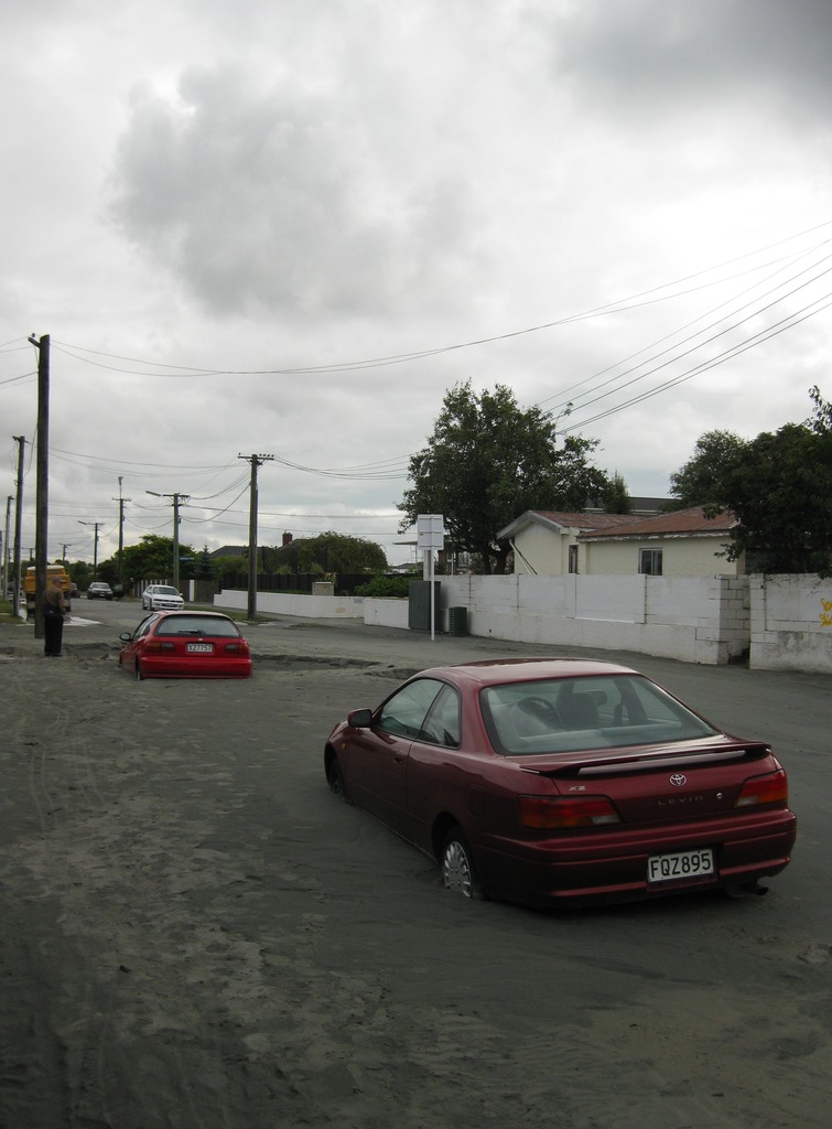
A major earthquake occurred in Christchurch on Tuesday 22 February 2011 at 12:51 p.m. local time (23:51 UTC, 21 February). The () earthquake struck the entire of the Canterbury region in the South Island, centred south-east of the central business district. It caused widespread damage across Christchurch, killing 185 people, in New Zealand's fifth-deadliest disaster. Christchurch's central city and eastern suburbs were badly affected, with damage to buildings and infrastructure already weakened by the magnitude 7.1 Canterbury earthquake of 4 September 2010 and its aftershocks. Significant liquefaction affected the eastern suburbs, producing around 400,000 tonnes of silt. The earthquake was felt across the South Island and parts of the lower and central North Island. While the initial quake only lasted for approximately 10 seconds, the damage was severe because of the location and shallowness of the earthquake's focus in relation to Christchurch as well as ... [...More Info...] [...Related Items...] OR: [Wikipedia] [Google] [Baidu] |
2011 Lorca Earthquake
The 2011 Lorca earthquake ( es, link=no, Terremoto de Lorca de 2011) was a moderate 5.1 earthquake that occurred 6:47 p.m. CEST (16:47 UTC) on 11 May 2011, near the town of Lorca, causing significant localized damage in the Region of Murcia, Spain, and panic among locals, and displacing many from their homes. The quake was preceded by a magnitude 4.4 () foreshock at 17:05 (15:05 UTC), that inflicted substantial damage to many older structures in the area, including the historical Espolón Tower of Lorca Castle, the Hermitage of San Clemente and the Convent of Virgen de Las Huertas. Three people were killed by a falling cornice. A total of nine deaths have been confirmed, while dozens are reported injured. The earthquake was the worst to hit the region since a 5.0 Mw tremor struck west of Albolote, Granada in 1956. Geology The magnitude 5.1 main shock occurred inland on 11 May 2011 at 18:47 local time (16:47 UTC) in the locality of Lorca, Spain, at a depth of . Much ... [...More Info...] [...Related Items...] OR: [Wikipedia] [Google] [Baidu] |
Iwaki, Fukushima
is a city located in Fukushima Prefecture, Japan. , Iwaki had a population of 337,765 in 143,500 households, and population density of 270 persons per km2. The total area of the city is , making it the largest city in the prefecture and the 10th largest city in Japan (2010) in terms of area. Iwaki is a designated core city, and is also one of the growing number of cities written in ''hiragana''. The present Iwaki City started as the merger of 14 smaller municipalities on October 1, 1966. Every year, Iwaki hosts the Taira Tanabata Festival from 6–8 August. Geography and climate The city is located at the southeastern end of Tōhoku region and borders on Ibaraki Prefecture. The city occupies around 8.9 percent of the total area of Fukushima Prefecture. The eastern part of the city is made up of of coastline which faces the Pacific Ocean and the western part goes through the Abukuma highlands and joins up with the central part of Fukushima Prefecture. The western part is a range ... [...More Info...] [...Related Items...] OR: [Wikipedia] [Google] [Baidu] |
April 2011 Fukushima Earthquake
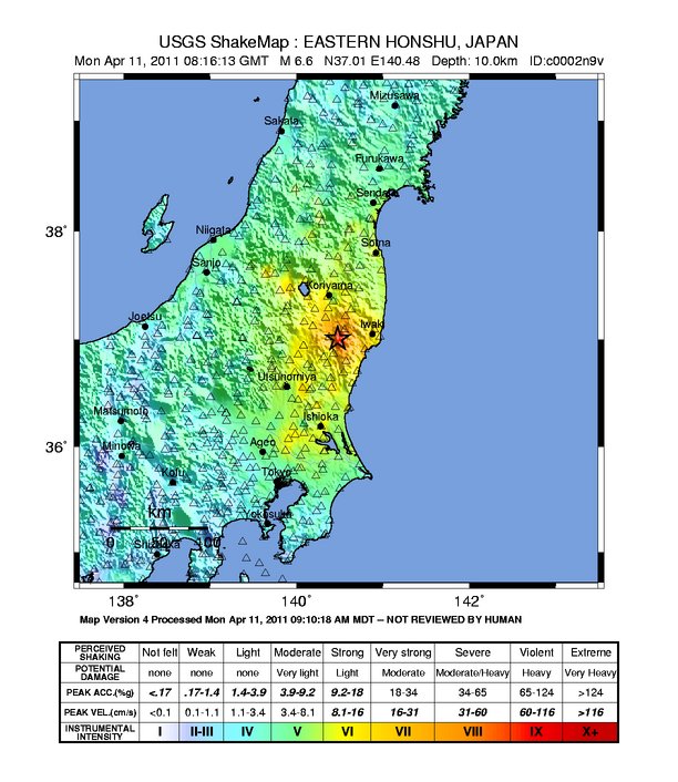
A potent magnitude 6.6 Mw intraplate aftershock occurred at 17:16 JST (08:16 UTC) on 11 April, in the Hamadōri region of Fukushima, Japan. With a shallow focus of , the earthquake was centred inland about west of Iwaki, causing widespread strong to locally severe shaking. It was one of many aftershocks to follow the 11 March Tōhoku earthquake, and the strongest to have its epicentre located inland. The earthquake occurred as a result of normal faulting to the west of Iwaki, and triggered numerous landslides across adjacent mountainous areas. A few fires broke out, and 220,000 households lost electricity. Officials issued localised tsunami alerts, though no significant waves were generated. The earthquake caused little structural damage, but killed four people and injured ten others. The strong ground movements triggered the reactivation of a nearby geological fault, prompting researchers to conduct extensive surveys in the region. Geology The m ... [...More Info...] [...Related Items...] OR: [Wikipedia] [Google] [Baidu] |
April 2011 Miyagi Earthquake
The occurred off the coast of Miyagi Prefecture, approximately east of Sendai, Japan. The thrust earthquake was classified as an aftershock of the March 11 Tōhoku earthquake, and occurred at 23:32 JST (14:32 UTC) on Thursday, 7 April 2011. Several tsunami warnings were issued for the northeastern coast of Honshu; however, they were all canceled 90 minutes later. Over 3 million households in the area were left without power, and several nuclear plants suffered minor malfunctions. There was no major structural damage, but the quake killed at least 4 people and injured 141. Earthquake The submarine earthquake occurred at a focal depth of 49 km (30.4 mi) in the western Pacific Ocean on 7 April 2011 at 14:21 UTC, approximately 66 km (41 mi) east of Sendai. The quake was a direct result of thrust faulting on or near the subduction zone plate boundary between the Pacific and North American Plates. Initially estimated at ... [...More Info...] [...Related Items...] OR: [Wikipedia] [Google] [Baidu] |
Chiang Rai (city)
Chiang Rai ( th, เชียงราย, ; nod, , เจียงฮาย, ) is the northernmost major city in Thailand, with a population of about 200,000 people. It is located in Mueang Chiang Rai District, Chiang Rai Province. Chiang Rai was established as a capital city in the reign of King Mangrai, in 1262 CE. History The city was founded by King Mangrai in 1262 and became the capital of the Mangrai Dynasty. The word 'Chiang' means 'city' in Thai, so Chiang Rai would mean 'the City of (Mang) Rai'. Subsequently, Chiang Rai was conquered by Burma and remained under Burmese rule for several hundred years. It was not until 1786 that Chiang Rai became a Chiang Mai vassal. Siam (Thailand) annexed Chiang Mai in 1899, and Chiang Rai was proclaimed a province of Thailand in 1933. In 1432, during the reign of King Sam Fang Kaen of the Mangrai Dynasty (1402–1441), the Phra Kaeo, or Emerald Buddha, the most revered Buddha statue, was discovered in Chiang Rai when an earthq ... [...More Info...] [...Related Items...] OR: [Wikipedia] [Google] [Baidu] |
March 2011 Myanmar Earthquake
The 2011 Tarlay earthquake occurred on 24 March in Shan State, Myanmar. The earthquake measured 6.8 and had an epicenter northwest of the border between Myanmar, Thailand and Laos. It occurred in a region accommodating tectonic deformation brought by the collision between the Indo-Australian and Eurasian plates. Strike-slip faulting along the Nan Ma Fault was identified as the cause. There were between 75 and 151 fatalities; including one death in Thailand. An additional 212 people were injured. Hundreds of buildings and some transport infrastructure were damaged in Myanmar and Thailand. Tectonic setting Myanmar lies at the junction of the Alpide belt and Sunda Arc. In northern Myanmar, continental collision is ongoing between the between the northward moving Indo-Australian Plate and the Eurasian Plate. Collision also occurs along the Indo-Burman Ranges (Patkai, Naga and Chin Hills) and Arakan Mountains of western Myanmar. In this zone of highly oblique collision, most of th ... [...More Info...] [...Related Items...] OR: [Wikipedia] [Google] [Baidu] |
Mito, Ibaraki
is the capital city of Ibaraki Prefecture, in the northern Kantō region of Japan. , the city had an estimated population of 269,330 in 123,282 households and a population density of 1239 persons per km2. The percentage of the population aged over 65 was 27.1%. The total area of the city is . Geography Mito is located in central Ibaraki Prefecture. Mito Station is about 10 km inland from the Pacific Ocean which Naka River, flowing from the north to the east of the city, pours into. Immediately south is Lake Senba, a recreational area. A main street extends from Mito Station to the west, and residential areas to the south and the west in particular. Surrounding municipalities Ibaraki Prefecture * Hitachinaka * Kasama * Naka * Ibaraki * Ōarai * Shirosato Climate Mito has a Humid subtropical climate (Köppen ''Cfa'') characterized by warm summers and cold winters with light snowfall. The average annual temperature in Mito is 13.6 °C. The average annual rainfall ... [...More Info...] [...Related Items...] OR: [Wikipedia] [Google] [Baidu] |
2011 Tohoku Earthquake And Tsunami
Eleven or 11 may refer to: *11 (number), the natural number following 10 and preceding 12 * one of the years 11 BC, AD 11, 1911, 2011, or any year ending in 11 Literature * ''Eleven'' (novel), a 2006 novel by British author David Llewellyn *''Eleven'', a 1970 collection of short stories by Patricia Highsmith *''Eleven'', a 2004 children's novel in The Winnie Years by Lauren Myracle *''Eleven'', a 2008 children's novel by Patricia Reilly Giff *''Eleven'', a short story by Sandra Cisneros Music *Eleven (band), an American rock band * Eleven: A Music Company, an Australian record label *Up to eleven, an idiom from popular culture, coined in the movie ''This Is Spinal Tap'' Albums * ''11'' (The Smithereens album), 1989 * ''11'' (Ua album), 1996 * ''11'' (Bryan Adams album), 2008 * ''11'' (Sault album), 2022 * ''Eleven'' (Harry Connick, Jr. album), 1992 * ''Eleven'' (22-Pistepirkko album), 1998 * ''Eleven'' (Sugarcult album), 1999 * ''Eleven'' (B'z album), 2000 * ''Eleven'' (Reamonn ... [...More Info...] [...Related Items...] OR: [Wikipedia] [Google] [Baidu] |
Myitkyina
Myitkyina (, ; (Eng; ''mitchinar'') Jinghpaw: ''Myitkyina'', ) is the capital city of Kachin State in Myanmar (Burma), located from Yangon, and from Mandalay. In Burmese it means "near the big river", and Myitkyina is on the west bank of the Ayeyarwady River, just below from Myit-son (Burmese for confluence) of its two headstreams (the Mali and N'mai rivers). It is the northernmost river port and railway terminus in Myanmar. The city is served by Myitkyina Airport. History Myitkyina has been an important trading town between China and Myanmar since ancient times. American Baptist missionary George J. Geis and his wife arrived in Myitkyina in the late 1890s and in 1900 they requested permission to build a mansion in the town. The building was named Geis Memorial Church. It is one of the Kachin Baptist Convention (KBC) churches in Myitkyina. Japanese forces captured the town and nearby airbase during World War II in 1942. In August 1944, Myitkyina was recaptured by the A ... [...More Info...] [...Related Items...] OR: [Wikipedia] [Google] [Baidu] |
2011 Yunnan Earthquake
The 2011 Yunnan earthquake was a 5.4 magnitude earthquake that occurred on 10 March 2011 at 12:58 CST, with its epicenter in Yingjiang County, Yunnan, People's Republic of China, near the Burmese border. A total of 26 people died and 313 were injured with 133 in serious condition. China's Xinhua reports that up to seven aftershocks, measuring up to a magnitude of 4.7, followed the initial quake, which caused a total of 127,000 people to be evacuated to nearby shelters. It joined over 1,000 other minor tremors that affected the region in the two preceding months. Following damage surveys, officials reported that 1,039 buildings were destroyed and 4,994 more were seriously damaged. The earthquake occurred one day before a much larger earthquake struck Japan that triggered a tsunami. Damage and casualties The epicenter was from the center of the county, which has a population of more than 270,000 people and is home to several of China's ethnic minorities. The state news agency rep ... [...More Info...] [...Related Items...] OR: [Wikipedia] [Google] [Baidu] |


