|
List Of Collieries In Yorkshire (1984–2015)
In 1984, the Yorkshire area had a total of 56 collieries. The last deep coal mine was Kellingley Colliery which closed on Friday 18 December 2015 signalling the end of deep coal mining not only in Yorkshire but in Britain as a whole. Hatfield Colliery closed in mid 2015. In 1984, 15 of the collieries were in the Wakefield district, 11 in the Rotherham district, 10 in the Barnsley district, 9 in the Doncaster district, 6 in the Selby district, 3 in the Leeds district and 2 in the Kirklees district. The Yorkshire Area of the Coal Board also included Manton and Shireoaks collieries, which were geographically in Nottinghamshire; they closed in 1994 and 1990 respectively. References * Colin Jackson, ''The Complete A-Z of Colliery Names, Pre-1947 Owners, Areas & Dates, Volume 2'', published by the National Coal Mining Museum for England, 2002. * Coal Mining in the British IslesNorthern Mine Research Society {{DEFAULTSORT:Collieries in Yorkshire (1984-present) Histor ... [...More Info...] [...Related Items...] OR: [Wikipedia] [Google] [Baidu] |
Colliery
Coal mining is the process of extracting coal from the ground. Coal is valued for its energy content and since the 1880s has been widely used to generate electricity. Steel and cement industries use coal as a fuel for extraction of iron from iron ore and for cement production. In the United Kingdom and South Africa, a coal mine and its structures are a colliery, a coal mine is called a 'pit', and the above-ground structures are a 'pit head'. In Australia, "colliery" generally refers to an underground coal mine. Coal mining has had many developments in recent years, from the early days of men tunneling, digging and manually extracting the coal on carts to large open-cut and longwall mines. Mining at this scale requires the use of draglines, trucks, conveyors, hydraulic jacks and shearers. The coal mining industry has a long history of significant negative environmental impacts on local ecosystems, health impacts on local communities and workers, and contributes heavily to th ... [...More Info...] [...Related Items...] OR: [Wikipedia] [Google] [Baidu] |
Brodsworth Colliery
Brodsworth Colliery was a coal mine north west of Doncaster and west of the Great North Road. in South Yorkshire, England. Two shafts were sunk between October 1905 and 1907 in a joint venture by the Hickleton Main Colliery Company and the Staveley Coal and Iron Company. The colliery exploited the coal seams of the South Yorkshire Coalfield including the Barnsley seam which was reached at a depth of 595 yards and was up to 9 feet thick. After a third shaft was sunk in 1923, Brodsworth, the largest colliery in Yorkshire, had the highest output of a three-shaft colliery in Britain. The colliery and five others were merged into Doncaster Amalgamated Collieries in 1937 and the National Coal Board in 1947. It closed in 1990. The colliery was consistently amongst those that employed the most miners in Britain, employing around 2,800 workers throughout the 1980s. The company built Woodlands, a model village for its workers. Since the colliery closed, its spoil tip has been restore ... [...More Info...] [...Related Items...] OR: [Wikipedia] [Google] [Baidu] |
Frickley Colliery
Frickley & South Elmsall Colliery was opened by the Carlton Main Colliery Company Ltd in 1903 in South Elmsall, in Yorkshire, England. Frickley & South Elmsall Colliery The first sod was cut on 23 April 1903 of shafts No.1 and No.2 and the Barnsley Bed was hit on 23 May 1905 at a depth of 606 m. Sumps were established at a depth of 624 m in the Dunsil seam. Both shafts were 7 m in diameter and brick lined throughout. South Elmsall Colliery, situated in the same curtilage as Frickley, was sunk during 1920–23 reaching the Shafton seam at a depth of 218 m. This No.3 shaft was 4.26 m in diameter and brick lined throughout. Despite being located in South Elmsall, the colliery was sunk within the land of Frickley Hall, part of the small Hamlet of Frickley, hence the Frickley name. The Carlton Main Colliery Company was a model employer with strong views on the welfare of its workers. It built the Warde-Aldam Hospital in 1911 and it's welfare schemes ... [...More Info...] [...Related Items...] OR: [Wikipedia] [Google] [Baidu] |
South Kirkby
South Kirkby is a town in the City of Wakefield in West Yorkshire, England which is governed locally by South Kirkby and Moorthorpe Town Council. The town forms half of the civil parish of South Kirkby and Moorthorpe. The parish has a population of 10,979. Town council The town retains its own town council and is represented on the district council by Wilf Benson (Independent), Michelle Collins ( Labour Party) and Steve Tulley (Labour Party). The South Kirkby and Moorthorpe Town Council motto is 'Friendship, Unity & Progress', and the two settlements have been twinned with Sprockhövel in the Ruhr Valley of Germany since 1981. The establishment of 'Sprockhövel International Friendship Circle' led to the same named organisation in South Kirkby & Moorthorpe. Since that time the ''Sprockhövel IFK'' and the ''South Kirkby & Moorthorpe IFC'' have organised an annual exchange visit. History The town was first mentioned 1086 in the ''Domesday Book'', and South Kirkby retains the site ... [...More Info...] [...Related Items...] OR: [Wikipedia] [Google] [Baidu] |
Emley, West Yorkshire
Emley is a village in West Yorkshire, England, between Huddersfield and Wakefield with a population of 1,497 at the last census (2011) It is east of Huddersfield and west of Wakefield. The village dates from Anglo-Saxon times and is on high ground, close to the Emley Moor transmitting station. History The name "Emley" is derived from an Old English personal name, Em(m)a or Eama, and ''lēah'', a wood or woodland clearing. The village was recorded as Amalaie and Amelai in the 1086 ''Domesday Book'' and usually as Emmeley by the 13th century. The Saxon settlement was at Emley Park. An influx of invading Danes settled in the area in the 9th century, as evidenced by place names ending in ''by'' and ''thorpe''. Manor After the Norman Conquest, Godric, a descendant of the original Saxon settlers, was retained as lord of the manor by William the Conqueror and Emley became part of the Royal Manor of Wakefield. Godric passed the manor to his son, Ketelbern, some time after 1080, and he ... [...More Info...] [...Related Items...] OR: [Wikipedia] [Google] [Baidu] |
Dodworth
Dodworth is a village in the metropolitan borough of Barnsley in South Yorkshire, England. Historically part of the West Riding of Yorkshire, it has a population of 5,742, increasing to 5,900 at the 2011 Census (9,777 for Dodworth Ward). History Dodworth was historically a township in the ancient parish of Silkstone in the West Riding of Yorkshire. It became a separate civil parish in 1866, and an urban district in 1894. The urban district and civil parish were abolished in 1974, when Dodworth was transferred to the Metropolitan Borough of Barnsley in the new county of South Yorkshire. Dodworth is now an unparished area. Dodworth is a former coal mining village with approximately 5,800 people. The land occupying the former pit is now the Dodworth Business Park. The "muck" stack from the pit is clearly visible throughout the village. During the early 1980s a mass planting of silver birch trees began to halt erosion and create a wildlife habitat. Over the past twenty years, tree ... [...More Info...] [...Related Items...] OR: [Wikipedia] [Google] [Baidu] |
Dinnington, South Yorkshire
Dinnington is a town and civil parish in the Metropolitan Borough of Rotherham in South Yorkshire, England. It is near to the towns of Worksop and Rotherham and cities of Sheffield and Doncaster. Historically part of the West Riding of Yorkshire, Dinnington is the principal settlement in the civil parish of Dinnington St John's, which also includes the small satellite hamlets of Throapham and St John's. The Dinnington St John's parish is the most populous constituent of the St John's ward, which also includes the parishes of Laughton-en-le-Morthen, Firbeck, Letwell and Gildingwells. In 2001 this ward had a population of 11,476, with Dinnington St John's itself making up 9,161 of that figure. The population of the ward at the 2011 Census had increased to 12,517. Dinnington is about above sea level. History Excavations show Dinnington to have been inhabited since at least Neolithic times, and it has been suggested that the settlement takes its name from a local barrow, though ... [...More Info...] [...Related Items...] OR: [Wikipedia] [Google] [Baidu] |
Dearne Valley
The Dearne Valley is an area of South Yorkshire, England, along the River Dearne. It encompasses the towns of Wombwell, Wath-upon-Dearne, Swinton, Conisbrough and Mexborough, the large villages of Ardsley, Bolton on Dearne, Goldthorpe, Thurnscoe, Darfield, Stairfoot and Brampton Bierlow, and many other smaller villages and hamlets. In 1995 the area became a regeneration area, as it had suffered much from the sudden decline of the deep coal mining industry in the 1980s. In the 2011 census the ONS-identified Barnsley/Dearne Valley built-up area had a population of 223,281, however this region includes Barnsley and certain other smaller towns and villages that might not historically have considered themselves a part of the Dearne Valley. History Many high-grade coal seams, including the prolific Barnsley seam, lie close to the surface in this area. This meant that by far the most prevalent industry in the area was deep coal mining, indeed much of the economic activity of ... [...More Info...] [...Related Items...] OR: [Wikipedia] [Google] [Baidu] |
Darfield, South Yorkshire
Darfield is a village within the Barnsley (borough), Metropolitan Borough of Barnsley, South Yorkshire, England. It is Historic counties of England, historically part of the West Riding of Yorkshire. The village is situated approximately east from Barnsley town centre. Darfield had a population of 8,066 at the 2001 UK Census, increasing to 10,685 at the 2011 Census. History Roman coins have been unearthed in Darfield, and there is evidence to suggest that the village contained Roman Britain, Roman habitation during its history. In Old English language, Saxon, the name "Feld" describes '' 'a large area of pasture land' '', while the term "Dere" refers to the deer which inhabited the forest. When combined, this gives the name ''Derefeld'' which later became ''Darfield''. There are records of an 8th-century church in Darfield, but when the ''Domesday Book'' was written in 1086 there was no mention of it. Darfield remained an insignificant agricultural village for many centuries ... [...More Info...] [...Related Items...] OR: [Wikipedia] [Google] [Baidu] |
Cortonwood
Cortonwood was a colliery near Rotherham, South Yorkshire, England. The colliery's proposed closure was a tipping point in the 1984-85 miners' strike. The site is now a shopping and leisure centre. History Cortonwood colliery was sunk in 1873, a year after the formation of the Brampton Colliery Company, which took its name from the local parish of Brampton Bierlow, near Rotherham. By March 1875, two shafts had been dug to a depth of to work the Barnsley Seam which was at a depth of . The shafts were two of the deepest in the South Yorkshire Coalfield at that time. In 1908, the depths of the shafts were increased to to access the Parkgate Seam which was located at down. From 1927 onwards, the Swallow Wood and Silkstone Seams were being mined and the Parkgate and Barnsley Seams were worked out. During the 1970s, Cortonwood was producing only coking coal for steel plants. The Silkstone Seam which was first developed in 1927, was to become just a few years later, on 9 December ... [...More Info...] [...Related Items...] OR: [Wikipedia] [Google] [Baidu] |
Overton, Wakefield
Overton is a village between Wakefield and Huddersfield in West Yorkshire, England. The village is situated approximately south-west of Wakefield, south of Ossett, west of Netherton and 4 miles south-west of Horbury. Overton is conjoined at its north-east to the larger village of Middlestown. Coxley Woods are less than to the south-east. Overton was historically called 'Over Shitlington',"Thornhill: Shitlington" ''The National Gazetteer of Great Britain and Ireland'' 1868. Retrieved 15 January 2015 and was one of four villages in the of 'Shitlington' in the |
Caphouse Colliery
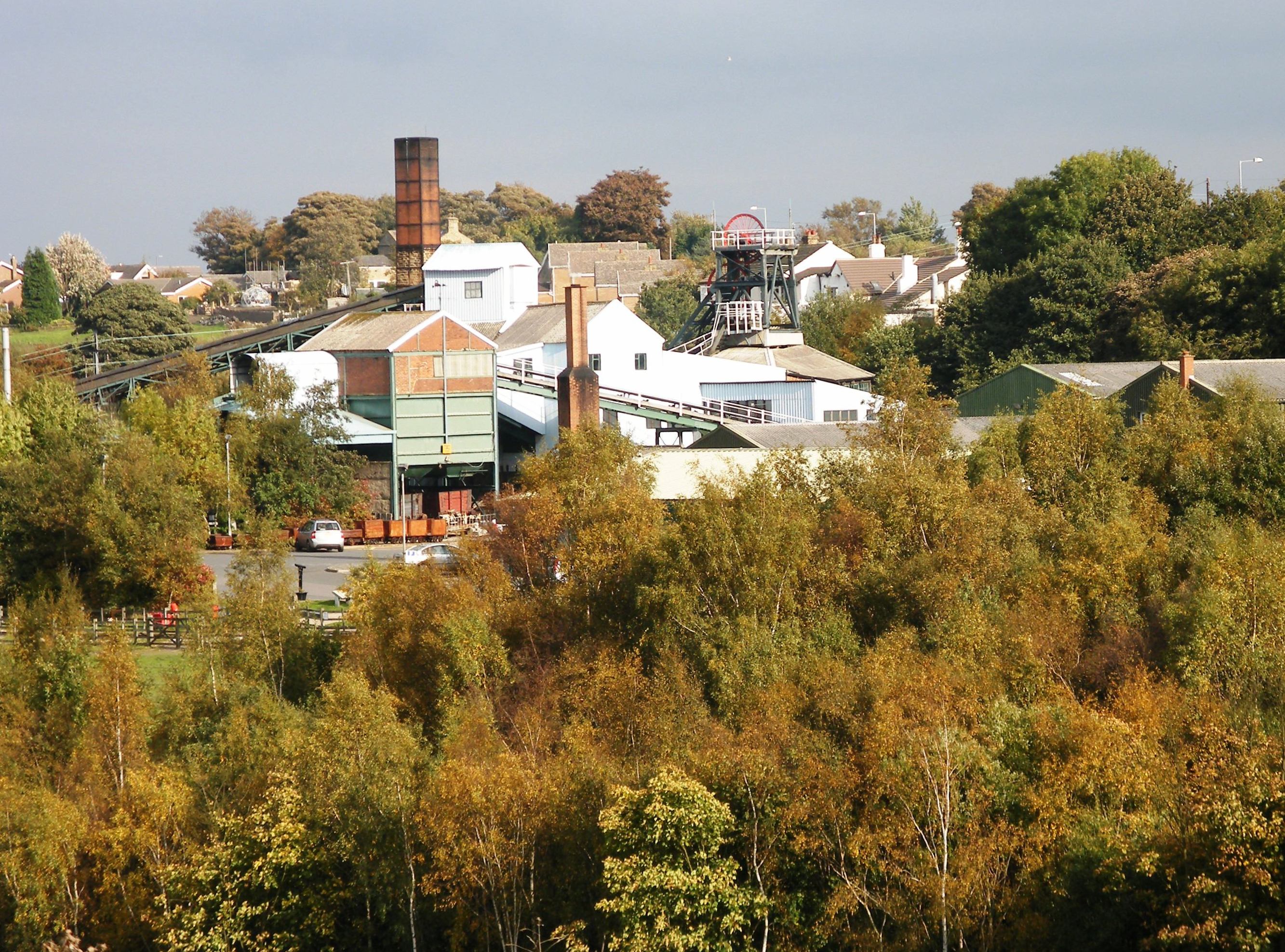
Caphouse Colliery, originally known as Overton Colliery, was a coal mine in Overton, near Wakefield, West Yorkshire, England. It was situated on the Denby Grange estate owned by the Lister Kaye family, and was worked from the 18th century until 1985. It reopened as the Yorkshire Mining Museum in 1988, and is now the National Coal Mining Museum for England. History The colliery was on the Denby Grange Estate, home of the Lister Kayes, in an area where coal had been mined for many years. Coal was close to the surface and the Flockton Thick Seam was mined in 1793. Leases for mining coal were held by Timothy Smith who leased the original Denby Grange Colliery north of Flockton and James Milnes who mined coal at Emroyd and Old Flockton. Some coal was supplied locally, but much more was sent to distant markets to the east of Pontefract via the Calder and Hebble Navigation. Smith's coal pits were under the control of Sir John Lister Kaye by 1817 and were managed by estate managers inc ... [...More Info...] [...Related Items...] OR: [Wikipedia] [Google] [Baidu] |


