|
List Of Buildings And Structures In Cape Verde
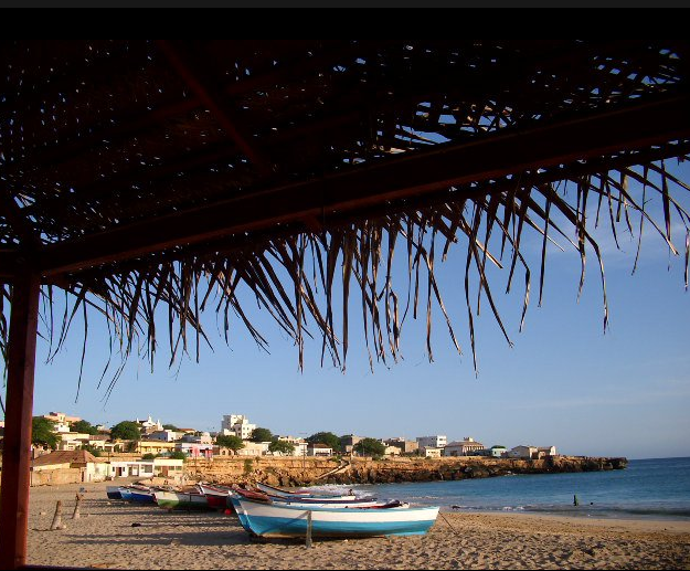
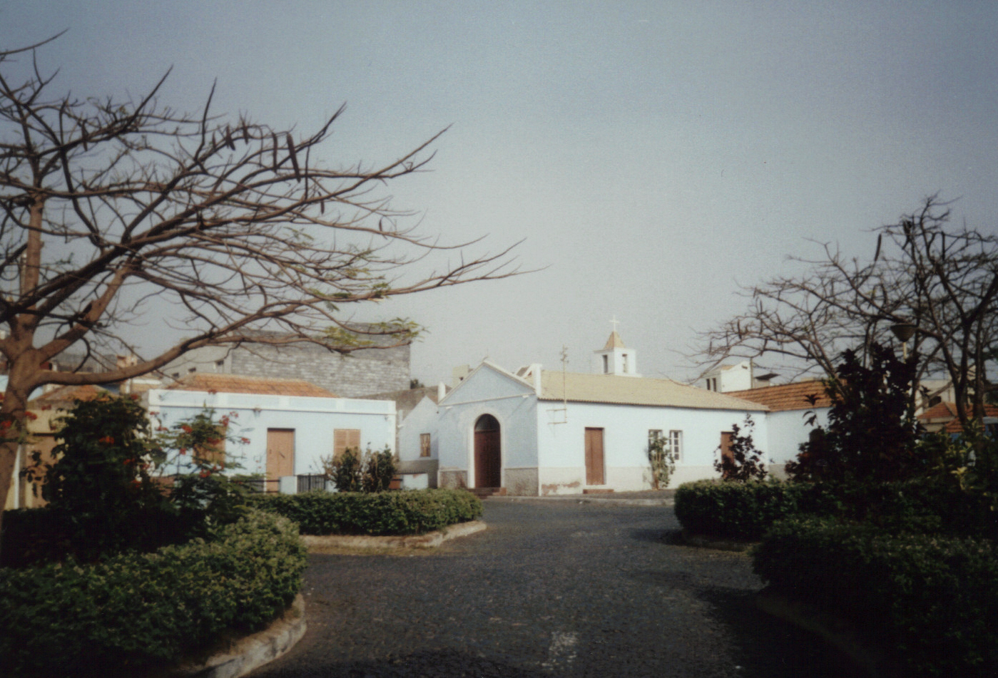
This article is a list of buildings and structures in Cape Verde ordered by city or island: Boa Vista * Nossa Senhora da Conceição church in Povoação Velha *Aristides Pereira International Airport near Rabil * Forte Duque de Bragança on Ilhéu de Sal Rei *Estádio Municipal Arsénio Ramos in Sal Rei Brava *Esperadinha Airport (closed) *Estádio Aquiles de Oliveira in Nova Sintra *Ilhéu de Cima Lighthouse Fogo * Estádio Municipal Francisco José Rodrigues in Mosteiros * Estádio Monte Pelado in Cova Figueira * Estádio 5 de Julho in São Filipe * Museu Municipal de São Filipe in São Filipe *São Filipe Airport near São Filipe Maio * Estádio Municipal 20 de Janeiro - Cidade do Maio - multiuse stadium Sal *Amílcar Cabral International Airport, Espargos *Estádio Marcelo Leitão, Espargos * Farol da Ponta do Sinó, Santa Maria * Farol de Ponta de Vera Cruz, Santa Maria * Farol de Pedra de Lume, Pedra de Lume * Farol da Ponta Norte Santiago Santo Antão *Est� ... [...More Info...] [...Related Items...] OR: [Wikipedia] [Google] [Baidu] |
Cape Verde
, national_anthem = () , official_languages = Portuguese , national_languages = Cape Verdean Creole , capital = Praia , coordinates = , largest_city = capital , demonym = Cape Verdean or Cabo Verdean , ethnic_groups_year = 2017 , government_type = Unitary semi-presidential republic , leader_title1 = President , leader_name1 = José Maria Neves , leader_title2 = Prime Minister , leader_name2 = Ulisses Correia e Silva , legislature = National Assembly , area_rank = 166th , area_km2 = 4033 , area_sq_mi = 1,557 , percent_water = negligible , population_census = 561,901 , population_census_rank = 172nd , population_census_year = 2021 , population_density_km2 = 123.7 , population_density_sq_mi = 325.0 , population_density_rank = 89th , GDP_PPP ... [...More Info...] [...Related Items...] OR: [Wikipedia] [Google] [Baidu] |
Mosteiros, Cape Verde
Mosteiros (also: ''Cidade da Igreja'') is a cityCabo Verde, Statistical Yearbook 2015 Instituto Nacional de Estatística, p. 32-33 in the northeastern part of the island of Fogo, Cape Verde. It is situated on the coast, 24 km northeast of the island capital São Filipe. It is the seat of the [...More Info...] [...Related Items...] OR: [Wikipedia] [Google] [Baidu] |
Ponta De Vera Cruz
Ponta de Vera Cruz is a headland at the waterfront of the city Santa Maria in the south of Sal, Cape Verde. It is situated near the harbour of Santa Maria. There is a lighthouse on the headland, attached to a restaurant. See also * List of lighthouses in Cape Verde * List of buildings and structures in Cape Verde This article is a list of buildings and structures in Cape Verde ordered by city or island: Boa Vista * Nossa Senhora da Conceição church in Povoação Velha *Aristides Pereira International Airport near Rabil * Forte Duque de Bragança on Ilh ... References {{Authority control , additional=Q42402555 Vera Cruz Geography of Sal, Cape Verde Santa Maria, Cape Verde Lighthouses in Cape Verde ... [...More Info...] [...Related Items...] OR: [Wikipedia] [Google] [Baidu] |
Farol Da Ponta Do Sinó
Farol is a municipality in the state of Paraná in the Southern Region of Brazil. See also *List of municipalities in Paraná This is a list of the municipalities in the state of Paraná (PR), located in the South Region of Brazil. Paraná is divided into 399 municipalities, which are grouped into 39 microregions, which are grouped into 10 mesoregions. See also * ... References Municipalities in Paraná {{ParanáBR-geo-stub ... [...More Info...] [...Related Items...] OR: [Wikipedia] [Google] [Baidu] |
Estádio Marcelo Leitão
Estádio Marcelo Leitão is a multi-use stadium in Sal Island, Cape Verde. It is used mostly for football matches and now track and field and has a capacity of 8,000 people. It is named for Marcelo Leitão, one of the two main features on the island, the other is a square located in Santa Maria. The stadium is owned by the municipality of Sal and still does as the municipality has yet to split into two. The stadium are operated by the Sal Regional Football (Soccer) and Athletic associations. It is the home stadium of Espargos teams, Académico do Aeroporto and others based in a neighborhood Juventude and recently Chã de Matias, Gaviões, Jovens Unidos of Ribeira Funda (the three since 2014) and Pretória (since 2017), it is also home to the island's club Académica do Sal. The ground is made of artificial grass, its area is 105 x 68 meters. Its location is south of the road connecting the east of the city with the road encircling most of the city. The stadium also had rece ... [...More Info...] [...Related Items...] OR: [Wikipedia] [Google] [Baidu] |
Amílcar Cabral International Airport
Amílcar Cabral International Airport , also known as Sal International Airport, is the main international airport of Cape Verde. The airport is named after the revolutionary leader Amílcar Cabral. It is located two km west-southwest from Espargos on Sal Island. Sal is the main hub for the national airline, Cabo Verde Airlines; and serves as a base for carrier Cabo Verde Express. This airport was also one of NASA's locations for a facility to handle the Space Shuttle after reentering from orbit. History The first airport on Sal Island was built in 1939 by Italy, as a fuel and provisions stopping-point on routes from Europe to South America. The first flight, an arrival from Rome and Seville, was on 15 December 1939. As a consequence of World War II, the Italian involvement in the airport project ceased. After World War II, the Portuguese colonial government purchased the airport from Italy and by 1949 the airport was a fully operational. In 1950, DC-4 service on Alitalia began o ... [...More Info...] [...Related Items...] OR: [Wikipedia] [Google] [Baidu] |
Sal, Cape Verde
Sal (Portuguese for "salt") is an island in Cape Verde. Sal is a tourist destination with white sandy beaches and over 350 days of sunshine a year. It is one of the three sandy eastern islands of the Cape Verde archipelago in the central Atlantic Ocean, off the west coast of Africa. Cabo Verde is known for year-round kiteboarding, for the large reserve of Caretta turtles which hatch from July to September, and the music of Cesaria Evora. History For Europeans , the island was discovered on 3 December 1460 and named ''Llana'' ("flat"). This name was changed into the current "Sal" when the two large salt ponds (Pedra de Lume and Santa Maria) were discovered. The first three centuries after its discovery, the island was only sparsely inhabited; in 1720 there was a small fishing village near present Palmeira. This changed when the salt industry was developed at the end of the 18th century, starting in Pedra de Lume. Santa Maria was founded in the south of the island in 1830 by ... [...More Info...] [...Related Items...] OR: [Wikipedia] [Google] [Baidu] |
Estádio Municipal 20 De Janeiro
Estádio Municipal 20 de Janeiro is a multi-use stadium in Maio, Cape Verde. Its location is east of the town center of Cidade do Maio about 300 meters nearly south of the Maio- Figueira da Horta Road (EN3-MA01), the Maio Circular Route and is in the residential sector. It stadium is named after a holiday named Heroes Day It is currently used mostly for football matches and is the home stadium of Académico 83 and Onze Unidos. Every other clubs from the island based outside Cidade do Maio including Académica da Calheta and Barreirense plays at the stadium. The stadium is operated by the Maio Regional Football Association (ARFM). The stadium holds 1.000 people (some sources says 4,000) and size is and its grass is artificial. Every football (soccer) championships of the Maio Island League along with the Maio Cup, the Maio Super Cup and the Maio Opening Tournament are played at the stadium. Also track and field at the regional level (Boa Vista-Maio) are played. Early sta ... [...More Info...] [...Related Items...] OR: [Wikipedia] [Google] [Baidu] |
Maio, Cape Verde
Maio is the easternmost of the Sotavento islands of Cape Verde. Maio is located south of the island of Boa Vista and east of Santiago. Administratively, the island forms one ''concelho'' (municipality): Maio. History The island was discovered in 1460. It was first settled at the end of the 16th century, when the land was used to raise livestock, especially goats. Salt was first exploited in the 17th century which caused the population to grow. The English exported salt to Europe from Porto Inglês, hence the name of that city.História Municipio do Maio The inconclusive was fought between British and French |
São Filipe Airport
São Filipe Airport ( pt, Aeródromo de São Filipe, also: ''Aeródromo do Fogo'') is Cape Verde's fifth most-used airport, located in the island of Fogo. It is located 2 km southeast of the town of São Filipe, near the Atlantic Ocean The Atlantic Ocean is the second-largest of the world's five oceans, with an area of about . It covers approximately 20% of Earth's surface and about 29% of its water surface area. It is known to separate the " Old World" of Africa, Europe .... It is used for domestic flights only. The airport was completed in 1997,Aeródromo do Fogo Aeroportos e Segurança Aérea replacing a smaller airfield at the same location. Its runway measures by wide. The maximum single-wheel load is 20 tonnes. [...More Info...] [...Related Items...] OR: [Wikipedia] [Google] [Baidu] |
Museu Municipal De São Filipe
Museu Municipal de São Filipe (Portuguese for "São Filipe Municipal Museum") is a museum located in the historic centre of São Filipe, on the island of Fogo, Cape Verde. It is located in a sobrado, a colonial town house. The museum was opened on December 13, 2008, by the town president Eugênio Miranda da Veiga. See also *List of museums in Cape Verde *List of buildings and structures in Cape Verde This article is a list of buildings and structures in Cape Verde ordered by city or island: Boa Vista * Nossa Senhora da Conceição church in Povoação Velha *Aristides Pereira International Airport near Rabil * Forte Duque de Bragança on Ilh ... Notes External links Official website {{coord, 14.8942, -24.4999, source:wikidata, display=title São Filipe, Cape Verde Museums in Cape Verde Museums established in 2008 2008 establishments in Cape Verde ... [...More Info...] [...Related Items...] OR: [Wikipedia] [Google] [Baidu] |
São Filipe, Cape Verde
São Filipe (Portuguese for "Saint Philip") is a cityCabo Verde, Statistical Yearbook 2015 Instituto Nacional de Estatística, p. 32-33 on the west coast of the island of Fogo, . It is the capital of the island, and the seat of the São Filipe Municipality. The island's a ... [...More Info...] [...Related Items...] OR: [Wikipedia] [Google] [Baidu] |

.jpg)

.jpg)

