|
List Of British Railways Shed Codes
British Railways shed codes were used to identify the engine sheds that its locomotives and multiple units were allocated to for maintenance purposes. The former London, Midland and Scottish Railway (LMS) alpha-numeric system was extended to cover all regions and used until replaced by alphabetic codes in 1973. System of codes The coding system had its origins in a reorganisation of locomotive operation and maintenance on the LMS in the 1933-35 period. It grouped all sheds into districts with a main shed, given the district number followed by the letter A as its code, and subsidiary sheds with the same number followed by B, C, or D etc. Many sheds were also responsible for sub-sheds where day-to-day servicing could be carried out but which lacked the facilities for intermediate or heavy overhauls. The extension of the system to all regions was brought into use in 1950, each region being given a block of district numbers: * 1 – 28 London Midland Region * 30 – 41 Eastern Region ... [...More Info...] [...Related Items...] OR: [Wikipedia] [Google] [Baidu] |
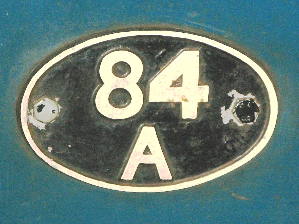
Laira 84A Shedplate On D1023
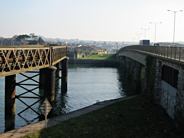
Laira – previously recorded as Lare(1591), Lary poynte (1638), the Leerie (1643), and the Lairy (1802) – was originally the name given to that part of the estuary of the River Plym from the Cattewater up to Marsh Mills in Plymouth, Devon, England. The name may derive from a Common Brittonic, Brythonic word corresponding to the Welsh language, Welsh ''llaeru'', meaning 'to ebb'. The A379 road and the disused Plymouth to Yealmpton Branch, Plymouth to Yealmpton railway line cross the estuary just above the Plymouth suburb of Cattedown by two bridges both known as Laira Bridge. The name Laira now also refers to the area of Plymouth surrounding the Laira Traction Maintenance Depot. Much of the housing here was built around 1900 for employees of the depot. There is a memorial plaque to the men of Laira who died in the World War I, Great War along Old Laira Road. Also situated on Old Laira Road is the old Police / Fire Station which is currently used as a library. Laira Green Pr ... [...More Info...] [...Related Items...] OR: [Wikipedia] [Google] [Baidu] |
British Rail Class 42
The British Rail Class 42 ''Warship'' diesel-hydraulic locomotives were introduced in 1958. It was apparent at that time that the largest centre of expertise on diesel-hydraulic locomotives was in West Germany. The Western Region of British Railways negotiated a licence with German manufacturers to scale down the German Federal Railway's "V200" design to suit the smaller loading gauge of the British network, and to allow British manufacturers to construct the new locomotives. The resultant design bears a close resemblance, both cosmetically and in the engineering employed, to the original V200 design. Warship locomotives were divided into two batches: those built at BR's Swindon works were numbered in the series D800-D832 and D866-D870, had a maximum tractive effort of and eventually became British Rail Class 42. 33 others, D833–D865, were constructed by the North British Locomotive Company and became British Rail Class 43. They were allocated to Bristol Bath Road, Plymou ... [...More Info...] [...Related Items...] OR: [Wikipedia] [Google] [Baidu] |
Devons Road
Devons Road is a road in Bow Common and Bromley-by-Bow in east London. Part of the B140 road, it gives its name to the Devons Road DLR station. Motive power depots The North London Railway established a large motive power depot at Bow around 1850, which was demolished in 1882 and incorporated into Bow railway works. Two larger locomotive depots were then built at Devons Road nearby. ;Devons Road No.1 shed The No.1 shed was badly damaged by bombing during the Second World War. It was rebuilt in 1946 by the London Midland and Scottish Railway, and then converted into the first UK diesel maintenance depot by British Railways in 1958. It was closed in 1964 and demolished. ;Devons Road No.2 shed The No.2 shed was closed by the London Midland and Scottish Railway in 1935 and demolished. Stroudley Walk The closure of Devons Road Number 1 shed by British Railways in the 1960s freed up the land for development as social housing. This led to a new street layout with streets and building ... [...More Info...] [...Related Items...] OR: [Wikipedia] [Google] [Baidu] |
Watford Junction Railway Station
Watford Junction is a railway station that serves Watford, Hertfordshire. The station is on the West Coast Main Line (WCML), 17 miles 34 chains from London Euston and the Abbey Line, a branch line to St Albans. Journeys to London take between 16 and 52 minutes depending on the service used: shorter times on fast non-stop trains and slower on the stopping Watford DC line services. Trains also run to and East Croydon via the West London Line. The station is a major hub for local bus services and the connecting station for buses to Warner Bros. Studio Tour London – The Making of Harry Potter. The station is located north of a viaduct over the Colne valley and immediately south of Watford Tunnel. History The first railway station to open in Watford was situated on the north side of St Albans Road, approximately further up the line from the present-day station. This small, single-storey red-brick building was built 1836-7 when the first section of the London and Birmingham Ra ... [...More Info...] [...Related Items...] OR: [Wikipedia] [Google] [Baidu] |
Camden Motive Power Depot
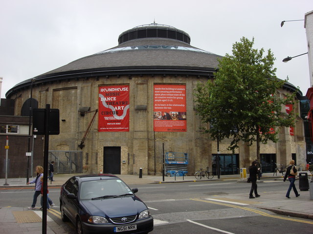
Camden Motive Power Depot was a railway motive power depot, close to Chalk Farm, Camden in London, England from 1837 until 1966, servicing express passenger locomotives using Euston Railway Station. It was closed following the electrification of the West Coast Main Line and largely demolished. However, part of the original facility has been preserved as The Roundhouse centre for the performing arts. History The London and Birmingham Railway opened a locomotive servicing facility at Chalk Farm near to the present site in 1837, which was replaced in 1847 by two further buildings on either side of the West Coast Main Line. On the north side was a roundhouse intended for freight locomotives, and on the south side was a larger depot for passenger locomotives using Euston railway station. The roundhouse was closed in 1871 and replaced by the Willesden motive power depot. Its building was converted into a storage warehouse and in time became The Roundhouse centre for the performing ... [...More Info...] [...Related Items...] OR: [Wikipedia] [Google] [Baidu] |
Willesden Traction Maintenance Depot
Willesden TMD is a railway locomotive and electric multiple unit traction maintenance depot, situated in Harlesden, north London. The depot is situated next to the West Coast Main Line, to the south-east of Willesden Junction station and on the way into London Euston station. The depot code is WN. History The original locomotive servicing facility at Willesden was on the south side of the main line, west of the station, which closed in 1965. It was replaced by the present facility. Shed layout The current depot was designed in the 1960s to service electric locomotive classes AL1 to AL6 (TOPS classes 81, 82, 83, 84, 85 and 86); subsequently, in the early 1970s, Class 87s were included. It consists of six parallel shed roads, each holding four locomotives inside the shed, and several arrivals and departure sidings externally. There is also a road that runs round to the north of the shed, which provides access to the fuel siding; for many years, this was used only for the ... [...More Info...] [...Related Items...] OR: [Wikipedia] [Google] [Baidu] |
Toton
Toton is a large village in the Borough of Broxtowe, Nottinghamshire, England. The electoral ward of Toton and Chilwell Meadows population of this ward was 7,298 in the 2001 census. It increased to 8,238 at the 2011 census. Until 1974 Toton was part of Beeston and Stapleford Urban District, having been in Stapleford Rural District until 1935. The border with Derbyshire is immediately to the west. Toton is predominantly rural and is one of the main entrances to Chetwynd Barracks (also known as Chilwell Depot), which forms a boundary to the east, with the Midland Railway and Toton Sidings forming a boundary to the west. History Although the village of Toton has existed since at least Norman times, little is known of its history. It is known that Toton parish at one time encompassed a much larger area than is now apparent, including much of what is now Attenborough village, and shared a church (probably on the site of St. Mary's, Attenborough) with neighbouring Chilwell paris ... [...More Info...] [...Related Items...] OR: [Wikipedia] [Google] [Baidu] |
Cricklewood Depot
Cricklewood sidings currently provides stabling for passenger trains, and is the site of a former steam shed and diesel traction maintenance depot located in Cricklewood, Greater London, England. It is situated beside the Midland Main Line, to the east of Cricklewood station. The depot code was CW. Passenger train stabling Trains berthing in the stabling roads between services are cleaned and have their water tanks refilled. Train types include East Midlands Railway Class 43 HSTs, Class 222 Meridians as well as Thameslink Class 700 EMUs. Domestic waste operations The North London Waste Authority operates Hendon transfer station, which is located immediately behind the northern end of the site and accessed through the passenger sidings. Freightliner Heavy Haul hauls a waste container train, nicknamed " The Binliner" from here to a landfill site at Calvert in Buckinghamshire Buckinghamshire (), abbreviated Bucks, is a ceremonial county in South East England that b ... [...More Info...] [...Related Items...] OR: [Wikipedia] [Google] [Baidu] |
Lostock Hall
Lostock Hall is a suburban village within the South Ribble borough of Lancashire, England. It is located on the south side of the River Ribble, some south of Preston and north of Leyland. It is bordered on its southeastern side by the interchange for the M6, M61 and M65 motorways. At the time of the United Kingdom Census 2001, the central Lostock Hall area had a population of 3,948,Neighbourhood Statistics - Lostock Hall (Ward) URL accessed 17 November 2007. falling to 3,762 at the 2011 Census. Lostock Hall traces its origins to James de Lostock who in 1212 built Lostock's Hall in the then rural area of Cuerden Green in the |
Longsight
Longsight is an inner city suburb of Manchester, England, located south of the city centre. It is bounded by Ardwick and West Gorton to the north; Levenshulme to the south; and Chorlton-on-Medlock, Victoria Park and Fallowfield to the west. Historically in Lancashire, it had a population of 15,429 at the 2011 census. History An ethnically diverse area, for many years, Longsight has been plagued by gang related violence, similar to that of nearby Moss Side. Most of the violence came from tensions between two rival gangs which fought "turf wars" with each other since the 1990s, resulting in many shootings and several deaths. The Gooch Gang, from neighbouring Moss Side, were jailed in 2009, Consequently, gun crime in Greater Manchester as a whole has fallen dramatically, from a high of 120 gang-related shootings in 2006 to just 16 in 2011. Governance Longsight has been in the parliamentary constituency of Manchester Gorton since boundary changes in 1983. The seat has been r ... [...More Info...] [...Related Items...] OR: [Wikipedia] [Google] [Baidu] |
Allerton, Liverpool
Allerton is a suburb of Liverpool, England. Historically in Lancashire, it is located southeast of the city centre and is bordered by the suburbs of Garston, Hunt's Cross, Mossley Hill, and Woolton. It has a number of large houses in the prestigious Calderstones Park area, with mainly 1930s semi-detached housing around the shopping area of Allerton Road. It is paired with Hunts Cross to form the Allerton and Hunts Cross city council ward, which had a population of 14,853 at the 2011 census. History In the Domesday Book, Allerton appears as ''Alretune'', meaning "the alder enclosure". This was derived from the Old English ''alr'', meaning "alder", and ''tún'', meaning "enclosure or village". It was made an urban district by the Local Government Act 1894, and added to the county borough of Liverpool on 9 November 1913. Over the course of the 2010s, many new bars and restaurants opened on Allerton Road, increasing its popularity. Education *New Heys *Calderstones School Attr ... [...More Info...] [...Related Items...] OR: [Wikipedia] [Google] [Baidu] |
Crewe
Crewe () is a railway town and civil parish in the unitary authority of Cheshire East in Cheshire, England. The Crewe built-up area had a total population of 75,556 in 2011, which also covers parts of the adjacent civil parishes of Willaston, Shavington cum Gresty and Wistaston. Crewe is perhaps best known as a large railway junction and home to Crewe Works; for many years, it was a major railway engineering facility for manufacturing and overhauling locomotives, but now much reduced in size. From 1946 until 2002, it was also the home of Rolls-Royce motor car production. The Pyms Lane factory on the west of the town now exclusively produces Bentley motor cars. Crewe is north of London, south of Manchester city centre, and south of Liverpool city centre. History Medieval The name derives from an Old Welsh word ''criu'', meaning 'weir' or 'crossing'. The earliest record is in the Domesday Book, where it is written as ''Creu''. Modern Until the Grand Junction Railw ... [...More Info...] [...Related Items...] OR: [Wikipedia] [Google] [Baidu] |


_2018.png)
