|
Linlithgow
Linlithgow ( ; ; ) is a town in West Lothian, Scotland. It was historically West Lothian's county town, reflected in the county's historical name of Linlithgowshire. An ancient town, it lies in the Central Belt on a historic route between Edinburgh and Falkirk beside Linlithgow Loch. The town is situated approximately 20 miles (32 km) west of Edinburgh. During the medieval period, the town grew in prominence as a royal burgh and residence around Linlithgow Palace. In later centuries, Linlithgow became a centre of industry in leather making and other materials, before developing rapidly in the Victorian era with the opening of the Union Canal in the 1820s and the arrival of the railway in 1842. Linlithgow was the former county town of the county but the Council now resides in nearby Livingston. Today Linlithgow has less industry and the economy of the town centre is focused on hospitality, heritage and tourism services. Linlithgow's patron saint is Saint Michael and its ... [...More Info...] [...Related Items...] OR: [Wikipedia] [Google] [Baidu] |
Linlithgow Palace
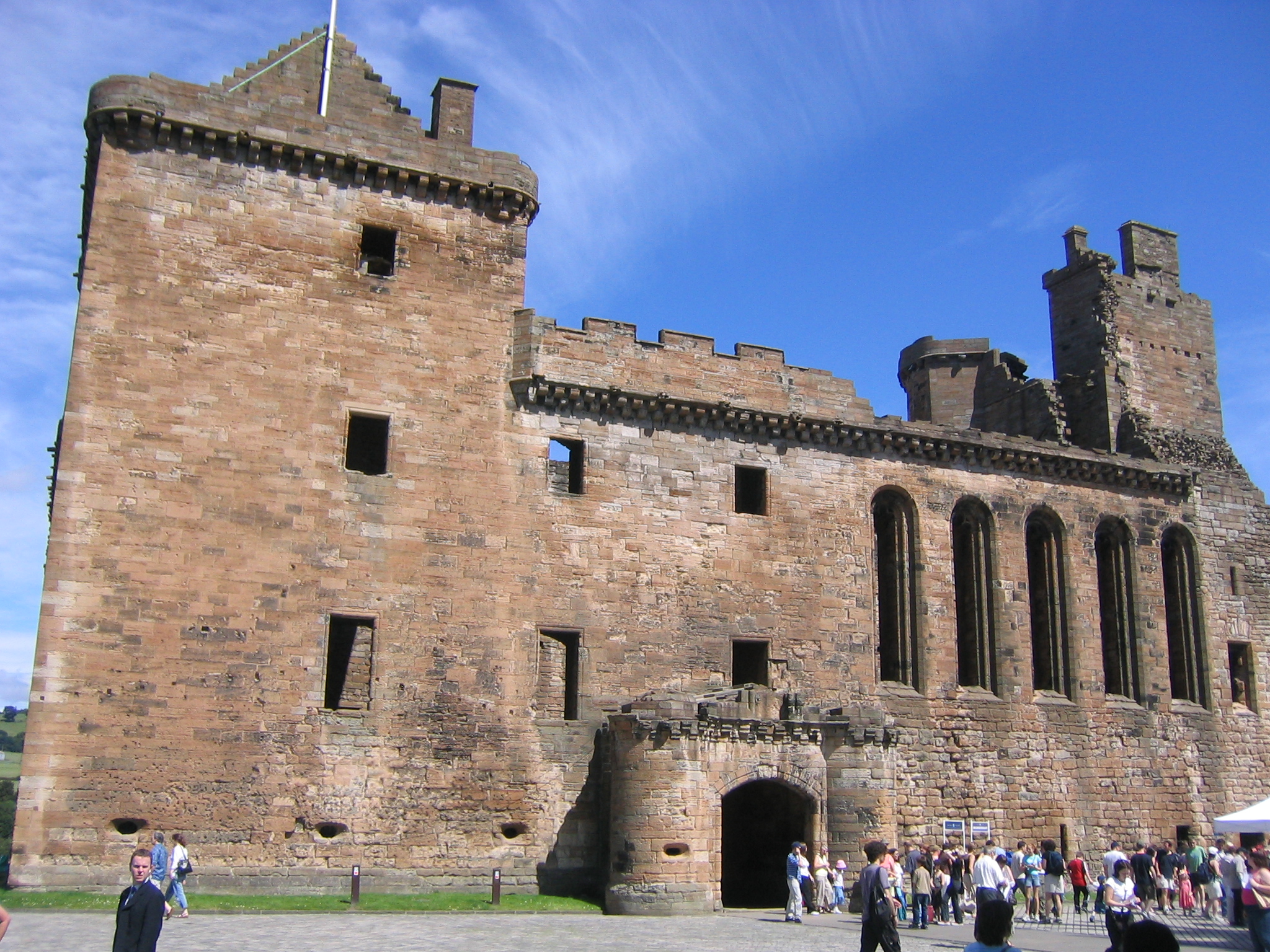
The ruins of Linlithgow Palace are located in the town of Linlithgow, West Lothian, Scotland, west of Edinburgh. The palace was one of the principal residences of the monarchs of Kingdom of Scotland, Scotland in the 15th and 16th centuries. Although maintained after Scotland's monarchs left for England in 1603, the palace was little used, and was burned out in 1746. It is now a visitor attraction in the care of Historic Environment Scotland. Origins A royal manor existed on the site from the 12th century. This was later enclosed by a timber palisade and outer fosse to create a fortification known as 'the Peel', built in 1301/2 by occupying English forces under Edward I of England, Edward I. The site of the manor made it an ideal military base for securing the supply routes between Edinburgh Castle and Stirling Castle. The English fort was begun in March 1302 under the supervision of two priests, Richard de Wynepol and Henry de Graundeston, to the designs of Master ... [...More Info...] [...Related Items...] OR: [Wikipedia] [Google] [Baidu] |
West Lothian
West Lothian (; ) is one of the 32 council areas of Scotland, bordering (in a clockwise direction) the City of Edinburgh council area, Scottish Borders, South Lanarkshire, North Lanarkshire and Falkirk (council area), Falkirk. The modern council area was formed in 1975 when the West Lothian (historic), historic county of West Lothian, also known as Linlithgowshire, was reshaped substantially as part of local government reforms; some areas that had formerly been part of Midlothian (historic), Midlothian were added to a new West Lothian Districts of Scotland, District within the Local government areas of Scotland 1973 to 1996, Region of Lothian, whilst some areas in the north-west were transferred to the Falkirk District and areas in the north-east were transferred to the Edinburgh (district), City of Edinburgh District. In 1996 West Lothian became a unitary authority area, using the same name and territory as in 1975. West Lothian lies on the southern shore of the Firth of Forth ... [...More Info...] [...Related Items...] OR: [Wikipedia] [Google] [Baidu] |
Linlithgow (Scottish Parliament Constituency)
Linlithgow is a constituency of the Scottish Parliament ( Holyrood) covering part of the council area of West Lothian. It elects one Member of the Scottish Parliament (MSP) by the plurality (first past the post) method of election. It is also one of nine constituencies in the Lothian electoral region, which elects seven additional members, in addition to the nine constituency MSPs, to produce a form of proportional representation for the region as a whole. The seat has been held by Fiona Hyslop of the Scottish National Party since the 2011 Scottish Parliament election. Electoral region The other eight constituencies of the Lothian region are: Almond Valley, Edinburgh Central, Edinburgh Eastern, Edinburgh Northern and Leith, Edinburgh Pentlands, Edinburgh Southern, Edinburgh Western and Midlothian North and Musselburgh The region includes all of the City of Edinburgh council area, parts of the East Lothian council area, parts of the Midlothian council area and ... [...More Info...] [...Related Items...] OR: [Wikipedia] [Google] [Baidu] |
Linlithgow Loch
Linlithgow Loch lies immediately north of the town of Linlithgow in West Lothian, Scotland. 1.3 kilometres in length and 0.4 in breadth, its area of 41 hectares makes it the largest natural freshwater loch in Lothian. It is, however, shallow, with a mean depth of 2.3 metres and a maximum depth of 9.2 metres. The loch is fed by four small streams, the Hatchery Burn, the Bonnytoun Burn, the Springfield Burn, and Bell's Burn,"Linlithgow Loch and its wildlife" West Lothian Council. NB: the Hatchery Burn is shown unlabelled in the top right corner of the map. and drained by the Mill Burn on its western side, which eventually joins the River Avon, Falkirk, Avon. The loch is the source of the town of Linlithgow's name; the Brittonic languages, British ''llyn ... [...More Info...] [...Related Items...] OR: [Wikipedia] [Google] [Baidu] |
Linlithgow Burgh Halls
Linlithgow Burgh Halls is a municipal structure at The Cross, Linlithgow, Scotland. The complex includes the Town House, the former headquarters of Linlithgow Burgh Council, which is a Category A listed building. and the Old County Hall, the former headquarters of West Lothian County Council, which is a Category B listed building. History The first municipal building in the town was a medieval tolbooth with a large bell tower: it was demolished on the orders of the Lord Protector, Oliver Cromwell, to provide improved access to Linlithgow Palace, in 1650. Following the Stuart Restoration, burgh leaders decided to commission a new town house: the new building was designed by John Smith in the neoclassical style, built by Robert Mylne in ashlar stone and was completed in late 1670. The design involved a symmetrical main frontage with seven bays facing onto The Cross; the central bay featured a square headed doorway on the first floor which was originally accessed by a single fligh ... [...More Info...] [...Related Items...] OR: [Wikipedia] [Google] [Baidu] |
Bathgate And Linlithgow (UK Parliament Constituency)
Bathgate and Linlithgow is a List of UK Parliament constituencies, constituency of the House of Commons of the United Kingdom, House of Commons in the Parliament of the United Kingdom, UK Parliament. Further to the completion of the 2023 review of Westminster constituencies, it was first contested at the 2024 United Kingdom general election, 2024 general election, when it was won by Kirsteen Sullivan of the Labour Party (UK), Labour Party. The constituency name refers to the West Lothian towns of Bathgate and Linlithgow. Boundaries The constituency comprises the following: * In full: the Falkirk (council area), Falkirk Council ward of Bo'ness and Blackness (ward), Bo'ness and Blackness; and the West Lothian, West Lothian Council wards of Armadale and Blackridge (ward), Armadale and Blackridge, Bathgate (ward), Bathgate, Linlithgow (ward), Linlithgow, and Whitburn and Blackburn (ward), Whitburn and Blackburn * In part: the West Lothian council ward of Broxburn, Uphall and Winchbu ... [...More Info...] [...Related Items...] OR: [Wikipedia] [Google] [Baidu] |
Linlithgow (ward)
Linlithgow is one of the nine wards used to elect members of the West Lothian Council West Lothian Council is the Local government in Scotland, local government authority for West Lothian, West Lothian council area. History West Lothian District Council Local government across Scotland was reorganised in 1975 under the Local .... It elects four Councillors. In 2019, the population of the ward was 16,499. Councillors Election Results 2022 Election 2022 West Lothian Council election 2017 Election 2017 West Lothian Council election 2012 Election 2012 West Lothian Council election 2007 Election 2007 West Lothian Council election References {{Wards of West Lotian Wards of West Lothian Linlithgow ... [...More Info...] [...Related Items...] OR: [Wikipedia] [Google] [Baidu] |
Union Canal (Scotland)
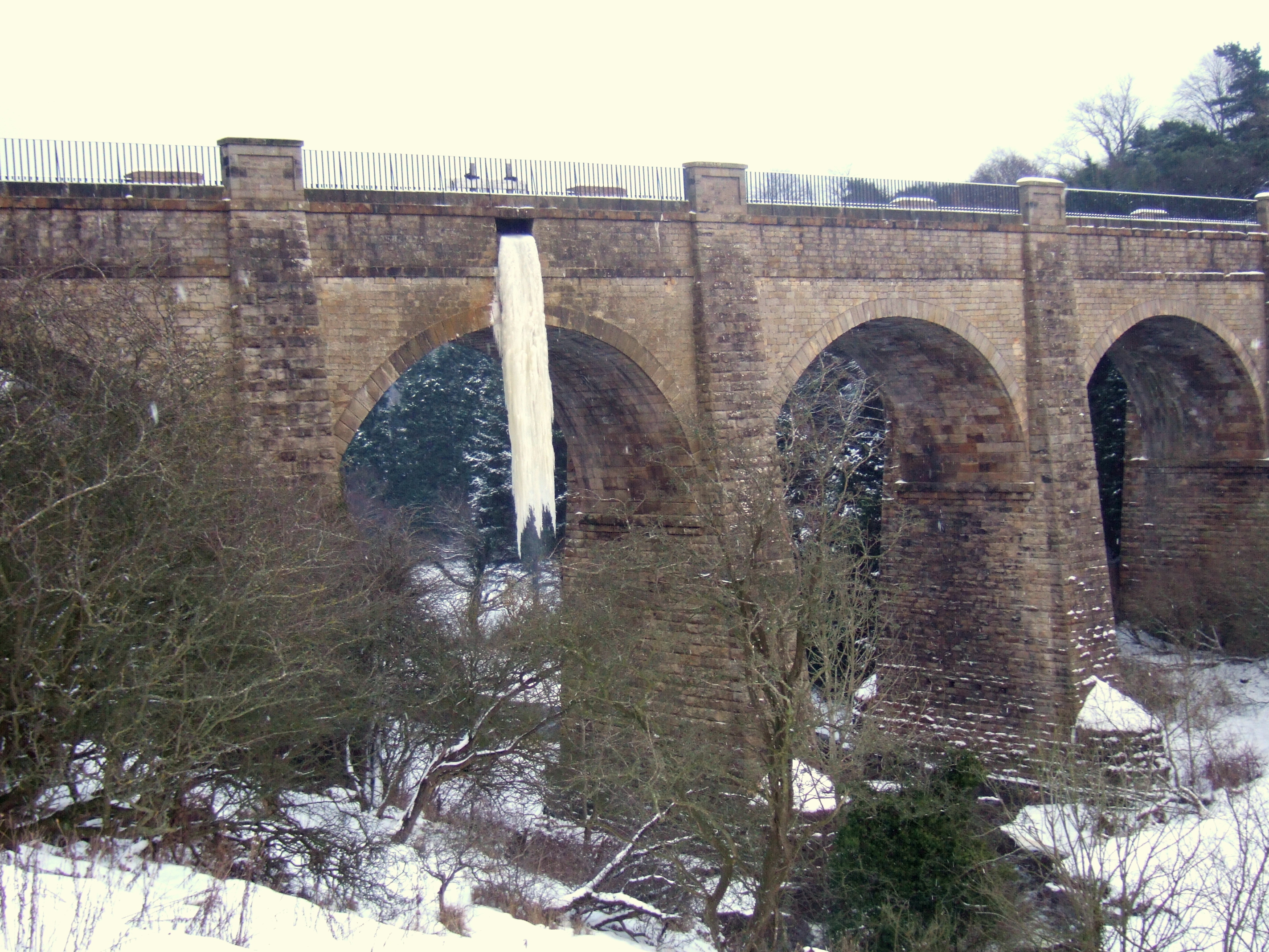
The Union Canal, full name the Edinburgh and Glasgow Union Canal, is a canal in Scotland, running from Falkirk to Edinburgh, constructed to bring minerals, especially coal, to the capital. It was opened in 1822 and was initially successful, but the construction of railways, particularly the Edinburgh and Glasgow Railway, which opened in 1842, diminished its value as a transport medium. It fell into slow commercial decline and was closed to commercial traffic in 1933. It was officially closed in 1965. The canal is listed as three individual scheduled monuments by Historic Scotland according to the three former counties, Midlothian, West Lothian and Stirlingshire, through which it flows. It has benefited from a general revival of interest in canals and, as a result of the Millennium Link, was reopened in 2001 and reconnected to the Forth and Clyde Canal in 2002 by the Falkirk Wheel. It is now in popular use for leisure purposes. History Proposal The canal was conceived ... [...More Info...] [...Related Items...] OR: [Wikipedia] [Google] [Baidu] |
Livingston, West Lothian
Livingston (, ) is the largest town in West Lothian, Scotland. Designated in 1962, it is the fourth post-war New towns in the United Kingdom, new town to be built in Scotland. Taking its name from Livingston Village, a village of the same name incorporated into the new town, it was originally developed in the then-counties of Midlothian (historic), Midlothian and West Lothian (historic), West Lothian along the banks of the River Almond, Lothian, River Almond. It is situated approximately west of Edinburgh and east of Glasgow, and is close to the towns of Broxburn, West Lothian, Broxburn to the north-east and Bathgate to the north-west. The town was built around a collection of small villages, Livingston Village, Bellsquarry, and Livingston Station (now part of Deans, West Lothian, Deans). The town has a number of residential areas. These include Craigshill, Howden, Livingston, Howden, Ladywell, Livingston, Ladywell, Knightsridge, Deans, West Lothian, Deans, Dedridge, Murieston ... [...More Info...] [...Related Items...] OR: [Wikipedia] [Google] [Baidu] |
James I Of Scotland
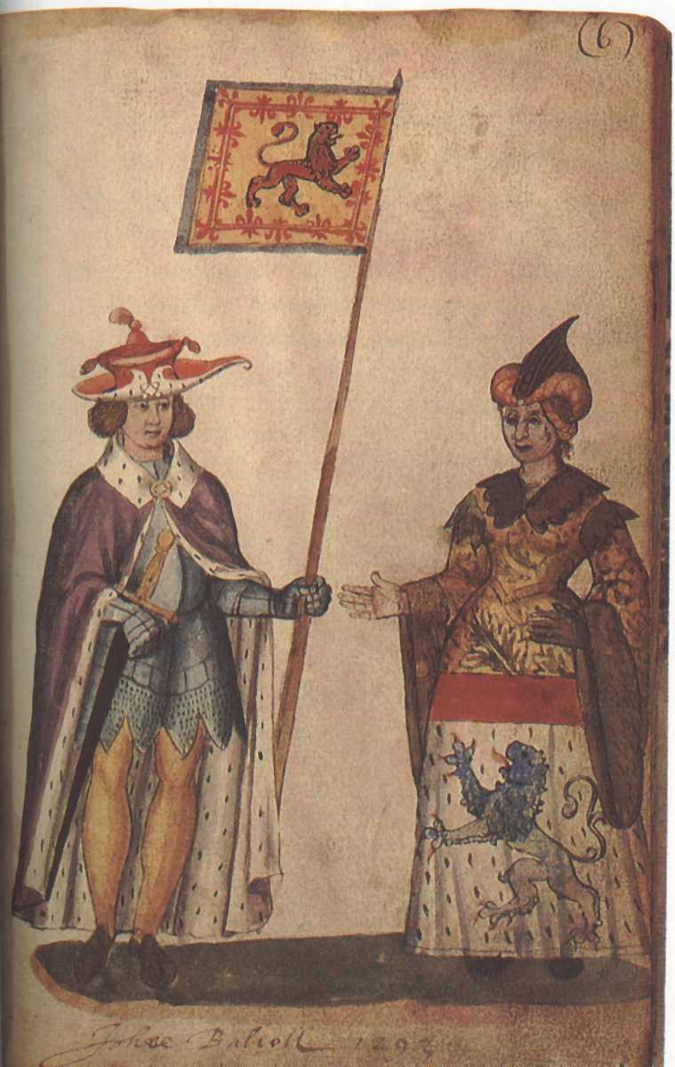
James I (late July 1394 – 21 February 1437) was List of Scottish monarchs, King of Scots from 1406 until his assassination in 1437. The youngest of three sons, he was born in Dunfermline Abbey to King Robert III of Scotland, Robert III and Annabella Drummond. His eldest brother David, Duke of Rothesay, died under suspicious circumstances while detained by his uncle, Robert, Duke of Albany. James's other brother, Robert, died young. Concerns for James's safety deepened in the winter of 1405–1406 prompting plans to send him to France. In February 1406, James took refuge in the castle of the Bass Rock in the Firth of Forth after his escort was attacked by supporters of Archibald, 4th Earl of Douglas. He remained there until mid-March when he boarded a vessel bound for France. On 22 March, an English vessel captured the ship and delivered James to Henry IV of England. The ailing Robert III died on 4 April and the 11-year-old James, now the uncrowned King of Scotland, would rema ... [...More Info...] [...Related Items...] OR: [Wikipedia] [Google] [Baidu] |
List Of Scottish Monarchs
The monarch of Scotland was the head of state of the Kingdom of Scotland. According to tradition, Kenneth I MacAlpin () was the founder and first King of the Kingdom of Scotland (although he never held the title historically, being King of the Picts instead). The List of kings of the Picts, Kingdom of the Picts just became known as the Kingdom of Alba in Scottish Gaelic, which later became known in Scots language, Scots and English as ''Scotland''; the terms are retained in both languages to this day. By the late 11th century at the very latest, Scottish kings were using the term , or King of Scots, to refer to themselves in Latin. The Kingdom of Scotland was merged with the Kingdom of England to form a single Kingdom of Great Britain in 1707. Thus, Anne, Queen of Great Britain, Queen Anne became the last monarch of the ancient kingdoms of Scotland and England and the first of Great Britain, although the kingdoms had shared a monarch since 1603 (see Union of the Crowns). Her un ... [...More Info...] [...Related Items...] OR: [Wikipedia] [Google] [Baidu] |
County Town
In Great Britain and Ireland, a county town is usually the location of administrative or judicial functions within a county, and the place where public representatives are elected to parliament. Following the establishment of county councils in England in 1889, the headquarters of the new councils were usually established in the county town of each county; however, the concept of a county town pre-dates these councils. The concept of a county town is ill-defined and unofficial. Some counties in Great Britain have their administrative bodies housed elsewhere. For example, Lancaster, Lancashire, Lancaster is the county town of Lancashire, but the county council is in Preston, Lancashire, Preston. Owing to the creation of Unitary authorities of England, unitary authorities, some county towns in Great Britain are administratively separate from the county. For example, Nottingham is separated from the rest of Nottinghamshire, and Brighton and Hove is separate from East Sussex. On a ce ... [...More Info...] [...Related Items...] OR: [Wikipedia] [Google] [Baidu] |


