|
Linga, Yell Sound
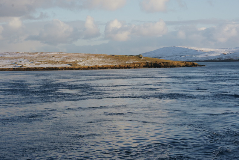
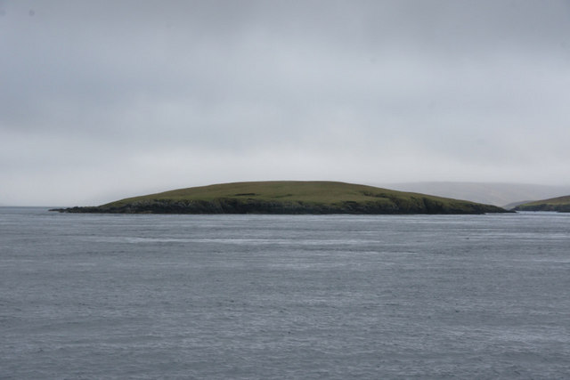
Linga is one of the Shetland Islands, in Yell Sound. Geography and geology Linga is an extremely common name in Shetland, meaning heather island. This Linga is not far from Firth and Firths Voe, in the West. Fish Holm Fish Holm is a small island, east of Mainland, Shetland. It is near the village of Mossbank. It is at its highest point, and a mile south of Samphrey in Yell Sound Yell Sound is the strait running between Yell (island), Yell and Mainland, ... is to the North and Lunna Ness to the east. Linga is made of coarse gneiss, with some granite. It is about 43 ha in area and 40m at its highest point. Footnotes Uninhabited islands of Shetland {{Shetland-geo-stub ... [...More Info...] [...Related Items...] OR: [Wikipedia] [Google] [Baidu] |
Mainland, Shetland
The Mainland is the main island of Shetland, Scotland. The island contains Shetland's only burgh, Lerwick, and is the centre of Shetland's ferry and air connections. Geography It has an area of , making it the third-largest Scottish island and the fifth largest of the British Isles after Great Britain, Ireland, Lewis and Harris and Skye. Mainland is the second most populous of the Scottish islands (only surpassed by Lewis and Harris), and had 18,765 residents in 2011 compared to 17,550 in 2001. The mainland can be broadly divided into four sections: *The long southern peninsula, south of Lerwick, has a mixture of moorland and farmland and contains many important archaeological sites. **Bigton, Cunningsburgh, Sandwick, Scalloway, and Sumburgh *The Central Mainland has more farmland and some woodland plantations. *The West Mainland **Aith, Walls, and Sandness *The North Mainland – in particular the large Northmavine peninsula, connected to Mainland by a narrow isthmus at ... [...More Info...] [...Related Items...] OR: [Wikipedia] [Google] [Baidu] |
Shetland
Shetland, also called the Shetland Islands and formerly Zetland, is a subarctic archipelago in Scotland lying between Orkney, the Faroe Islands and Norway. It is the northernmost region of the United Kingdom. The islands lie about to the northeast of Orkney, from mainland Scotland and west of Norway. They form part of the border between the Atlantic Ocean to the west and the North Sea to the east. Their total area is ,Shetland Islands Council (2012) p. 4 and the population totalled 22,920 in 2019. The islands comprise the Shetland (Scottish Parliament constituency), Shetland constituency of the Scottish Parliament. The local authority, the Shetland Islands Council, is one of the 32 council areas of Scotland. The islands' administrative centre and only burgh is Lerwick, which has been the capital of Shetland since 1708, before which time the capital was Scalloway. The archipelago has an oceanic climate, complex geology, rugged coastline, and many low, rolling hills. The lar ... [...More Info...] [...Related Items...] OR: [Wikipedia] [Google] [Baidu] |
Shetland Islands
Shetland, also called the Shetland Islands and formerly Zetland, is a subarctic archipelago in Scotland lying between Orkney, the Faroe Islands and Norway. It is the northernmost region of the United Kingdom. The islands lie about to the northeast of Orkney, from mainland Scotland and west of Norway. They form part of the border between the Atlantic Ocean to the west and the North Sea to the east. Their total area is ,Shetland Islands Council (2012) p. 4 and the population totalled 22,920 in 2019. The islands comprise the Shetland constituency of the Scottish Parliament. The local authority, the Shetland Islands Council, is one of the 32 council areas of Scotland. The islands' administrative centre and only burgh is Lerwick, which has been the capital of Shetland since 1708, before which time the capital was Scalloway. The archipelago has an oceanic climate, complex geology, rugged coastline, and many low, rolling hills. The largest island, known as " the Mainland", ha ... [...More Info...] [...Related Items...] OR: [Wikipedia] [Google] [Baidu] |
Yell Sound
Yell Sound is the strait running between Yell (island), Yell and Mainland, Shetland, Scotland. It is the boundary between the Mainland and the North Isles and it contains many small islands. Sullom Voe, on the shores of which is a substantial oil terminal, is an arm of Yell Sound. The ferry to the North Isles crosses the sound, which can experience strong tides and adverse weather conditions. There are numerous shipwreck sites and several lighthouses to guide shipping. Yell Sound is mentioned briefly in the medieval ''Orkneyinga saga'' and during the 19th century there was a short flourishing of the kelp industry. Commercial fishing has long been a mainstay of the local economy and part of the sound is as Special Area of Conservation set up to protect the local wildlife. Early history The Old Norse name was ''Alasund'' although the original meaning of the name is not clear.Anderson, Joseph (Ed.) (1893) ''Orkneyinga Saga''. Translated by Jón A. Hjaltalin & Gilbert Goudie. Edinbu ... [...More Info...] [...Related Items...] OR: [Wikipedia] [Google] [Baidu] |
Firth, Shetland
*''Note: "Firth" is a common name for sounds in Shetland'' Firth is a village in the north east of Mainland, Shetland, Scotland, in the parish of Delting, not far from Mossbank. It is 27 miles from Lerwick. History Along with a stone memorial at the entrance to the village, many abandoned croft houses still stand on the hill across Firth Voe from Mossbank. These commemorate the infamous "Delting Disaster Delting is a civil parish and community council area on Mainland, Shetland, Scotland. It includes the Sullom Voe oil terminal and its main settlements are Brae, Mossbank and Voe. The parish, as described in 1882–1884, included the islands of ..." of 21 December 1900 when twenty-two local fishermen were lost during a storm, decimating the community. Because of the oil industry, which grew in 1970s Shetland, a number of temporary dwellings were built, followed by some housing estates, some now demolished. Footnotes External links Canmore - Elizabeth: Infield, Delting, ... [...More Info...] [...Related Items...] OR: [Wikipedia] [Google] [Baidu] |
Fish Holm
Fish Holm is a small island, east of Mainland, Shetland. It is near the village of Mossbank. It is at its highest point, and a mile south of Samphrey in Yell Sound Yell Sound is the strait running between Yell (island), Yell and Mainland, Shetland, Scotland. It is the boundary between the Mainland and the North Isles and it contains many small islands. Sullom Voe, on the shores of which is a substantial oi .... References Shetlopedia Uninhabited islands of Shetland {{Shetland-geo-stub ... [...More Info...] [...Related Items...] OR: [Wikipedia] [Google] [Baidu] |
Lunna Ness
Lunna (born June 30, 1960; born María Socorro García de la NocedaGarcia de la Noceda is her paternal surname) is a Puerto Rican singer of popular music and jazz who was the director of the television show '' Objetivo Fama'', the Latin version of '' American Idol''. Early years Lunna was born and raised by both her parents in Ponce, Puerto Rico. While in elementary school, she learned how to play the guitar and in 1972, her mother had her take private singing lessons. In the 1960s, while still in high school, she began to sing under the name "Sockey", which was short for her middle name Socorro. In 1978, Lunna auditioned and was accepted in a group called Allegro 72, a locally popular group which included singer Tito Lara and Luis Antonio Cosme. Besides singing for Allegro 72, she also landed jobs singing radio and television commercials. Lunna eventually left the group to start singing solo. Her agent recommended that she change her artistic name, resulting in the "Lunna" ... [...More Info...] [...Related Items...] OR: [Wikipedia] [Google] [Baidu] |
Gneiss
Gneiss ( ) is a common and widely distributed type of metamorphic rock. It is formed by high-temperature and high-pressure metamorphic processes acting on formations composed of igneous or sedimentary rocks. Gneiss forms at higher temperatures and pressures than schist. Gneiss nearly always shows a banded texture characterized by alternating darker and lighter colored bands and without a distinct cleavage. Gneisses are common in the ancient crust of continental shields. Some of the oldest rocks on Earth are gneisses, such as the Acasta Gneiss. Description Orthogneiss from the Czech Republic In traditional English and North American usage, a gneiss is a coarse-grained metamorphic rock showing compositional banding (gneissic banding) but poorly developed schistosity and indistinct cleavage. In other words, it is a metamorphic rock composed of mineral grains easily seen with the unaided eye, which form obvious compositional layers, but which has only a weak tendency to fracture ... [...More Info...] [...Related Items...] OR: [Wikipedia] [Google] [Baidu] |
Granite
Granite () is a coarse-grained (phaneritic) intrusive igneous rock composed mostly of quartz, alkali feldspar, and plagioclase. It forms from magma with a high content of silica and alkali metal oxides that slowly cools and solidifies underground. It is common in the continental crust of Earth, where it is found in igneous intrusions. These range in size from dikes only a few centimeters across to batholiths exposed over hundreds of square kilometers. Granite is typical of a larger family of ''granitic rocks'', or ''granitoids'', that are composed mostly of coarse-grained quartz and feldspars in varying proportions. These rocks are classified by the relative percentages of quartz, alkali feldspar, and plagioclase (the QAPF classification), with true granite representing granitic rocks rich in quartz and alkali feldspar. Most granitic rocks also contain mica or amphibole minerals, though a few (known as leucogranites) contain almost no dark minerals. Granite is nearly alway ... [...More Info...] [...Related Items...] OR: [Wikipedia] [Google] [Baidu] |


