|
Lilliput Glacier
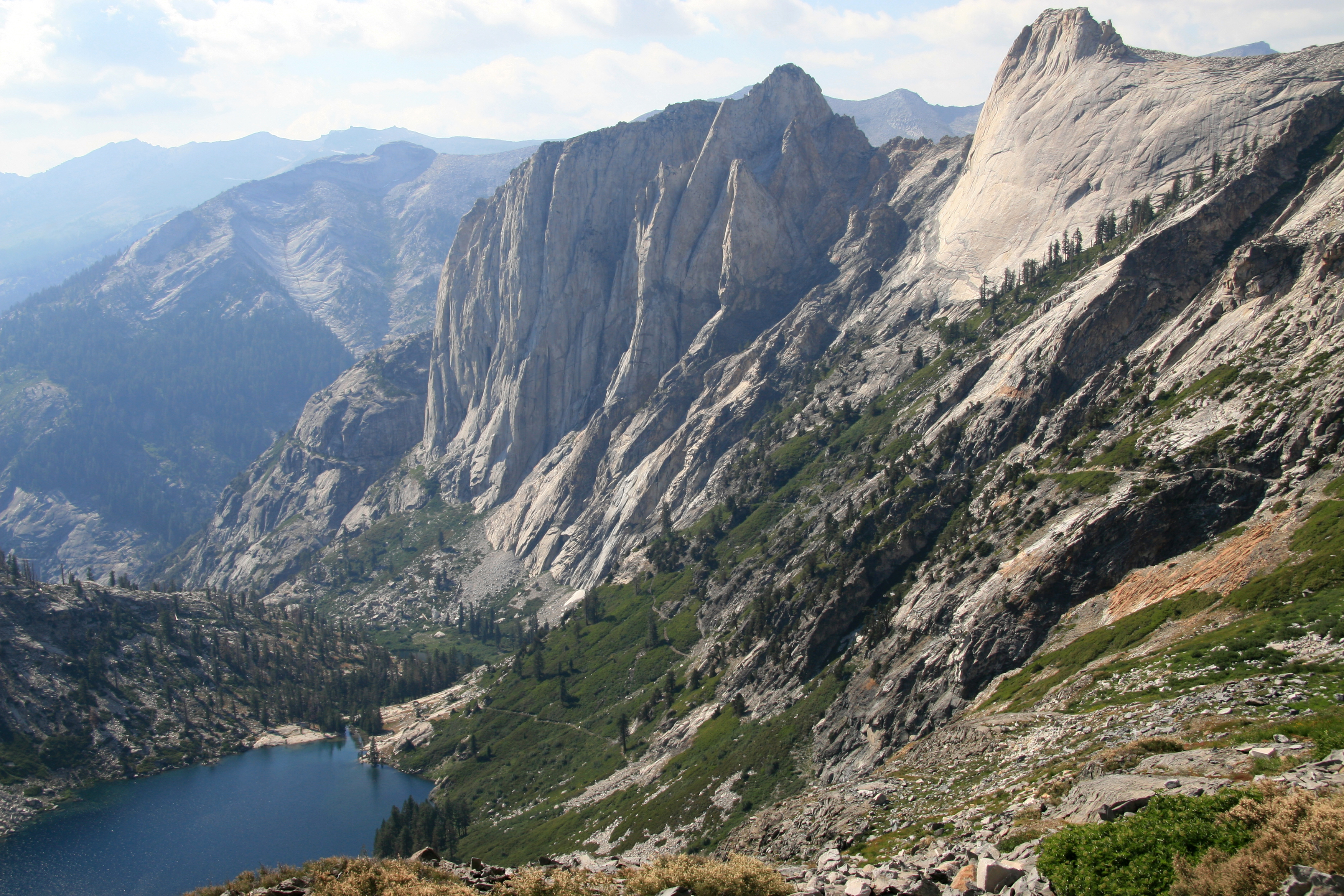
Lilliput Glacier is the smallest named glacier in the Sierra Nevada of California. The glacier has an area of , which is approximately 12.2 acres. In terms of area this is about the size of 48 typical suburb (1/4 acre or approx. 100' × 100') lots that single family homes are built on. This glacier lies on the shaded north-facing vertical cliff of Mount Stewart, being the southernmost named glacier in the United States. See also *List of glaciers in the United States This is a list of glaciers existing in the United States, currently or in recent centuries. These glaciers are located in nine states, all in the Rocky Mountains or farther west. The southernmost named glacier among them is the Lilliput Glacier ... References Glaciers of California Sequoia National Park Glaciers of the Sierra Nevada (United States) Glaciers of Tulare County, California {{US-glacier-stub ... [...More Info...] [...Related Items...] OR: [Wikipedia] [Google] [Baidu] |
Mount Stewart (California)
Mount Stewart is on the Great Western Divide, a sub-range of the Sierra Nevada in California. It is located in Sequoia National Park, southeast of Triple Divide Peak and northwest of Black Kaweah. The High Sierra Trail traverses Kaweah Gap south of the summit, and Lilliput Glacier is on the mountain's northern flank. The mountain is named for George W. Stewart, editor of ''Visalia Delta''. Stewart was the leader of a campaign to protect the "Big Trees". Francis P. Farquhar, author and former president of the Sierra Club, credits Stewart as "the father" of Sequoia National Park. Climate According to the Köppen climate classification system, Mount Stewart is located in an alpine climate zone. Most weather fronts originate in the Pacific Ocean, and travel east toward the Sierra Nevada mountains. As fronts approach, they are forced upward by the peaks (orographic lift), causing them to drop their moisture in the form of rain or snowfall Snow comprises individual ice cr ... [...More Info...] [...Related Items...] OR: [Wikipedia] [Google] [Baidu] |
Sequoia National Park
Sequoia National Park is an American national park in the southern Sierra Nevada (U.S.), Sierra Nevada east of Visalia, California. The park was established on September 25, 1890, and today protects of forested mountainous terrain. Encompassing a vertical relief of nearly , the park contains the highest point in the contiguous United States, Mount Whitney, at above sea level. The park is south of, and contiguous with, Kings Canyon National Park; both parks are administered by the National Park Service together as the Sequoia and Kings Canyon National Parks. UNESCO designated the areas as Sequoia-Kings Canyon Man and the Biosphere Programme, Biosphere Reserve in 1976. The park is notable for its Sequoiadendron giganteum, giant sequoia trees, including the General Sherman (tree), General Sherman tree, the List of largest giant sequoias, largest tree on Earth by volume. The General Sherman tree grows in the Giant Forest, which contains five of the ten largest trees in the world. T ... [...More Info...] [...Related Items...] OR: [Wikipedia] [Google] [Baidu] |
Tulare County, California
Tulare County ( ) is a County (United States), county located in the U.S. state of California. As of the 2010 United States Census, 2020 census, the population was 473,117. The county seat is Visalia, California, Visalia. The county is named for Tulare Lake, once the largest freshwater lake west of the Great Lakes. Drained for agricultural development, the site is now in Kings County, California, Kings County, which was created in 1893 from the western portion of the formerly larger Tulare County. Tulare County comprises the Visalia-Porterville, California, Porterville, CA Metropolitan Statistical Area. The county is located south of Fresno, California, Fresno, spanning from the San Joaquin Valley east to the Sierra Nevada. Sequoia National Park is located in the county, as is part of Kings Canyon National Park, in its northeast corner (shared with Fresno County, California, Fresno County), and part of Mount Whitney, on its eastern border (shared with Inyo County, California, Iny ... [...More Info...] [...Related Items...] OR: [Wikipedia] [Google] [Baidu] |
Glacier
A glacier (; ) is a persistent body of dense ice that is constantly moving under its own weight. A glacier forms where the accumulation of snow exceeds its Ablation#Glaciology, ablation over many years, often Century, centuries. It acquires distinguishing features, such as Crevasse, crevasses and Serac, seracs, as it slowly flows and deforms under stresses induced by its weight. As it moves, it abrades rock and debris from its substrate to create landforms such as cirques, moraines, or fjords. Although a glacier may flow into a body of water, it forms only on land and is distinct from the much thinner sea ice and lake ice that form on the surface of bodies of water. On Earth, 99% of glacial ice is contained within vast ice sheets (also known as "continental glaciers") in the polar regions, but glaciers may be found in mountain ranges on every continent other than the Australian mainland, including Oceania's high-latitude oceanic island countries such as New Zealand. Between lati ... [...More Info...] [...Related Items...] OR: [Wikipedia] [Google] [Baidu] |
Sierra Nevada (U
The Sierra Nevada () is a mountain range in the Western United States, between the Central Valley of California and the Great Basin. The vast majority of the range lies in the state of California, although the Carson Range spur lies primarily in Nevada. The Sierra Nevada is part of the American Cordillera, an almost continuous chain of mountain ranges that forms the western "backbone" of the Americas. The Sierra runs north-south and its width ranges from to across east–west. Notable features include General Sherman, the largest tree in the world by volume; Lake Tahoe, the largest alpine lake in North America; Mount Whitney at , the highest point in the contiguous United States; and Yosemite Valley sculpted by glaciers from one-hundred-million-year-old granite, containing high waterfalls. The Sierra is home to three national parks, twenty wilderness areas, and two national monuments. These areas include Yosemite, Sequoia, and Kings Canyon National Parks; and Devils ... [...More Info...] [...Related Items...] OR: [Wikipedia] [Google] [Baidu] |
List Of Glaciers In The United States
This is a list of glaciers existing in the United States, currently or in recent centuries. These glaciers are located in nine states, all in the Rocky Mountains or farther west. The southernmost named glacier among them is the Lilliput Glacier in Tulare County, east of the Central Valley of California. Glaciers of Alaska There are approximately 664 named glaciers in Alaska according to the Geographic Names Information System (GNIS). * Agassiz Glacier - Saint Elias Mountains * Aialik Glacier - Kenai Peninsula * Alsek Glacier - Glacier Bay * Aurora Glacier - Glacier Bay * Bacon Glacier *Barnard Glacier * Bear Glacier - Aialik Peninsula, Resurrection Bay *Bering Glacier * Black Rapids *Brady Glacier *Brooks Glacier - Alaska Range *Buckskin Glacier - Alaska Range * Burns Glacier (Alaska) - Kenai Mountains *Byron Glacier - Kenai Mountains * Caldwell Glacier - Alaska Range *Cantwell Glacier - Alaska Range *Carroll Glacier - Glacier Bay *Casement Glacier - Glacier Bay *Cast ... [...More Info...] [...Related Items...] OR: [Wikipedia] [Google] [Baidu] |
Glaciers Of California
A glacier (; ) is a persistent body of dense ice that is constantly moving under its own weight. A glacier forms where the accumulation of snow exceeds its ablation over many years, often centuries. It acquires distinguishing features, such as crevasses and seracs, as it slowly flows and deforms under stresses induced by its weight. As it moves, it abrades rock and debris from its substrate to create landforms such as cirques, moraines, or fjords. Although a glacier may flow into a body of water, it forms only on land and is distinct from the much thinner sea ice and lake ice that form on the surface of bodies of water. On Earth, 99% of glacial ice is contained within vast ice sheets (also known as "continental glaciers") in the polar regions, but glaciers may be found in mountain ranges on every continent other than the Australian mainland, including Oceania's high-latitude oceanic island countries such as New Zealand. Between latitudes 35°N and 35°S, glaciers occur only in ... [...More Info...] [...Related Items...] OR: [Wikipedia] [Google] [Baidu] |
Glaciers Of The Sierra Nevada (United States)
A glacier (; ) is a persistent body of dense ice that is constantly moving under its own weight. A glacier forms where the accumulation of snow exceeds its ablation over many years, often centuries. It acquires distinguishing features, such as crevasses and seracs, as it slowly flows and deforms under stresses induced by its weight. As it moves, it abrades rock and debris from its substrate to create landforms such as cirques, moraines, or fjords. Although a glacier may flow into a body of water, it forms only on land and is distinct from the much thinner sea ice and lake ice that form on the surface of bodies of water. On Earth, 99% of glacial ice is contained within vast ice sheets (also known as "continental glaciers") in the polar regions, but glaciers may be found in mountain ranges on every continent other than the Australian mainland, including Oceania's high-latitude oceanic island countries such as New Zealand. Between latitudes 35°N and 35°S, glaciers occur only in ... [...More Info...] [...Related Items...] OR: [Wikipedia] [Google] [Baidu] |

.jpg)


