|
Lightmoor Platform Railway Station
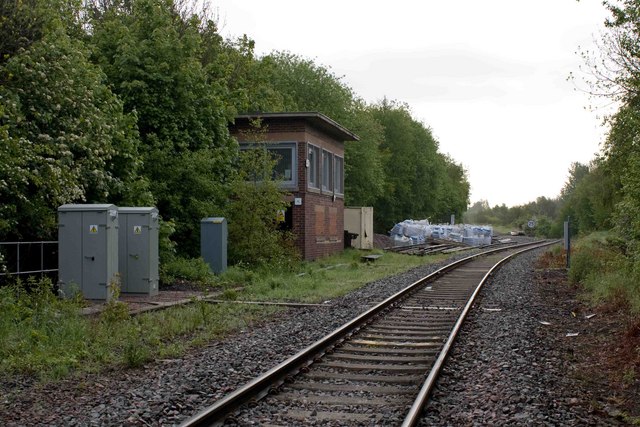
Lightmoor Platform railway station was a station to the east of Coalbrookdale, Shropshire, England. The station was opened in 1907 and closed in 1962. The station was situated on the Madeley Junction to Buildwas Line to the west of Lightmoor Junction Lightmoor Junction was a railway junction between Ironbridge Power Station at Buildwas and Madeley Junction in Shropshire, England. From Lightmoor Junction, a line ran towards Wellington via Doseley and Horsehay. Following the complete closure .... References Further reading * Disused railway stations in Shropshire Railway stations in Great Britain opened in 1907 Railway stations in Great Britain closed in 1917 Railway stations in Great Britain opened in 1919 Railway stations in Great Britain closed in 1962 Former Great Western Railway stations {{WestMidlands-railstation-stub ... [...More Info...] [...Related Items...] OR: [Wikipedia] [Google] [Baidu] |
Coalbrookdale
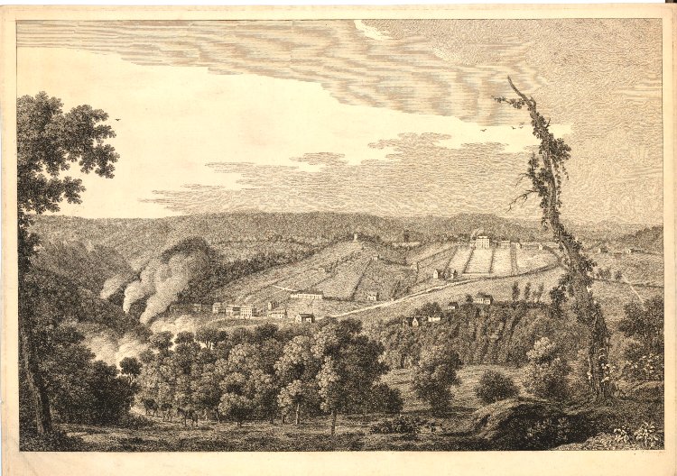
Coalbrookdale is a village in the Ironbridge Gorge in Shropshire, England, containing a settlement of great significance in the history of iron ore smelting. It lies within the civil parish called the Gorge. This is where iron ore was first smelted by Abraham Darby using easily mined "coking coal". The coal was drawn from drift mines in the sides of the valley. As it contained far fewer impurities than normal coal, the iron it produced was of a superior quality. Along with many other industrial developments that were going on in other parts of the country, this discovery was a major factor in the growing industrialisation of Britain, which was to become known as the Industrial Revolution. Today, Coalbrookdale is home to the Ironbridge Institute, a partnership between the University of Birmingham and the Ironbridge Gorge Museum Trust offering postgraduate and professional development courses in heritage. Before Abraham Darby Before the Dissolution of the Monasteries, Madeley ... [...More Info...] [...Related Items...] OR: [Wikipedia] [Google] [Baidu] |
Shropshire
Shropshire (; alternatively Salop; abbreviated in print only as Shrops; demonym Salopian ) is a landlocked historic county in the West Midlands region of England. It is bordered by Wales to the west and the English counties of Cheshire to the north, Staffordshire to the east, Worcestershire to the southeast, and Herefordshire to the south. A unitary authority of the same name was created in 2009, taking over from the previous county council and five district councils, now governed by Shropshire Council. The borough of Telford and Wrekin has been a separate unitary authority since 1998, but remains part of the ceremonial county. The county's population and economy is centred on five towns: the county town of Shrewsbury, which is culturally and historically important and close to the centre of the county; Telford, which was founded as a new town in the east which was constructed around a number of older towns, most notably Wellington, Dawley and Madeley, which is today th ... [...More Info...] [...Related Items...] OR: [Wikipedia] [Google] [Baidu] |
Ordnance Survey National Grid
The Ordnance Survey National Grid reference system (OSGB) (also known as British National Grid (BNG)) is a system of geographic grid references used in Great Britain, distinct from latitude and longitude. The Ordnance Survey (OS) devised the national grid reference system, and it is heavily used in their survey data, and in maps based on those surveys, whether published by the Ordnance Survey or by commercial map producers. Grid references are also commonly quoted in other publications and data sources, such as guide books and government planning documents. A number of different systems exist that can provide grid references for locations within the British Isles: this article describes the system created solely for Great Britain and its outlying islands (including the Isle of Man); the Irish grid reference system was a similar system created by the Ordnance Survey of Ireland and the Ordnance Survey of Northern Ireland for the island of Ireland. The Universal Transverse Merca ... [...More Info...] [...Related Items...] OR: [Wikipedia] [Google] [Baidu] |
Great Western Railway
The Great Western Railway (GWR) was a British railway company that linked London with the southwest, west and West Midlands of England and most of Wales. It was founded in 1833, received its enabling Act of Parliament on 31 August 1835 and ran its first trains in 1838 with the initial route completed between London and Bristol in 1841. It was engineered by Isambard Kingdom Brunel, who chose a broad gauge of —later slightly widened to —but, from 1854, a series of amalgamations saw it also operate standard-gauge trains; the last broad-gauge services were operated in 1892. The GWR was the only company to keep its identity through the Railways Act 1921, which amalgamated it with the remaining independent railways within its territory, and it was finally merged at the end of 1947 when it was nationalised and became the Western Region of British Railways. The GWR was called by some "God's Wonderful Railway" and by others the "Great Way Round" but it was famed as the "Holiday ... [...More Info...] [...Related Items...] OR: [Wikipedia] [Google] [Baidu] |
Madeley Junction To Buildwas Line
{{disambiguation, geodis ...
Madeley may refer to: Places * Madeley, Shropshire, a town, now part of the new town of Telford * Madeley, Staffordshire, near Newcastle-under-Lyme * Madeley, Western Australia, a suburb of Perth, Australia Other uses * Madeley (surname) * Madeley Wood Company, company * Madeley Old Manor, medieval manor * Madeley Old Hall, historic building * Madeley High School See also * Madeley railway station (other), for all stations named Madeley * Madely (other) * Madley Madley is a village and civil parish in the English county of Herefordshire. It is located six miles west of the city of Hereford. The population of the civil parish at the 2011 census was 1,200. Other settlements The parish includes the hamle ... [...More Info...] [...Related Items...] OR: [Wikipedia] [Google] [Baidu] |
Lightmoor Junction
Lightmoor Junction was a railway junction between Ironbridge Power Station at Buildwas and Madeley Junction in Shropshire, England. From Lightmoor Junction, a line ran towards Wellington via Doseley and Horsehay. Following the complete closure of this line in 1981, Lightmoor Junction Signal Box was retained to control the connection between the double-track section towards Ironbridge Power Station and the single-track section towards Madeley Junction. The signal box closed on 23 October 2006, when the line towards Ironbridge Power Station was singled, with new signalling controlled from Madeley Junction Signal Box (since 2011 transferred to West Midlands Signalling Centre). Telford Steam Railway use a portion of the former line to Wellington, and intend to use the signal box as part of their heritage railway A heritage railway or heritage railroad (US usage) is a railway operated as living history to re-create or preserve railway scenes of the past. Heritage railways are o ... [...More Info...] [...Related Items...] OR: [Wikipedia] [Google] [Baidu] |
Green Bank Halt Railway Station
Green Bank Halt railway station was a station in Coalbrookdale, Shropshire Shropshire (; alternatively Salop; abbreviated in print only as Shrops; demonym Salopian ) is a landlocked historic county in the West Midlands region of England. It is bordered by Wales to the west and the English counties of Cheshire to th ..., England. The station was opened in 1934 and closed in 1962. References Further reading * Disused railway stations in Shropshire Railway stations in Great Britain opened in 1934 Railway stations in Great Britain closed in 1962 Former Great Western Railway stations {{WestMidlands-railstation-stub ... [...More Info...] [...Related Items...] OR: [Wikipedia] [Google] [Baidu] |
Wellington To Craven Arms Railway
The Wellington to Craven Arms Railway was formed by a group of railway companies that eventually joined the Great Western Railway family, and connected Wellington, Shropshire and Shifnal, with Coalbrookdale, Buildwas, Much Wenlock and a junction near Craven Arms. Its objectives were dominated by the iron, colliery and limestone industries around Coalbrookdale. The route sections that together formed the network were * the Shrewsbury and Birmingham Railway Coalbrookdale branch from Madeley Junction (near Shifnal) to Lightmoor; * the Wellington and Severn Junction Railway from Ketley Junction (near Wellington) to Lightmoor; * the Great Western Railway Coalbrookdale extension from Lightmoor to Coalbrookdale; * the Wenlock Railway from Coalbrookdale to Buildwas; * the Much Wenlock and Severn Junction Railway from Buildwas to Much Wenlock; * the Wenlock Railway from Much Wenlock to Marsh Farm Junction, north of Craven Arms. The railways were opened in the period from 1854 to 1867. ... [...More Info...] [...Related Items...] OR: [Wikipedia] [Google] [Baidu] |
Madeley (Shropshire) Railway Station
Madeley railway station (sometimes referred to as Madeley Salop railway station) is a disused railway station in Madeley, Shropshire, England. The station was opened by the Great Western Railway The Great Western Railway (GWR) was a British railway company that linked London with the southwest, west and West Midlands of England and most of Wales. It was founded in 1833, received its enabling Act of Parliament on 31 August 1835 and ran ... in 1859 as Madeley Court. In 1897 it was renamed simply Madeley. The station was closed in 1915 but reopened in July 1925 only to close permanently in September of the same year. References ;Notes ;Sources * Further reading * Disused railway stations in Shropshire Former Great Western Railway stations Railway stations in Great Britain opened in 1859 Railway stations in Great Britain closed in 1915 Railway stations in Great Britain opened in 1925 Railway stations in Great Britain closed in 1925 {{WestMidlands-rai ... [...More Info...] [...Related Items...] OR: [Wikipedia] [Google] [Baidu] |
Shrewsbury And Birmingham Railway
The Shrewsbury and Birmingham Railway was authorised in 1846. It agreed to joint construction with others of the costly Wolverhampton to Birmingham section, the so-called Stour Valley Line. This work was dominated by the hostile London and North Western Railway, which used underhand and coercive tactics. The section between Shrewsbury and Wellington was also built jointly, in this case with the Shropshire Union Railway. The S&BR opened from Shrewsbury to its own Wolverhampton terminus in 1849. The Stour Valley Line was still delayed by the LNWR, but the S&BR eventually got access to it in 1852. By this time it was obvious that the LNWR was an impossible partner, and the S&BR allied itself to the Great Western Railway, which reached Wolverhampton in 1854. The S&BR merged with the GWR in 1854. With the S&BR and other absorbed railways, the GWR obtained a through route between London and the River Mersey at Birkenhead, and to Manchester and Liverpool by the use of running powers. Th ... [...More Info...] [...Related Items...] OR: [Wikipedia] [Google] [Baidu] |


