|
Lido Beach, New York
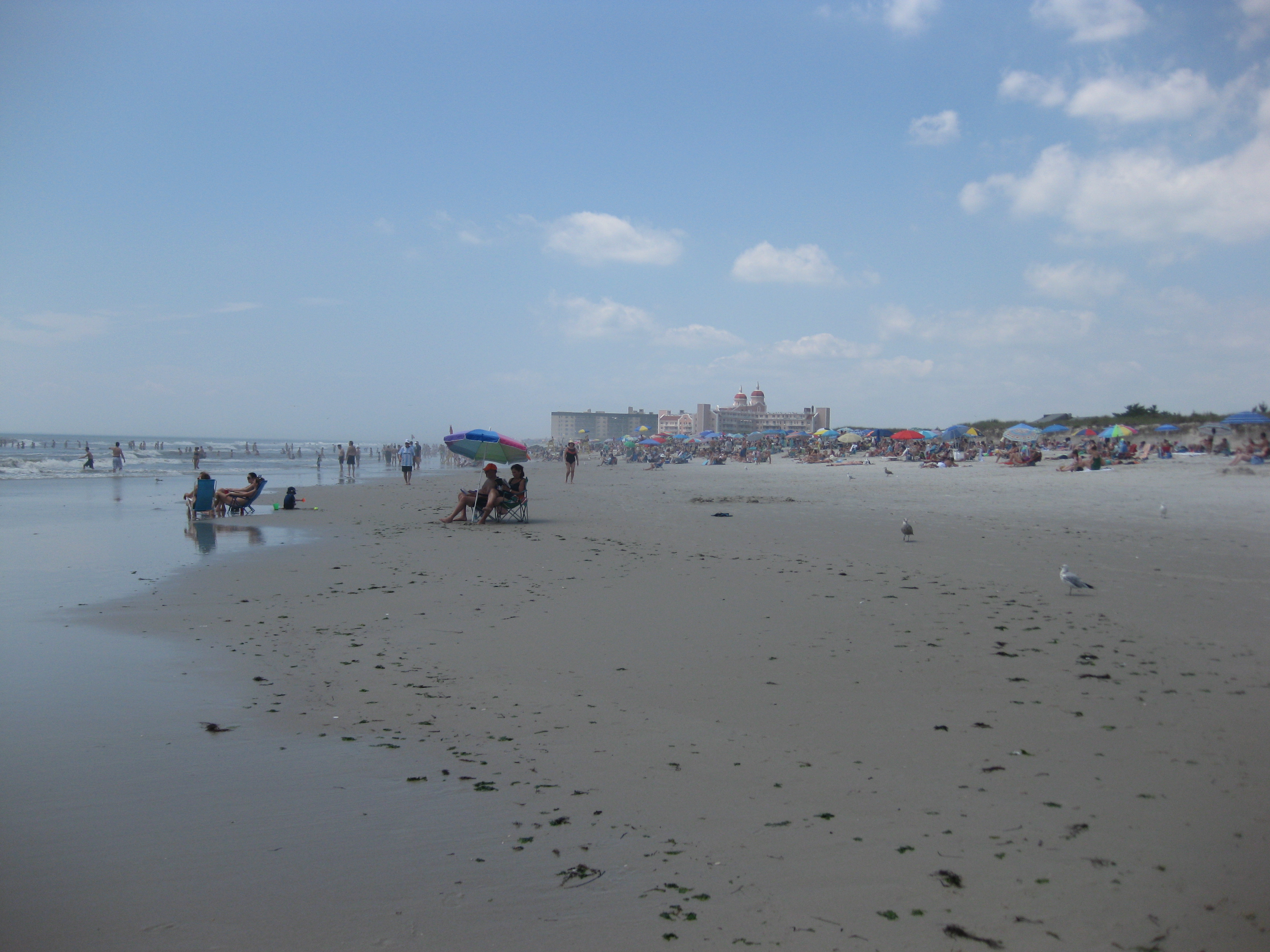
Lido Beach is a hamlet and census-designated place (CDP) in the Town of Hempstead in Nassau County, New York, United States. Located on the Long Beach Barrier Island, it is a suburb of the City of Long Beach, and is in the immediate metropolitan area. The population was 2,719 at the time of the 2020 census. History Lido Beach was developed by William H. Reynolds, in the early 1900s. The 39-year-old former state senator and real estate developer had already developed four Brooklyn neighborhoods ( Bedford-Stuyvesant, Borough Park, Bensonhurst, and South Brownsville), as well as Coney Island's Dreamland, the world's largest amusement park. Reynolds also owned a theater and produced plays. Beginning in 1906, he gathered investors and acquired the oceanfront from private owners and the rest of Long Beach island from the Town of Hempstead. He planned to build a boardwalk, homes, and hotels, and dredged Reynolds Channel to create the Long Beach, New York resort area. Th ... [...More Info...] [...Related Items...] OR: [Wikipedia] [Google] [Baidu] |
Hamlet (New York)
The administrative divisions of New York are the various units of government that provide local services in the American state of New York. The state is divided into boroughs, counties, cities, towns, and villages. (The only boroughs, the five boroughs of New York City, have the same boundaries as their respective counties.) They are municipal corporations, chartered (created) by the New York State Legislature, as under the New York State Constitution the only body that can create governmental units is the state. All of them have their own governments, sometimes with no paid employees, that provide local services. Centers of population that are not incorporated and have no government or local services are designated hamlets. Whether a municipality is defined as a borough, city, town, or village is determined not by population or land area, but rather on the form of government selected by the residents and approved by the New York State Legislature. Each type of local ... [...More Info...] [...Related Items...] OR: [Wikipedia] [Google] [Baidu] |
Long Beach Barrier Island
Long Beach is one of the Outer barrier, outer barrier islands off the south coast of Long Island, New York (state), New York, United States. Long Beach is the westernmost of these barrier islands, fronting on Reynolds Channel to the north and the Atlantic Ocean to the south. History The first inhabitants on the Long Beach Barrier Island were the Rockaway Indians; the island was sold to the New Netherland colonists in 1643. Local Long Island baymen and farmers used the island for fishing and harvesting salt hay; no people lived on the island year round for more than two centuries. The United States Congress established a lifesaving station in 1849, a dozen years after 62 people died when the barque ''Mexico'' carrying Irish immigrants to New York ran ashore on New Year's Day. Development began on the island as a resort and was organized by Austin Corbin, a builder from Brooklyn, New York (state), New York. Austin Corbin formed a partnership with the Long Island Rail Road to fi ... [...More Info...] [...Related Items...] OR: [Wikipedia] [Google] [Baidu] |
Venice Lido
The Lido, or Venice Lido (), is an barrier island in the Venetian Lagoon, Northern Italy; it is home to about 20,400 residents. The Venice Film Festival takes place at the Lido in late August/early September. Geography The Lido island is one of the two barrier islands of the Lagoon of Venice; the other is Pellestrina. They form the central part of the coastline of the lagoon on the Adriatic Sea. The peninsula of Cavallino/Punta Sabbioni forms the northern part and the peninsula of Sottomarina forms the southern part. The sea has access to the lagoon through three inlets between the islands and between the islands and the peninsulas. At the northern end of Lido there is the Lido inlet which separates it from Cavallino/Punta Sabbioni and at the southern end there is the Malamocco inlet which separates it from Pellestrina. These two inlets have been dredged to a greater depth to allow big ships through. The Malamocco inlet is the deepest one and is used by container ships and ... [...More Info...] [...Related Items...] OR: [Wikipedia] [Google] [Baidu] |
Reynolds Channel
Reynolds Channel is a strait in Nassau County, New York that separates Long Beach Barrier Island, which contains the City of Long Beach and the villages of Atlantic Beach, Lido Beach, and Point Lookout, from Long Island, Barnum Island, Harbor Isle, and various uninhabited islands between Long Beach Island and Long Island. The channel begins at the East Rockaway Inlet to the west, and ends at Point Lookout to the east, where it merges with the Jones Inlet. The channel is named after William H. Reynolds, a developer and former State Senator who greatly built up Long Beach Island in the early 20th century. Bridges over the channel There are four bridges that cross Reynolds channel: * The Atlantic Beach Bridge, which carries NY-878 over the channel. * The Wreck Lead Bridge, which carries the Long Beach Branch of the Long Island Rail Road The Long Island Rail Road , or LIRR, is a Rail transport, railroad in the southeastern part of the U.S. state of New York ... [...More Info...] [...Related Items...] OR: [Wikipedia] [Google] [Baidu] |
Boardwalk (entertainment District)
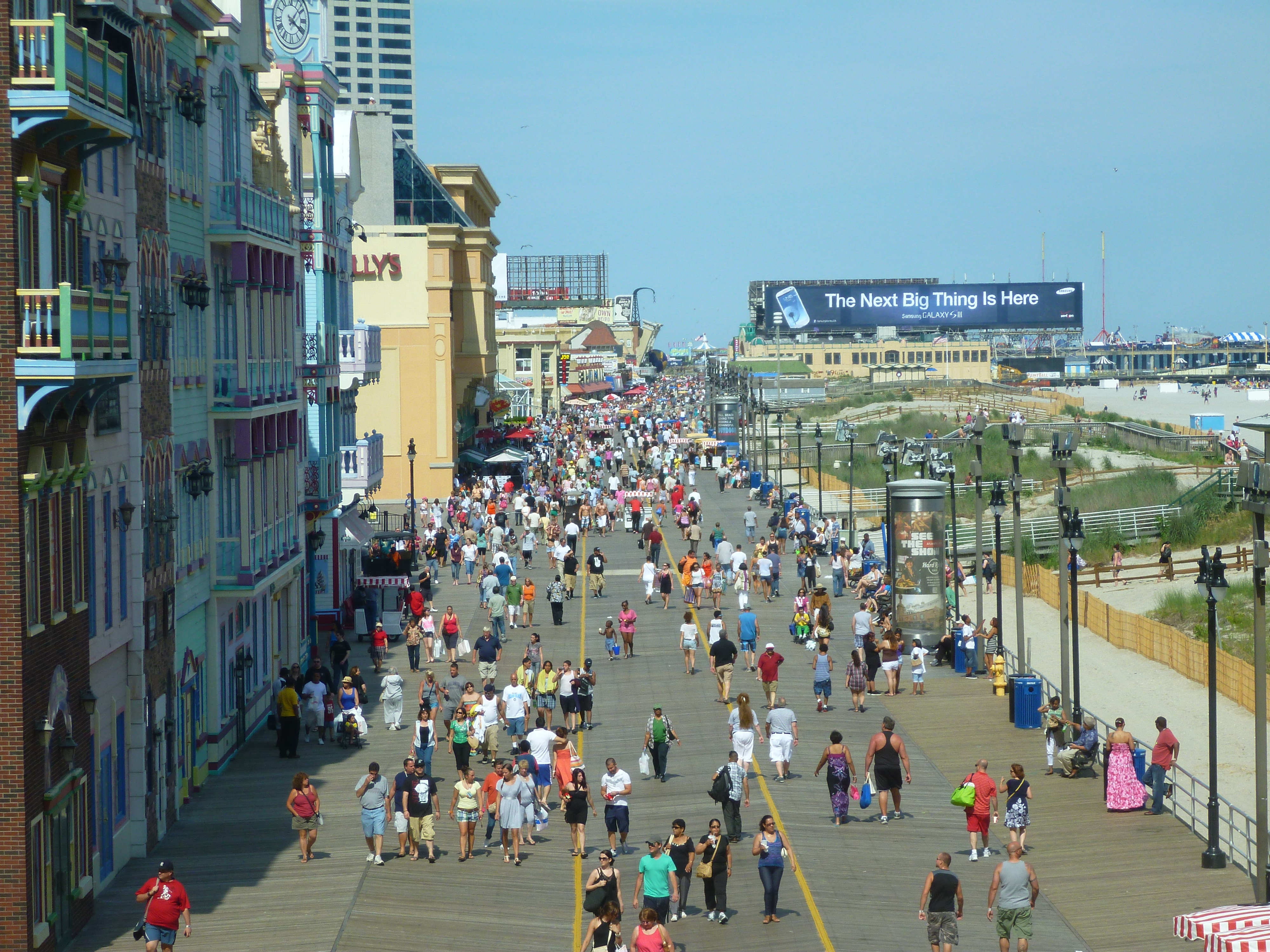
A boardwalk is a promenade along a beach or waterfront. In North America, and particularly in the United States, many waterfront commercial boardwalks have become so successful as tourist attractions that the simple wooden pathways have been replaced by esplanades made of concrete, brick or other construction, sometimes with a wooden façade on the surface. An entertainment boardwalk often contains an amusement park, casinos, or hotels on a pier-like structure. One of the earliest such boardwalks was designed in New Jersey and opened June 26, 1870, in Atlantic City, New Jersey, Atlantic City, and one of the longest is Mazatlán's Mazatlán#The Malecón of Mazatlán, Malecón, at of oceanfront boardwalk. History In the 19th century, coast, seaside living and entertainment became popular. Primarily in the Jersey Shore coastal region of New Jersey, United States, walks made of boards (hence the name 'boardwalk') began to be placed among seaside hotels and other establishments so ... [...More Info...] [...Related Items...] OR: [Wikipedia] [Google] [Baidu] |
Town Of Hempstead, New York
The Town of Hempstead is the largest of the three towns in Nassau County (alongside North Hempstead and Oyster Bay) on Long Island, in New York, United States. The town's combined population was 793,409 at the 2020 census. It occupies the southwestern part of the county, on the western half of Long Island. Twenty-two incorporated villages (one of which is named Hempstead) are completely or partially within the town. Hofstra University's campus is located in Hempstead. History The town was first settled around 1644 following the establishment of a treaty between English colonists, John Carman and Robert Fordham, and the Lenape Indians in 1643. Although the settlers were from the new English colony of New Haven (1638), later incorporated into, Connecticut in 1662, a patent was issued by the government of New Netherland after the settlers had purchased land from the local natives. This transaction is depicted in a mural in the Hempstead Village Hall, reproduced from a poster ... [...More Info...] [...Related Items...] OR: [Wikipedia] [Google] [Baidu] |
Dreamland (Coney Island, 1904)
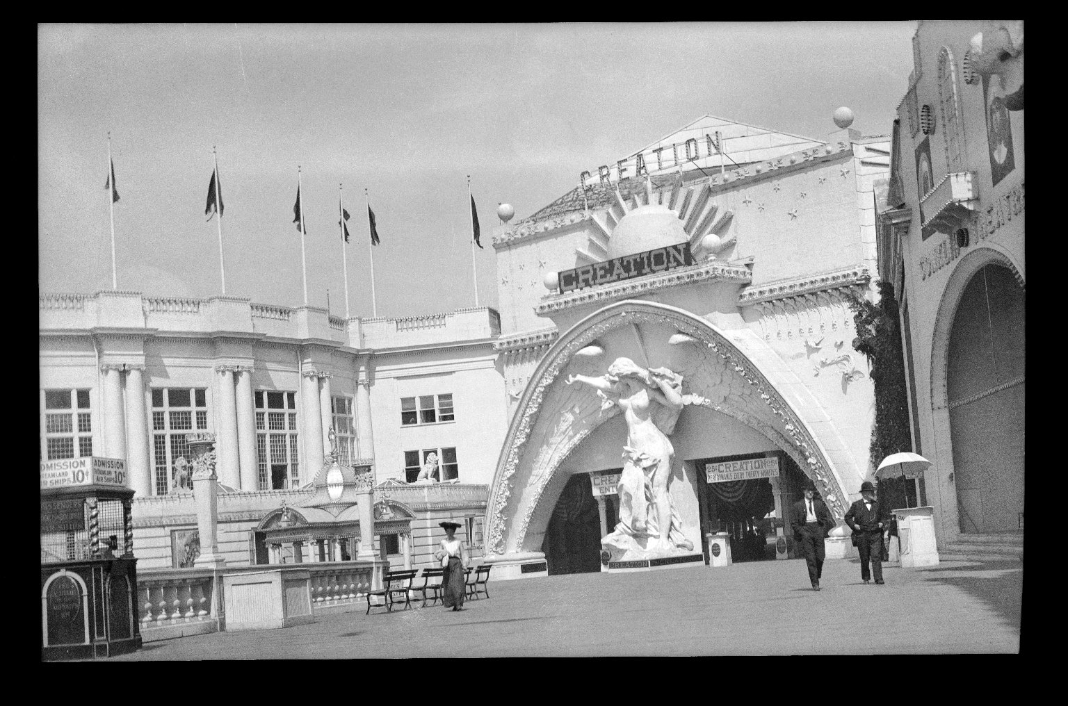
Dreamland was an amusement park that operated in the Coney Island neighborhood of Brooklyn in New York City, United States, from 1904 to 1911. It was the last of the three original large parks built on Coney Island, along with Steeplechase Park and Luna Park. The park was between Surf Avenue to the north and the Atlantic Ocean to the south. It was arranged roughly as a horseshoe, with a pier facing south toward the Atlantic Ocean. Dreamland contained several attractions that were larger versions of those at Luna Park, and it included a human zoo, several early roller coasters, a Shoot the Chutes ride, and a replica of Venice. Dreamland also hosted entertainment and dramatic spectacles based on morality themes. Several structures, such as the Pompeiian, Electricity, and Submarine Boat buildings, were dedicated to exhibits. Former state senator William H. Reynolds announced plans in July 1903 for an amusement park rivaling Luna Park, originally known as the Hippodrome. The Dreaml ... [...More Info...] [...Related Items...] OR: [Wikipedia] [Google] [Baidu] |
Coney Island
Coney Island is a neighborhood and entertainment area in the southwestern section of the New York City borough of Brooklyn. The neighborhood is bounded by Brighton Beach to its east, Lower New York Bay to the south and west, and Gravesend to the north and includes the subsection of Sea Gate on its west. More broadly, the Coney Island peninsula consists of Coney Island proper, Brighton Beach, and Manhattan Beach. This was formerly the westernmost of the Outer Barrier islands on the southern shore of Long Island, but in the early 20th century it became connected to the rest of Long Island by land fill. The origin of Coney Island's name is disputed, but the area was originally part of the colonial town of Gravesend. By the mid-19th century it had become a seaside resort, and by the late 19th century, amusement parks had also been built at the location. The attractions reached a historical peak during the first half of the 20th century. However, they declined in popularity aft ... [...More Info...] [...Related Items...] OR: [Wikipedia] [Google] [Baidu] |
Brownsville, Brooklyn
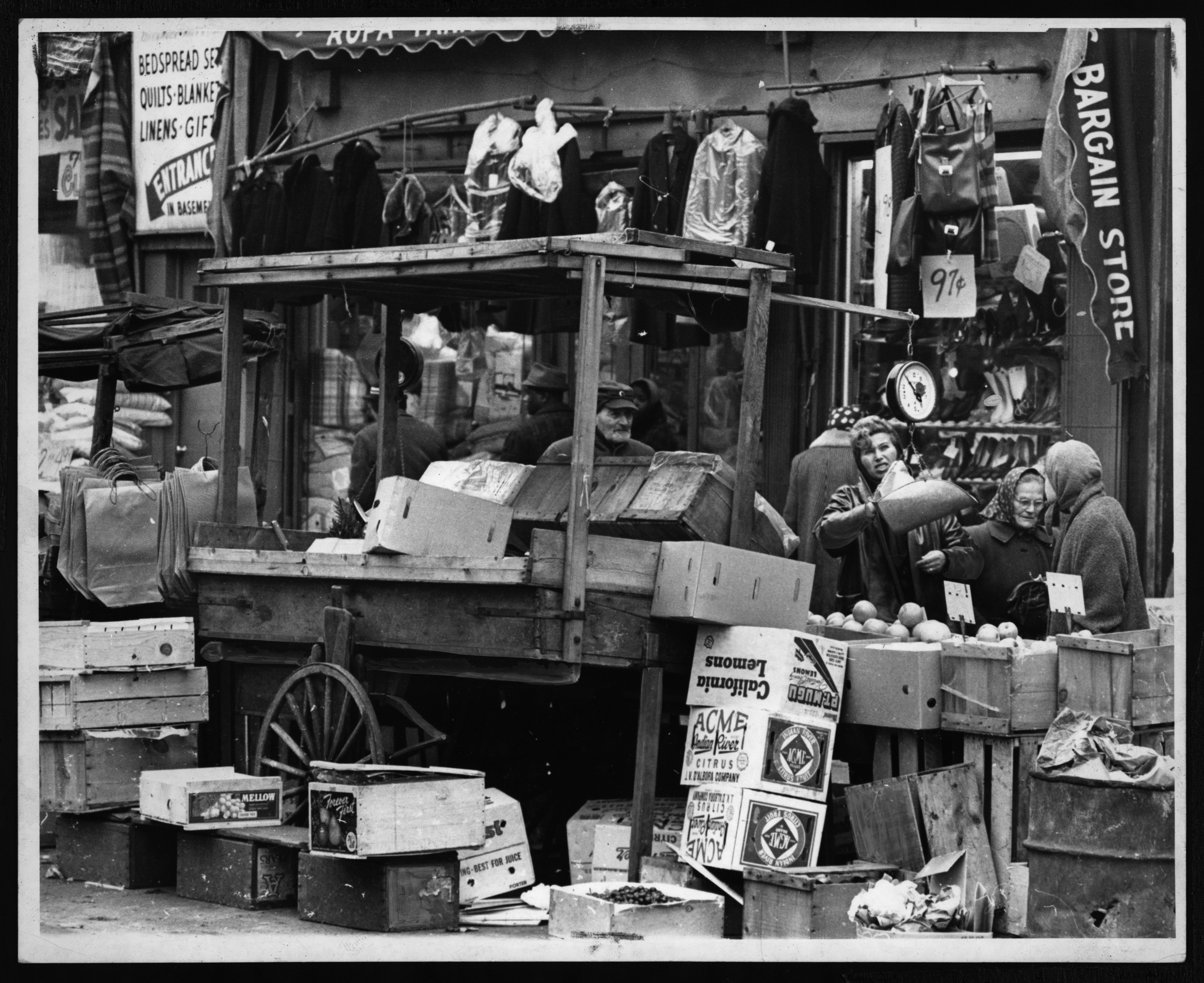
Brownsville is a residential neighborhood in eastern Brooklyn in New York City. The neighborhood is bordered by Crown Heights, Brooklyn, Crown Heights to the northwest; Bedford–Stuyvesant, Brooklyn, Bedford–Stuyvesant and the subsection of Ocean Hill, Brooklyn, Ocean Hill to the north; East New York, Brooklyn, East New York to the east; Canarsie, Brooklyn, Canarsie to the south; and East Flatbush, Brooklyn, East Flatbush to the west. The area that comprises Brownsville has 58,300 residents as of the 2010 United States Census, with an estimated population of 128,369 residents in 2019. Founded in its current incarnation in 1858, Brownsville was initially a settlement composed of Jewish factory workers. The neighborhood underwent a major demographic change in the 1950s that saw an influx of African-American residents. Since the late 20th century, Brownsville has consistently held one of the highest poverty and crime rates of any neighborhood in New York City. Brownsville is p ... [...More Info...] [...Related Items...] OR: [Wikipedia] [Google] [Baidu] |
Bensonhurst, Brooklyn
Bensonhurst is a residential neighborhood in the southwestern section of the New York City borough of Brooklyn. The neighborhood is bordered on the northwest by 14th Avenue, on the northeast by 60th Street, on the southeast by Avenue P and 22nd Avenue (Bay Parkway) and on the southwest by 86th Street. It is adjacent to the neighborhoods of Dyker Heights to the northwest, Borough Park and Mapleton to the northeast, Bath Beach to the southwest, and Gravesend to the southeast. Bensonhurst contains several major ethnic enclaves. It was traditionally known as a Little Italy of Brooklyn. Bensonhurst today is home to Brooklyn's second Chinatown and has the largest population of residents born in China and Hong Kong of any neighborhood in New York City. The neighborhood accounts for 9.5% of the 330,000 Chinese-born residents of the city, based on data from 2007 to 2011. Bensonhurst is part of Brooklyn Community District 11, and its primary ZIP Codes are 11204 and 11214. It is pat ... [...More Info...] [...Related Items...] OR: [Wikipedia] [Google] [Baidu] |
Borough Park, Brooklyn
Borough Park (also spelled Boro Park) is a neighborhood in the southwestern part of the borough (New York City), borough of Brooklyn, in New York City. The neighborhood is bordered by Bensonhurst, Brooklyn, Bensonhurst to the south, Dyker Heights, Brooklyn, Dyker Heights to the southwest, Sunset Park, Brooklyn, Sunset Park to the west, Kensington, Brooklyn, Kensington and Green-Wood Cemetery to the northeast, Flatbush, Brooklyn, Flatbush to the east, and Mapleton, Brooklyn, Mapleton to the southeast. It is economically diverse and home to one of the largest Orthodox Judaism, Orthodox Jewish communities outside Israel, with one of the largest concentrations of Jews in the United States. With Orthodox and Haredi families having an average of 6.72 children, Boro Park is experiencing a sharp growth in population. The neighborhood is part of Brooklyn Community Board 12, Brooklyn Community District 12, and its primary ZIP Code is 11219. It is patrolled by the 66th Precinct of the New ... [...More Info...] [...Related Items...] OR: [Wikipedia] [Google] [Baidu] |
