|
Lichtenrade
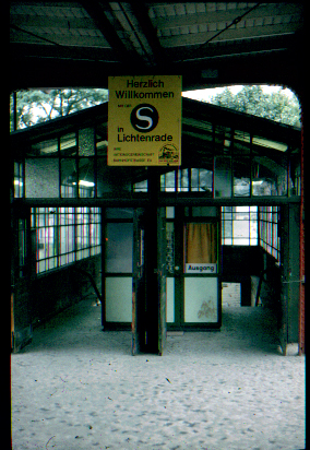
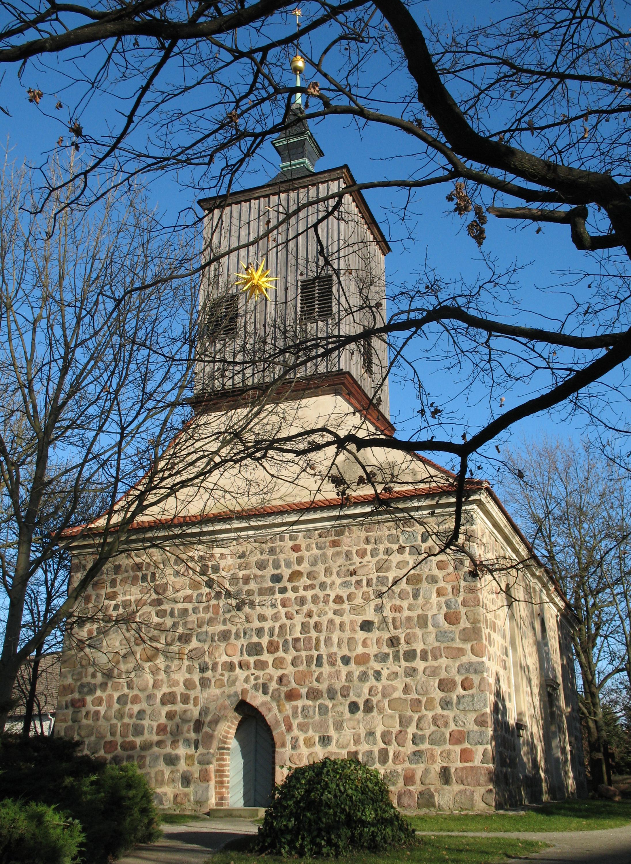
Lichtenrade () is a German locality (''Ortsteil'') within the borough (''Bezirk'') of Tempelhof-Schöneberg, Berlin. Until 2001 it was part of the former borough of Tempelhof. History The locality was first mentioned in 1375, named ''Lichtenrode''. Autonomous Prussian municipality of the former Teltow district, Lichtenrade was incorporated into Berlin in 1920, with the "Greater Berlin Act". During World War II, a branch of the Sachsenhausen concentration camp was located in this locality. After 1941, prisoners of war from Ukraine were interned in the camp. During the Cold War it was a part of West Berlin bordering with East Germany. Its long boundary with Brandenburg was surrounded by the Berlin Wall from 1961 to 1989. Geography Located in the southern suburb of Berlin, it is one of the southernmost areas of the city, largely bounded by the Brandenburger municipalities of Schönefeld (Dahme-Spreewald district), Blankenfelde-Mahlow and Großbeeren (both in Teltow-Fläming district ... [...More Info...] [...Related Items...] OR: [Wikipedia] [Google] [Baidu] |
Berlin-Lichtenrade Station
Berlin-Lichtenrade station is a station on the Berlin–Dresden railway in the locality of Lichtenrade in the Berlin Berlin ( , ) is the capital and List of cities in Germany by population, largest city of Germany by both area and population. Its 3.7 million inhabitants make it the European Union's List of cities in the European Union by population within ci ... borough of Tempelhof-Schöneberg. It is served by Berlin S-Bahn line S2 (Berlin), S2. History The railway line from Berlin to Dresden was opened on 17 June 1875. Eight years later, a station was built the still single-track line at the village of Lichtenrade, which was opened on 1 June 1883. The 30 metre-long gravel platform was located south of today's Bahnhofstrasse (“station street”). The Royal Prussian Military Railway ran on its western edge from 1875, but it was dismantled after the First World War in 1919. In 1892, a second track was built and the two-storey, yellow brick station building was built north o ... [...More Info...] [...Related Items...] OR: [Wikipedia] [Google] [Baidu] |
Berlin S-Bahn
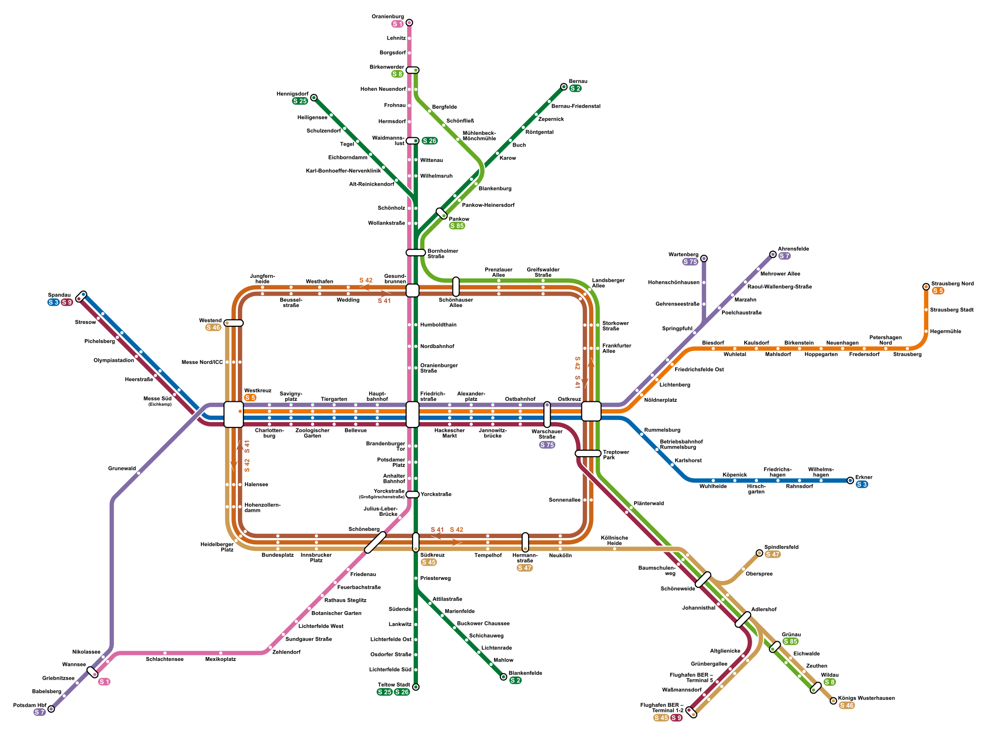
The Berlin S-Bahn () is a rapid transit railway system in and around Berlin, the capital city of Germany. It has been in operation under this name since December 1930, having been previously called the special tariff area ''Berliner Stadt-, Ring- und Vorortbahnen'' (Berlin city, orbital, and suburban railways). It complements the Berlin U-Bahn and is the link to many outer-Berlin areas, such as Berlin Brandenburg Airport. As such, the Berlin S-Bahn blends elements of a commuter rail service and a rapid transit system. In its first decades of operation, the trains were steam-drawn; even after the electrification of large parts of the network, a number of lines remained under steam. Today, the term ''S-Bahn'' is used in Berlin only for those lines and trains with third-rail electrical power transmission and the special Berlin S-Bahn loading gauge. The third unique technical feature of the Berlin S-Bahn, the , is being phased out and replaced by a communications-based train con ... [...More Info...] [...Related Items...] OR: [Wikipedia] [Google] [Baidu] |
Berlin Schichauweg Station
Schichauweg station is a station on the Berlin–Dresden railway in the locality of Lichtenrade in the Berlin borough of Tempelhof-Schöneberg. It is served by Berlin S-Bahn line S2. It was the only new S-Bahn station constructed by the Berliner Verkehrsbetriebe (BVG, Berlin Transportation Company) after it took over the operations of the S-Bahn in West Berlin. It consists of two side platforms, each of which has exits to the south to the streets of Schichauweg and Barnetstraße. Additional northern entrances were opened from both platforms to the streets of Miethepfad and Kettinger Straße on 25 November 1991. History The railway line was opened at ground level through undeveloped land in 1875. There was a signalman's house southwest of the present station. The line was raised and placed on an embankment in 1938. The Berlin Outer Freight Ring (German: ''Güteraußenring'', GAR) was built at the same time; this ran east–west to the north of the present station. A connecting ... [...More Info...] [...Related Items...] OR: [Wikipedia] [Google] [Baidu] |
Bundesstraße 96
The Bundesstraße 96 (B 96) is a federal highway in Germany. It begins in Zittau in Saxony, close to the border triangle between Germany, Poland, and the Czech Republic, heads north through Berlin and ends in Sassnitz on the island of Rügen in the Baltic Sea. Some sections of B 96 form a part of the European route E22. History Before the formation of East Germany the highway was known as ''Reichsstraße 96''. The former F (''Fernverkehrsstraße'') 96 was the longest road in the GDR and a major route in north-south direction. When the Berlin Wall was built in 1961 the route of the F 96 was altered so that it went through Mahlow just south East Berlin and Birkenwerder just north of East Berlin. This section is now called B 96a. South of Berlin was the B 96 different from today's route at Klausdorf Mellensee (both now at the municipality Am Mellensee) because of a diversion around Wünsdorf and Zossen the site of the headquarters of the Supreme Command of the Group of Soviet F ... [...More Info...] [...Related Items...] OR: [Wikipedia] [Google] [Baidu] |
Boroughs And Localities Of Berlin
Berlin is both a city and one of Germany’s federated states (city state). Since the 2001 administrative reform, it has been made up of twelve districts (german: Bezirke, ), each with its own administrative body. However, unlike the municipalities and counties of other German states, the Berlin districts are not territorial corporations of public law () with autonomous competencies and property, but simple administrative agencies of Berlin's state and city government, the City of Berlin forming a single municipality () since the Greater Berlin Act of 1920. Thus they cannot be equated to US or UK boroughs in the traditional meaning of the term. Each district possesses a district representatives' assembly () directly elected by proportional representation and an administrative body called district board (). The district board, comprising since October 2021 six (until then five) members - a district mayor () as head and five (earlier four) district councillors () - is elected by t ... [...More Info...] [...Related Items...] OR: [Wikipedia] [Google] [Baidu] |
Schönefeld
Schönefeld (meaning ''beautiful field'') is a suburban municipality in the Dahme-Spreewald district, Brandenburg, Germany. It borders the southeastern districts of Berlin. The municipal area encompasses the old Berlin Schönefeld Airport (SXF) and the new Berlin Brandenburg Airport (BER). Geography It is located about southeast of the Berlin city centre, next to Berlin's only airport, Berlin Brandenburg Airport (BER). In the north, Schönefeld adjoins to the Berlin boroughs of Tempelhof-Schöneberg, Neukölln, and Treptow-Köpenick with the localities of Lichtenrade, Gropiusstadt, Buckow, Rudow, Altglienicke, and Bohnsdorf. In the south, it borders Mittenwalde, in the west, Blankenfelde-Mahlow and in the east, Schulzendorf and Zeuthen. Civil parishes The Schönefeld municipal area comprises six districts (''Ortsteile''), former municipalities in their own right which were incorporated in 2003: *Schönefeld proper * Großziethen * Selchow * Kiekebusch * Waltersdorf *Waßman ... [...More Info...] [...Related Items...] OR: [Wikipedia] [Google] [Baidu] |
Buckow (Berlin)
Buckow ( or ) is a locality (''Ortsteil'') within the Berlin borough (''Bezirk'') of Neukölln. History The village was founded in 1373 by German settlers probably at the place of an earlier Wends' village of the name ''Buk'' (a Beech tree) spelled along with its patronymic suffix ''-ow''. Until 1920 Buckow was a municipality of the former Teltow district, merged into Berlin with the "Greater Berlin Act". From 1961 to 1989 its borders with Brandenburg were crossed by the Berlin Wall due to its position in the boundaries of West Berlin with East Germany. In ''Goldammerstraße'' 34 is situated an historical smock mill, the '' Jungfernmühle'', one of the oldest of Berlin. It was built in 1753 (or 1757) and it has only shutter wing and wind rose mockups ... [...More Info...] [...Related Items...] OR: [Wikipedia] [Google] [Baidu] |
Mariendorf
Mariendorf () is a locality in the southern Tempelhof-Schöneberg borough of Berlin. Geography Mariendorf is situated between the localities of Tempelhof in the north and Marienfelde and Lichtenrade in the south. To the west it shares a border with the Lankwitz locality of Steglitz-Zehlendorf, to the east with Britz and Buckow, parts of the borough of Neukölln. History Mariendorf was mentioned for the first time in a document of 1348, when it was held by the Bailiwick of Brandenburg of the Order of Saint John (the ''Johanniterorden''). The ''Johanniter'' sold Mariendorf, together with Tempelhof and Marienfelde, to the city of Berlin and Coelln in 1435. In 1800, Mariendorf had 162 inhabitants. Beginning in 1872, a ''Villenkolonie'' ("mansion colony") was developed in the south end of Mariendorf, and by 1900 the village had 5,764 inhabitants. The ''Trabrennbahn'' (harness racing track) opened in 1913, and in 1920 Mariendorf became formally amalgamated into the greater city ... [...More Info...] [...Related Items...] OR: [Wikipedia] [Google] [Baidu] |
Marienfelde
Marienfelde () is a locality in southwest Berlin, Germany, part of the Tempelhof-Schöneberg borough. The former village, incorporated according to the Greater Berlin Act of 1920, today is a mixed industrial and residential area. Geography The Marienfelde quarter borders the Tempelhof-Schöneberg localities of Mariendorf in the northeast and Lichtenrade in the southeast. In the west, it borders on Lankwitz, part of the Steglitz-Zehlendorf borough. In the south, it is bounded by the Berlin city limits and the border with the state of Brandenburg. History The medieval ''Angerdorf'' arose together with neighbouring Mariendorf during the German '' Ostkolonisation'' migration about 1220 AD, then affiliated with the Teltow estates held by the Knights Templar commandry at Tempelhof. A fieldstone church was erected around 1240 which, still preserved, is one of the oldest in the Berlin area. The settlement of ''Merghenvelde'' itself was first mentioned in a 1344 deed, after the Bra ... [...More Info...] [...Related Items...] OR: [Wikipedia] [Google] [Baidu] |
Tempelhof-Schöneberg
Tempelhof-Schöneberg () is the seventh borough of Berlin, formed in 2001 by merging the former boroughs of Tempelhof and Schöneberg. Situated in the south of the city it shares borders with the boroughs of Mitte and Friedrichshain-Kreuzberg in the north, Charlottenburg-Wilmersdorf and Steglitz-Zehlendorf in the west as well as Neukölln in the east. Subdivision Tempelhof-Schöneberg consists of six localities as from north to south: * Schöneberg * Friedenau * Tempelhof * Mariendorf * Marienfelde * Lichtenrade Demographics As of 2010, the borough had a population of 335,060, of whom about 105,000 (31%) were of non-German origin. The largest ethnic minorities were Turks constituting 7% of the population; Poles at 4%; Yugoslavians at 3%; Arabs at 2.5%; Afro-Germans at 1.5% and Russians at 1.3%. Politics District council The governing body of Tempelhof-Schöneberg is the district council (''Bezirksverordnetenversammlung''). It has responsibility for passing laws and electi ... [...More Info...] [...Related Items...] OR: [Wikipedia] [Google] [Baidu] |
Blankenfelde-Mahlow
Blankenfelde-Mahlow is a municipality in the Teltow-Fläming district of Brandenburg, Germany. It is situated approximately south of Berlin. History The municipality shared its borders with the former West Berlin, and so during the period 1961-1990 it was separated. Blankenfelde Blankenfelde was first mentioned in documents in 1375. However, a substantial part of this district, the so-called Gagfah settlement, did not develop until the 1930s, after the Süd-Berlin Bodenaktiengesellschaft had acquired and parceled out the area. As a result, the population increased significantly - from 766 inhabitants in 1930 to 6228 inhabitants in 1939. Mahlow Mahlow was first mentioned in documents in 1287. After the place had received a station in 1875, the immigration of wealthy Berliners. Its constituency is under Teltow from 1945 until its dissolution in 1952. As early as 1950, the community Glasow was merged with the community Mahlow. The construction of the Berlin Wall from 13 August ... [...More Info...] [...Related Items...] OR: [Wikipedia] [Google] [Baidu] |
Christian Fiedler
Christian Fiedler (born 27 March 1975 in Berlin) is a German football coach and former football goalkeeper who spent his entire playing career with Hertha BSC. He is currently the goalkeeper coach of Greuther Fürth. Football career Fiedler led Hertha BSC's amateurs to the 1993 Cup final, losing to a lone Ulf Kirsten strike, 15 minutes from time. He started his professional career in the second division, helping the side promote in 1996–97. For most of his topflight career, however, he was only second-choice to Hertha, successively to Gábor Király and Jaroslav Drobný; his best years came in 2004–07, before the Czech's arrival. On 2 August 2008, in a test match against Newcastle United, Fiedler sustained a serious injury, which ultimately forced him to retire at the end of the 2008–09 season. On 1 July 2009, he began working as goalkeeper coach for Hertha, having totalled 234 matches (both major divisions combined). Honours Hertha BSC * DFL-Ligapokal: 2001, ... [...More Info...] [...Related Items...] OR: [Wikipedia] [Google] [Baidu] |


