|
Leyner, Colorado
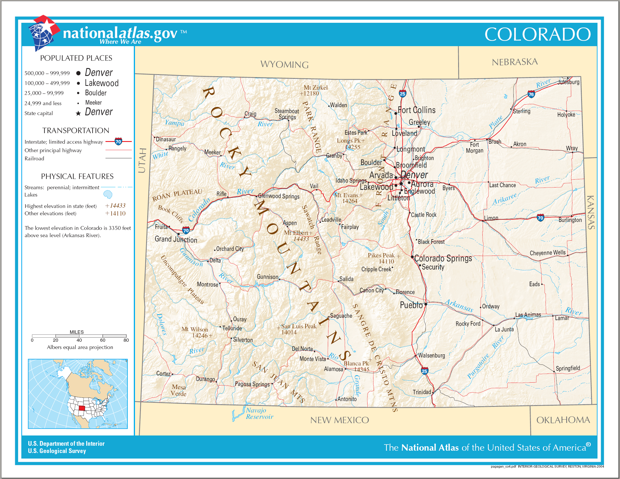
Leyner is an unincorporated community and a census-designated place (CDP) located in and governed by Boulder County, Colorado, United States. The CDP is a part of the Boulder, CO Metropolitan Statistical Area. The population of the Leyner CDP was 40 at the United States Census 2020. The Lafayette post office ( Zip Code 80026) serves the area. Geography Leyner is located in eastern Boulder County along the west side of U.S. Route 287, north of Lafayette. Boulder Creek forms the northern edge of the CDP. The Leyner CDP has an area of , including of water. History A rail line was built through the Leyner area in the early 1870s by the Denver & Boulder Valley Railroad, connecting Boulder and Brighton. The D&BV was acquired by the Union Pacific Railroad in 1898. Leyner does not appear on topographic maps until 1951, and it was adjacent to a siding, indicating that it was probably a railway station at some point in history. The rail line has been owned since 2009 by the Reg ... [...More Info...] [...Related Items...] OR: [Wikipedia] [Google] [Baidu] |
Census-designated Place
A census-designated place (CDP) is a concentration of population defined by the United States Census Bureau for statistical purposes only. CDPs have been used in each decennial census since 1980 as the counterparts of incorporated places, such as self-governing cities, towns, and villages, for the purposes of gathering and correlating statistical data. CDPs are populated areas that generally include one officially designated but currently unincorporated community, for which the CDP is named, plus surrounding inhabited countryside of varying dimensions and, occasionally, other, smaller unincorporated communities as well. CDPs include small rural communities, edge cities, colonias located along the Mexico–United States border, and unincorporated resort and retirement communities and their environs. The boundaries of any CDP may change from decade to decade, and the Census Bureau may de-establish a CDP after a period of study, then re-establish it some decades later. Most unin ... [...More Info...] [...Related Items...] OR: [Wikipedia] [Google] [Baidu] |
Colorado Cities And Towns
The U.S. State of Colorado has 272 active incorporated municipalities, comprising 197 towns, 73 cities, and two consolidated city and county governments. At the 2020 United States Census, 4,299,942 of the 5,773,714 Colorado residents (74.47%) lived in one of these 272 municipalities. Another 714,417 residents (12.37%) lived in one of the 210 census-designated places, while the remaining 759,355 residents (13.15%) lived in the many rural and mountainous areas of the state. Colorado municipalities range in population from the City and County of Denver, the state capital, with a 2020 population of 715,522, to the Town of Carbonate, which has had no year-round population since the 1890 Census due to its severe winter weather and difficult access. The City of Black Hawk with a 2020 population of 127 is the least populous Colorado city, while the Town of Castle Rock with a 2020 population of 73,158 is the most populous Colorado town. Only of Colorado's of land area (1.90%) a ... [...More Info...] [...Related Items...] OR: [Wikipedia] [Google] [Baidu] |
State Of Colorado
Colorado (, other variants) is a state in the Mountain West subregion of the Western United States. It encompasses most of the Southern Rocky Mountains, as well as the northeastern portion of the Colorado Plateau and the western edge of the Great Plains. Colorado is the eighth most extensive and 21st most populous U.S. state. The 2020 United States census enumerated the population of Colorado at 5,773,714, an increase of 14.80% since the 2010 United States census. The region has been inhabited by Native Americans and their ancestors for at least 13,500 years and possibly much longer. The eastern edge of the Rocky Mountains was a major migration route for early peoples who spread throughout the Americas. "''Colorado''" is the Spanish adjective meaning "ruddy", the color of the Fountain Formation outcroppings found up and down the Front Range of the Rocky Mountains. The Territory of Colorado was organized on February 28, 1861, and on August 1, 1876, U.S. President Ulysses S. ... [...More Info...] [...Related Items...] OR: [Wikipedia] [Google] [Baidu] |
Index Of Colorado-related Articles
This is an alphabetical list of articles related to the U.S. State of Colorado. 0–9 * .co.us – Internet second-level domain for the State of Colorado * 4 Corners ** 4 Corners Monument * 6th Principal Meridian * 10-mile Range * 10th Mountain Division (United States) * 16th Street Mall * 25th meridian west from Washington * 32nd meridian west from Washington * 37th parallel north * 38th parallel north * 39th parallel north * 40th parallel north * 41st parallel north * 64 counties of the State of Colorado * 100 km isolated peaks of Colorado * 103rd meridian west * 104th meridian west * 105th meridian west * 106th meridian west * 107th meridian west * 108th meridian west * 109th meridian west * 1500 meter prominent peaks of Colorado * 4000 meter peaks of Colorado * 5280 magazinebr>website* 14,000-foot peaks of Colorado A * Adams County, Colorado * Adams-Onís Treaty of 1819 * Adjacent States: (seven, the third most of the 50 states) ** ** ** ** ** ** ... [...More Info...] [...Related Items...] OR: [Wikipedia] [Google] [Baidu] |
Outline Of Colorado
The following outline is provided as an overview of and topical guide to the U.S. state of Colorado: Colorado – 22nd most populous, the eighth most extensive, and the highest in average elevation of the 50 United States. Colorado is one of the western Mountain States. The 30 highest major summits of the Rocky Mountains all rise within Colorado. The Territory of Colorado joined the Union as the 38th state on August 1, 1876. General reference * Names ** Common name: Colorado *** Pronunciation: ** Official name: State of Colorado ** Abbreviations and name codes *** Postal symbol: CO *** ISO 3166-2 code: US-CO *** Internet second-level domain: .co.us ** Nicknames ***Buffalo Plains State (in disuse) ***Centennial State (previously used on license plates) ***Colorful Colorado (previously used on license plates) ***Columbine State ***Highest State ***Lead State (in disuse) ***Mother of Rivers ***Rocky Mountain Empire ***Rocky Mountain State ***Silver State ... [...More Info...] [...Related Items...] OR: [Wikipedia] [Google] [Baidu] |
United States Census 2010
The United States census of 2010 was the twenty-third United States national census. National Census Day, the reference day used for the census, was April 1, 2010. The census was taken via mail-in citizen self-reporting, with enumerators serving to spot-check randomly selected neighborhoods and communities. As part of a drive to increase the count's accuracy, 635,000 temporary enumerators were hired. The population of the United States was counted as 308,745,538, a 9.7% increase from the 2000 census. This was the first census in which all states recorded a population of over half a million people as well as the first in which all 100 largest cities recorded populations of over 200,000. Introduction As required by the United States Constitution, the U.S. census has been conducted every 10 years since 1790. The 2000 U.S. census was the previous census completed. Participation in the U.S. census is required by law of persons living in the United States in Title 13 of the United S ... [...More Info...] [...Related Items...] OR: [Wikipedia] [Google] [Baidu] |
Regional Transportation District
The Regional Transportation District, more commonly referred to as RTD, is the regional agency operating public transit services in eight out of the twelve counties in the Denver-Aurora-Boulder Combined Statistical Area in the U.S. state of Colorado. It operates over a area, serving 3.08 million people. RTD was organized in 1969 and is governed by a 15-member, publicly elected Board of Directors. Directors are elected to a four-year term and represent a specific district of about 180,000 constituents. RTD currently operates a bus and rail system that has a service area of . In , the system had a ridership of , or about per weekday as of . It employed 2,888 people. It had a $675.5 million operating budget for the year of 2018. Google has RTD schedules attached to its trip planner, and 3rd party mobile applications are now available for the iPhone and other platforms. RTD is constructing the voter-approved FasTracks transit expansion that will add of new commuter rail and l ... [...More Info...] [...Related Items...] OR: [Wikipedia] [Google] [Baidu] |
Union Pacific Railroad
The Union Pacific Railroad , legally Union Pacific Railroad Company and often called simply Union Pacific, is a freight-hauling railroad that operates 8,300 locomotives over routes in 23 U.S. states west of Chicago and New Orleans. Union Pacific is the second largest railroad in the United States after BNSF, with which it shares a duopoly on transcontinental freight rail lines in the Western, Midwestern and Southern United States. Founded in 1862, the original Union Pacific Rail Road was part of the first transcontinental railroad project, later known as the Overland Route. Over the next century, UP absorbed the Missouri Pacific Railroad, the Chicago and North Western Transportation Company, the Western Pacific Railroad, the Missouri–Kansas–Texas Railroad and the Chicago, Rock Island and Pacific Railroad. In 1996, the Union Pacific merged with Southern Pacific Transportation Company, itself a giant system that was absorbed by the Denver and Rio Grande Western Railroad ... [...More Info...] [...Related Items...] OR: [Wikipedia] [Google] [Baidu] |
Brighton, Colorado
Brighton is a List of municipalities in Colorado#Home rule municipality, home rule municipality city located in Adams County, Colorado, Adams and Weld County, Colorado, Weld List of counties in Colorado, counties, Colorado, United States. Brighton is the county seat of Adams County and a part of the Denver–Aurora–Lakewood, CO Metropolitan Statistical Area and the Front Range Urban Corridor. The city population was 40,083 at the 2020 United States Census with 39,718 residing in Adams County and 365 residing in Weld County. History The town was named for Brighton Beach, New York (state), New York. Brighton was founded in the 1870s as a stage/railroad depot and farming community. The town was originally named Hughes Station. The town was incorporated in 1887. Among the notable scholars born there are Richard Ling, founding editor of ''Mobile Media & Communication'', currently the Shaw Foundation Professor of Media Technology at Nanyang Technological University, and Max Pfeffer, S ... [...More Info...] [...Related Items...] OR: [Wikipedia] [Google] [Baidu] |
Boulder, Colorado
Boulder is a home rule city that is the county seat and most populous municipality of Boulder County, Colorado, United States. The city population was 108,250 at the 2020 United States census, making it the 12th most populous city in Colorado. Boulder is the principal city of the Boulder, CO Metropolitan Statistical Area and an important part of the Front Range Urban Corridor. Boulder is located at the base of the foothills of the Rocky Mountains, at an elevation of above sea level. Boulder is northwest of the Colorado state capital of Denver. It is home of the main campus of the University of Colorado, the state's largest university. History On November 7, 1861, the Colorado General Assembly passed legislation to locate the University of Colorado in Boulder. On September 20, 1875, the first cornerstone was laid for the first building (Old Main) on the CU campus. The university officially opened on September 5, 1877. In 1907, Boulder adopted an anti- saloon ordinanc ... [...More Info...] [...Related Items...] OR: [Wikipedia] [Google] [Baidu] |
Boulder Creek (Colorado)
Boulder Creek is a U.S. Geological Survey. National Hydrography Dataset high-resolution flowline dataThe National Map, accessed March 25, 2011 creek draining the Rocky Mountains to the west of Boulder, Colorado, as well as the city itself and surrounding plains. Route The creek is formed by two main tributaries rising along the Continental Divide: North and Middle Boulder Creek; and later joined by South Boulder Creek. North Boulder Creek forms in a valley between Navajo Peak and Arikaree Peak on the Continental Divide, in the Green Lakes chain of lakes. The creek flows past the community of Switzerland Park to join Middle Boulder Creek. Middle Boulder Creek rises as two forks from the Continental Divide: the North Fork rises in a cirque below Mount Neva and flows to the South Fork. The South Fork rises at Rollins Pass on the Continental Divide and flows to the North Fork. From the junction of the two forks, Middle Boulder Creek, long, flows east through the towns of ... [...More Info...] [...Related Items...] OR: [Wikipedia] [Google] [Baidu] |


