|
Leongatha
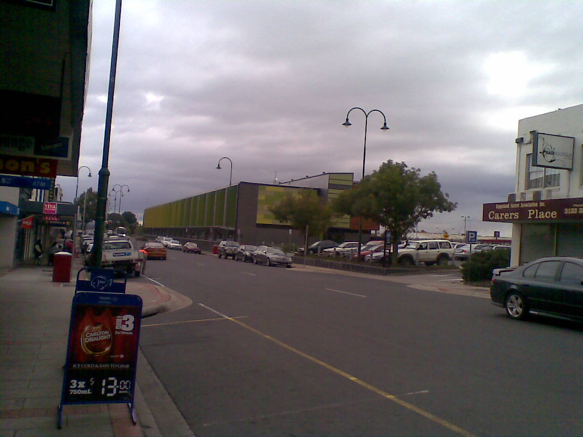
Leongatha is a town in the foothills of the Strzelecki Ranges, South Gippsland Shire, Victoria, Australia, located south-east of Melbourne. At the , Leongatha had a population of 5,869. Canadian dairy company Saputo which trades in Australia under the ''Devondale'' label, among others, has a dairy processing plant on the north side of the town producing milk-based products for Australian and overseas markets. History First settlement of the area by Europeans occurred in 1845. The Post Office opened as Koorooman on 1 October 1887 and renamed Leongatha in 1891 when a township was established on the arrival of the railway. The railway line from Melbourne reached the town in 1891, and stimulated further settlement. Regular V/Line passenger operations on the line to the local railway station ceased in 1993. The Leongatha Magistrates' Court closed on 1 January 1990. Transport The town is located on the South Gippsland Highway which links Leongatha to Melbourne. Leongatha was ... [...More Info...] [...Related Items...] OR: [Wikipedia] [Google] [Baidu] |
South Gippsland Railway Line
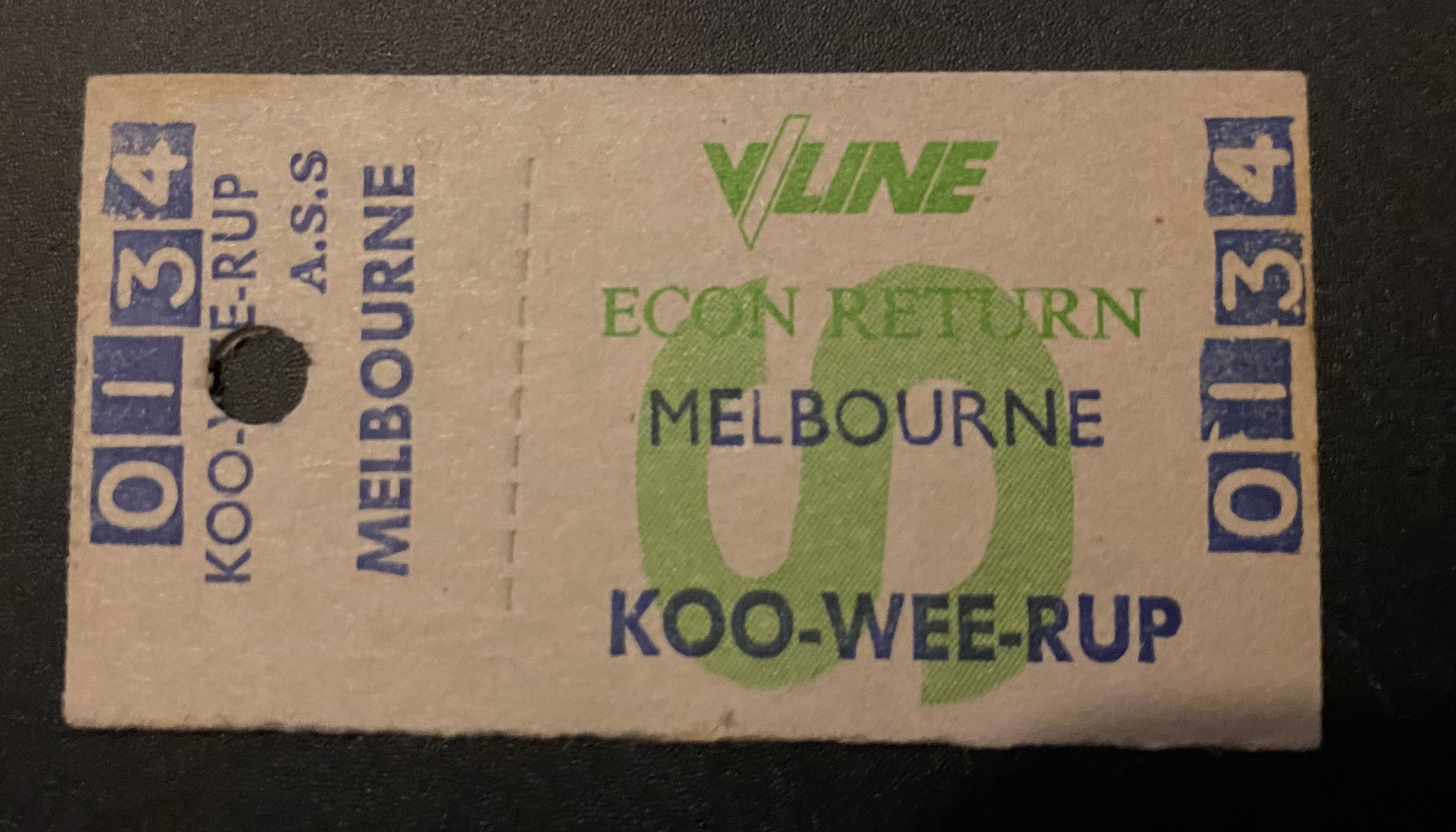
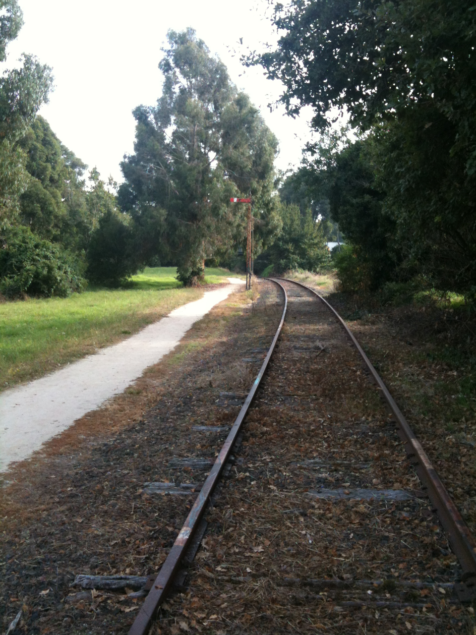
The South Gippsland railway line is a partially closed railway line in Victoria, Australia. It was first opened in 1892, branching from the Orbost line at Dandenong, and extending to Port Albert. Much of it (the section up to Leongatha) remained open until December 1994 (passenger services finished the previous July). Today, only the section between Dandenong and Cranbourne remains open for use. The section of the line from Nyora to Leongatha was used by the South Gippsland Tourist Railway until it ceased operations in 2016. The section from Nyora to Welshpool, with extension trail to Port Welshpool and a portion of the former line at Koo Wee Rup, have been converted into the Great Southern Rail Trail. History The Melbourne and Suburban Railway Company opened a line from Princes Bridge railway station to Punt Road (Richmond) and South Yarra in 1859 and extended to Dandenong in 1879. The South Gippsland railway line was opened from Dandenong to Cranbourne in 1888 and extended ... [...More Info...] [...Related Items...] OR: [Wikipedia] [Google] [Baidu] |
Leongatha Railway Station, Victoria
Leongatha is a railway station in the town of Leongatha, Victoria on the former South Gippsland railway line in South Gippsland, Victoria, Australia. The station opened in 1891 as a terminus, the line being extended to Welshpool the next year. Initially the station was planned to be named "Koorooman", later being changed to "Leongatha" at time of construction. For a number of years after the ending of regular V/Line passenger operations on the line east of Cranbourne in 1993, the station was the terminus of the former South Gippsland Tourist Railway, but its operations ceased in January 2016. The track south of Leongatha has been dismantled and turned into the Great Southern Rail Trail. The station precinct includes a well preserved red brick station building, goods shed, water tower and footbridge. The goods shed has since been demolished with a view of converting the unused railway reservation for a shopping plaza, which has not yet eventuated. The track east of Leongatha Sta ... [...More Info...] [...Related Items...] OR: [Wikipedia] [Google] [Baidu] |
Great Southern Rail Trail
The Great Southern Rail Trail is a 109-kilometre rail trail from Nyora to Welshpool in South Gippsland, Victoria, Australia. This mostly flat or gently undulating trail goes through lush dairy farmland, areas of remnant bush and lowland scrub. It climbs from the foothills of Fish Creek up past Mount Hoddle and then down a steep descent through dense forest out into magnificent views of Wilsons Promontory and Corner Inlet, continuing on to Foster. before ending at Welshpool. The trail is well maintained with a surface of compacted gravel. Koalas Wombats and wallabies can often be seen from the trail particularly in the early mornings and evenings. The 10 km Toora to Welshpool section was opened on 7 February 2015. A section from Koonwarra to Minns road was opened in March 2016 incorporating what were three very dilapidated wooden trestle bridges. This section replaces what was a three kilometer diversion to the nearby South Gippsland Highway. The section provides a contin ... [...More Info...] [...Related Items...] OR: [Wikipedia] [Google] [Baidu] |
South Gippsland Shire
The Shire of South Gippsland is a local government area in Victoria, Australia, located in the south-eastern part of the state. It covers an area of and, in June 2018, had a population of 29,576. It includes the towns of Leongatha, Korumburra, Foster, Poowong, Mirboo North and Meeniyan. It was formed in 1994 from the amalgamation of the former Shire of South Gippsland with the Shire of Mirboo, and parts of the Shire of Korumburra and Shire of Woorayl. The Shire is governed and administered by the South Gippsland Shire Council; its seat of local government and administrative centre is located at the council headquarters in Leongatha, it also has a service centre located in Mirboo North. The Shire is named after the Gippsland region, in which the LGA occupies the southernmost portion, including Wilsons Promontory at the southern tip of the Australian continent. Council Current composition The council is composed of three wards and nine councillors, with three councillors pe ... [...More Info...] [...Related Items...] OR: [Wikipedia] [Google] [Baidu] |
Leongatha Airport
Leongatha Airport is located southwest of Leongatha, Victoria, Australia Australia, officially the Commonwealth of Australia, is a Sovereign state, sovereign country comprising the mainland of the Australia (continent), Australian continent, the island of Tasmania, and numerous List of islands of Australia, sma .... See also * List of airports in Victoria References Airports in Victoria (Australia) Leongatha, Victoria {{VictoriaAU-struct-stub ... [...More Info...] [...Related Items...] OR: [Wikipedia] [Google] [Baidu] |
South Gippsland Highway
The South Gippsland Highway is a partially divided highway in Victoria, Australia which connects the city of Melbourne with the South Gippsland region of Victoria, ending in the town of Sale. The highway begins at Lonsdale Street (Princes Highway), Dandenong. At the Greens Road intersection, it adopts Metropolitan Route 12 until Pound Road, then continues until the South Gippsland Freeway / Western Port Highway interchange where it becomes the M420. The M420 continues through and until the Bass Highway turnoff, at which point the road is then designated A440 onwards to Sale. From the Bass Highway junction, the highway is undivided. The South Gippsland Highway is the gateway from Melbourne to many attractions including Wilsons Promontory and Phillip Island as well as being an important road for farmers in Gippsland. Route The highway commences in Dandenong, branching from the Princes Highway, and heads in a general south-east direction at first. It is mostly a dual carriagewa ... [...More Info...] [...Related Items...] OR: [Wikipedia] [Google] [Baidu] |
Foster, Victoria
Foster is a dairying and grazing town south-east of Melbourne on the South Gippsland Highway in Victoria, Australia. At the Foster had an urban population of 1,164. It is about north of the Gippsland coastline which includes Shallow Inlet, Corner Inlet, Waratah Bay, Yanakie and Wilsons Promontory. History Originally called Stockyard Creek, after the stream which still flows through the centre of the town, Foster was initially just a resting place for drovers travelling from Port Albert to Western Port. This changed with the discovery of gold in the 1880s, leading to a (modest) gold rush. The post office opened on 20 February 1871 as Stockyard Creek and was renamed Foster in 1879 when the township was established. In 1870 a gold rush along Stockyard Creek resulted in the township of that name and in late 1884 following comments by the Police Magistrate from Sale (Mr William H Foster) that he couldn't hold court in a creek the town suddenly became ‘Foster’. Previously a s ... [...More Info...] [...Related Items...] OR: [Wikipedia] [Google] [Baidu] |
V/Line
V/Line is a statutory authority that operates regional passenger train and coach services in Victoria, Australia. It provides passenger train services on five commuter lines and eight long-distance routes from its major hub at Southern Cross railway station in Melbourne, as well as bus services across Victoria and into New South Wales, the Australian Capital Territory and South Australia. In addition, V/Line is responsible for the maintenance of much of the Victorian freight and passenger rail network outside of the areas managed by Metro Trains Melbourne and the Australian Rail Track Corporation. The V/Line brand was introduced after the split-up of VicRail in 1983, and has been used by all successive government and private operators of the state's regional public transport. Until 1999, when its freight operations were privatised, V/Line Freight was also a monopoly government provider of the state's rail freight services. Since 2004, V/Line Pty Ltd, the main operating rail ... [...More Info...] [...Related Items...] OR: [Wikipedia] [Google] [Baidu] |
Morwell, Victoria
Morwell is a town in the Latrobe Valley area of Gippsland, in South-Eastern Victoria, Australia approximately 152 km (94 mi) east of Melbourne. Morwell has a population of 14,389 people at the . It is both the seat of local government and administrative centre for the City of Latrobe. Morwell is located in the centre of the Latrobe Valley urban area, which has a population of 77,168 at the 2021 Census and is home to many of the greater urban area's civic institutions, administrative functions and infrastructure. The city is known for its role as a major energy production centre for Victoria as the centre of a major coal mining and fossil-fuel power generation industry. Morwell's centenary rose garden located in the central business district, won an award in 2009 for being a 'garden of excellence'. Since 2018, the town has hosted the International Rose Garden Festival Morwell (IRGFM). Naming The name of the town of Morwell is likely to be derived from a local In ... [...More Info...] [...Related Items...] OR: [Wikipedia] [Google] [Baidu] |
Wonthaggi, Victoria
Wonthaggi is a seaside town located south east of Melbourne via the South Gippsland and Bass Highways, in the Bass Coast Shire of Gippsland, Victoria, Australia. Known originally for its coal mining, it is now the largest town in South Gippsland, a regional area with extensive tourism, beef and dairy industries. The name "Wonthaggi" is an Australian Aboriginal name meaning "home" from the Boonwurrung (south-central Kulin). It was used in the area some time before 1 August 1910 when the town was founded. History The Boonwurrung aboriginal people were custodians of this stretch of coast for thousands of years prior to white settlement. The Boakoolawal clan lived in the Kilcunda area south of the Bass River, and the Yowenjerre were west of the Tarwin River along what is now the Bunurong Marine and Coastal Park. Middens containing charcoal and shellfish mark the location of their campsites along the coast. Coal was discovered by explorer William Hovell at Cape Paterson in 1 ... [...More Info...] [...Related Items...] OR: [Wikipedia] [Google] [Baidu] |
Electoral District Of Gippsland South
The electoral district of Gippsland South (initially known as South Gippsland) is a Lower House electoral district of the Victorian Parliament. It is located within the Eastern Victoria Region of the Legislative Council. Gippsland South extends along the state's coast from Venus Bay to Loch Sport and includes the country Victorian towns of Foster, Korumburra, Leongatha, Mirboo North, Port Albert, Port Welshpool, Rosedale, Sale and Yarram. The electorate includes all of South Gippsland Shire and the southern parts of Wellington Shire. Industries include agriculture, timber production and tourism. Dairying is the biggest agricultural contributor to the local economy. Natural features include Wilsons Promontory National Park, Corner Inlet, and a number of lakes and islands along the coast and border. Its area was initially defined by the 1858 Electoral Act as: "''Commencing at the mouth of Merryman's Creek on the Ninety Mile Beach; bounded on the north by Merryman's Creek t ... [...More Info...] [...Related Items...] OR: [Wikipedia] [Google] [Baidu] |
County Of Buln Buln
The County of Buln Buln is one of the 37 counties of Victoria which are part of the cadastral divisions of Australia, used for land titles. It was first proclaimed in government gazette on 24 Feb 1871 together with others from the Gipps Land District. It includes Wilsons Promontory, and the Victorian coast from around Venus Bay in the west to Lake Wellington in the east. Sale is near its north-eastern edge. Some time earlier maps showed proposed counties of Bass, Douro, and part of Haddington and Bruce occupying the area of Buln Buln. Parishes Parishes include: * Alberton East, Victoria * Alberton West, Victoria * Allambee, Victoria * Allambee East, Victoria * Balloong, Victoria * Beek Beek, Victoria * Binginwarri, Victoria * Boodyarn, Victoria * Booran, Victoria * Bruthen, Victoria * Budgeree, Victoria * Bulga, Victoria * Callignee, Victoria * Carrajung, Victoria * Coolungoolun, Victoria * Darnum, Victoria * Darriman, Victoria * Devon, Victoria * Doomburrim, Vic ... [...More Info...] [...Related Items...] OR: [Wikipedia] [Google] [Baidu] |


