|
Leon (Souda Bay)
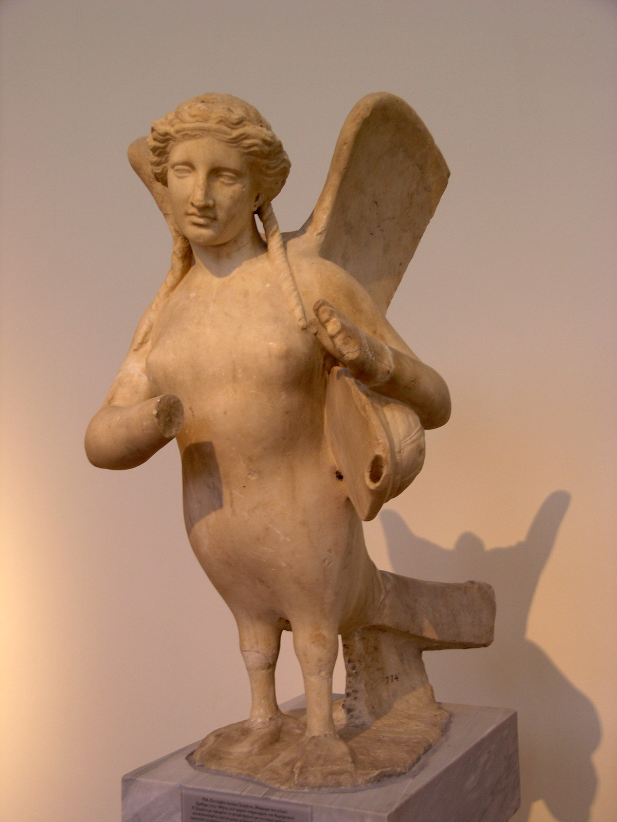
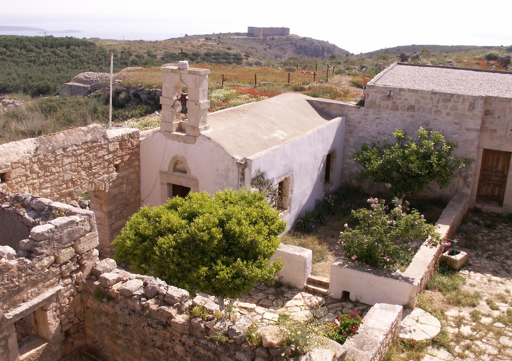
Leon ( el, Λέων, "lion"), also known colloquially as Nisi ("the island") and during Venetian rule as Rabbit Island, is an islet in Souda Bay on the northwest coast of Crete. On the southeast side of the islet, a small distance away, there is another larger islet called Souda. In ancient times these two islets were referred to as Leukai (Greek for "white ones") and pronounced "Lefkai". Their name came from the ancient Greek myth about a musical contest between the Sirens and the Muses. Out of their anguish from losing the competition, writes Stephanus of Byzantium, the Muses plucked their rivals' feathers from their wings; the Sirens turned white and fell into the sea at Aptera ("featherless") where they formed the islands in the bay that were called Lefkai.Caroline M. Galt, "A marble fragment at Mount Holyoke College from the Cretan city of Aptera", ''Art and Archaeology'' 6 (1920:150). See also *List of islands of Greece Greece has many islands, with estimates rangi ... [...More Info...] [...Related Items...] OR: [Wikipedia] [Google] [Baidu] |
Modern Regions Of Greece
The regions of Greece ( el, περιφέρειες, translit=periféries) are the country's thirteen first-level administrative entities, each comprising several second-level units, originally known as prefectures and, since 2011, as regional units. History The current regions were established in July 1986 (the presidential decree officially establishing them was signed in 1987), by decision of the interior minister, Menios Koutsogiorgas, as second-level administrative entities, complementing the prefectures (Law 1622/1986). Ν.1622/86 "Τοπική Αυτοδιοίκηση - Περιφερειακή Ανάπτυξη - Δημοκρατικός Προγραμματισμός", (ΦΕΚ 92/τ.Α΄/14-7-1986) Before 1986, there was a traditional division into broad historical–geographical regions (γεωγραφικά διαμερίσματα), which, however, was often arbitrary; not all of the pre-1986 traditional historical-geographic regions had official administrative bodie ... [...More Info...] [...Related Items...] OR: [Wikipedia] [Google] [Baidu] |
Crete
Crete ( el, Κρήτη, translit=, Modern: , Ancient: ) is the largest and most populous of the Greek islands, the 88th largest island in the world and the fifth largest island in the Mediterranean Sea, after Sicily, Sardinia, Cyprus, and Corsica. Crete rests about south of the Greek mainland, and about southwest of Anatolia. Crete has an area of and a coastline of 1,046 km (650 mi). It bounds the southern border of the Aegean Sea, with the Sea of Crete (or North Cretan Sea) to the north and the Libyan Sea (or South Cretan Sea) to the south. Crete and a number of islands and islets that surround it constitute the Region of Crete ( el, Περιφέρεια Κρήτης, links=no), which is the southernmost of the 13 top-level administrative units of Greece, and the fifth most populous of Greece's regions. Its capital and largest city is Heraklion, on the north shore of the island. , the region had a population of 636,504. The Dodecanese are located to the no ... [...More Info...] [...Related Items...] OR: [Wikipedia] [Google] [Baidu] |
Regional Units Of Greece
The 74 regional units of Greece ( el, περιφερειακές ενότητες, ; sing. , ) are the country's Seventy-four second-level administrative units. They are divisions of the country's 13 regions, and are further divided into municipalities. They were introduced as part of the Kallikratis administrative reform on 1 January 2011 and are comparable in area and, in the mainland, coterminous with the 'pre-Kallikratis' prefectures of Greece During the first administrative division of independent Greece in 1833–1836 and again from 1845 until their abolition with the Kallikratis reform in 2010, the prefectures ( el, νομοί, sing. νομός, translit=nomoi, sing. nomós) were .... List References {{Articles on second-level administrative divisions of European countries Regional units Greece transport-related lists Subdivisions of Greece ... [...More Info...] [...Related Items...] OR: [Wikipedia] [Google] [Baidu] |
Chania (regional Unit)
Chania ( el, Περιφερειακή ενότητα Χανίων) is one of the four regional units of Greece, regional units of Crete; it covers the westernmost quarter of the island. Its capital is the city of Chania. Chania borders only one other regional unit: that of Rethymno (regional unit), Rethymno to the east. The western part of Crete is bounded to the north by the Sea of Crete, Cretan Sea, and to the west and south by the Mediterranean Sea. The regional unit also includes the southernmost island of Europe, Gavdos. Geography Chania regional unit, often informally termed 'Western Crete', is a part of the island which includes the districts of Apokoronas, Sfakia, and Selino in the far South West corner. Other towns in the Chania prefecture include Sfakia#Hora Sfakion, Hora Sfakion, Kastelli-Kissamos, Kissamos, Palaiochora, Maleme, Vryses, Vamos, Georgioupolis and Kalives. The natural park of Samariá Gorge, a tourist attraction and a refuge for the rare Cretan wild goat ... [...More Info...] [...Related Items...] OR: [Wikipedia] [Google] [Baidu] |
Republic Of Venice
The Republic of Venice ( vec, Repùblega de Venèsia) or Venetian Republic ( vec, Repùblega Vèneta, links=no), traditionally known as La Serenissima ( en, Most Serene Republic of Venice, italics=yes; vec, Serenìsima Repùblega de Venèsia, links=no), was a sovereign state and Maritime republics, maritime republic in parts of present-day Italy (mainly Northern Italy, northeastern Italy) that existed for 1100 years from AD 697 until AD 1797. Centered on the Venetian Lagoon, lagoon communities of the prosperous city of Venice, it incorporated numerous Stato da Màr, overseas possessions in modern Croatia, Slovenia, Montenegro, Greece, Albania and Cyprus. The republic grew into a Economic history of Venice, trading power during the Middle Ages and strengthened this position during the Renaissance. Citizens spoke the still-surviving Venetian language, although publishing in (Florentine) Italian became the norm during the Renaissance. In its early years, it prospered on the salt ... [...More Info...] [...Related Items...] OR: [Wikipedia] [Google] [Baidu] |
Souda Bay
Souda Bay is a bay and natural harbour near the town of Souda on the northwest coast of the Greece, Greek island of Crete. The bay is about 15 km long and only two to four km wide, and a deep natural harbour. It is formed between the Akrotiri (Crete), Akrotiri peninsula and Cape Drapano, and runs west to east. The bay is overlooked on both sides by hills, with a relatively low and narrow isthmus in the west near Chania. Near the mouth of Souda bay, between the Akrotiri and the town of Kalives, there is a group of small islands with Venice, Venetian fortifications. The largest island is Souda Island, giving its name to the bay. Souda Bay is now a popular tourist destination although there are no formal public beaches designed in the area, due to the presence of the Crete Naval Base, a major naval installation of the Hellenic Navy and NATO in the eastern Mediterranean. Villages such as Megala Chorafia and Kalives afford fine views of the bay, and house-building, particular ... [...More Info...] [...Related Items...] OR: [Wikipedia] [Google] [Baidu] |
Souda Island
Souda ( el, Σούδα) is an islet in Souda Bay on the northwest coast of Crete. In ancient times this islet was one of two islets that were referred to as Leukai. The second islet is known today as Leon. History The island was fortified by the Venetians due to its strategic location, controlling the entrance to the anchorage of Souda Bay (which is still an important Greek and NATO naval base). Although the rest of Crete fell to Ottoman control in the Cretan War (1645–1669), the fortress of Souda (along with the island fortresses of Gramvousa and Spinalonga) remained in Venetian hands until 1715, when they too fell to the Ottomans. During this time, the island served as a refuge for Cretan insurgents. Mythology On the northwest side of the islet, a small distance away, there is another island which is almost round in shape, which used to be referred to on medieval Venetian maps as ''Rabbit Island'' (known as ''Nisi'' and ''Leon'' today). In ancient times these two islets w ... [...More Info...] [...Related Items...] OR: [Wikipedia] [Google] [Baidu] |
Souda (island)
Souda ( el, Σούδα) is an islet in Souda Bay on the northwest coast of Crete. In ancient times this islet was one of two islets that were referred to as Leukai. The second islet is known today as Leon. History The island was fortified by the Venetians due to its strategic location, controlling the entrance to the anchorage of Souda Bay (which is still an important Greek and NATO naval base). Although the rest of Crete fell to Ottoman control in the Cretan War (1645–1669), the fortress of Souda (along with the island fortresses of Gramvousa and Spinalonga) remained in Venetian hands until 1715, when they too fell to the Ottomans. During this time, the island served as a refuge for Cretan insurgents. Mythology On the northwest side of the islet, a small distance away, there is another island which is almost round in shape, which used to be referred to on medieval Venetian maps as ''Rabbit Island'' (known as ''Nisi'' and ''Leon'' today). In ancient times these two islets w ... [...More Info...] [...Related Items...] OR: [Wikipedia] [Google] [Baidu] |
Siren (mythology)
In Greek mythology, the sirens (Ancient Greek: singular: ; plural: ) were humanlike beings with alluring voices; they appear in a scene in the Odyssey in which Odysseus saves his crew's lives. Roman poets placed them on some small islands called Sirenum scopuli. In some later, rationalized traditions, the literal geography of the "flowery" island of Anthemoessa, or Anthemusa, is fixed: sometimes on Cape Pelorum and at others in the islands known as the Sirenuse, near Paestum, or in Capreae. All such locations were surrounded by cliffs and rocks. Sirens continued to be used as a symbol for the dangerous temptation embodied by women regularly throughout Christian art of the medieval era. Nomenclature The etymology of the name is contested. Robert S. P. Beekes has suggested a Pre-Greek origin. Others connect the name to σειρά (''seirá'', "rope, cord") and εἴρω (''eírō'', "to tie, join, fasten"), resulting in the meaning "binder, entangler", i.e. one who binds ... [...More Info...] [...Related Items...] OR: [Wikipedia] [Google] [Baidu] |
Muses
In ancient Greek religion and mythology, the Muses ( grc, Μοῦσαι, Moûsai, el, Μούσες, Múses) are the inspirational goddesses of literature, science, and the arts. They were considered the source of the knowledge embodied in the poetry, lyric songs, and myths that were related orally for centuries in ancient Greek culture. Melete, Aoede, and Mneme are the original Boeotian Muses, and Calliope, Clio, Erato, Euterpe, Melpomene, Polyhymnia, Terpsichore, Thalia, and Urania are the nine Olympian Muses. In modern figurative usage, a Muse may be a source of artistic inspiration. Etymology The word ''Muses'' ( grc, Μοῦσαι, Moûsai) perhaps came from the o-grade of the Proto-Indo-European root (the basic meaning of which is 'put in mind' in verb formations with transitive function and 'have in mind' in those with intransitive function), or from root ('to tower, mountain') since all the most important cult-centres of the Muses were on mountains or hills. R ... [...More Info...] [...Related Items...] OR: [Wikipedia] [Google] [Baidu] |
Stephanus Of Byzantium
Stephanus or Stephan of Byzantium ( la, Stephanus Byzantinus; grc-gre, Στέφανος Βυζάντιος, ''Stéphanos Byzántios''; centuryAD), was a Byzantine grammarian and the author of an important geographical dictionary entitled ''Ethnica'' (). Only meagre fragments of the dictionary survive, but the epitome is extant, compiled by one Hermolaus, not otherwise identified. Life Nothing is known about the life of Stephanus, except that he was a Greek grammarian who was active in Constantinople, and lived after the time of Arcadius and Honorius, and before that of Justinian II. Later writers provide no information about him, but they do note that the work was later reduced to an epitome by a certain Hermolaus, who dedicated his epitome to Justinian; whether the first or second emperor of that name is meant is disputed, but it seems probable that Stephanus flourished in Byzantium in the earlier part of the sixth century AD, under Justinian I. The ''Ethnica'' Even as an ... [...More Info...] [...Related Items...] OR: [Wikipedia] [Google] [Baidu] |
Aptera, Greece
Aptera ( or ) or Apteron was an ancient city, now an archaeological site in western Crete, a kilometre inland from the southern shore of Souda Bay, about 13 km east of Chania in the municipality of Akrotiri. History It is mentioned (A-pa-ta-wa) in Linear B tablets from the 14th-13th centuries BC. With its highly fortunate geographical situation, the city-state was powerful from Minoan through Hellenistic times, when it gradually declined. However, the Minoan settlement of the Bronze Age was located about 1.5 km away from Aptera, at the place of the modern Stylos settlement. In Greek mythology, Aptera was the site of the legendary contest between the Sirens and the Muses, when after the victory of the Muses, the Sirens lost the feathers of their wings from their shoulders, and having thus become white, cast themselves into the sea. The name of the city literally means "without wings", and the neighbouring islands Leucae means "white". In the third century BC, Apt ... [...More Info...] [...Related Items...] OR: [Wikipedia] [Google] [Baidu] |


