|
Lenzie
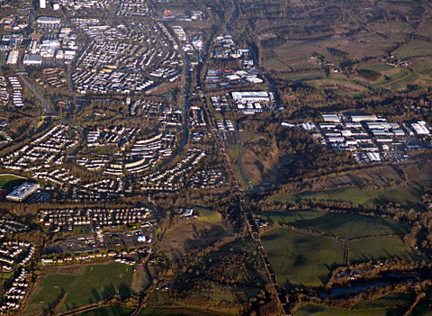
Lenzie () is an affluent town by the Edinburgh and Glasgow Railway in the East Dunbartonshire council area of Scotland. It is about north-east of Glasgow city centre and south of Kirkintilloch. At the 2011 census, it had a population of 8,873. United Kingdom Census 2011 The ancient barony of Lenzie was held by William de Comyn, Baron of Lenzie and Lord of Cumbernauld in the 12th century. Toponymy Lenzie is now generally pronounced with a /z/, but used to be pronounced /lɛnjɪ/. This is because the original Scots spelling, Lenȝie, contained the letter yogh, which was later confused with the tailed z. The name probably derives from the Gaelic ''Lèanaidh'' (), a locative form of ''lèana'', meaning a "wet meadow". The whole parish was split into Easter Lenzie which now contains for example Lenziemill, and Wester Lenzie which came to be dominated by Kirkintilloch. History Lenzie, as a town, was built in the 19th century as a commuter town for those travelling to Glasgow and ... [...More Info...] [...Related Items...] OR: [Wikipedia] [Google] [Baidu] |
Lenzie Academy
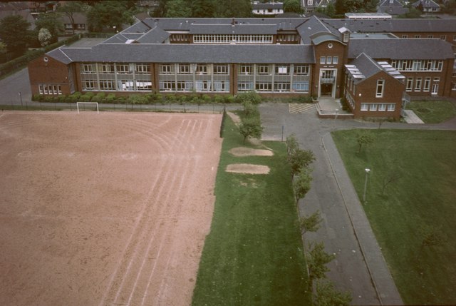
Lenzie Academy is a co-educational comprehensive secondary school located in Lenzie, East Dunbartonshire, Scotland. The catchment area covers Lenzie, Auchinloch and southern parts of Kirkintilloch. Senior management team The school is managed by the senior management team, composed of the Head Teacher and six Deputy Head Teachers, each in charge of a year group. In 2011–present the headteacher was Brian Paterson. School roll The most recently reported school roll is 1296, taught by a teaching staff of 101. The S1 intake cap is 240, based on an average annual first year intake of eight classes of approximately thirty pupils each, mostly coming from four associated primary schools, namely Auchinloch, Millersneuk, Lairdsland and Lenzie Meadow Primary. Approximately 40% of the total roll are from outside the catchment area (human geography), catchment area, attending as placing requests. The S1 rolls have slightly reduced in recent years and in early 2012 the reported 2012/20 ... [...More Info...] [...Related Items...] OR: [Wikipedia] [Google] [Baidu] |
Lenzie Moss
Lenzie Moss is a local nature reserve in Lenzie, East Dunbartonshire, Scotland. It is a boggy, marshy area that has not been built on. The reserve comprises lowland raised bogs, which were extensively exploited for peat, and now feature the characteristics of peat cutting, and several acres of deciduous woodland mainly made up of silver birch. The area is a sanctuary for wildlife, including rabbits, deer and foxes. The Lenzie Peat Railway Lenzie Peat Railway was a Narrow gauge railway, narrow-gauge railway which ran on Lenzie Moss, which is situated to the west of the town of Lenzie in Scotland. The bogs of the moss were exploited for peat, and the site was served by a railway ... was a narrow gauge railway which ran on Lenzie Moss serving the peat trade. Threats of development In 2012 locals feared that the nature reserve was under threat after Lenzie Rugby Football Club revealed plans to develop land that borders Lenzie Moss. A local resident said: “Lenzie Moss is a u ... [...More Info...] [...Related Items...] OR: [Wikipedia] [Google] [Baidu] |
Lenzie Peat Railway
Lenzie Peat Railway was a narrow-gauge railway which ran on Lenzie Moss, which is situated to the west of the town of Lenzie in Scotland. The bogs of the moss were exploited for peat, and the site was served by a railway which took the cut peat to a storage and dispatch area (peat packing shed on the map) adjacent to the Edinburgh and Glasgow Railway (E&G). The works were owned by the Peat Development Co Ltd."Lenzie Peat Railway", Hamish Stevenson, Industrial Railway Record, Volume 222: September 2015 The railway was worked by two Lister petrol locomotives, Works Nos. 26286 of 1944 and 29890 of 1946. The Lenzie Peat Railway closed around 1966. The Lister locomotive 29890 is now owned by the West Lancashire Light Railway. The cut peat was transported in wooden slatted wagons to the peat packing shed, and would be loaded onto trains at the sidings next to the Edinburgh and Glasgow Railway just west of Lenzie station , symbol_location = gb , symbol = r ... [...More Info...] [...Related Items...] OR: [Wikipedia] [Google] [Baidu] |
Lenziemill
Lenziemill is the site one of Cumbernauld's several industrial estates, built as satellite developments on the periphery of the Scottish town's residential areas. Toponymy The etymology of the name is uncertain but may distinguish the mill here in ancient Easter Lenzie from a nearby flax mill at Pettycastle in Blairlinn in the parish of Old Monklands. History Several other old maps show Lenzie Mill with various spellings including maps by William Forrest, and John Thomson. There used to be a corn mill which was powered by water from the Luggie. Modern Estate There are several roads on the estate, several branching from Lenziemill Road which is 12 miles from Glasgow and 30 miles from Edinburgh. Companies include Cube Glass Limited, R & S Plant Limited, Dow Waste Management, Elite Print Services, Suresafe Protection Limited, The Artificial Grass Company Scotland Ltd, Thermashield Windows & Maintenance Limited, and Bathroom And Tiles Direct Ltd. Near of the estate is a steep ... [...More Info...] [...Related Items...] OR: [Wikipedia] [Google] [Baidu] |
Kirkintilloch
Kirkintilloch (; sco, Kirkintulloch; gd, Cair Cheann Tulaich) is a town and former barony burgh in East Dunbartonshire, Scotland. It lies on the Forth and Clyde Canal and on the south side of Strathkelvin, about northeast of central Glasgow. Historically part of Dunbartonshire, the town is the administrative home of East Dunbartonshire council area, its population in 2009 was estimated at 19,700 and its population in 2011 was 19,689. Toponymy "Kirkintilloch" comes from the Gaelic ''Cair Cheann Tulaich'' or ''Cathair Cheann Tulaich'', meaning "fort at the end of the hill". This, in turn, may come from a Cumbric name, ''Caer-pen-taloch'', which has the same meaning. A possible reference to the site is made in the 9th century Welsh text Historia Brittonum, in which the Antonine Wall is said to end at 'Caerpentaloch'. The fort referred to is the former Roman settlement on the wall and the hillock is the volcanic drumlin which would have offered a strategic viewpoint for miles to ... [...More Info...] [...Related Items...] OR: [Wikipedia] [Google] [Baidu] |
Lenzie Railway Station
, symbol_location = gb , symbol = rail , image = File:Lenzie - Abellio 385021 Glasgow service.JPG , caption = A going to , borough = Lenzie, East Dunbartonshire , country = Scotland , coordinates = , grid_name = Grid reference , grid_position = , manager = ScotRail , platforms = 2 , code = LNZ , transit_authority = SPT , original = Edinburgh and Glasgow Railway , pregroup = North British Railway , postgroup = London and North Eastern Railway , years = 5 July 1848 , events = Opened as Kirkintilloch JunctionButt (1995), page 136 , years1 = December 1849 , events1 = Renamed Campsie JunctionButt (1995), page 52 , years2 = November 1867 , events2 = Renamed Lenzie JunctionButt (1995), page 141 , years3 = June 189 ... [...More Info...] [...Related Items...] OR: [Wikipedia] [Google] [Baidu] |
East Dunbartonshire
East Dunbartonshire ( sco, Aest Dunbartanshire; gd, Siorrachd Dhùn Bhreatainn an Ear) is one of the 32 council areas of Scotland. It borders the north of Glasgow and contains many of the affluent areas to the north of the city, including Bearsden, Milngavie, Milton Of Campsie, Balmore and Torrance, as well as many of the city's commuter towns and villages. East Dunbartonshire also shares borders with North Lanarkshire, Stirling and West Dunbartonshire. The council area covers parts of the historic counties of Dunbartonshire, Lanarkshire and Stirlingshire. The council area was formed in 1996, as a result of the Local Government etc. (Scotland) Act 1994, from the former Bearsden and Milngavie district and most of the former Strathkelvin district (all areas except Chryston and Auchinloch, which became part of North Lanarkshire council area), within the wider Strathclyde region. Demographics East Dunbartonshire council area has low levels of deprivation, with relatively low u ... [...More Info...] [...Related Items...] OR: [Wikipedia] [Google] [Baidu] |
Scottish Feudal Barony Of Lenzie
The feudal barony of Lenzie was a Scottish feudal barony, feudal barony with its ''caput, caput baronium'' at an unknown location in East Dunbartonshire, Scotland. The barony was granted to William Comyn, Lord of Badenoch, William Comyn, Baron Lenzie in 1170. After the Clan Cumming, Comyns were disinherited by King Robert the Bruce, the barony was given to the Clan Fleming, Fleming family after 1306.Boardman, p. 91. Citations References *Boardman, Steve, et al. ''The Exercise of Power in Medieval Scotland, C. 1200-1500''; Four Courts (2003) {{DEFAULTSORT:Scottish feudal barony of Lenzie Feudalism in Scotland, Barony of Lenzie Scottish society, Barony of Lenzie East Dunbartonshire, Barony of Lenzie Baronies in the Baronage of Scotland, Lenzie Prescriptive Baronies, lenzie Titles in Scotland, Barony of Lenzie Lists of British nobility Scots law, Barony of Lenzie Barons by country, Scotland ... [...More Info...] [...Related Items...] OR: [Wikipedia] [Google] [Baidu] |
Edinburgh And Glasgow Railway
The Edinburgh and Glasgow Railway was authorised by Act of Parliament on 4 July 1838. It was opened to passenger traffic on 21 February 1842, between its Glasgow Queen Street railway station (sometimes referred to at first as Dundas Street) and Haymarket railway station in Edinburgh. Construction cost £1,200,000 for 46 miles (74 km). The intermediate stations were at Corstorphine (later Saughton), Gogar, Ratho, Winchburgh, Linlithgow, Polmont, Falkirk, Castlecary, Croy, North Lanarkshire, Croy, Kirkintilloch (later Lenzie) and Bishopbriggs. There was a ticket platform at Cowlairs. The line was extended eastwards from Haymarket to North Bridge, Edinburgh, North Bridge in 1846, and a joint station for connection with the North British Railway was opened on what is now Edinburgh Waverley railway station in 1847. The quantity of passenger business on the line considerably exceeded estimates, reaching almost double the daily volume, and by 1850 company needed 58 locomotives ... [...More Info...] [...Related Items...] OR: [Wikipedia] [Google] [Baidu] |
Cumbernauld
Cumbernauld (; gd, Comar nan Allt, meeting of the streams) is a large town in the historic county of Dunbartonshire and council area of North Lanarkshire, Scotland. It is the tenth most-populous locality in Scotland and the most populated town in North Lanarkshire, positioned in the centre of Scotland's Central Belt. Geographically, Cumbernauld sits between east and west, being on the Scottish watershed between the Forth and the Clyde; however, it is culturally more weighted towards Glasgow and the New Town's planners aimed to fill 80% of its houses from Scotland's largest city to reduce housing pressure there. Traces of Roman occupation are still visible, for example at Westerwood and, less conspicuously, north of the M80 where the legionaries surfaced the Via Flavii, later called the "Auld Cley Road". This is acknowledged in Cumbernauld Community Park, also site of Scotland's only visible open-air Roman altar, in the shadow of the imposing Carrickstone Water Tower. For ... [...More Info...] [...Related Items...] OR: [Wikipedia] [Google] [Baidu] |
Woodilee Hospital
Woodilee Hospital was a psychiatric institution situated in Lenzie, East Dunbartonshire, Scotland. History Early years In 1869 the Parochial Board of the Barony Parish of Glasgow set up a special committee, under Andrew Menzies of Balornock, to examine the problem of the provision of asylums in Glasgow. The Board of Lunacy favoured asylums in the countryside that offered a peaceful refuge from a hostile world for vulnerable people and gave them opportunities for employment and activity. It was a radical idea which no other Parochial Board had tried, and so before the committee could consider it they first had to clarify the law. After resolving that they could legally build a separate asylum for "pauper lunatics", a site was chosen at the junction of Woodilee estate and Lenzie Junction on the Glasgow to Edinburgh railway. It extended to , larger than the Board wanted, but at £58 per acre it was cheaper than any other site. The site was acquired in March 1871. Seven architects t ... [...More Info...] [...Related Items...] OR: [Wikipedia] [Google] [Baidu] |
Campsie Branch
The Glasgow to Aberfoyle Line was a railway line in Scotland, built in stages, leaving the Edinburgh and Glasgow Railway near Lenzie. Tourist traffic was a dominant part of the motivation for building the line, and road tours to the Trossachs from Aberfoyle formed a significant part of the traffic. The first section to open was the Campsie branch of the Edinburgh and Glasgow Railway, to Lennoxtown, in 1848; this became known as the picnic line, and was much used for the purpose by city dwellers. This was followed by the independent Blane Valley Railway in 1866, which reached Killearn. Finally the Strathendrick and Aberfoyle Railway constructed the northernmost section, which opened in 1882. Running through sparsely populated terrain, the line never made money although the tourist traffic was useful. When road transport became practicable from the 1920s, the decline of the line was inevitable. Cost reduction measures achieved little and in 1951 the passenger service was withdrawn ... [...More Info...] [...Related Items...] OR: [Wikipedia] [Google] [Baidu] |


