|
Lentz Park
Lentz Park is a urban park in the Haughville neighborhood of Indianapolis, Indiana, United States. The park is named after Sarah Lentz, who sold the land to Indianapolis for $1.00 in 1928. Located at 700 North Traub Avenue, Lentz Park is five blocks west of the White River. Lentz Park was once a locale for amateur and semi-professional baseball, formerly playing host to a segregated baseball team. In addition to a baseball field, the park also had a rest station, tennis court, and horseshoe pit. In 1970, United States Department of Housing and Urban Development funds were used to renovate the park with new basketball and baseball areas, balancing beams, rope swings, and sculptural trees. After decades of subsequent decline, Lentz Park has been left with a small children's play area and a decrepit basketball court. See also *List of parks in Indianapolis This list of parks in Indianapolis provides a general overview of parkland in Indianapolis, Indiana, United States. Parks ... [...More Info...] [...Related Items...] OR: [Wikipedia] [Google] [Baidu] |
Urban Park
An urban park or metropolitan park, also known as a municipal park (North America) or a public park, public open space, or municipal gardens ( UK), is a park in cities and other incorporated places that offer recreation and green space to residents of, and visitors to, the municipality. The design, operation, and maintenance is usually done by government agencies, typically on the local level, but may occasionally be contracted out to a park conservancy, "friends of" group, or private sector company. Common features of municipal parks include playgrounds, gardens, hiking, running and fitness trails or paths, bridle paths, sports fields and courts, public restrooms, boat ramps, and/or picnic facilities, depending on the budget and natural features available. Park advocates claim that having parks near urban residents, including within a 10-minute walk, provide multiple benefits. History A park is an area of open space provided for recreational use, usually owned and maintain ... [...More Info...] [...Related Items...] OR: [Wikipedia] [Google] [Baidu] |
Haughville
Haughville is a neighborhood west of downtown Indianapolis. Its borders are roughly White River Parkway to the east, Tibbs Avenue to the west, 16th Street to the north, and Michigan Street to the south. It was first settled in the 1830s and grew after a bridge over White River was built connecting to Indianapolis, which annexed the town in 1897. The modern version of the bridge is also the connection between Haughville on the west side of the river and the Sidney & Lois Eskenazi Hospital and Indiana University - Purdue University Indianapolis on the east. The population in the late 1890s included Slovenian, German, and Irish immigrants, among other European immigrants. In the 21st century, the neighborhood suffers from a high crime rate and low property values. History A portion of the neighborhood, roughly bounded by 10th Street, Belleview Place, Walnut Street. and Concord Street, is listed on the National Register of Historic Places as the Haughville Historic District, a nati ... [...More Info...] [...Related Items...] OR: [Wikipedia] [Google] [Baidu] |
Indianapolis
Indianapolis (), colloquially known as Indy, is the state capital and most populous city of the U.S. state of Indiana and the seat of Marion County. According to the U.S. Census Bureau, the consolidated population of Indianapolis and Marion County was 977,203 in 2020. The "balance" population, which excludes semi-autonomous municipalities in Marion County, was 887,642. It is the 15th most populous city in the U.S., the third-most populous city in the Midwest, after Chicago and Columbus, Ohio, and the fourth-most populous state capital after Phoenix, Arizona, Austin, Texas, and Columbus. The Indianapolis metropolitan area is the 33rd most populous metropolitan statistical area in the U.S., with 2,111,040 residents. Its combined statistical area ranks 28th, with a population of 2,431,361. Indianapolis covers , making it the 18th largest city by land area in the U.S. Indigenous peoples inhabited the area dating to as early as 10,000 BC. In 1818, the Lenape relinquished their ... [...More Info...] [...Related Items...] OR: [Wikipedia] [Google] [Baidu] |
Indianapolis Recorder
The ''Indianapolis Recorder'' is an American weekly newspaper based in Indianapolis, Indiana. First published in 1895, the ''Recorder'' is the longest-running African-American newspaper in Indiana and fourth in the U.S. History The newspaper was first established by George P. Stewart and William H. Porter as a two-page church bulletin. Although they began the ''Recorder'' together, Porter sold his share of the newspaper to Stewart in 1899. By 1916, the two-page church bulletin had become a four-page newspaper. During this time, the ''Recorder'' urged African-Americans to be moral, proud of their heritage, and combat stereotypes. Popular sermons were excerpted, and biographical sketches were also published with a moral focus. In the 1920s and 1930s, the paper encouraged economic growth in its readership. The weekly also pressed for the end of racial discrimination in employment practices, spoke out against the Ku Klux Klan, and publicly endorsed anti-Klan politicians. During Wo ... [...More Info...] [...Related Items...] OR: [Wikipedia] [Google] [Baidu] |
White River (Indiana)
The White River is an American two-forked river that flows through central and southern Indiana and is the main tributary to the Wabash River. Via the west fork, considered to be the main stem of the river by the U.S. Board on Geographic Names, the White River is long.U.S. Geological Survey. National Hydrography Dataset high-resolution flowline dataThe National Map accessed May 19, 2011 Indiana's capital, Indianapolis, is located on the river. The two forks meet just north of Petersburg and empty into the Wabash River at Mount Carmel, Illinois. West Fork The West Fork, long, is the main fork of the river. Federal maps refer to it simply as the White River, per a 1950 Board on Geographic Names decision. It starts south of Winchester in Randolph County at 40° 04' 46" N, 84° 55' 58" W in Washington Township. The river winds through Muncie, Anderson, Noblesville, and Indianapolis before being joined by the east fork in the triad of Daviess, Knox, and Pike counties. Alon ... [...More Info...] [...Related Items...] OR: [Wikipedia] [Google] [Baidu] |
Indianapolis Times
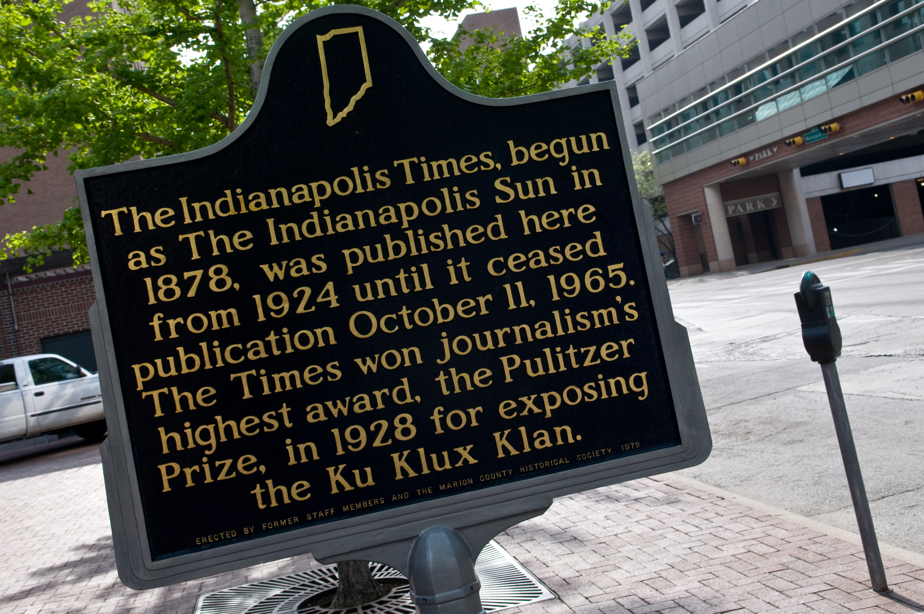
The ''Indianapolis Times'' was an evening newspaper that served the city of Indianapolis, Indiana, from 1888 to 1965 when the paper ceased publishing. History The ''Indianapolis Times'' began as the ''Sun'' in 1888, "the only one cent paper in Indiana" at the time. J. J. Sweeney owned the majority of the company and Fred L. Purdy owned a minority share and filled the role of editor. From 1888 to 1899, the ''Sun's'' circulation grew to almost 13,000. The daily paper was renamed the ''Indianapolis Sun'' in 1899. Indiana newspaper businessman Rudolph G. Leeds bought the ''Indianapolis Sun'' in 1910 before selling it to George H. Larke and William D. Boyce in 1913. Under the name ''Evening Sun'' from 1913 to 1914, the circulation of the paper spiked to over 34,000. Boyce and the new co-owner, John W. Banbury, renamed the paper the ''Indiana Daily Times'' in 1914, and it reached a circulation of over 46,000 the following year. It was not until 1922 that the paper became the ''Ind ... [...More Info...] [...Related Items...] OR: [Wikipedia] [Google] [Baidu] |
United States Department Of Housing And Urban Development
The United States Department of Housing and Urban Development (HUD) is one of the executive departments of the U.S. federal government. It administers federal housing and urban development laws. It is headed by the Secretary of Housing and Urban Development, who reports directly to the President of the United States and is a member of the president's Cabinet. Although its beginnings were in the House and Home Financing Agency, it was founded as a Cabinet department in 1965, as part of the "Great Society" program of President Lyndon B. Johnson, to develop and execute policies on housing and metropolises. History The idea of a department of Urban Affairs was proposed in a 1957 report to President Dwight D. Eisenhower, led by New York Governor Nelson A. Rockefeller. The idea of a department of Housing and Urban Affairs was taken up by President John F. Kennedy, with Pennsylvania Senator and Kennedy ally Joseph S. Clark Jr. listing it as one of the top seven legislative prioritie ... [...More Info...] [...Related Items...] OR: [Wikipedia] [Google] [Baidu] |
List Of Parks In Indianapolis
This list of parks in Indianapolis provides a general overview of parkland in Indianapolis, Indiana, United States. Parks in the city are managed primarily by the City of Indianapolis Department of Parks and Recreation, also known as Indy Parks. In 2020, there were 212 city parks, four state-owned parks, and numerous privately-managed parks. Municipal parks Other facilities Indy Parks operates several standalone recreational facilities, including Kuntz Memorial Soccer Stadium and the Major Taylor Velodrome. Private parks Not managed by any municipality, each of these parks is run by its own independent volunteer board of directors, and operates with fundraising and volunteer support. State parks Former parks See also *List of attractions and events in Indianapolis Notes References External links Indy Parks and Recreation website {{Indianapolis Parks Indianapolis Indianapolis (), colloquially known as Indy, is the state capital and most populous city o ... [...More Info...] [...Related Items...] OR: [Wikipedia] [Google] [Baidu] |


