|
Lee–Miles
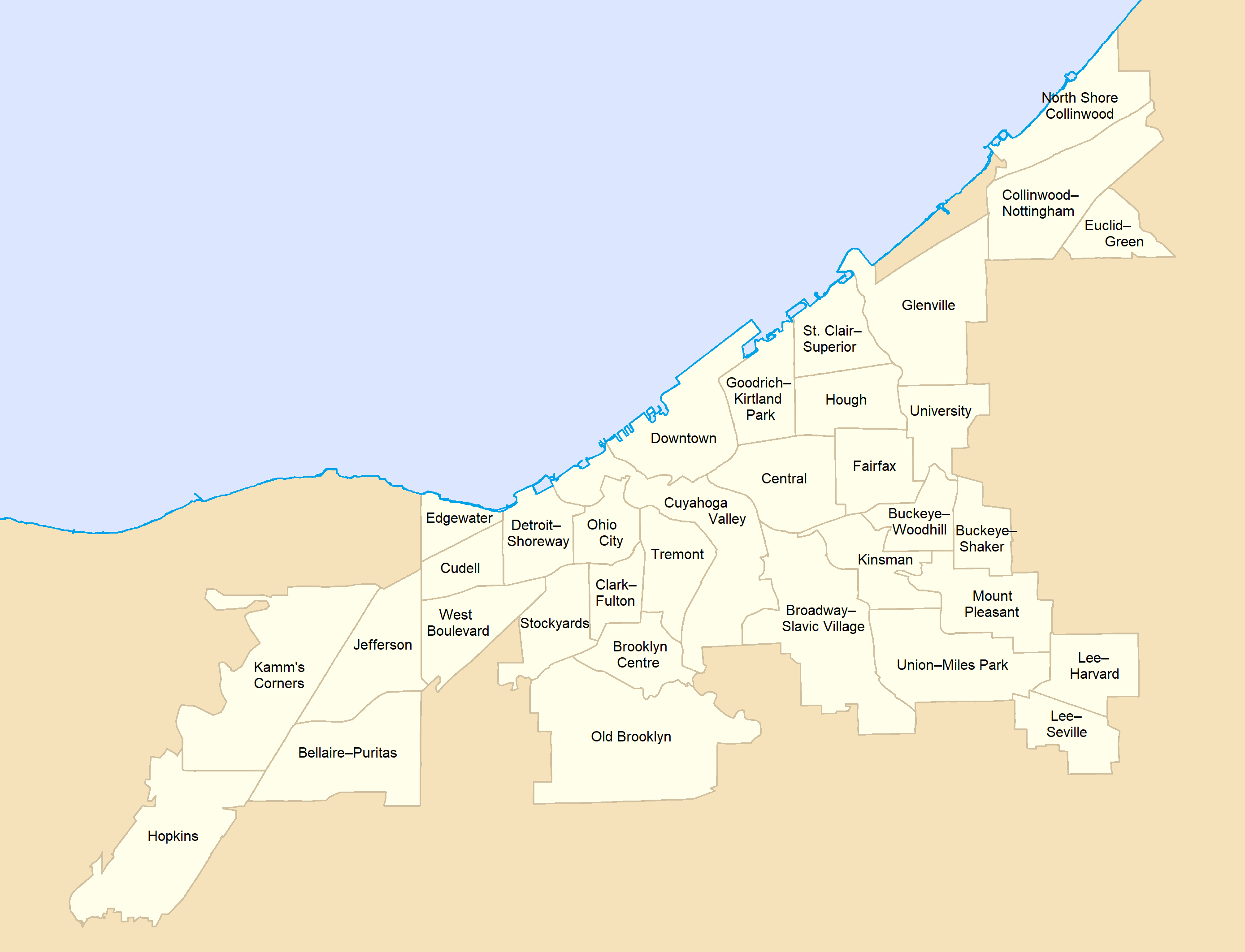
Lee–Miles is a historical area on the Southeast side of Cleveland, Ohio, comprising the two neighborhoods of Lee–Harvard and Lee–Seville. Once an independent municipality known as Miles Heights, it was annexed by Cleveland after a referendum in 1932. Today, it most corresponds to Cleveland's Ward 1. A mostly middle-class African American neighborhood, Lee–Miles is bordered by the suburban cities of Shaker Heights to the north, Warrensville Heights to the east, Maple Heights to the south, Garfield Heights to the southwest and Cleveland's Union–Miles Park neighborhood to the northwest. Parks and recreations *Kerruish Park (located along the Mill Creek) *Frederick Douglass Park *Lee–Harvard Community Service Center *John F. Kennedy Recreational Center Education *John F. Kennedy high school * Whitney M. Young *Charles W. Eliot School * Citizens Academy SouthwestInvictus High school *Archbishop Lyke Campus * Harvard Avenue Community School * Ceogc Preschool * Adlai ... [...More Info...] [...Related Items...] OR: [Wikipedia] [Google] [Baidu] |
Neighborhoods In Cleveland
Neighborhoods in Cleveland refer to the 34 neighborhood communities of the city of Cleveland, Ohio, as defined by the Cleveland City Planning Commission. Based on historical definitions and census data, the neighborhoods serve as the basis for various urban planning initiatives on both the municipal and metropolitan levels. Technically known as Statistical Planning Areas (SPAs), they also provide a "framework for summarizing socio-economic and other statistics within the city." City neighborhood boundaries were last revised by the City Planning Commission in 2012. Cleveland's neighborhoods are generally defined by their position on either the East Side or West Side of the Cuyahoga River. Downtown and Cuyahoga Valley are situated between the East and West Sides, while the Broadway–Slavic Village neighborhood is sometimes referred to as the South Side. Neighborhoods Notes References External links Cleveland Neighborhoods Destination ClevelandNeighborhoods and Landmark ... [...More Info...] [...Related Items...] OR: [Wikipedia] [Google] [Baidu] |
Union–Miles Park
Union–Miles Park is a neighborhood on the Southeast side of Cleveland, Ohio, in the United States. The neighborhood draws its name from Union Avenue (which bifurcates the northern part of the neighborhood), and Miles Park in its far southwest corner (originally the town square of Newburgh Village). Union–Miles Park was originally part of Newburgh Township, which was organized in 1814. Settled by whites as an area of farms and orchards, Union–Miles Park became one of two centers in the Cleveland steelmaking industry beginning in 1856. The steel mills drew Irish, Scottish, and Welsh immigrants to the area, with the intersection of E. 93rd Street and Union Avenue becoming known as "Irishtown". After an 1882 strike at the steel mill was broken using Polish and Slovak strikebreakers, the large Irish and Welsh communities were displaced by these two new immigrant groups. Railroads cut through many areas of Union–Miles Park, defining the area. The steel industry in Union–Miles ... [...More Info...] [...Related Items...] OR: [Wikipedia] [Google] [Baidu] |
Mount Pleasant, Cleveland
Mount Pleasant is a Neighborhoods in Cleveland, neighborhood on the East Side of Cleveland, Ohio. It borders the neighborhoods of Buckeye–Shaker and Buckeye–Woodhill to the north, Kinsman, Cleveland, Kinsman to the west, Union–Miles Park to the south, and the suburb of Shaker Heights, Ohio, Shaker Heights and the Lee–Harvard neighborhood of Cleveland's Lee–Miles area to the east. The neighborhood has been home to numerous ethnic groups, first Manx people, Manx Immigration to the United States, immigrants, then German Americans, Germans, Czech Americans, Czechs, Russian Americans, Russians, Jewish Americans, Jews, and Italian Americans, Italians. Today, it is a predominantly African Americans, African American neighborhood. Together with Buckeye–Shaker, it is politically part of Cleveland's Cleveland City Council, Ward 4. References Neighborhoods in Cleveland {{CuyahogaCountyOH-geo-stub ... [...More Info...] [...Related Items...] OR: [Wikipedia] [Google] [Baidu] |
Cleveland
Cleveland ( ), officially the City of Cleveland, is a city in the U.S. state of Ohio and the county seat of Cuyahoga County. Located in the northeastern part of the state, it is situated along the southern shore of Lake Erie, across the U.S. maritime border with Canada, northeast of Cincinnati, northeast of Columbus, and approximately west of Pennsylvania. The largest city on Lake Erie and one of the major cities of the Great Lakes region, Cleveland ranks as the 54th-largest city in the U.S. with a 2020 population of 372,624. The city anchors both the Greater Cleveland metropolitan statistical area (MSA) and the larger Cleveland–Akron–Canton combined statistical area (CSA). The CSA is the most populous in Ohio and the 17th largest in the country, with a population of 3.63 million in 2020, while the MSA ranks as 34th largest at 2.09 million. Cleveland was founded in 1796 near the mouth of the Cuyahoga River by General Moses Cleaveland, after whom the city was named ... [...More Info...] [...Related Items...] OR: [Wikipedia] [Google] [Baidu] |
Cleveland City Council
Cleveland City Council is the legislative branch of government for the City of Cleveland, Ohio. Its chambers are located at Cleveland City Hall at 601 Lakeside Avenue, across the street from Public Auditorium in Downtown Cleveland. Cleveland City Council members are elected from 17 wards to four-year terms. In Cleveland's mayor–council (strong mayor) form of government, council acts as a check against the power of the city executive, the mayor. Its responsibilities include "monitoring city departments, approving budgets, and enacting legislation to improve the quality of life or the citizens of the city" The current President of Council is Blaine Griffin. The council Majority Leader is Kerry McCormack, and the Majority Whip is Jasmin Santana. Patricia Britt serves as the Clerk of Council. History The structure and membership of City Council have fluctuated throughout Cleveland's history. Established in 1802, it initially included three trustees, and when Cleveland was inco ... [...More Info...] [...Related Items...] OR: [Wikipedia] [Google] [Baidu] |
Shaker Heights, Ohio
Shaker Heights is a city in Cuyahoga County, Ohio, United States. As of the 2020 Census, the city population was 29,439. Shaker Heights is an inner-ring streetcar suburb of Cleveland, abutting the eastern edge of the city's limits. In July 1911, a petition by property owners was successful in detaching a long strip of land from the south of Cleveland Heights, to be named Shaker Village. In November 1911, the voters of Shaker Village formed Shaker Heights Village, which was incorporated in January 1912. It is the birthplace of the actor Paul Newman. Shaker Heights was a planned community developed by the Van Sweringen brothers, railroad moguls who envisioned the community as a suburban retreat from the industrial inner city of Cleveland. Geography Topography Shaker Heights is located at . According to the United States Census Bureau, the city has a total area of , of which is land and is water. Shaker Heights is roughly 1,050 feet (320 m) above sea level, and is located ab ... [...More Info...] [...Related Items...] OR: [Wikipedia] [Google] [Baidu] |
Case Western Reserve University
Case Western Reserve University (CWRU) is a private research university in Cleveland, Ohio. Case Western Reserve was established in 1967, when Western Reserve University, founded in 1826 and named for its location in the Connecticut Western Reserve, and Case Institute of Technology, founded in 1880 through the endowment of Leonard Case Jr., formally federated. Case Western Reserve University is a member of the Association of American Universities and is classified among "R1: Doctoral Universities – Very high research activity". According to the National Science Foundation, in 2019 the university had research and development (R&D) expenditures of $439 million, ranking it 20th among private institutions and 58th in the nation. The university has eight schools that offer more than 100 undergraduate programs and about 160 graduate and professional options. Seventeen Nobel laureates have been affiliated with Case Western Reserve's faculty and alumni or one of its two predecessors ... [...More Info...] [...Related Items...] OR: [Wikipedia] [Google] [Baidu] |
Cleveland Public Library
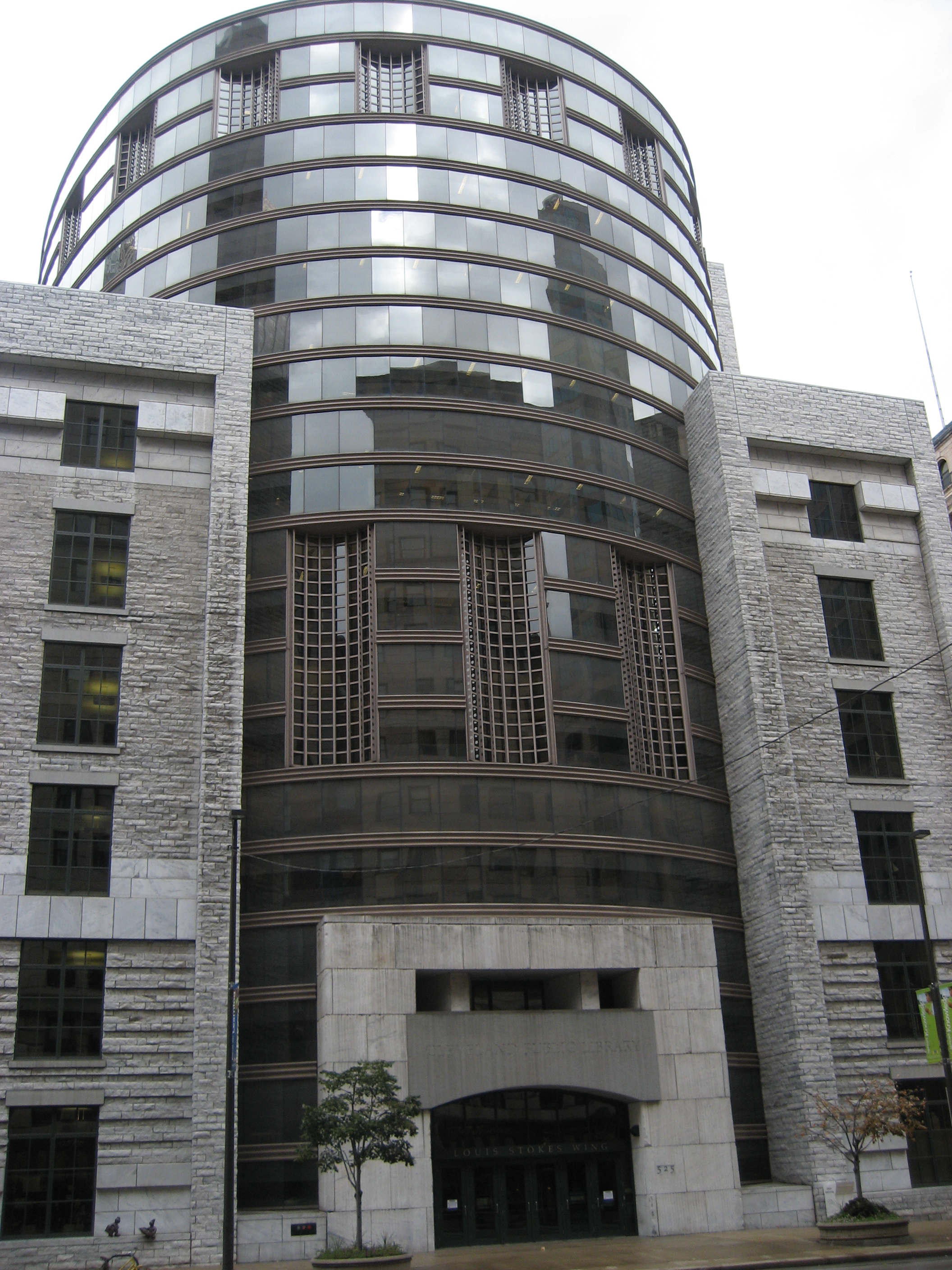
Cleveland Public Library, located in Cleveland, Ohio, operates the Main Library on Superior Avenue in downtown Cleveland, 27 branches throughout the city, a mobile library, a Public Administration Library in City Hall, and the Ohio Library for the Blind and Physically Disabled. The library replaced the State Library of Ohio as the location for the Ohio Center for the Book in 2003. History Founding In 1811, the idea behind the Cleveland Public Library came "out of small beginnings" when sixteen of Cleveland's sixty-four residents subscribed to its first library, established to distribute the rare printed book. The members read books such as the history of Rome, ''Lives of the English Poets'', Goldsmith's ''Greece'', and ''Don Quixote''. In 1867, thCleveland an [...More Info...] [...Related Items...] OR: [Wikipedia] [Google] [Baidu] |
MetroHealth
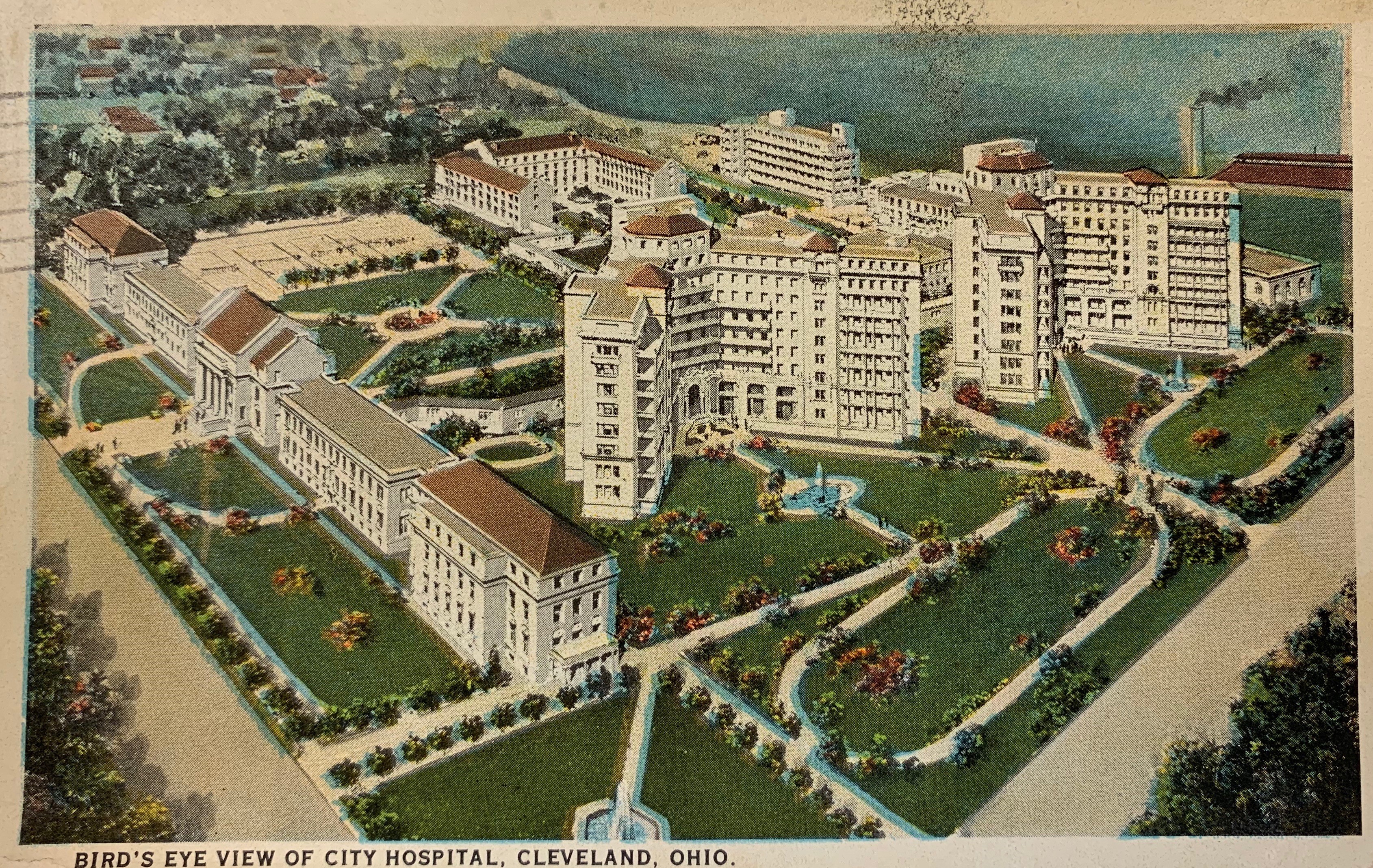
The MetroHealth System is a nationally ranked non-profit, public health care system located in Cleveland, Ohio. Founded in 1837 as City Hospital, The MetroHealth System serves the residents of the city of Cleveland and Cuyahoga County. It is one of the three major health care systems in Cleveland, Ohio, along with Cleveland Clinic and University Hospitals of Cleveland. The system provides care at four hospitals, more than 20 health centers and 40 additional sites throughout Cuyahoga County. As of December 2018, it had more than 7,700 employees. The system is the 10th largest employer in Northeast Ohio. MetroHealth is a Level I Adult Trauma Center and Level II Pediatric Trauma Center. It offers the only adult and pediatric burn center in the state of Ohio. In 1982, MetroHealth established itMetro Life Flightair ambulance service. Metro Life Flight has completed more than 90,000 medical missions, all safely. This air ambulance service is internationally known and has trained crews ... [...More Info...] [...Related Items...] OR: [Wikipedia] [Google] [Baidu] |
Cuyahoga County, Ohio
Cuyahoga County ( or ) is a large urban county located in the northeastern part of the U.S. state of Ohio. It is situated on the southern shore of Lake Erie, across the Canada–United States border, U.S.-Canada maritime border. As of the 2020 United States census, 2020 census, its population was 1,264,817, making it the List of counties in Ohio, second-most-populous county in the state. The county seat and largest city is Cleveland. The county is bisected by the Cuyahoga River, after which it was List of Ohio county name etymologies, named. "Cuyahoga" is an Iroquoian languages, Iroquoian word meaning "crooked river". Cuyahoga County is the core of the Greater Cleveland, Greater Cleveland Metropolitan Area and of the Northeast_Ohio#Combined_Statistical_Area, Cleveland–Akron–Canton combined statistical area. History The land that became Cuyahoga County was previously part of the French colony of New France, Canada (New France), which was ceded in 1763 to Kingdom of Great Br ... [...More Info...] [...Related Items...] OR: [Wikipedia] [Google] [Baidu] |
Garfield Heights, Ohio
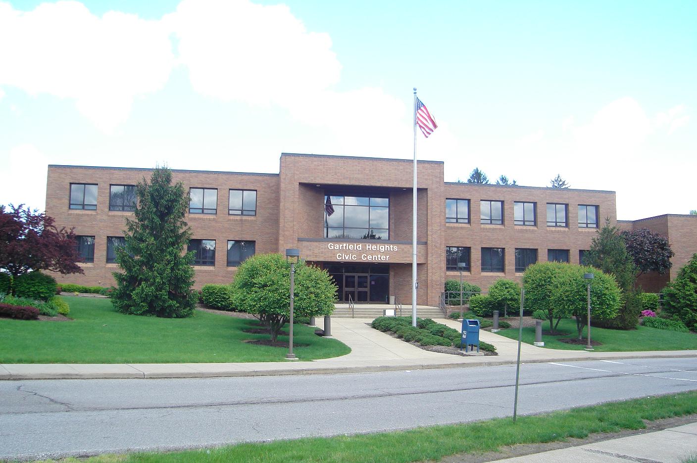
Garfield Heights is a city in Cuyahoga County, Ohio, Cuyahoga County, Ohio, United States. It is a suburb of Cleveland. The population was 28,849 at the time of the United States Census 2010, 2010 census. Geography Garfield Heights is located at (41.421423, -81.602682). According to the United States Census Bureau, the city has a total area of , of which is land and is water. The elevation of Garfield Heights is above sea level where it borders Cleveland, and its highest elevation is above sea level at the Garfield Heights Justice Center. History The area was originally part of Defunct townships of Cuyahoga County, Ohio#Newburgh_Township, Newburgh Township. The Village of South Newburgh was formed in 1907, and it was incorporated as Garfield Heights in 1930. The city is named after Garfield Park, which in turn was named in honor of President James A. Garfield. Economy Marymount Hospital, part of the Cleveland Clinic system, is the city's largest employer. The Ohio Departm ... [...More Info...] [...Related Items...] OR: [Wikipedia] [Google] [Baidu] |
Maple Heights, Ohio
Maple Heights is a city in Cuyahoga County, Ohio, United States. It is a suburb of Cleveland. The population was 23,138 at the 2010 census. History Maple Heights Transit In 1935, the City created Maple Heights Transit to provide connections to Downtown Cleveland, crosstown service, and service for schools. Southgate USA Built as one of the first large shopping centers, Southgate USA was dedicated in 1955, boasting over 80 retail stores, including JCPenney, Sears, and May Company. In 2002, the GCRTA dedicated its Southgate Transit Center, serving as a connection between multiple bus lines between Downtown Cleveland, Bedford, Shaker Heights, East Cleveland, and the Summit County Line. Late 20th and Early 21st Centuries (1970-Present) With deficit fund balances of over $2.8 million and defaults on 3 loan payments, Ohio Auditor of State Dave Yost declared the City to be in fiscal emergency in February 2015. Since February 2015, the City improved its finances and budgeting si ... [...More Info...] [...Related Items...] OR: [Wikipedia] [Google] [Baidu] |


