|
Leenaun
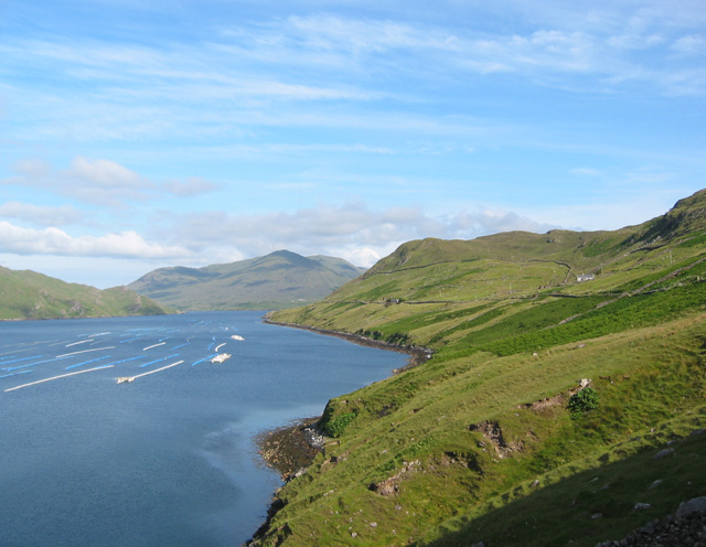
Leenaun (), also Leenane, is a village and 1,845 acre townland in County Galway, Ireland, on the southern shore of Killary Harbour and the northern edge of Connemara. Location Leenaun is situated on the junction of the N59 road (Ireland), N59 road, and the R336 road (Ireland), R336 road in Connemara. Leenaun lies where the deep u-shaped Maam Valley, bounded by the Devilsmother to the east, and the massif of Leenaun Hill to the west, meets Killary Harbour, Ireland's deepest fjord. Across the fjord from the village, is the massif of Ben Gorm, with the larger massif of Mweelrea behind it; while to the east, lie the scenic Aasleagh falls. The village is on the route of the Western Way long-distance trail and the Wild Atlantic Way. Bridge loss and replacement On 18 July 2007, following heavy rain, the only river bridge in the village was swept away, cutting the town in half, and altering some local routes by over 100-kilometres.; the bridge had stood for over 182 years. A permanent ... [...More Info...] [...Related Items...] OR: [Wikipedia] [Google] [Baidu] |
Leenaun Hill
Leenaun Hill () at , is the 201st–highest peak in Ireland on the Lists of mountains in Ireland#Arderins, Arderin scale, and the 243rd–highest peak on the Lists of mountains in Ireland#Vandeleur-Lynams, Vandeleur-Lynam scale.Mountainviews, (September 2013), "A Guide to Ireland's Mountain Summits: The Vandeleur-Lynams & the Arderins", Collins Books, Cork, Leenaun Hill lies on a massif that overlooks Leenaun village and Killary Harbour, and which is at the far northeastern sector of the Maumturks mountain range in the Connemara National Park in County Galway, Galway, Ireland; this massif is connected to the main range via the "Col of Despondency". Leenaun Hill is the 6th-highest mountain in the Maumturks, and its grassy massif, constructed from sandstone and siltstone, contrasts with the rocky ridges and summits constructed from quartzites, grits, and graphitic, of the middle and southern sectors of the range. Naming Irish academic Paul Tempan records that Leenaun hill has also ... [...More Info...] [...Related Items...] OR: [Wikipedia] [Google] [Baidu] |
R336 Road (Ireland)
__NOTOC__ The R336 road is a regional road in County Galway in Ireland which connects the N59 road at Leenaun beside Killary Harbour – via Inverin – to the N6 and N83 in Galway, to the southeastmap. ''Irish Statute Book'' (irishstatutebook.ie), 2012-02-28. On leaving the fjord in Killary Harbour at Leenaun, the road travels south between the Maumturk and mountain ranges in Joyce Country and passes through the Irish speaking [...More Info...] [...Related Items...] OR: [Wikipedia] [Google] [Baidu] |
N59 Road (Ireland)
The N59 road is a national secondary road in Ireland. It commences in County Sligo, south of Sligo Town at the Belladrehid interchange with the N4 north of Ballysadare. The route circles around the west of Ireland, passing west from Sligo into County Mayo and through Ballina. The N59 continues around Mayo, proceeding indirectly to Westport. Continuing south through Mayo into County Galway, the road passes through the village of Leenaun. The 182-year-old bridge in the centre of the village, carrying the road across the River Lahill, collapsed in floods on 18 July 2007. Due to the local terrain and road network, the diversionary route for getting from the south of the village to Westport was 110 km long. A temporary bridge was opened eight days after the floods, on 27 July. It has since been replaced by a new bridge. South of Leenaun, the N59 proceeds southwest through Connemara to Clifden. From there, it returns east through Maam Cross and to Oughterard, from wh ... [...More Info...] [...Related Items...] OR: [Wikipedia] [Google] [Baidu] |
Killary Harbour
Killary Harbour or Killary Fjord () is a fjord or fjard on the west coast of Ireland, in northern Connemara. To its north is County Mayo and the mountains of Mweelrea and Ben Gorm; to its south is County Galway and the Maumturk Mountains. Structure The flooded valley is long, and in the centre over deep; the sea level is higher outside its mouth, as is normal for a fjord.Collins Press, Cork, Ireland - Ireland's Coastline: Exploring its Nature and Heritage - Nairn, Richard, 2007: "the long, narrow fjord of Killary Harbour, which forms the boundary between the counties of Mayo and Galway. ... only a few hundred metres wide. A glacier must have scoured the bottom as it moved towards the sea, taking large volumes of rock and gravel with it. Just outside the entrance, the depth reduces dramatically and there are a number of rocky islands giving a profile that is typical of the fjords of Scandinavia." For nearly half its length, it runs south east from the Atlantic, and then it cro ... [...More Info...] [...Related Items...] OR: [Wikipedia] [Google] [Baidu] |
Maam Valley
Gleann an Mháma (English: Maam Valley) is a glacial valley in County Galway, Ireland. It lies within Joyce Country in Connemara and is part of an aspirant geopark. Much of the valley is in the Connemara Gaeltacht. Location and topography The valley runs north-northwest from An Mám (also known, unofficially, in English, as Maum or Maam) and the north-western end of Lough Corrib to just south of Leenaun (also known in English as Leenane) on Killary Harbour. Starting near its northern end, the valley holds the main course of the Joyce River, coming down from the western flanks to pick up small tributaries. In turn this river is subsumed into the Bealnabrack River, also coming from the valley's western side, near An Mám, and then the combined river absorbs the Failmore River and some small streams before merging into Lough Corrib. The valley passes through part of the Maamturk or Maum Turk Mountains. There is a pass, the Mamean or Mameen Pass, crossing part of the mountai ... [...More Info...] [...Related Items...] OR: [Wikipedia] [Google] [Baidu] |
Western Way
The Western Way () is a long-distance trail in Ireland. It is long and begins in Oughterard, County Galway and ends in Ballycastle, County Mayo. It is typically completed in seven days. It is designated as a National Waymarked Trail by the National Trails Office of the Irish Sports Council and is managed by Coillte, Galway County Council, Mayo County Council, South Mayo Development Company and Mayo North & East Development Company. Route Galway section Starting from Oughterard, the trail follows the western edge of Lough Corrib before breaking away across the Maumturks chain at the pass of Maumeen. It descends to the Inagh Valley along the base of the "Turks", following them around to Leenaun at the head of Killary Harbour fjord. The Galway section ends here and the Mayo section begins. Mayo section From Leenaun, the Mayo section of the trail climbs over Sheefry Bridge, then down into Westport, then on through Newport, Sheskin, Ballycastle, Killala, Ballina, ending a ... [...More Info...] [...Related Items...] OR: [Wikipedia] [Google] [Baidu] |
Connemara
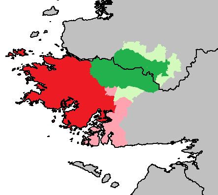
Connemara (; )( ga, Conamara ) is a region on the Atlantic coast of western County Galway, in the west of Ireland. The area has a strong association with traditional Irish culture and contains much of the Connacht Irish-speaking Gaeltacht, which is a key part of the identity of the region and is the largest Gaeltacht in the country. Historically, Connemara was part of the territory of Iar Connacht (West Connacht). Geographically, it has many mountains (notably the Twelve Bens), peninsulas, coves, islands and small lakes. Connemara National Park is in the northwest. It is mostly rural and its largest settlement is Clifden. Etymology "Connemara" derives from the tribal name , which designated a branch of the , an early tribal grouping that had a number of branches located in different parts of . Since this particular branch of the lived by the sea, they became known as the (sea in Irish is , genitive , hence "of the sea"). Definition One common definition of the area is that ... [...More Info...] [...Related Items...] OR: [Wikipedia] [Google] [Baidu] |
Mweelrea
Mweelrea (; ) at , is the 26th-highest peak in Ireland on the Arderin scale, and the 34th-highest peak on the Vandeleur-Lynam scale.Mountainviews, (September 2013), "A Guide to Ireland's Mountain Summits: The Vandeleur-Lynams & the Arderins", Collins Books, Cork, Mweelrea is situated near the apex of a "horseshoe-shaped" massif that includes the peaks of Ben Lugmore and Ben Bury, and which is located between Killary Harbour and Doo Lough, in Mayo, Ireland. Mweelrea is the provincial top for Connacht, and is noted for its southeastern cliff lined corries, and its views. The massif is called the Mweelrea Mountains or the Mweelrea Range. Naming Mweelrea is an anglicisation of the , which translates as "bald hill with the smooth top", which describes the profile of the mountain. Geology The geology of what is known as the '' Mweelrea Formation'' is very different from that of the Twelve Bens, on the other side of Killary Harbour. At a summary level, the ''Mweelrea Formatio ... [...More Info...] [...Related Items...] OR: [Wikipedia] [Google] [Baidu] |
Provinces Of Ireland
There have been four Provinces of Ireland: Connacht (Connaught), Leinster, Munster, and Ulster. The Irish language, Irish word for this territorial division, , meaning "fifth part", suggests that there were once five, and at times Kingdom_of_Meath, Meath has been considered to be the fifth province; in the medieval period, however, there were often more than five. The number of provinces and their delimitation fluctuated until 1610, when they were permanently set by the English administration of James VI and I, James I. The provinces of Ireland no longer serve administrative or political purposes but function as historical and cultural entities. Etymology In modern Irish language, Irish the word for province is (pl. ). The modern Irish term derives from the Old Irish (pl. ) which literally meant "a fifth". This term appears in 8th-century law texts such as and in the legendary tales of the Ulster Cycle where it refers to the five kingdoms of the "Pentarchy". MacNeill enumer ... [...More Info...] [...Related Items...] OR: [Wikipedia] [Google] [Baidu] |
Wild Atlantic Way
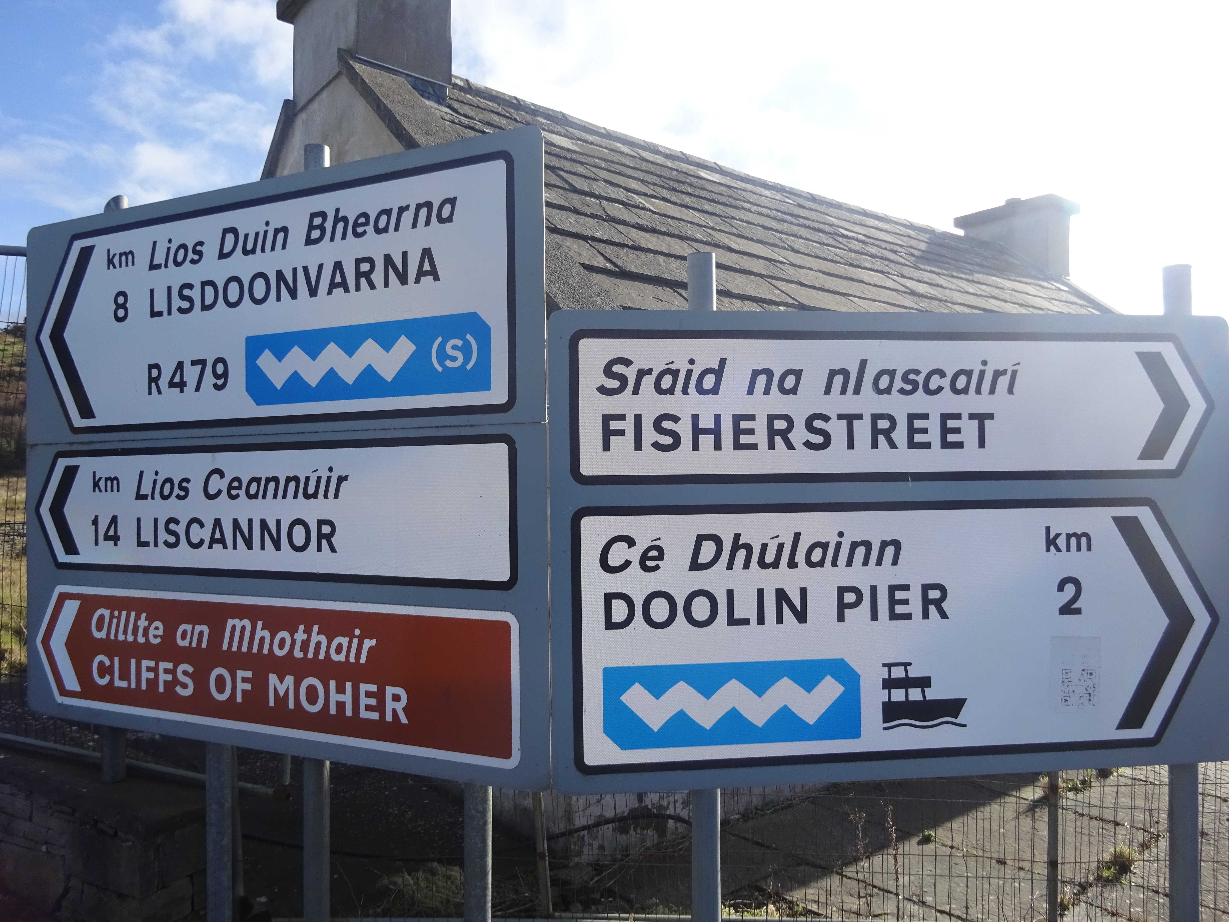
The Wild Atlantic Way ( ga, Slí an Atlantaigh Fhiáin) is a tourism trail on the west coast, and on parts of the north and south coasts, of Ireland. The 2,500 km (1,553 mile) driving route passes through nine counties and three provinces, stretching from County Donegal's Inishowen Peninsula in Ulster to Kinsale, County Cork, in Munster, on the Celtic Sea coast. Description The route is broken down into five sections: * County Donegal * County Donegal to County Mayo * County Mayo to County Clare * County Clare to County Kerry * County Kerry to County Cork Along the route, there are 157 discovery points, 1,000 attractions and more than 2,500 activities. The route was officially launched in 2014 by the Minister of State for Tourism and Sport, Michael Ring, T.D. Key points of interest North West - Donegal, Leitrim and Sligo * Malin Head, Ireland’s most northerly point * Lough Foyle * Lough Swilly * Isle of Doagh * Carrickabraghy Castle * Shrove * Fort ... [...More Info...] [...Related Items...] OR: [Wikipedia] [Google] [Baidu] |
RTÉ Archives
(RTÉ) (; Irish for "Radio & Television of Ireland") is the national broadcaster of Ireland headquartered in Dublin. It both produces and broadcasts programmes on television, radio and online. The radio service began on 1 January 1926, while regular television broadcasts began on 31 December 1961, making it one of the oldest continuously operating public service broadcasters in the world. RTÉ also publishes a weekly listings and lifestyle magazine, the '' RTÉ Guide''. RTÉ is a statutory body, overseen by a board appointed by the Government of Ireland, with general management in the hands of the Executive Board, headed by the Director-General. RTÉ is regulated by the Broadcasting Authority of Ireland. RTÉ is financed by television licence fee and through advertising, with some of its services funded solely by advertising, while others are funded solely by the licence fee. Radio Éireann, RTÉ's predecessor and at the time a section of the Department of Posts ... [...More Info...] [...Related Items...] OR: [Wikipedia] [Google] [Baidu] |


