 |
Law On Abolishment Of Nagorno-Karabakh Autonomous Oblast
The Law on Abolishment of Nagorno-Karabakh Autonomous Oblast (Resolution No. 279-XII) was a motion passed by the Supreme Soviet of the Republic of Azerbaijan and signed into law by the President of Azerbaijan Ayaz Mutalibov on November 26, 1991. The law had been prompted by a vote in the National Assembly of the Nagorno-Karabakh Autonomous Oblast in favor of uniting itself with the Armenian SSR on 20 February 1988. The vote was followed by an independence referendum in 1991 which was boycotted by the Azerbaijani population of the Oblast; most voted in favor of independence. While these votes and elections had mainly been conducted in a relatively peaceful manner, in the following months, as the Soviet Union disintegrated, it gradually grew into an increasingly violent conflict between ethnic Armenians and ethnic Azerbaijanis. Both sides claimed that ethnic cleansing was being carried out. The declaration of secession from Azerbaijan was the final result of a territorial confli ... [...More Info...] [...Related Items...] OR: [Wikipedia] [Google] [Baidu] |
 |
Nagorno Karabakh03
Nagorno-Karabakh ( ) is a landlocked region in the South Caucasus, within the mountainous range of Karabakh, lying between Lower Karabakh and Syunik, and covering the southeastern range of the Lesser Caucasus mountains. The region is mostly mountainous and forested. Nagorno-Karabakh is a disputed territory, internationally recognized as part of Azerbaijan, but most of it is governed by the unrecognised Republic of Artsakh (also known as the Nagorno-Karabakh Republic (NKR)) since the first Nagorno-Karabakh War. Since the end of the war in 1994, representatives of the governments of Armenia and Azerbaijan have been holding peace talks mediated by the OSCE Minsk Group on the region's disputed status. The region is usually equated with the administrative borders of the former Nagorno-Karabakh Autonomous Oblast, comprising . The historical area of the region, however, encompasses approximately . On 27 September 2020, a new war erupted in Nagorno-Karabakh and the surroundin ... [...More Info...] [...Related Items...] OR: [Wikipedia] [Google] [Baidu] |
|
Javanshir Uyezd
The Jevanshir uezd was a county (''uezd'') of the Elizavetpol Governorate of the Russian Empire, with its center in Terter (present-day Tartar). Geography The Jevanshir uezd was made up of two parts, the northeastern lowland and the southwestern mountainous part of Jraberd. The area covered 4,818.4 square verst. The lower part, called Arran was hot and dry during summers which made the inhabitants move to mountainous areas for the duration of season. The winters were mild and short. The middle part of the uezd is located on the hills and is enriched with forests. The southern part is located high in the mountains. The highest peaks in mountainous ranges stretching from Gokcha are Murovdag (11,219 ft), Gozeldere-bashi (11,606 ft) and Ginal-dag (11,057 ft). A big part of Jevanshir uezd is within the Tartarchay basin, which starts high in the mountains near the border with the Nor Bayazet and Zangezur ''uezds'' and flows through uezd discharging into Kura. The imp ... [...More Info...] [...Related Items...] OR: [Wikipedia] [Google] [Baidu] |
|
|
Tartar Rayon
Tartar District ( az, Tərtər rayonu) is one of the 66 districts of Azerbaijan. It is located in the west of the country and belongs to the Karabakh Economic Region. The district borders the districts of Kalbajar, Goranboy, Yevlakh, Barda, and Agdam. Its capital and largest city is Tartar. As of 2020, the district had a nominal population of 104,700. History The district was expanded to include the eastern part of the Mardakert District of Nagorno-Karabakh Autonomous Oblast The Nagorno-Karabakh Autonomous Oblast (NKAO), DQMV, hy, Լեռնային Ղարաբաղի Ինքնավար Մարզ, ԼՂԻՄ was an autonomous oblast within the Azerbaijan Soviet Socialist Republic that was created on July 7, 1923. Its cap ... following its abolishment, however only a small part of it remained under the control of Azerbaijan following the First Nagorno-Karabakh war. Azerbaijan recaptured Talish and Madagiz villages of Tartar during the 2020 Nagorno-Karabakh war and the rest ... [...More Info...] [...Related Items...] OR: [Wikipedia] [Google] [Baidu] |
|
|
Mardakert District (NKAO)
Mardakert District ( az, Mardakert rayonu, Мардакерт рајону; hy, Մարդակերտի շրջան) was an administrative unit within the former Nagorno-Karabakh Autonomous Oblast (NKAO) of the Azerbaijan Soviet Socialist Republic. History The district was formed on 8 August 1930, as the ''Jrabert district''. It was renamed to Mardakert district on 17 September 1939. The administrative centre of the district was Mardakert. 3 urban-type settlements existed in the region: Madagiz (gained urban status in 1943), Mardakert (since 1960), Leninavan (since 1966). The district was the largest one in NKAO in terms of area and population. The Nagorno-Karabakh Autonomous Oblast was abolished on 26 November 1991 and the district was renamed Aghdara ( az, Ağdərə). On 13 October 1992, the Aghdara district was also abolished and split between the three neighbouring districts, with the western part being incorporated into Kalbajar District, the northeastern part into the Ta ... [...More Info...] [...Related Items...] OR: [Wikipedia] [Google] [Baidu] |
|
 |
Aghdara (town)
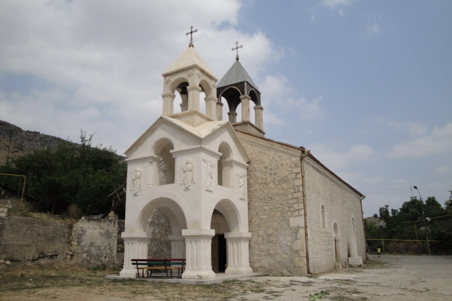
Martakert ( hy, Մարտակերտ, also , ) or Aghdara ( az, Ağdərə ) is a town ''de facto'' in the breakaway Republic of Artsakh as the administrative capital of its Martakert Province, ''de jure'' in the Tartar District of Azerbaijan, in the disputed region of Nagorno-Karabakh. The town has an ethnic Armenian-majority population, and also had an Armenian majority in 1989. The town underwent heavy destruction by Azerbaijani forces while under their control during the First Nagorno-Karabakh War. Etymology Traditionally the name of the town is interpreted as consisting of the elements ''mard'' ("man, person," or in this context "brave") and ''kert'' ("built by"), supposedly referring to the inhabitants' reputation for bravery.'''' Other explanations link the name with the word ''matuṛ'' ("chapel").'''' The Azerbaijani name for the settlement, Aghdara, translates to "white valley." History The site of the settlement was historically a part of the Melikdom of Jraberd, ... [...More Info...] [...Related Items...] OR: [Wikipedia] [Google] [Baidu] |
 |
Khankendi
/ az, Xankəndi, italic=no , settlement_type = City , image_skyline = File:StepanakertCollage.jpg , imagesize = 300px , image_caption = From top left: Holy Mother of God Cathedral Renaissance Square • Downtown Stepanakert Stepanakert Airport • Stepanakert skyline Park Hotel Artsakh • '' We Are Our Mountains'' Artsakh University • Stepanakert Memorial , image_flag = Flag of Stepanakert, Artsakh.svg , shield_size = 75px , map_caption = Location of Stepanakert in Artsakh and in Azerbaijan. , pushpin_map = Republic of Artsakh#Azerbaijan , subdivision_type = Country , subdivision_name = Artsakh , subdivision_type1 = Province , subdivision_name1 = Stepanakert , subdivision_type2 = Country , subdivision_nam ... [...More Info...] [...Related Items...] OR: [Wikipedia] [Google] [Baidu] |
 |
Stepanakert
/ az, Xankəndi, italic=no , settlement_type = City , image_skyline = File:StepanakertCollage.jpg , imagesize = 300px , image_caption = From top left: Holy Mother of God Cathedral Renaissance Square • Downtown Stepanakert Stepanakert Airport • Stepanakert skyline Park Hotel Artsakh • '' We Are Our Mountains'' Artsakh University • Stepanakert Memorial , image_flag = Flag of Stepanakert, Artsakh.svg , shield_size = 75px , map_caption = Location of Stepanakert in Artsakh and in Azerbaijan. , pushpin_map = Republic of Artsakh#Azerbaijan , subdivision_type = Country , subdivision_name = Artsakh , subdivision_type1 = Province , subdivision_name1 = Stepanakert , subdivision_type2 = Country , subdivision_name ... [...More Info...] [...Related Items...] OR: [Wikipedia] [Google] [Baidu] |
 |
Azerbaijani Language
Azerbaijani () or Azeri (), also referred to as Azeri Turkic or Azeri Turkish, is a Turkic language from the Oghuz sub-branch spoken primarily by the Azerbaijani people, who live mainly in the Republic of Azerbaijan where the North Azerbaijani variety is spoken, and in the Azerbaijan region of Iran, where the South Azerbaijani variety is spoken. Although there is a very high degree of mutual intelligibility between both forms of Azerbaijani, there are significant differences in phonology, lexicon, morphology, syntax, and sources of loanwords. North Azerbaijani has official status in the Republic of Azerbaijan and Dagestan (a federal subject of Russia), but South Azerbaijani does not have official status in Iran, where the majority of Azerbaijani people live. It is also spoken to lesser varying degrees in Azerbaijani communities of Georgia and Turkey and by diaspora communities, primarily in Europe and North America. Both Azerbaijani varieties are members of the Ogh ... [...More Info...] [...Related Items...] OR: [Wikipedia] [Google] [Baidu] |
|
Constitution Of Azerbaijan
The Constitution of Azerbaijan ( az, Azərbaycan konstitusiyası) was adopted on 12 November 1995 by popular referendum. This Constitution was the first Constitution of independent Azerbaijan. The first Constitution of independent Azerbaijan consists of 5 chapters, 12 sections and 147 articles. It was amended on 24 August 2002 and again on 18 March 2009. It carries the "highest legal force" in Azerbaijan as per article 147. The most recent amendments to the Constitution were approved after the Constitutional referendum held on 26 September 2016. In 2002, 31 amendments were made to 22 articles; in 2009, 41 amendments were made to 29 articles; and in 2016, 23 articles were amended and new 6 new articles were added. History The Azerbaijan Democratic Republic founded in 1918 and existed 23 months until 1920 was not able to adopt its constitution. Therefore, the history of Constitution building in Azerbaijan generally starts from the period of Azerbaijan being part of Soviet Union. The ... [...More Info...] [...Related Items...] OR: [Wikipedia] [Google] [Baidu] |
|
 |
Azerbaijanis In Armenia
Azerbaijanis in Armenia ( az, Ermənistan azərbaycanlıları or Qərbi azərbaycanlılar, lit=Western Azerbaijanis) numbered 29 people according to the 2001 census of Armenia. Although they have previously been the biggest minority in the country according to 1831–1989 censuses, they are virtually non-existent since 1988–1991 when most fled or were forced out of the country as a result of the tensions of the First Nagorno-Karabakh War to neighboring Azerbaijan. The UNHCR estimates that the current population of Azerbaijanis in Armenia to be somewhere between 30 and a few hundred people,Second Report Submitted by Armenia Pursuant to Article 25, Paragraph 1 of the Framework Convention for the Protecti ... [...More Info...] [...Related Items...] OR: [Wikipedia] [Google] [Baidu] |
 |
Armenian Nationalism
Armenian nationalism in the modern period has its roots in the romantic nationalism of Mikayel Chamchian (1738–1823) and generally defined as the creation of a free, independent and united Armenia formulated as the Armenian Cause ( hy, Հայ Դատ, or ''Hye Dat''). Armenian national awakening developed in the 1880s in the context of the general rise of nationalism under the Ottoman Empire. The Russian Armenia followed with significant causes. The Armenian Apostolic Church has been a great defender of Armenian nationalism, with leaders like Khrimian Hayrik who devoted his life to the peasantry. The establishment of modern Armenia (1991) and Armenian social fabric becoming more complex gradually decrease the political influence of Hay Dat and shifted towards a modern Armenian nationalism modeled as a liberal nationalism. National awakening The situation of the non-Muslim minorities within the Ottoman Empire changed substantially as a result of reforms introduced dur ... [...More Info...] [...Related Items...] OR: [Wikipedia] [Google] [Baidu] |
|
Zangezur Uyezd
The Zangezur uezd was a county (''uezd'') of the Elizavetpol Governorate of the Russian Empire with its administrative center in Gerusy (present-day Goris) from 1868 until its formal abolition and partition between the Soviet republics of Armenia and Azerbaijan in 1921. The area of the Zangezur uezd corresponded to most of the contemporary Syunik province of Armenia, and Lachin, Gubadly, Zangilan, and Shusha districts of Azerbaijan. Geography Almost the entirety of the area is mountainous with many gorges and valleys of the Lesser Caucasus mountain range. The altitude ranges from 10,000–12,855 feet at Mount Kaputjugh, a mountain range which forms the natural boundary between the governorates of Elizavetpol and Erivan. The rivers of the Zangezur uezd are located within the Aras River basin—The Bargushad, Chaundurchay, , and Megrichay rivers played important roles in the irrigation system of the ''uezd''. History Historically, the Zangezur region was part of the Syunik pro ... [...More Info...] [...Related Items...] OR: [Wikipedia] [Google] [Baidu] |