|
Laurel Mountain (California)
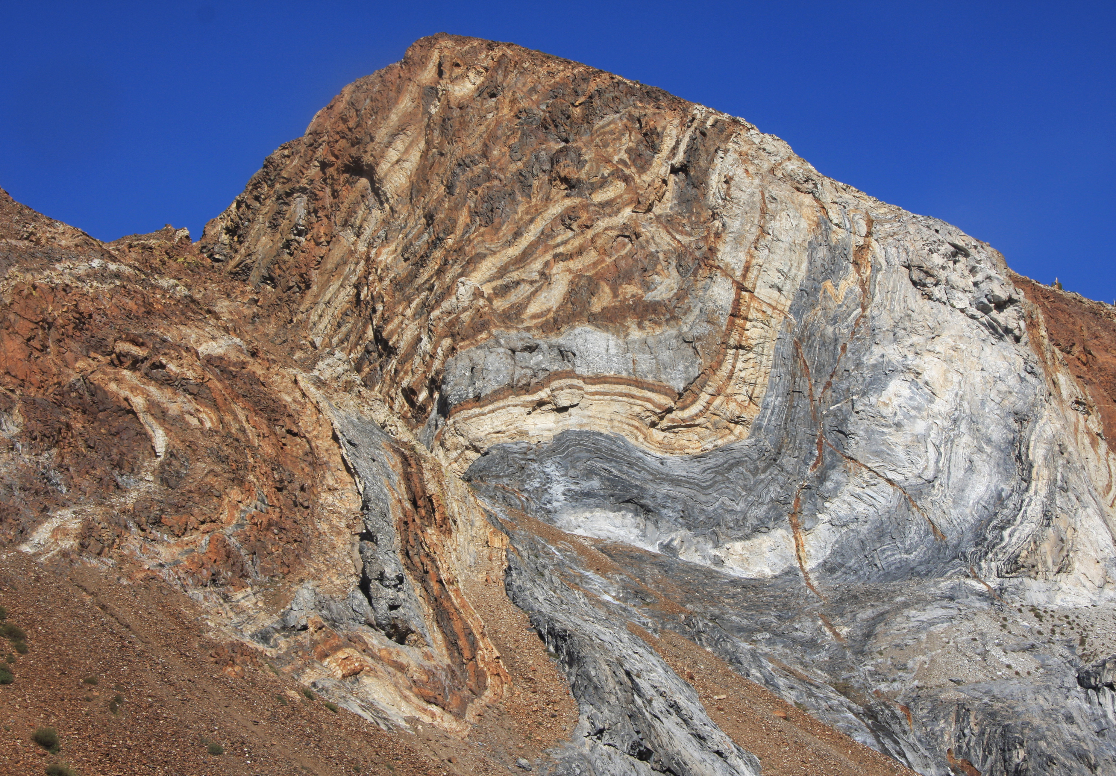
Laurel Mountain is a peak in Mono County, California. It lies in the Sherwin Range of the Sierra Nevada and is in the Inyo National Forest and the John Muir Wilderness. It reaches a height of and is largely composed of metamorphic rock caused by contact with an intruding pluton In geology, an igneous intrusion (or intrusive body or simply intrusion) is a body of intrusive igneous rock that forms by crystallization of magma slowly cooling below the surface of the Earth. Intrusions have a wide variety of forms and com ... in the late Cretaceous. References External links * * {{John Muir Wilderness Mountains of the John Muir Wilderness Mountains of Mono County, California Mountains of Northern California ... [...More Info...] [...Related Items...] OR: [Wikipedia] [Google] [Baidu] |
Convict Lake
Convict Lake (Mono: ''Wit-sa-nap'') is a lake located in Mono County, California, United States, situated in the Sherwin Range of the Sierra Nevada. It is known for its turquoise-blue water, the dramatic mountains (including Mount Morrison) that surround it, the trout fishing it affords, and its unusual history. The lake was renamed from its traditional Mono name by American settlers after an incident on September 23, 1871, in which a group of convicts escaped from prison in Carson City, Nevada, and took refuge near the lake. They were pursued by a posse, and after it caught up to the convicts, a shootout followed, in which a number of both posse members and convicts were killed or wounded. The remaining convicts who survived initially escaped but were eventually captured to be taken back to prison. They were lynched instead. Geography Convict Lake was originally carved out by glaciers. The lake's surface is approximately above sea level, with its greatest depths approximatel ... [...More Info...] [...Related Items...] OR: [Wikipedia] [Google] [Baidu] |
Sherwin Range
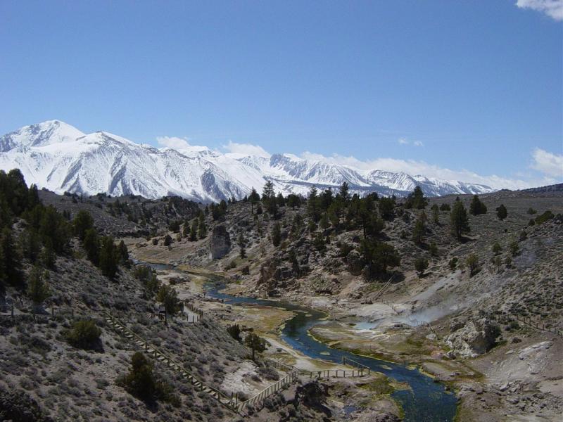
The Sherwin Range is a mountain range that is a sub-range of the Sierra Nevada system, in Mono County, eastern California. The range is also known locally as The Sherwins. Geography The Sherwin Range is immediately to the south of the Long Valley Caldera, and stretches from just south of the town of Mammoth Lakes. to the Wheeler Crest of the Sierra Nevada.Wheeler Crest: at The range lies to the south of the Long Valley Caldera. The range is named after Jim Sherwin, a prospector who operated the first toll road across the Sierra. Its eastern terminus was at Mammoth Lakes. Recreation The Sherwin Range is within Inyo National Forest. It is well known for hiking opportunities in the summer, and backcountry skiing in the winter. Geology The range largely consists of reddish metamorphic rock, which are the roof pendant for the Sierra Nevada. This rock was formed in the Paleozoic Era, and then was subsequently recrystallized and warped by the intrusion of the Sierra Nevada batholit ... [...More Info...] [...Related Items...] OR: [Wikipedia] [Google] [Baidu] |
Sierra Nevada (U
The Sierra Nevada () is a mountain range in the Western United States, between the Central Valley of California and the Great Basin. The vast majority of the range lies in the state of California, although the Carson Range spur lies primarily in Nevada. The Sierra Nevada is part of the American Cordillera, an almost continuous chain of mountain ranges that forms the western "backbone" of the Americas. The Sierra runs north-south and its width ranges from to across east–west. Notable features include General Sherman, the largest tree in the world by volume; Lake Tahoe, the largest alpine lake in North America; Mount Whitney at , the highest point in the contiguous United States; and Yosemite Valley sculpted by glaciers from one-hundred-million-year-old granite, containing high waterfalls. The Sierra is home to three national parks, twenty wilderness areas, and two national monuments. These areas include Yosemite, Sequoia, and Kings Canyon National Parks; and ... [...More Info...] [...Related Items...] OR: [Wikipedia] [Google] [Baidu] |
Mono County, California
Mono County ( ) is a county located in the east central portion of the U.S. state of California. As of the 2020 census, the population was 13,195, making it the fourth-least populous county in California. The county seat is Bridgeport. The county is located east of the Sierra Nevada between Yosemite National Park and Nevada. The only incorporated town in the county is Mammoth Lakes, which is located at the foot of Mammoth Mountain. Other locations, such as June Lake, are also famous as skiing and fishing resorts. Located in the middle of the county is Mono Lake, a vital habitat for millions of migratory and nesting birds. The lake is located in a wild natural setting, with pinnacles of tufa arising out of the salty and alkaline lake. Also located in Mono County is Bodie, the official state gold rush ghost town, which is now a California State Historic Park. History Mono County was formed in 1861 from parts of Calaveras, Fresno and Mariposa counties. A portion of n ... [...More Info...] [...Related Items...] OR: [Wikipedia] [Google] [Baidu] |
California
California is a state in the Western United States, located along the Pacific Coast. With nearly 39.2million residents across a total area of approximately , it is the most populous U.S. state and the 3rd largest by area. It is also the most populated subnational entity in North America and the 34th most populous in the world. The Greater Los Angeles area and the San Francisco Bay Area are the nation's second and fifth most populous urban regions respectively, with the former having more than 18.7million residents and the latter having over 9.6million. Sacramento is the state's capital, while Los Angeles is the most populous city in the state and the second most populous city in the country. San Francisco is the second most densely populated major city in the country. Los Angeles County is the country's most populous, while San Bernardino County is the largest county by area in the country. California borders Oregon to the north, Nevada and Arizona to the ea ... [...More Info...] [...Related Items...] OR: [Wikipedia] [Google] [Baidu] |
United States
The United States of America (U.S.A. or USA), commonly known as the United States (U.S. or US) or America, is a country primarily located in North America. It consists of 50 U.S. state, states, a Washington, D.C., federal district, five major unincorporated territories, nine United States Minor Outlying Islands, Minor Outlying Islands, and 326 Indian reservations. The United States is also in Compact of Free Association, free association with three Oceania, Pacific Island Sovereign state, sovereign states: the Federated States of Micronesia, the Marshall Islands, and the Palau, Republic of Palau. It is the world's List of countries and dependencies by area, third-largest country by both land and total area. It shares land borders Canada–United States border, with Canada to its north and Mexico–United States border, with Mexico to its south and has maritime borders with the Bahamas, Cuba, Russia, and other nations. With a population of over 333 million, it is the List of ... [...More Info...] [...Related Items...] OR: [Wikipedia] [Google] [Baidu] |
United States Geological Survey
The United States Geological Survey (USGS), formerly simply known as the Geological Survey, is a scientific agency of the United States government. The scientists of the USGS study the landscape of the United States, its natural resources, and the natural hazards that threaten it. The organization's work spans the disciplines of biology, geography, geology, and hydrology. The USGS is a fact-finding research organization with no regulatory responsibility. The agency was founded on March 3, 1879. The USGS is a bureau of the United States Department of the Interior; it is that department's sole scientific agency. The USGS employs approximately 8,670 people and is headquartered in Reston, Virginia. The USGS also has major offices near Lakewood, Colorado, at the Denver Federal Center, and Menlo Park, California. The current motto of the USGS, in use since August 1997, is "science for a changing world". The agency's previous slogan, adopted on the occasion of its hundredth an ... [...More Info...] [...Related Items...] OR: [Wikipedia] [Google] [Baidu] |
Hiking
Hiking is a long, vigorous walk, usually on trails or footpaths in the countryside. Walking for pleasure developed in Europe during the eighteenth century.AMATO, JOSEPH A. "Mind over Foot: Romantic Walking and Rambling." In ''On Foot: A History of Walking'', 101-24. NYU Press, 2004. Accessed March 1, 2021. http://www.jstor.org/stable/j.ctt9qg056.7. Religious pilgrimages have existed much longer but they involve walking long distances for a spiritual purpose associated with specific religions. "Hiking" is the preferred term in Canada and the United States; the term " walking" is used in these regions for shorter, particularly urban walks. In the United Kingdom and the Republic of Ireland, the word "walking" describes all forms of walking, whether it is a walk in the park or backpacking in the Alps. The word hiking is also often used in the UK, along with rambling , hillwalking, and fell walking (a term mostly used for hillwalking in northern England). The term bushwalking i ... [...More Info...] [...Related Items...] OR: [Wikipedia] [Google] [Baidu] |
Inyo National Forest
Inyo National Forest is a United States National Forest covering parts of the eastern Sierra Nevada of California and the White Mountains of California and Nevada. The forest hosts several superlatives, including Mount Whitney, the highest point in the contiguous United States; Boundary Peak, the highest point in Nevada; and the Ancient Bristlecone Pine Forest, which protects the oldest living trees in the world. The forest, encompassing much of the Owens Valley, was established by Theodore Roosevelt as a way of sectioning off land to accommodate the Los Angeles Aqueduct project in 1907, making the Inyo National Forest one of the least wooded forests in the U.S. National Forest system. Geography The forest covers and includes nine designated wilderness areas which protect over . Most of the forest is in California, but it includes about in western Nevada. It stretches from the eastern side of Yosemite to south of Sequoia National Park. Geographically it is split in two, o ... [...More Info...] [...Related Items...] OR: [Wikipedia] [Google] [Baidu] |
John Muir Wilderness
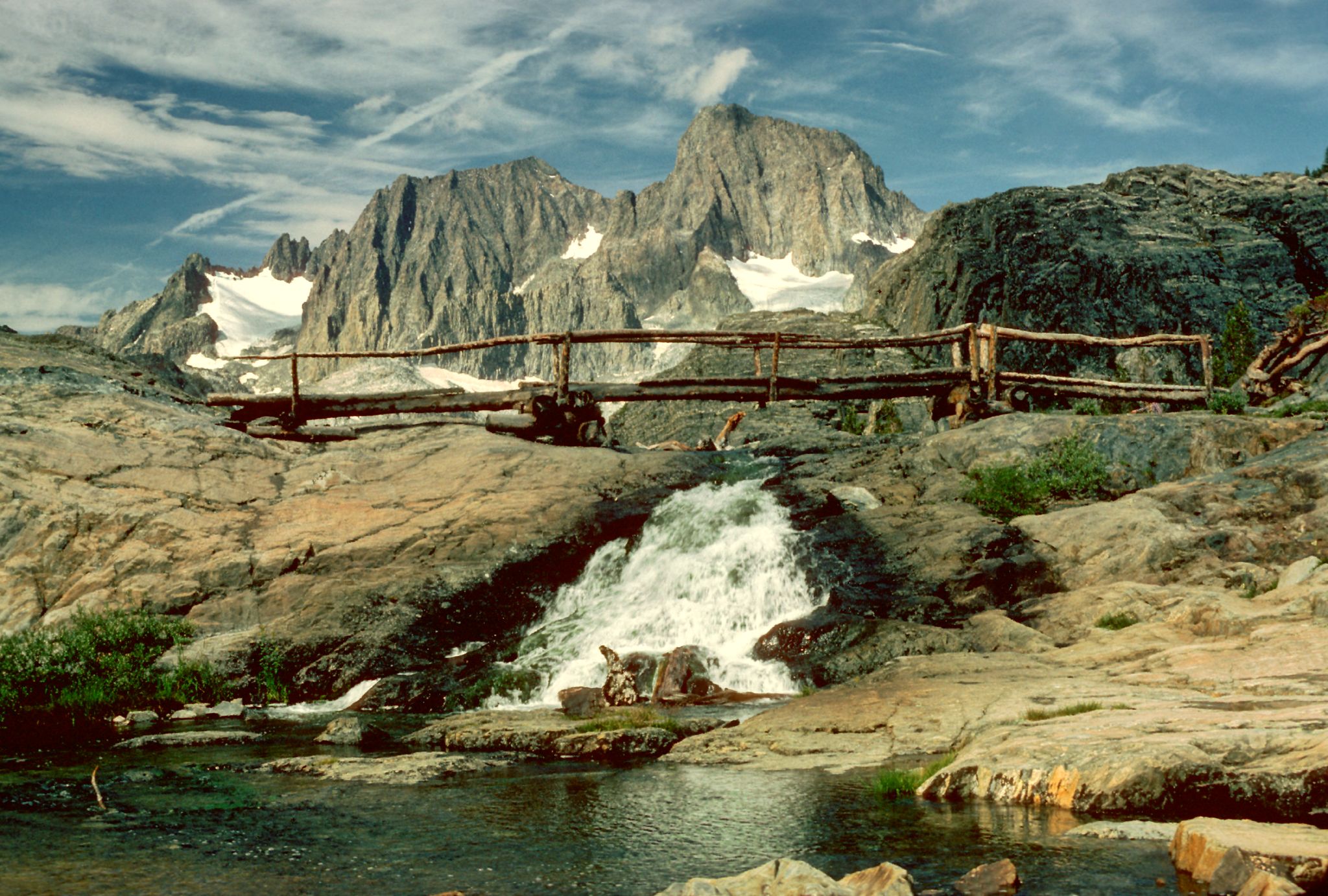
The John Muir Wilderness is a wilderness area that extends along the crest of the Sierra Nevada of California for , in the Inyo and Sierra National Forests. Established in 1964 by the Wilderness Act and named for naturalist John Muir, it encompasses . The wilderness lies along the eastern escarpment of the Sierra from near Mammoth Lakes and Devils Postpile National Monument in the north, to Cottonwood Pass near Mount Whitney in the south. The wilderness area also spans the Sierra crest north of Kings Canyon National Park, and extends on the west side of the park down to the Monarch Wilderness. Geography and geology The wilderness contains some of the most spectacular and highest peaks of the Sierra Nevada, with 57 peaks over in elevation. The peaks are typically made of granite from the Sierra Nevada Batholith, and are dramatically shaped by glacial action. The southernmost glacier in the United States, the Palisade Glacier, is contained within the wilderness area. Notable ... [...More Info...] [...Related Items...] OR: [Wikipedia] [Google] [Baidu] |
Metamorphic Rock
Metamorphic rocks arise from the transformation of existing rock to new types of rock in a process called metamorphism. The original rock ( protolith) is subjected to temperatures greater than and, often, elevated pressure of or more, causing profound physical or chemical changes. During this process, the rock remains mostly in the solid state, but gradually recrystallizes to a new texture or mineral composition. The protolith may be an igneous, sedimentary, or existing metamorphic rock. Metamorphic rocks make up a large part of the Earth's crust and form 12% of the Earth's land surface. They are classified by their protolith, their chemical and mineral makeup, and their texture. They may be formed simply by being deeply buried beneath the Earth's surface, where they are subject to high temperatures and the great pressure of the rock layers above. They can also form from tectonic processes such as continental collisions, which cause horizontal pressure, friction, and di ... [...More Info...] [...Related Items...] OR: [Wikipedia] [Google] [Baidu] |
Pluton
In geology, an igneous intrusion (or intrusive body or simply intrusion) is a body of intrusive igneous rock that forms by crystallization of magma slowly cooling below the surface of the Earth. Intrusions have a wide variety of forms and compositions, illustrated by examples like the Palisades Sill of New York and New Jersey; the Henry Mountains of Utah; the Bushveld Igneous Complex of South Africa; Shiprock in New Mexico; the Ardnamurchan intrusion in Scotland; and the Sierra Nevada Batholith of California. Because the solid country rock into which magma intrudes is an excellent insulator, cooling of the magma is extremely slow, and intrusive igneous rock is coarse-grained ( phaneritic). Intrusive igneous rocks are classified separately from extrusive igneous rocks, generally on the basis of their mineral content. The relative amounts of quartz, alkali feldspar, plagioclase, and feldspathoid is particularly important in classifying intrusive igneous rocks. Intrusio ... [...More Info...] [...Related Items...] OR: [Wikipedia] [Google] [Baidu] |


