|
Las Tintoreras
Las Tintoreras Islet (also called Tintorera or Villamil) is an islet to the south of the bay of Puerto Villamil in the island of Isabela, that forms part of the archipelago and national park of the Galapagos Islands, including administratively in the Province Of Galapagos. It is accessible by a boat trip where iguanas, boobies, penguins and seabirds can be observed. The name of the islet comes from a channel that is filled during high tide of whitetip reef sharks and tiger sharks, the latter typically referred to as Tintorera. It has an area of 12.4 hectares (0.12 square kilometers), is 68.8 kilometers from the center of the archipelago, and has a coastline of 2.64 kilometers. See also * Geography of Ecuador * Geography of South America The geography of South America contains many diverse regions and climates. Geographically, South America is generally considered a continent forming the southern portion of the landmass of the Americas, south and east of the Colombia– ... [...More Info...] [...Related Items...] OR: [Wikipedia] [Google] [Baidu] |
Galápagos Islands
The Galápagos Islands (Spanish: , , ) are an archipelago of volcanic islands. They are distributed on each side of the equator in the Pacific Ocean, surrounding the centre of the Western Hemisphere, and are part of the Republic of Ecuador. Located west of continental Ecuador, the islands are known for their large number of endemic species that were studied by Charles Darwin during the second voyage of HMS ''Beagle''. His observations and collections contributed to the inception of Darwin's theory of evolution by means of natural selection. The Galápagos Islands and their surrounding waters form the Galápagos Province of Ecuador, the Galápagos National Park, and the Galápagos Marine Reserve. The principal language on the islands is Spanish. The islands have a population of slightly over 25,000. The first recorded visit to the islands happened by chance in 1535, when Fray Tomás de Berlanga, the Bishop of Panamá, was surprised to find this undiscovered land on a vo ... [...More Info...] [...Related Items...] OR: [Wikipedia] [Google] [Baidu] |
Puerto Villamil
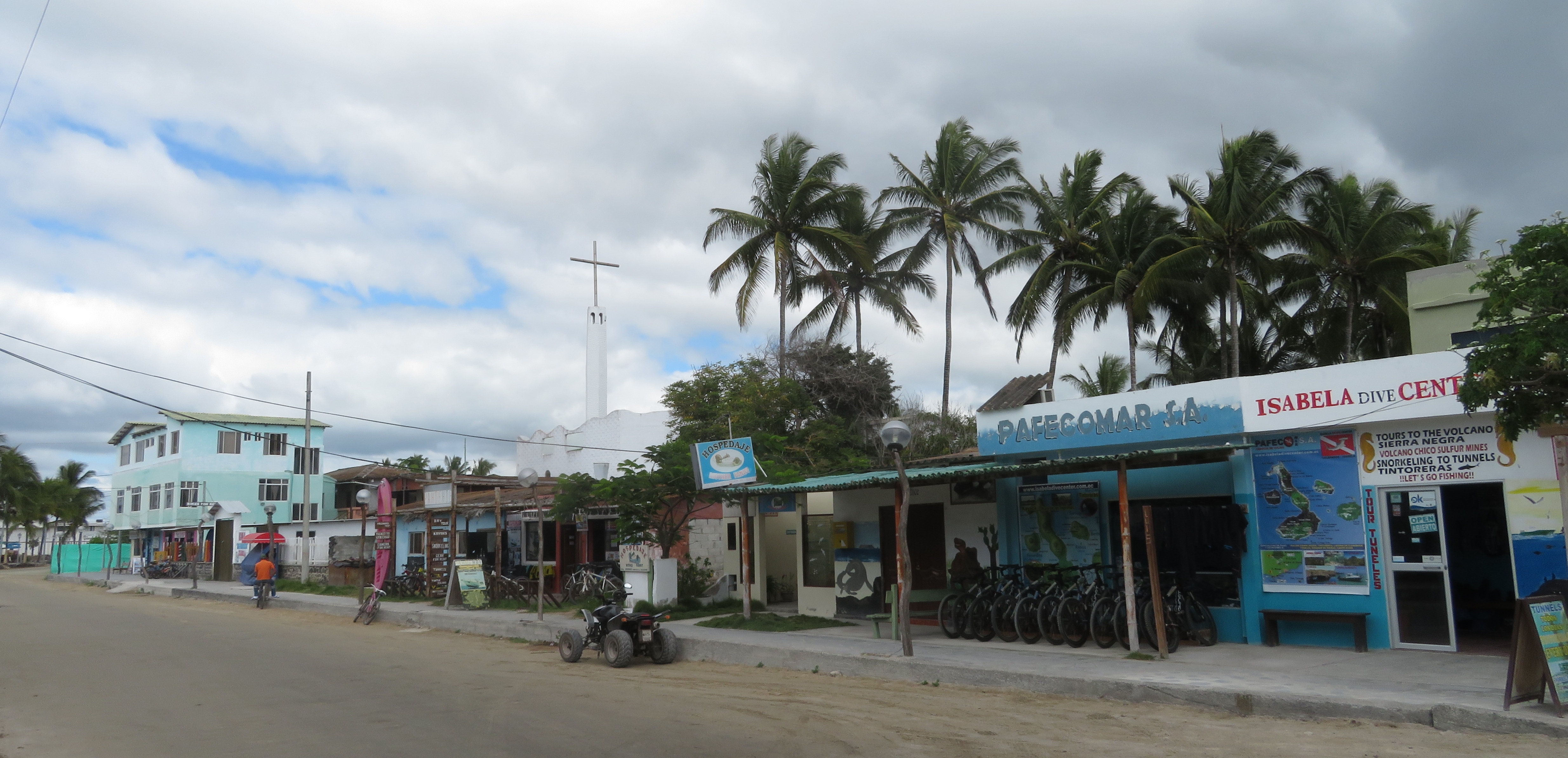
Puerto Villamil is a small port village located on the southeastern edge of Isla Isabela in the Galapagos Islands. Of the 2,200 people who live on Isabela, the majority live in Puerto Villamil. The harbor is frequently full with sailboats, as Villamil is a popular stop for private yachts making their way to the Marquesas Islands as it is the westernmost town in the Galapagos Islands. Puerto Villamil was founded in 1897 by Antonio Gil Traditionally residents of Puerto Villamil have earned a living either through agriculture or fishing . Over the years the government has made policies to move the population away from fishing and into tourist-based activities. This move has been hotly debated, and has created political incidents including one in 2000 when a group of sea cucumber fishermen kidnapped baby tortoises in order to have the government extend their fishing limits. The modern church ''Iglesia Cristo Salvador'' in the middle of town is worth a visit because of its col ... [...More Info...] [...Related Items...] OR: [Wikipedia] [Google] [Baidu] |
Isabela Island (Galápagos)
Isabela Island () is the largest island of the Galápagos Islands, Galápagos with an area of and length of , almost four times larger than Santa Cruz, the second largest of the archipelago. Isabela Island is larger than every other island in the Galápagos combined. It was named after Queen Isabella I of Castile. The island straddles the equator. This island was originally named Albemarle Island for the Duke of Albemarle by Ambrose Cowley, one of the first Europeans to set foot on the islands, in 1684. Geology One of the youngest islands, Isabela is located on the western edge of the archipelago near the Galápagos hotspot. At approximately 1 million years old, the seahorse-shaped island was formed by the merger of six shield volcanoes; Alcedo Volcano, Alcedo, Cerro Azul (Ecuador volcano), Cerro Azul, Darwin, Volcán Ecuador, Ecuador, Sierra Negra (Galápagos), Sierra Negra, and Volcán Wolf, Wolf. All of these volcanoes except Ecuador are still active, making it one of ... [...More Info...] [...Related Items...] OR: [Wikipedia] [Google] [Baidu] |
Whitetip Reef Sharks
The whitetip reef shark (''Triaenodon obesus'') is a species of requiem shark, in the family Carcharhinidae, and the only member of its genus. A small shark that does not usually exceed in length, this species is easily recognizable by its slender body and short but broad head, as well as tubular skin flaps beside the nostrils, oval eyes with vertical pupils, and white-tipped dorsal and caudal fins. One of the most common sharks found on Indo-Pacific coral reefs, the whitetip reef shark occurs as far west as South Africa and as far east as Central America. It is typically found on or near the bottom in clear water, at a depth of . During the day, whitetip reef sharks spend much of their time resting inside caves. Unlike other requiem sharks, which rely on ram ventilation and must constantly swim to breathe, this shark can pump water over its gills and lie still on the bottom. At night, whitetip reef sharks emerge to hunt bony fishes, crustaceans, and octopus in groups, their elo ... [...More Info...] [...Related Items...] OR: [Wikipedia] [Google] [Baidu] |
Tiger Sharks
The tiger shark (''Galeocerdo cuvier'') is a species of requiem shark and the last extant member of the family Galeocerdonidae. It is a large macropredator, capable of attaining a length over . Populations are found in many tropical and temperate waters, especially around central Pacific islands. Its name derives from the dark stripes down its body, which resemble a tiger's pattern, but fade as the shark matures. The tiger shark is a solitary, mostly nocturnal hunter. It is notable for having the widest food spectrum of all sharks, with a range of prey that includes crustaceans, fish, seals, birds, squid, turtles, sea snakes, dolphins, and even other smaller sharks. It also has a reputation as a "garbage eater", consuming a variety of inedible, man-made objects that linger in its stomach. Though apex predators, tiger sharks are sometimes taken as prey by groups of killer whales. It is considered a near threatened species because of finning and fishing by humans. The tiger sh ... [...More Info...] [...Related Items...] OR: [Wikipedia] [Google] [Baidu] |
Geography Of Ecuador
Ecuador is a country in western South America, bordering the Pacific Ocean at the Equator, for which the country is named. Ecuador encompasses a wide range of natural formations and climates, from the desert-like southern coast to the snowcapped peaks of the Andes mountain range to the plains of the Amazon Basin. Cotopaxi in Ecuador is one of the world's highest active volcanos. It also has a large series of rivers that follow the southern border and spill into the northwest area of Peru. Area and borders Ecuador is located on the west by the Pacific Ocean, and has 2,237 km of coastline. It has 2237 km of land boundaries, with Colombia in the north (708 km border) and Peru in the east and south (1,529 km border). is land and water. Ecuador is one of the smallest countries in South America, but bigger than Uruguay, Guyana, Suriname and French Guiana. It has the 29th largest exclusive economic zone of which includes the Galápagos Islands. Cities ... [...More Info...] [...Related Items...] OR: [Wikipedia] [Google] [Baidu] |
Geography Of South America
The geography of South America contains many diverse regions and climates. Geographically, South America is generally considered a continent forming the southern portion of the landmass of the Americas, south and east of the Colombia–Panama border by most authorities, or south and east of the Panama Canal by some. South and North America are sometimes considered a single continent or supercontinent, while constituent regions are infrequently considered subcontinents. South America became attached to North America only recently (geologically speaking) with the formation of the Isthmus of Panama some 3 million years ago, which resulted in the Great American Interchange. The Andes, likewise a comparatively young and seismically restless mountain range, runs down the western edge of the continent; the land to the east of the northern Andes is largely tropical rainforest, the vast Amazon River basin. The continent also contains drier regions such as eastern Patagonia and the extreme ... [...More Info...] [...Related Items...] OR: [Wikipedia] [Google] [Baidu] |


