|
Lapal
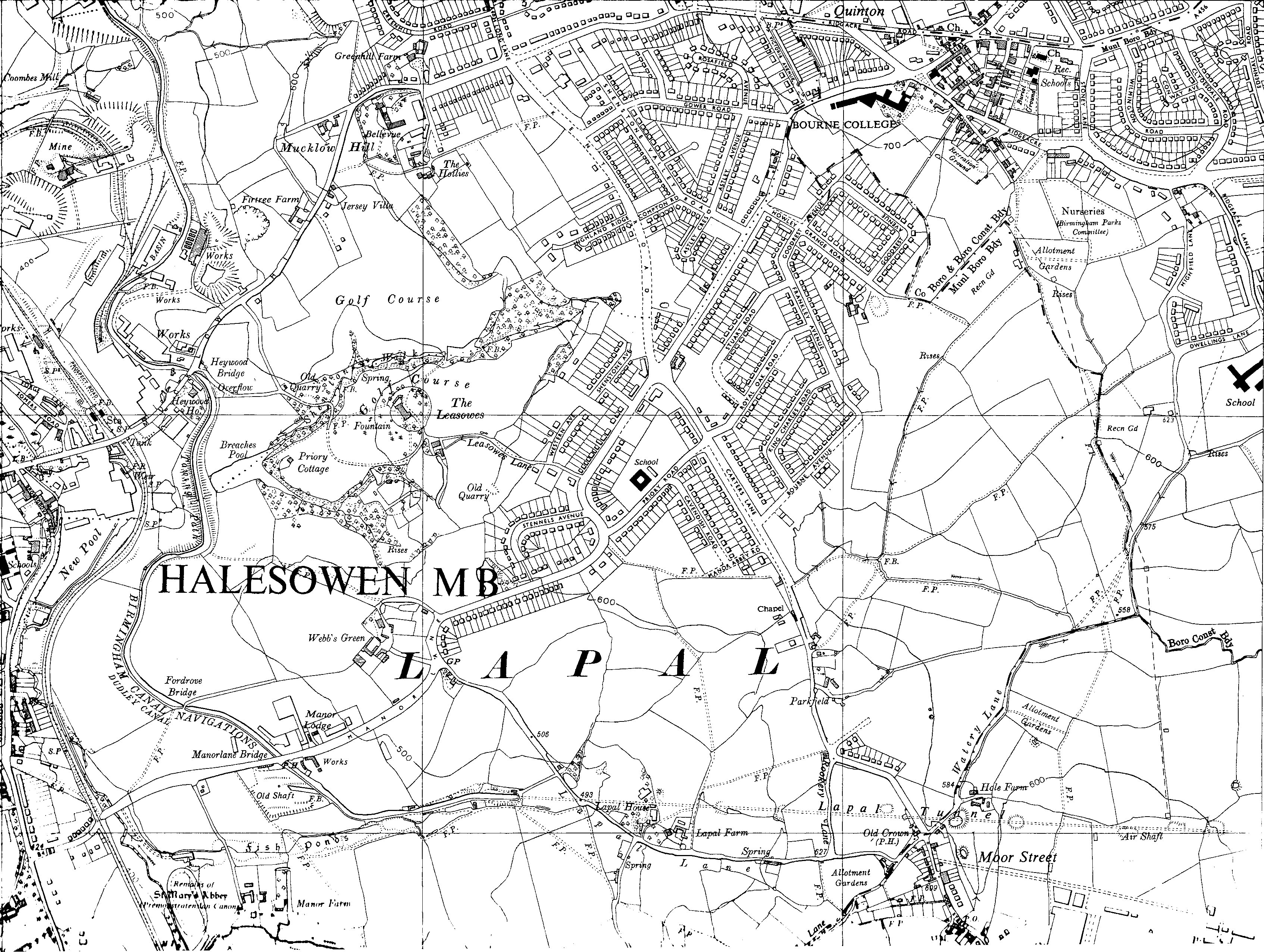
Lapal is a residential area of Halesowen in the West Midlands (county), West Midlands of England (part of Worcestershire until 1974). It is situated in the east of the town on the border with Birmingham. The Lapal area sits to the East of the Lapal Canal, to the North of Lapal Lane South up to what is now the M5 motorway, to the South West of Carters Lane and Kent Road, and to the South East of Mucklow Hill. Most of the houses were built between 1930 and 1980. In the late 1970s the large Abbeyfields estate was built alongside the currently disused portion of the Dudley Canal, adding to its already extensive owner-occupier housing stock. It is the most affluent suburb of Halesowen, commanding the largest average house prices of all the suburbs in the town. The area is served by Lapal Primary School and Leasowes High School, the Royal Oak public house and a small cluster of shops opposite, including a newsagent/post office, bakery, fish and chip shop, Chinese take-away, pharmacy an ... [...More Info...] [...Related Items...] OR: [Wikipedia] [Google] [Baidu] |
Dudley Canal
The Dudley Canal is a canal passing through Dudley in the West Midlands of England. The canal is part of the English and Welsh connected network of navigable inland waterways, and in particular forms part of the popular Stourport Ring narrowboat cruising route. The first short section, which connected to the Stourbridge Canal, opened in 1779, and this was connected through the Dudley Tunnel to the Birmingham Canal system in 1792. Almost immediately, work started on an extension, called Line No. 2, which ran through another long tunnel at Lapal, to reach the Worcester and Birmingham Canal. This was completed in 1798, but significant trade had to wait until the Worcester and Birmingham was completed in 1802. In 1846, the company amalgamated with the Birmingham Canal Navigations, and various improvements followed, including the Netherton Tunnel, of a similar length to the Dudley Tunnel, but much bigger, with towpaths on both sides and gas lighting. It was the last canal tunnel bui ... [...More Info...] [...Related Items...] OR: [Wikipedia] [Google] [Baidu] |
Lapal Tunnel
The Lapal Tunnel (old spelling Lappal Tunnel) is a disused canal tunnel on the five mile dry section of the Dudley No. 2 Canal in the West Midlands, England. It takes its name from the settlement of Lapal. History The narrow brick-lined tunnel, built in 1798 by William Underhill, had no towpath. It had a very small bore — at 7 feet 9 inches, barely wider than the boats which used it, with a headroom of only 6 feet. Boats originally took about three hours to complete the passage by legging or poling, so in 1841 a steam engine was built at the Halesowen end which drove a scoop wheel to load the tunnel with water. Stop gates could be opened at either end to assist boats along the tunnel in either direction. The tunnel suffered many collapses, and after a collapse in 1917 due to mining subsidence it was abandoned. It runs under Lapal, the M5 motorway near junction 3 and Woodgate Valley Country Park. The canal between Halesowen and Selly Oak is disused and some sections ha ... [...More Info...] [...Related Items...] OR: [Wikipedia] [Google] [Baidu] |
Lapal Canal
The Lapal Tunnel (old spelling Lappal Tunnel) is a disused canal tunnel on the five mile dry section of the Dudley No. 2 Canal in the West Midlands, England. It takes its name from the settlement of Lapal. History The narrow brick-lined tunnel, built in 1798 by William Underhill, had no towpath. It had a very small bore — at 7 feet 9 inches, barely wider than the boats which used it, with a headroom of only 6 feet. Boats originally took about three hours to complete the passage by legging or poling, so in 1841 a steam engine was built at the Halesowen end which drove a scoop wheel to load the tunnel with water. Stop gates could be opened at either end to assist boats along the tunnel in either direction. The tunnel suffered many collapses, and after a collapse in 1917 due to mining subsidence it was abandoned. It runs under Lapal, the M5 motorway near junction 3 and Woodgate Valley Country Park. The canal between Halesowen and Selly Oak is disused and some sections ha ... [...More Info...] [...Related Items...] OR: [Wikipedia] [Google] [Baidu] |
Halesowen
Halesowen ( ) is a market town in the Metropolitan Borough of Dudley, in the county of West Midlands, England. Historically an exclave of Shropshire and, from 1844, in Worcestershire, the town is around from Birmingham city centre, and from Dudley town centre. The population of the town, as measured by the United Kingdom Census 2011, was 58,135. Halesowen is included in the Halesowen and Rowley Regis constituency which is held by the Conservative James Morris. Geography and administration Halesowen was a detached part of the county of Shropshire but was incorporated into Worcestershire in 1844 by the Counties (Detached Parts) Act. Since the local government reorganisation of 1974 it has formed a part of the West Midlands Metropolitan county and Conurbation, in the Dudley Metropolitan Borough, which it joined at the same time as neighbouring Stourbridge, which had also been in Worcestershire until that point. Halesowen borders the Birmingham suburbs of Quinton and Bartley ... [...More Info...] [...Related Items...] OR: [Wikipedia] [Google] [Baidu] |
Lapal Primary School
Halesowen ( ) is a market town in the Metropolitan Borough of Dudley, in the county of West Midlands, England. Historically an exclave of Shropshire and, from 1844, in Worcestershire, the town is around from Birmingham city centre, and from Dudley town centre. The population of the town, as measured by the United Kingdom Census 2011, was 58,135. Halesowen is included in the Halesowen and Rowley Regis constituency which is held by the Conservative James Morris. Geography and administration Halesowen was a detached part of the county of Shropshire but was incorporated into Worcestershire in 1844 by the Counties (Detached Parts) Act. Since the local government reorganisation of 1974 it has formed a part of the West Midlands Metropolitan county and Conurbation, in the Dudley Metropolitan Borough, which it joined at the same time as neighbouring Stourbridge, which had also been in Worcestershire until that point. Halesowen borders the Birmingham suburbs of Quinton and Bartley ... [...More Info...] [...Related Items...] OR: [Wikipedia] [Google] [Baidu] |
Brierley Hill
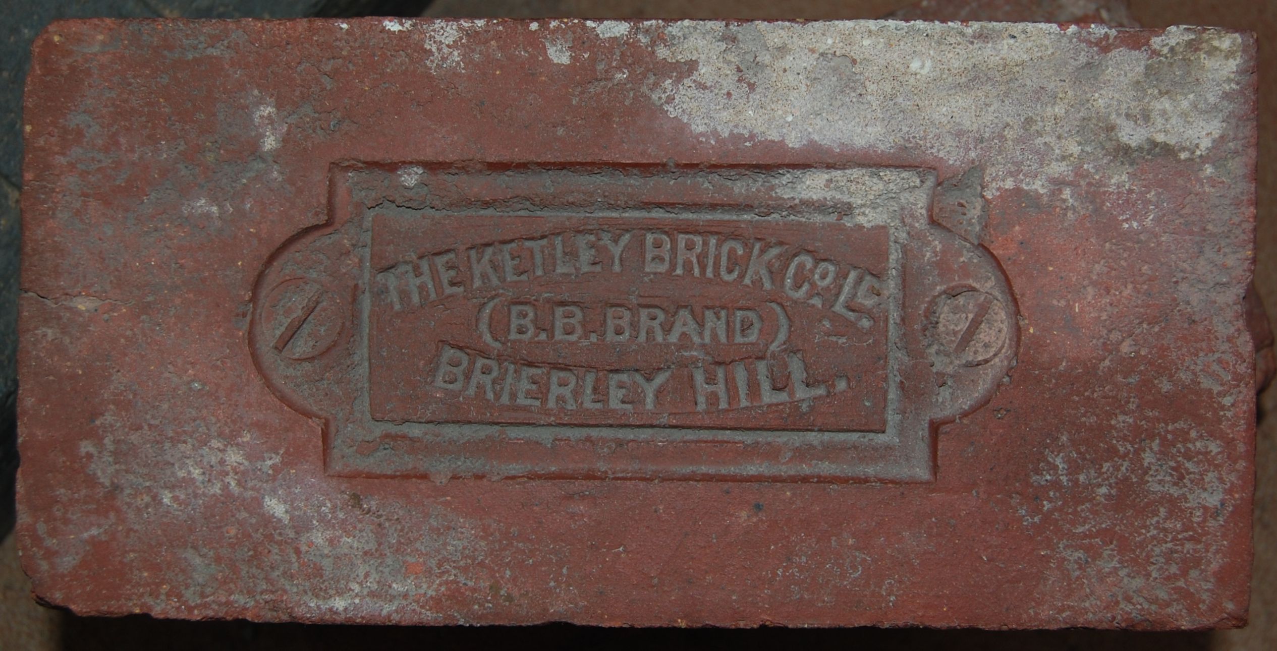
Brierley Hill is a town and electoral ward in the Metropolitan Borough of Dudley, West Midlands, England, 2.5 miles south of Dudley and 2 miles north of Stourbridge. Part of the Black Country and in a heavily industrialised area, it has a population of 13,935 at the 2011 census. It is best known for glass and steel manufacturing, although industry has declined considerably since the 1970s. One of the largest factories in the area was the Round Oak Steelworks, which closed down and was redeveloped in the 1980s to become the Merry Hill Shopping Centre. Brierley Hill was originally in Staffordshire. Since 2008, Brierley Hill has been designated as the Strategic Town Centre of the Dudley Borough. History The name Brierley Hill derives from the Old English words 'brer', meaning the place where the Briar Rose grew; 'leah', meaning a woodland clearing; and 'hill'. Largely a product of the Industrial Revolution, Brierley Hill has a relatively recent history, with the first written ... [...More Info...] [...Related Items...] OR: [Wikipedia] [Google] [Baidu] |
M5 Motorway
The M5 is a motorway in England linking the Midlands with the South West England, South West. It runs from junction 8 of the M6 motorway, M6 at West Bromwich near Birmingham to Exeter in Devon. Heading south-west, the M5 runs east of West Bromwich and west of Birmingham through Sandwell Valley. It continues past Bromsgrove (and from Birmingham and Bromsgrove is part of the Birmingham Motorway Box), Droitwich Spa, Worcester, England, Worcester, Tewkesbury, Cheltenham, Gloucester, Bristol, Clevedon, Weston-super-Mare, Bridgwater, Taunton, terminating at junction 31 for Exeter. Congestion on the section south of the M4 motorway, M4 is common during the summer holidays, on Friday afternoons and bank holidays. Route The M5 quite closely follows the route of the A38 road. The two deviate slightly around Bristol and the area south of Bristol from junctions 16 to the Sedgemoor services north of junction 22. The A38 goes straight through the centre of Bristol and passes by Bristol Airp ... [...More Info...] [...Related Items...] OR: [Wikipedia] [Google] [Baidu] |
Oldbury, West Midlands
Oldbury is a market town in the Metropolitan Borough of Sandwell, West Midlands, England. It is the administrative centre of the borough and one of its six constituent towns. At the 2011 census, the ward of Oldbury had a population of 13,606, while the 2017 population of the wider built-up area was estimated at 25,488. Sandwell Metropolitan Borough Council, which defines Oldbury Town as consisting of the wards of Bristnall, Langley, Oldbury, and Old Warley, gave the population as 50,641 in 2011. Etymology The place name Oldbury, comes from the Old English 'Ealdenbyrig', – signifying that Oldbury was old even in early English times over 1,000 years ago. ''Eald'' being Old English for 'old', ''Byrig'' is the plural of 'burh' in Old English – a burh being a fortification or fortified town. History Oldbury was part of the ancient parish of Halesowen, a detached part of Shropshire surrounded by Worcestershire and Staffordshire. After the dissolution of the monasteries, Henry ... [...More Info...] [...Related Items...] OR: [Wikipedia] [Google] [Baidu] |
Merry Hill, Wolverhampton
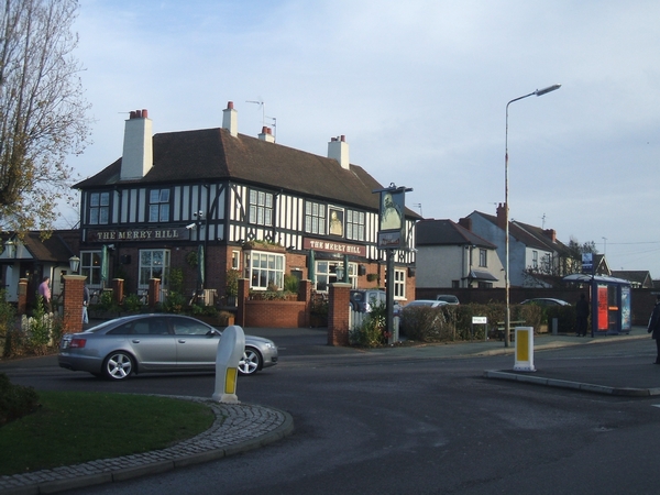
Merry Hill is a suburb of Wolverhampton, West Midlands and a ward of Wolverhampton City Council. It is situated in the south-west of the city, bordering South Staffordshire and the Tettenhall Wightwick, Park, Graiseley and Penn wards. It forms part of the Wolverhampton South West constituency. Merry Hill is itself is the main focal point of the ward, situated at the junction of five main roads. Because of the layout of the ward boundaries, parts of the suburbs of Bradmore, Castlecroft and Finchfield are covered by Merry Hill ward. The population of the ward taken at the 2011 census was 12,189. Highfields Secondary school, Uplands Junior school, St Michael's RC Primary school and Springdale Primary school are all situated within the ward. Merry Hill is served by National Express West Midlands National Express West Midlands (NXWM) is a bus operator in the West Midlands that operates services in Birmingham, Dudley, Sandwell, Walsall, Wolverhampton, and Solihull, as well ... [...More Info...] [...Related Items...] OR: [Wikipedia] [Google] [Baidu] |
Cradley Heath
Cradley Heath is a town in the Rowley Regis area of the Metropolitan Borough of Sandwell, West Midlands, England approximately north-west of Halesowen, south of Dudley and west of central Birmingham. Cradley Heath is often confused with the neighbouring Halesowen district of Cradley, although the two places are separated by the River Stour and have long been in separate local authorities, and until 1966 were in separate counties. Cradley Heath is one of several towns in central England still recognisable from their early 20th-century appearance. Many of the shops and houses in the High Street are still standing after 100 years, though some were demolished in the mid-2000s to make way for a bypass, to ease congestion in the town centre. History Cradley Heath was originally an area of heathland between Cradley, Netherton, and Old Hill, in the Staffordshire parish of Rowley Regis. The residents of Cradley had grazing rights, subject to an annual payment to the Lord of the ... [...More Info...] [...Related Items...] OR: [Wikipedia] [Google] [Baidu] |
Leasowes High School
Leasowes High School is a coeducational secondary school located in Halesowen in the West Midlands of England. It regularly performs well in the Dudley Borough's GCSE league tables; and there is a high application rate amongst primary school leavers, meaning that some local children have to attend schools further afield, such as Earls High School and Windsor High School. History The school was opened in September 1972 as a 13-18 mixed secondary school, as Halesowen borough council had abandoned the traditional 5-7 infant, 7-11 junior and 11-16/18 secondary schools in favour of a three-tier system of 5-9 first, 9-13 middle and 13-18 secondary schools. Leasowes High School effectively replaced Hill & Cakemore Secondary Modern Schools on Long Lane, with the old school becoming Greenhill Middle School. Halesowen was absorbed by Dudley (which had adopted 5-8 first and 8-12 middle schools in 1972) in April 1974, but the system in Halesowen continued until September 1982, when th ... [...More Info...] [...Related Items...] OR: [Wikipedia] [Google] [Baidu] |
Stourbridge
Stourbridge is a market town in the Metropolitan Borough of Dudley in the West Midlands, England, situated on the River Stour. Historically in Worcestershire, it was the centre of British glass making during the Industrial Revolution. The 2011 UK census recorded the town's population as 63,298. Geography Stourbridge is about west of Birmingham. Sitting within the Metropolitan Borough of Dudley at the southwestern edge of the Black Country and West Midlands conurbation, Stourbridge includes the suburbs of Amblecote, Lye, Norton, Oldswinford, Pedmore,Stambermill, Stourton, Wollaston, Wollescote and Wordsley. Much of Stourbridge consists of residential streets interspersed with green spaces. Mary Stevens Park, opened in 1931, has a lake, a bandstand, a cafe, and a mixture of open spaces and woodland. Bordered by green belt land, Stourbridge is close to countryside with the Clent Hills to the south and southwest Staffordshire and Kinver Edge to the west. Closest cities, tow ... [...More Info...] [...Related Items...] OR: [Wikipedia] [Google] [Baidu] |


