|
Landport (Gibraltar)
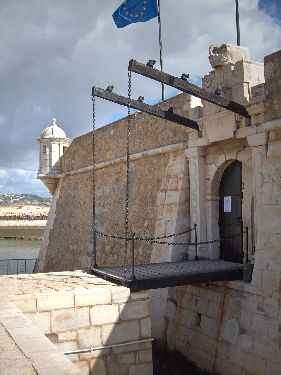
The Landport ( es, Puerta de Tierra) is a gate into the territory of Gibraltar. It was originally the only entrance to the fortification from the land and so was heavily fortified and guarded. Description After the territory was first captured from the Spanish in 1704, the British defended the Landport with twenty guns. The gate was subsequently defended by the ''Inundation'' — a flooded and fortified area of ground measuring about in length by about broad and was "nearly man-height" in depth. There were also obstacles in it such as ''chevaux de frise'' and metal hoops. There was also a moat covering the northern approach — the Landport Ditch. The ditch's defences included a palisade and a gunpowder mine which could be exploded beneath an assault. To cross these defences, there was a drawbridge which was pulled up at night. Tobacco smugglers would exit the gate at this time and lurk outside, waiting for an opportunity to cross the neutral ground into Spain du ... [...More Info...] [...Related Items...] OR: [Wikipedia] [Google] [Baidu] |
Landport Sign, Gibraltar
Landport is a district located on Portsea Island and is considered the city centre of modern-day Portsmouth, England. The district is centred around Commercial Road and encompasses the Guildhall, Civic Centre, Portsmouth and Southsea Station and Commercial Road central shopping area. The original historic old town of Portsmouth lies to the south of Landport and is now known as Old Portsmouth. The district of Portsea lies to the West; Somers Town and Southsea are to the south; Fratton lies to the East and the Kingston Crescent area to the north. Toponymy The area derives its name from Landport Gate. The Landport Gate held its name as early as 1727, however the settlement, while formed earlier and at least partially known as "Halfway-Houses", took the designation of Landport (Town) from 1831. History Halfway Houses took its name from the Halfway House, an inn on the road to London from Old Portsmouth. By 1716 a number of other buildings had appeared, including Ridge's Bre ... [...More Info...] [...Related Items...] OR: [Wikipedia] [Google] [Baidu] |
Land Mine
A land mine is an explosive device concealed under or on the ground and designed to destroy or disable enemy targets, ranging from combatants to vehicles and tanks, as they pass over or near it. Such a device is typically detonated automatically by way of pressure when a target steps on it or drives over it, although other detonation mechanisms are also sometimes used. A land mine may cause damage by direct blast effect, by fragments that are thrown by the blast, or by both. Landmines are typically laid throughout an area, creating a ''minefield'' which is dangerous to cross. The use of land mines is controversial because of their potential as indiscriminate weapons. They can remain dangerous many years after a conflict has ended, harming civilians and the economy. Seventy-eight countries are contaminated with land mines and 15,000–20,000 people are killed every year while many more are injured. Approximately 80% of land mine casualties are civilians, with children as the ... [...More Info...] [...Related Items...] OR: [Wikipedia] [Google] [Baidu] |
Southport Gates
The Southport Gates are three city gates in the British Overseas Territory of Gibraltar. They are located in the Charles V Wall, one of the 16th century fortifications of Gibraltar. The gates are clustered together, with the South Bastion to the west, and the Trafalgar Cemetery to the east. The first and second Southport Gates were constructed at present day Trafalgar Road in 1552 and 1883, respectively. The third gate, Referendum Gate, is the widest of the three and was constructed in 1967 at Main Street, immediately west of the first two gates. The Southport Gates are listed with the Gibraltar Heritage Trust. Description The Southport Gates are Gibraltar, the British Overseas Territory at the southern end of the Iberian Peninsula. The gates are located in the Charles V Wall, one of the early fortifications of Gibraltar that defended the former southern limit of the city. They are positioned between the South Bastion to the west and the Flat Bastion to the east, at the b ... [...More Info...] [...Related Items...] OR: [Wikipedia] [Google] [Baidu] |
Portsmouth
Portsmouth ( ) is a port and city in the ceremonial county of Hampshire in southern England. The city of Portsmouth has been a unitary authority since 1 April 1997 and is administered by Portsmouth City Council. Portsmouth is the most densely populated city in the United Kingdom, with a population last recorded at 208,100. Portsmouth is located south-west of London and south-east of Southampton. Portsmouth is mostly located on Portsea Island; the only English city not on the mainland of Great Britain. Portsea Island has the third highest population in the British Isles after the islands of Great Britain and Ireland. Portsmouth also forms part of the regional South Hampshire conurbation, which includes the city of Southampton and the boroughs of Eastleigh, Fareham, Gosport, Havant and Waterlooville. Portsmouth is one of the world's best known ports, its history can be traced to Roman times and has been a significant Royal Navy dockyard and base for centuries. Portsm ... [...More Info...] [...Related Items...] OR: [Wikipedia] [Google] [Baidu] |
King James's And Landport Gates
__NOTOC__ King James's and Landport Gates are two English Heritage gateways in Portsmouth, Hampshire, England. Original purpose Earthen ramparts protecting the land side of the port containing munitions, international goods storage, warehouses, shops and homes were constructed in the 14th century which were strengthened by order of Henry VIII in the 16th.Lilley, H T ''Early Portsmouth Defences'' (1923), Charpentier, PortsmouthLloyd, D W ''Buildings of Portsmouth and Environs: A Survey of the Dockyard, Defences, Homes, Churches, Commercial, Civic and Public Buildings'' (1974) City of Portsmouth Council Four ornate gateways were originally access points to Portsmouth through the town walls. The majority of the town walls were demolished in 1860. King James's Gate King James's Gate was built in 1687, probably as a reconstruction of the older Point gate on the same site, to control access to Portsmouth from The Point. When the town walls were demolished the gate was moved to a pave ... [...More Info...] [...Related Items...] OR: [Wikipedia] [Google] [Baidu] |
Grand Casemates Gates
Grand Casemates Gates, formerly Waterport Gate, provide an entrance from the northwest to the old, fortified portion of the city of the British Overseas Territory of Gibraltar, at Grand Casemates Square. Background The Rock of Gibraltar, linked to mainland Spain by a low isthmus, extends south into the Strait of Gibraltar which connects the Mediterranean Sea with the Atlantic Ocean. It is a strategic location that has been occupied in turn by the Moors, Spanish and British. The Rock is inaccessible on its eastern side, which rises in a tall and steep cliff. The town lies on the west side along the shore of the Bay of Gibraltar. For many years a gate provided access from the sea into the northwest of the town through the defensive wall that ran along the shore of the bay. The Moors occupied Gibraltar for centuries until Ferdinand IV of Castile took Gibraltar in the 1309 siege. In 1333 the Moors retook Gibraltar after a lengthy siege. The Spanish regained Gibraltar in August ... [...More Info...] [...Related Items...] OR: [Wikipedia] [Google] [Baidu] |
Tobacco Smuggler
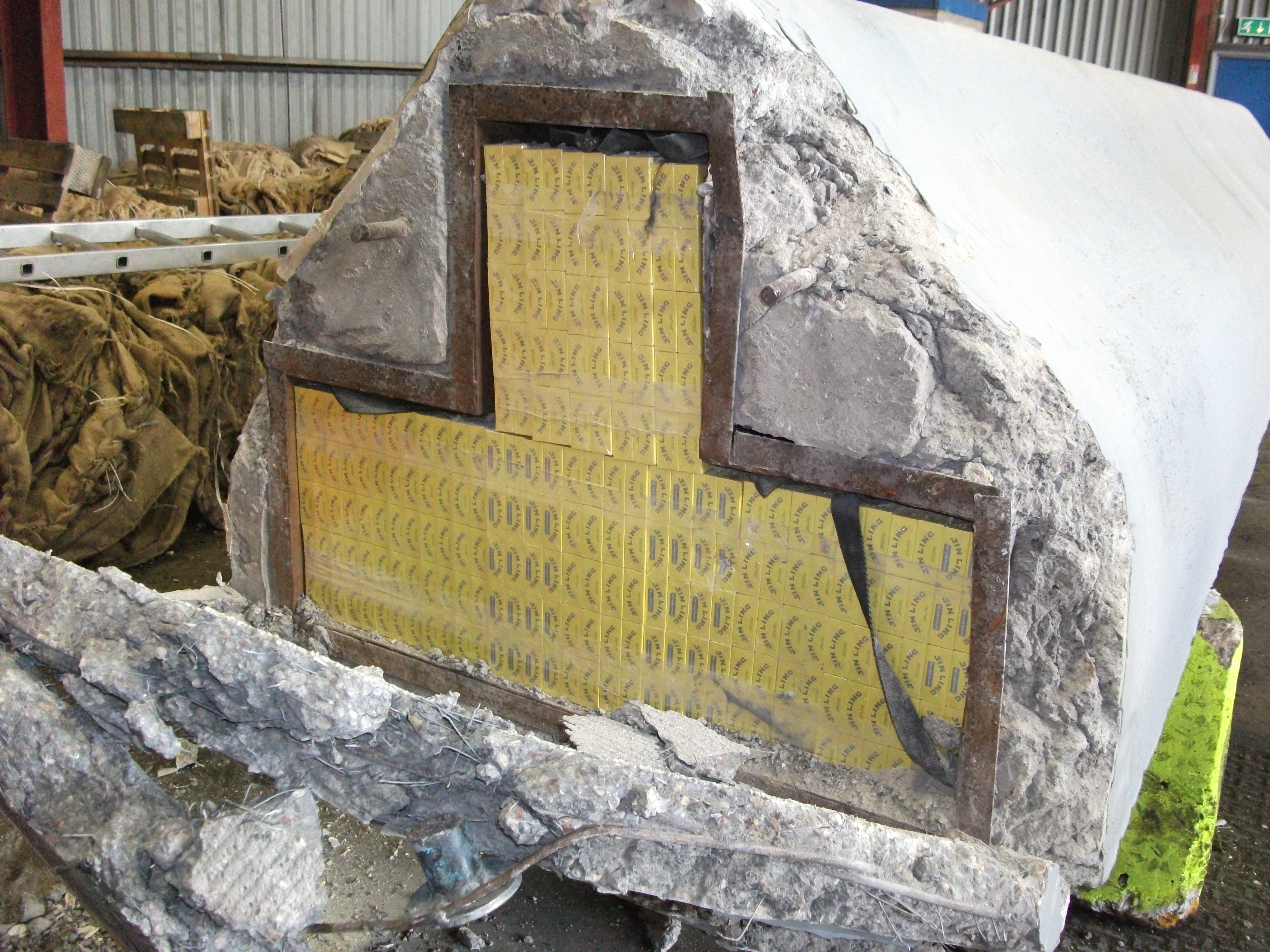
The illicit cigarette trade is defined as “the production, import, export, purchase, sale, or possession of tobacco goods which fail to comply with legislation” (FATF 2012). Illicit cigarette trade activities fall under 3 categories: # Contraband: cigarettes smuggled from abroad without domestic duty paid; # Counterfeit: cigarettes manufactured without authorization of the rightful owners, with intent to deceive consumers and to avoid paying duty; # Illicit whites: brands manufactured legitimately in one country, but smuggled and sold in another without duties being paid. Cigarette smuggling, also informally referred to as "buttlegging," is the illicit transportation of cigarettes or cigars from an administrative division with low taxation to a division with high taxation for sale and consumption. The practice, commonly used by the tobacco industry, organized crime syndicates and rebel groups, is a form of tax evasion. Interstate 95, a highway traversing the East Coast ... [...More Info...] [...Related Items...] OR: [Wikipedia] [Google] [Baidu] |
Drawbridge
A drawbridge or draw-bridge is a type of moveable bridge typically at the entrance to a castle or tower surrounded by a moat. In some forms of English, including American English, the word ''drawbridge'' commonly refers to all types of moveable bridges, such as bascule bridges, vertical-lift bridges and swing bridges, but this article concerns the narrower historical definition of the term where the bridge is used in a defensive structure. As used in castles or defensive structures, drawbridges provide access across defensive structures when lowered, but can quickly be raised from within to deny entry to an enemy force. Castle drawbridges Medieval castles were usually defended by a ditch or moat, crossed by a wooden bridge. In early castles the bridge might be designed to be destroyed or removed in the event of an attack, but drawbridges became very common. A typical arrangement would have the drawbridge immediately outside a gatehouse, consisting of a wooden deck with one ed ... [...More Info...] [...Related Items...] OR: [Wikipedia] [Google] [Baidu] |
Palisade
A palisade, sometimes called a stakewall or a paling, is typically a fence or defensive wall made from iron or wooden stakes, or tree trunks, and used as a defensive structure or enclosure. Palisades can form a stockade. Etymology ''Palisade'' derives from ''pale'', from the Latin word ', meaning stake, specifically when used side by side to create a wood defensive wall. Typical construction Typical construction consisted of small or mid-sized tree trunks aligned vertically, with as little free space in between as possible. The trunks were sharpened or pointed at the top, and were driven into the ground and sometimes reinforced with additional construction. The height of a palisade ranged from around a metre to as high as 3–4 m. As a defensive structure, palisades were often used in conjunction with earthworks. Palisades were an excellent option for small forts or other hastily constructed fortifications. Since they were made of wood, they could often be quickly and easil ... [...More Info...] [...Related Items...] OR: [Wikipedia] [Google] [Baidu] |
Fortifications Of Gibraltar
The Gibraltar peninsula, located at the far southern end of Iberia, has great strategic importance as a result of its position by the Strait of Gibraltar where the Mediterranean Sea meets the Atlantic Ocean. It has repeatedly been contested between European and North African powers and has endured fourteen sieges since it was first settled in the 11th century. The peninsula's occupants – Moors, Spanish, and British – have built successive layers of fortifications and defences including walls, bastions, casemates, gun batteries, magazines, tunnels and galleries. At their peak in 1865, the fortifications housed around 681 guns mounted in 110 batteries and positions, guarding all land and sea approaches to Gibraltar. Hughes & Migos, p. 91 The fortifications continued to be in military use until as late as the 1970s and by the time tunnelling ceased in the late 1960s, over of galleries had been dug in an area of only . Gibraltar's fortifications are clustered in three main a ... [...More Info...] [...Related Items...] OR: [Wikipedia] [Google] [Baidu] |
Cheval De Frise
The ''cheval de frise'' (plural: ''chevaux de frise'' , " Frisian horses") is a defensive obstacle, which existed in a number of forms and were employed in various applications. These included underwater constructions used to prevent the passage of ships or other vessels on rivers, or as anti-cavalry measure consisting of a portable frame (sometimes just a simple log) covered with many projecting long iron or wooden spikes or spears. They were principally intended as an anti- cavalry obstacle but could also be moved quickly to help block a breach in another barrier. They remained in occasional use until they were replaced by wire obstacles just after the American Civil War. During the Civil War, the Confederates used this type of barrier more often than the Union forces. During World War I, armies used ''chevaux de frise'' to temporarily plug gaps in barbed wire. Barbed wire ''chevaux de frise'' were used in jungle fighting on the South Pacific islands during World War II. ... [...More Info...] [...Related Items...] OR: [Wikipedia] [Google] [Baidu] |
Inundation, Gibraltar
The Inundation was a flooded and fortified area of ground on the sandy isthmus between Spain and Gibraltar, created by the British in the 18th century to restrict access to the territory as part of the fortifications of Gibraltar. It was originally a marshy area known as the Morass at the far south-western end of the isthmus, occupying the area adjacent to the north-western flank of the Rock of Gibraltar.#Hughes, Hughes & Migos, p. 267 The Morass was dug out and expanded to create an artificial lake which was further obstructed by iron and wooden obstacles in the water. Two small fortifications on either side controlled access to Gibraltar. The only road to and from the town ran along a narrow causeway between the Inundation and the sea which was enfiladed by batteries mounted on the lower slopes of the Rock.#Landmann, Landmann, "Gibraltar" The Inundation existed for about 200 years before it was infilled and built over after the Second World War. Creation of the Inundation Prior ... [...More Info...] [...Related Items...] OR: [Wikipedia] [Google] [Baidu] |


2009.jpg)


