|
Lamar Boulevard Bridge
The Lamar Boulevard Bridge is a historic arch bridge carrying Texas State Highway Loop 343 (Lamar Boulevard) over Lady Bird Lake in downtown Austin, Texas, United States. The bridge features six open-spandrel concrete arches spanning and carries tens of thousands of vehicles daily across the lake. Completed in 1942, the Lamar Boulevard Bridge was the second permanent bridge to cross the Colorado River (after the Ann W. Richards Congress Avenue Bridge), and one of the last Art Deco-style open-spandrel concrete arch bridges built in Texas. The bridge was named an Austin Landmark in 1993 and added to the National Register of Historic Places in 1994. History In the late 1930s, Austin had greatly outgrown its original town plan on the north bank of the Colorado River. In 1939, the city planned a new major north–south thoroughfare to run to the west of the Texas State Capitol and connect the city's western housing developments. This new street, eventually named Lamar Boulevard, wou ... [...More Info...] [...Related Items...] OR: [Wikipedia] [Google] [Baidu] |
Lady Bird Lake
Lady Bird Lake (formerly, and still colloquially referred to as Town Lake) is a river-like reservoir on the Colorado River in Austin, Texas, United States. The City of Austin created the reservoir in 1960 as a cooling pond for a new city power plant. The lake, which has a surface area of , is now used primarily for recreation and flood control. The reservoir is named in honor of former First Lady of the United States Lady Bird Johnson. Lady Bird Lake is the easternmost lake of a chain of reservoirs on the river, which is completely located in Texas, and should not be confused with the larger Colorado River located in the Southwestern United States. This chain, known locally as the Texas Highland Lakes, also includes Lake Buchanan, Inks Lake, Lake LBJ, Lake Marble Falls, Lake Travis, and Lake Austin. History The City of Austin constructed Longhorn Dam in 1960 to form Town Lake. The city needed the reservoir to serve as a cooling pond for the Holly Street Power Plant, which ope ... [...More Info...] [...Related Items...] OR: [Wikipedia] [Google] [Baidu] |
Waller Plan
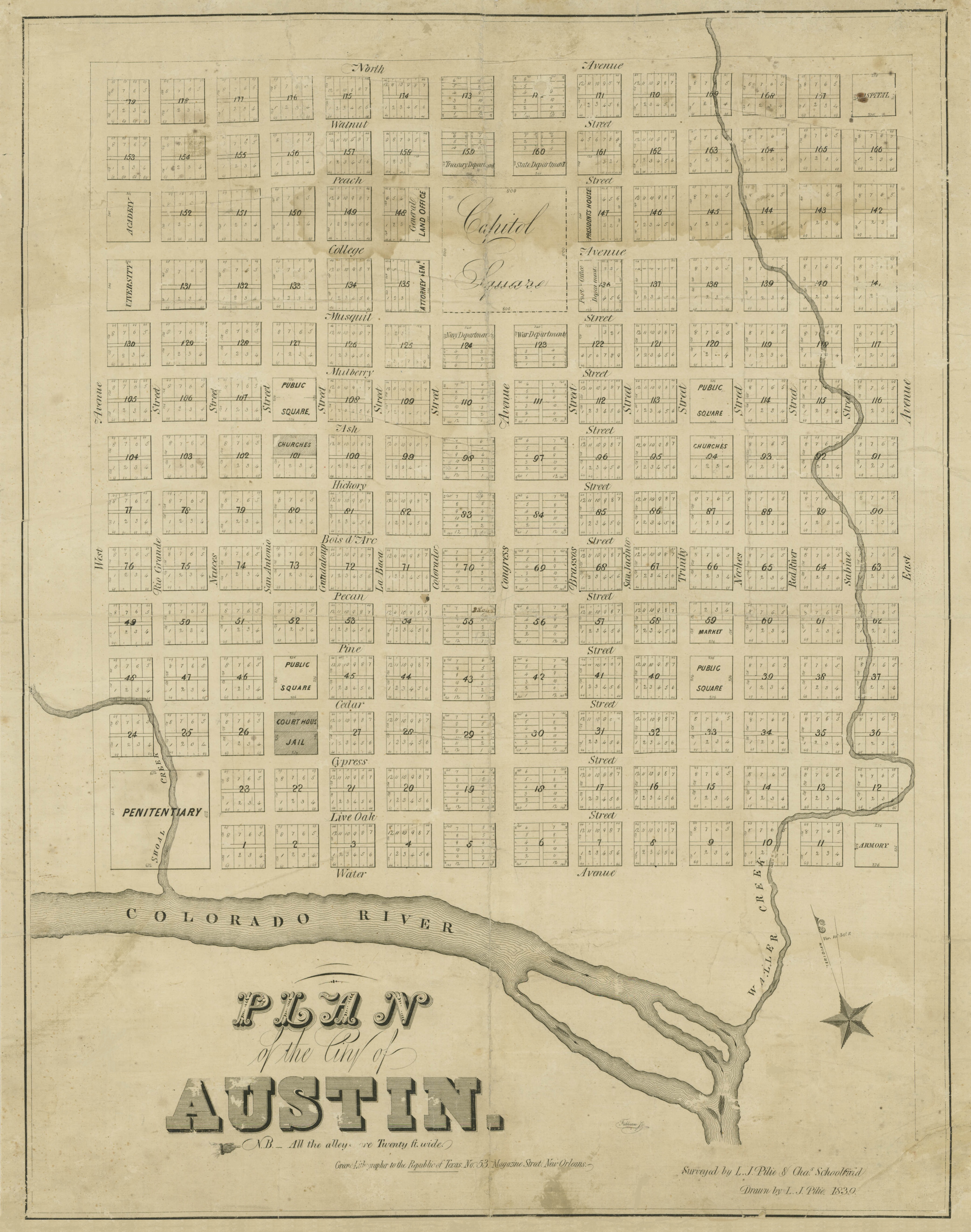
The 1839 Austin city plan (commonly known as the Waller Plan) is the original city plan for the development of Austin, Texas, which established the grid plan for what is now downtown Austin. It was commissioned in 1839 by the government of the Republic of Texas and developed by Edwin Waller, a Texian revolutionary and politician who would later become Austin's first mayor. History In January 1839 the Congress of the Republic of Texas appointed a committee to select a site for a new planned capital for the republic. Texas President Mirabeau B. Lamar instructed the committee to consider a site along the north bank of the Colorado River that he had visited the previous year. The committee was pleased with the site's scenery, resources, and central location within the country, and it approved the site in April, purchasing a parcel of of land that included the village of Waterloo. Shortly before the site selection was publicly announced, President Lamar appointed his friend Edwin ... [...More Info...] [...Related Items...] OR: [Wikipedia] [Google] [Baidu] |
Progressive Engineer
Progressive may refer to: Politics * Progressivism, a political philosophy in support of social reform ** Progressivism in the United States, the political philosophy in the American context * Progressive realism, an American foreign policy paradigm focused on producing measurable results in pursuit of widely supported goals Political organizations * Congressional Progressive Caucus, members within the Democratic Party in the United States Congress dedicated to the advancement of progressive issues and positions * Progressive Alliance (other) * Progressive Conservative (other) * Progressive Party (other) * Progressive Unionist (other) Other uses in politics * Progressive Era, a period of reform in the United States (c. 1890–1930) * Progressive tax, a type of tax rate structure Arts, entertainment, and media Music * Progressive music, a type of music that expands stylistic boundaries outwards * "Progressive" (song), a 2009 single b ... [...More Info...] [...Related Items...] OR: [Wikipedia] [Google] [Baidu] |
Sidewalk
A sidewalk (North American English), pavement (British English), footpath in Australia, India, New Zealand and Ireland, or footway, is a path along the side of a street, street, highway, terminals. Usually constructed of concrete, pavers, brick, stone, or asphalt, it is designed for pedestrians. A sidewalk is normally higher than the carriageway, roadway, and separated from it by a kerb (spelled "curb" in North America). There may also be a Road verge, planted strip between the sidewalk and the roadway and between the roadway and the adjacent land. In some places, the same term may also be used for a paved path, trail or footpath that is not next to a road, for example, a path through a park. Terminology The term "sidewalk" is preferred in most of North America. The term "pavement" is more common in the United Kingdom and other members of the Commonwealth of Nations, as well as parts of the Mid-Atlantic United States such as Philadelphia and parts of New Jersey. Many Commonwea ... [...More Info...] [...Related Items...] OR: [Wikipedia] [Google] [Baidu] |
Bicycle Lane
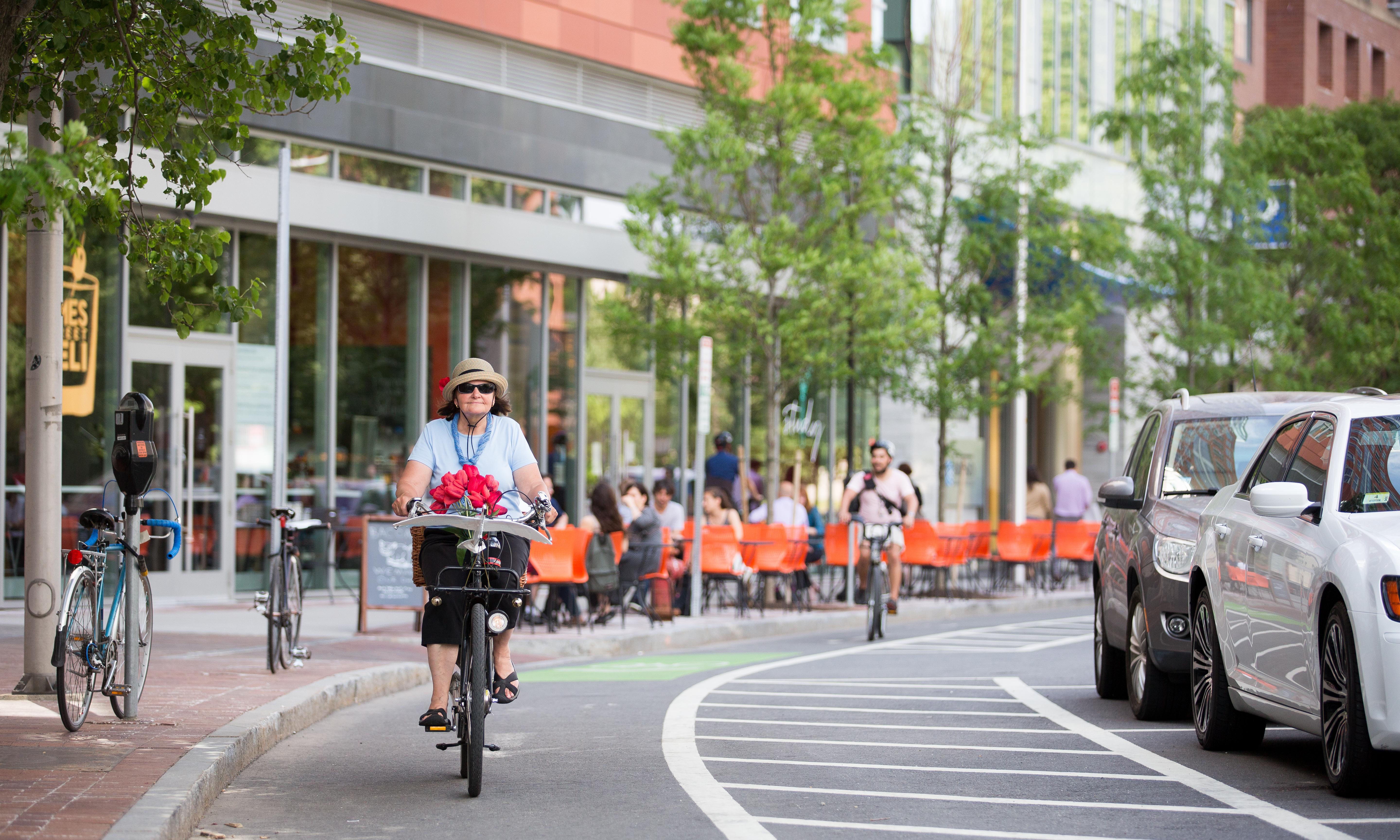
Bike lanes (US) or cycle lanes (UK) are types of bikeways (cycleways) with lanes on the roadway for cyclists only. In the United Kingdom, an on-road cycle-lane can be firmly restricted to cycles (marked with a solid white line, entry by motor vehicles is prohibited) or advisory (marked with a broken white line, entry by motor vehicles is permitted). In the United States, a ''designated bicycle lane'' (1988 MUTCD) or ''class II bikeway'' (Caltrans) is always marked by a solid white stripe on the pavement and is for 'preferential use' by bicyclists. There is also a ''class III bicycle route'', which has roadside signs suggesting a route for cyclists, and urging sharing the road. A ''class IV separated bike way'' (Caltrans) is a bike lane that is physically separate from motor traffic and restricted to bicyclists only. Effects According to a 2019 study, cities with separated bike lanes had 44% fewer road fatalities and 50% fewer serious injuries from crashes. The relationship wa ... [...More Info...] [...Related Items...] OR: [Wikipedia] [Google] [Baidu] |
KXAN
KXAN-TV (channel 36) is a television station in Austin, Texas, United States, affiliated with NBC. It is owned by Nexstar Media Group alongside Llano, Texas, Llano-licensed MyNetworkTV affiliate KBVO (TV), KBVO (channel 14); Nexstar also provides certain services to KNVA (channel 54), a ''de facto'' owned-and-operated station of The CW, under a local marketing agreement (LMA) with Vaughan Media. The stations share studios on West Farm to Market Road 969, Martin Luther King Jr. Boulevard in the Old West Austin Historic District, Old West Austin section, just west of the University of Texas at Austin campus and just north of Downtown Austin, downtown; the studios and offices consist of a setup which includes the main studio and newsroom, and an unconnected auxiliary office building across the street. KXAN-TV's transmitter is located at the West Austin Antenna Farm north of West Lake Hills, Texas, West Lake Hills. History The station first signed on the air on February 12, 1965, as ... [...More Info...] [...Related Items...] OR: [Wikipedia] [Google] [Baidu] |
Texas Capitol View Corridors
The Capitol View Corridors are a series of legal restrictions on construction in Austin, Texas, aimed at preserving protected views of the Texas State Capitol from various points around the city. First established by the Texas Legislature in 1983 and recodified in 2001, the corridors are meant to protect the capitol dome from obstruction by high-rise buildings. While supported by cultural and historical preservation organizations, the corridors have also been criticized for limiting the potential for the development of new tall structures in downtown Austin. History In 1931, the City of Austin, aiming to preserve the visual preeminence of the Texas State Capitol, enacted a local ordinance limiting the height of new buildings to a maximum of . From that time until the early 1960s, only the University of Texas Main Building Tower was built higher than the limit, using an exception allowing for additional height with a greater setback. On November 10, 1962, the '' Austin Statesma ... [...More Info...] [...Related Items...] OR: [Wikipedia] [Google] [Baidu] |
Longhorn Dam
Longhorn Dam is a dam crossing the Colorado River in Austin, Texas, United States, where it creates Lady Bird Lake. Completed in 1960, the dam was built by the City of Austin as the last in a chain of Colorado River dams in central Texas begun during the Great Depression. The name refers to its location on a ford used for longhorn cattle drives as a part of the Chisholm Trail in the late 19th century. History Longhorn Dam was constructed in the late 1950s to establish a cooling reservoir for Austin's Holly Street Power Plant, a 570-megawatt natural gas and fuel oil-fired electrical power plant. The reservoir it created, Lady Bird Lake, was also originally used as a source of drinking water for the city. It is not a hydroelectric dam and generates no electrical power. In 2007 the power plant was decommissioned and subsequently demolished to make way for a new lakeside urban park; today the reservoir's major uses are recreation and fishing. The stabilization of the downtown shorel ... [...More Info...] [...Related Items...] OR: [Wikipedia] [Google] [Baidu] |
World War II
World War II or the Second World War, often abbreviated as WWII or WW2, was a world war that lasted from 1939 to 1945. It involved the vast majority of the world's countries—including all of the great powers—forming two opposing military alliances: the Allies and the Axis powers. World War II was a total war that directly involved more than 100 million personnel from more than 30 countries. The major participants in the war threw their entire economic, industrial, and scientific capabilities behind the war effort, blurring the distinction between civilian and military resources. Aircraft played a major role in the conflict, enabling the strategic bombing of population centres and deploying the only two nuclear weapons ever used in war. World War II was by far the deadliest conflict in human history; it resulted in 70 to 85 million fatalities, mostly among civilians. Tens of millions died due to genocides (including the Holocaust), starvation, ma ... [...More Info...] [...Related Items...] OR: [Wikipedia] [Google] [Baidu] |
Street Light
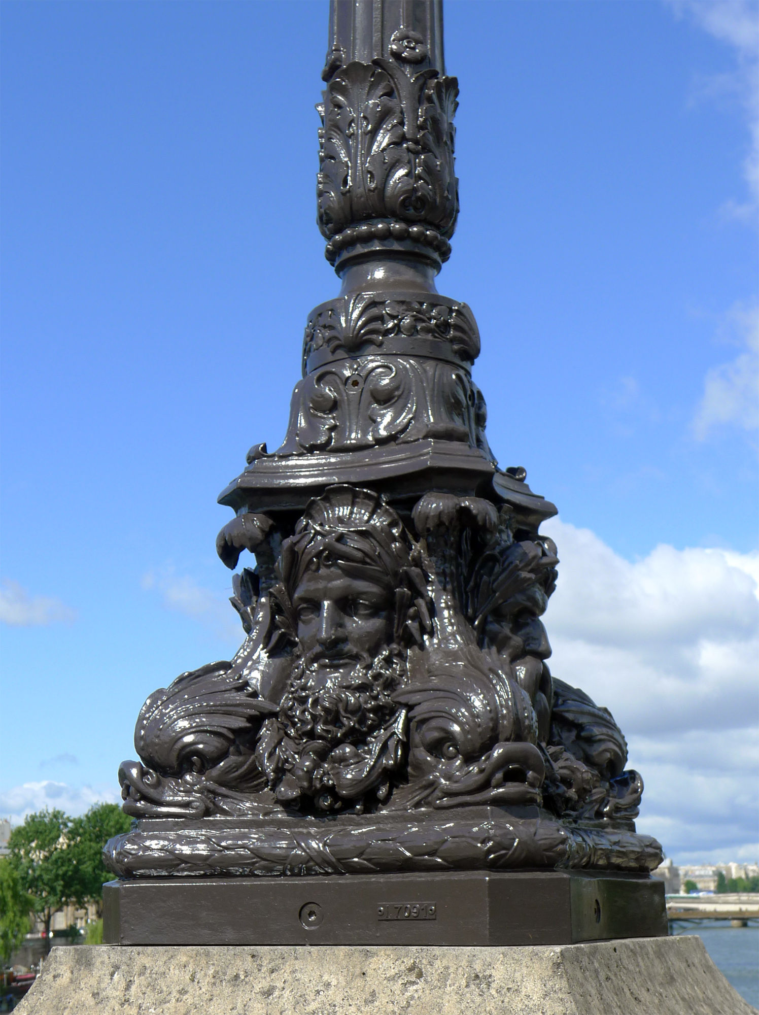
A street light, light pole, lamp pole, lamppost, street lamp, light standard, or lamp standard is a raised source of light on the edge of a road or path. Similar lights may be found on a railway platform. When urban electric power distribution became ubiquitous in developed countries in the 20th century, lights for urban streets followed, or sometimes led. Many lamps have light-sensitive photocells that activate the lamp automatically when needed, at times when there is little-to-no ambient light, such as at dusk, dawn, or at the onset of dark weather conditions. This function in older lighting systems could be performed with the aid of a solar dial. Many street light systems are being connected underground instead of wiring from one utility post to another. Street lights are an important source of public security lighting intended to reduce crime. History Preindustrial era Early lamps were used by Greek and Roman civilizations, where light primarily served the purpose of ... [...More Info...] [...Related Items...] OR: [Wikipedia] [Google] [Baidu] |
Texas Department Of Transportation
The Texas Department of Transportation (TxDOT ) is a government agency in the American state of Texas. Though the public face of the agency is generally associated with the construction and maintenance of the state's immense state highway system, the agency is also responsible for overseeing aviation, rail, and public transportation systems in the state. At one time, TxDOT also administered vehicle registration; but this function transferred to the Texas Department of Motor Vehicles, a state agency which began operations in November 2009. The agency has been headquartered in the Dewitt C. Greer Building at 125 East 11th Street in Downtown Austin, Texas, since 1933. History The Texas Legislature created the Texas Highway Department in 1916 to administer federal highway construction and maintenance. In 1975, its responsibilities increased when the agency merged with the Texas Mass Transportation Commission, resulting in the formation of the State Department of Highways and Pub ... [...More Info...] [...Related Items...] OR: [Wikipedia] [Google] [Baidu] |
Fredericksburg, Texas
Fredericksburg (german: Friedrichsberg) is the seat of Gillespie County, in the U.S. state of Texas. As of the 2010 Census, this city had a population of 10,530. Fredericksburg was founded in 1846 and named after Prince Frederick of Prussia. Old-time German residents often referred to Fredericksburg as Fritztown, a nickname that is still used in some businesses. It is approximately eighty miles west from Greater Austin. This city is also notable as the home of Texas German, a dialect spoken by the first generations of German settlers who initially refused to learn English. Fredericksburg shares many cultural characteristics with New Braunfels, which had been established by Prince Carl of Solms-Braunfels the previous year. Fredericksburg is the birthplace of Fleet Admiral Chester Nimitz. It is the sister city of Montabaur, Germany. On October 14, 1970, the Fredericksburg Historic District was added to the National Register of Historic Places in Texas. Geography Fredericksburg ... [...More Info...] [...Related Items...] OR: [Wikipedia] [Google] [Baidu] |


