|
Lake Seliger
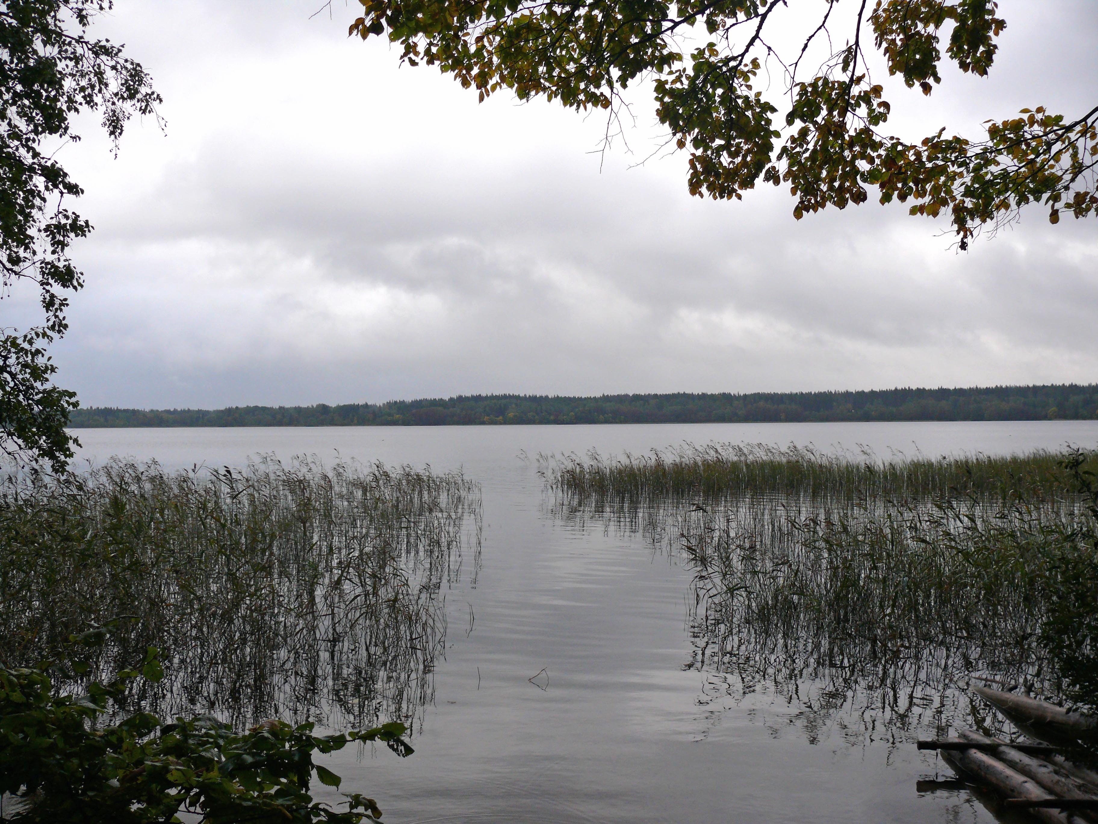
Seliger ( rus, Селиге́р, p=sʲɪlʲɪˈgʲɛr) is a lake in Ostashkovsky District of Tver Oblast and, in the extreme northern part, in Demyansky District of Novgorod Oblast of Russia, in the northwest of the Valdai Hills, a part of the Volga basin. It has the absolute height of , the area of , and the average depth of . Lake Seliger is a large system of lakes linked by effluents, has many small islands and is surrounded by forests, including pine woods with many berries and mushrooms. fro Russia InfoCentre Retrieved April 2009. It is one of the biggest natural lakes of Central Russia. The only outflow of the lake, the |
Stolobny Island
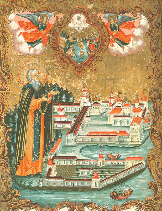
Stolobny Island is an island on Lake Seliger in the Tver Oblast of Russia, about north of the town of Ostashkov. Nilov Monastery The island is the home of Nilov Monastery, which was founded by Saint Nilus in 1594, and previously welcomed up to 40,000 pilgrims each year. Most of the buildings of the monastery were built in the 18th and 19th Centuries in a neoclassical style. Today the monastery complex remains one of the most impressive ensembles of Neoclassical architecture in Eastern Europe. Some of its churches date back to the 17th century. A graceful embankment was completed by 1812, and a large cathedral was built in 1821-25. The construction of the causeway to the island was completed in 1812. The Nilov Monastery was one of the largest and wealthiest monasteries in the Russian Empire. Origin of name Regarding the name of the island - "Stolobny" - there are two versions. At first, it got its name because of its shape, like a pole, and the second, is that there was an a ... [...More Info...] [...Related Items...] OR: [Wikipedia] [Google] [Baidu] |
Selizharovka River
The Selizharovka (russian: Селижа́ровка) is a river in Ostashkovsky and Selizharovsky Districts of Tver Oblast, Russia, a left tributary of the Volga. The length of the river is , and the area of its drainage basin is . It is one of the uppermost substantial tributaries of the Volga. The settlement of Selizharovo is located near the river mouth. The Selizharovka is the only outflow of Lake Seliger, the biggest natural lake of the Upper Volga basin. It starts at the southern corner of the lake, at the village of Nizhniye Kotitsy. It flows southeast, crosses into Selizharovsky District, and joins the Volga at the urban-type settlement of Selizharovo. The drainage basin of the Selizharovka includes the major part of Ostashkovsky District, south of Demyansky District of Novgorod Oblast, as well as minor areas in Firovsky District Firovsky District (russian: Фи́ровский райо́н) is an administrative and municipalLaw #4-ZO district (raion), one of the thi ... [...More Info...] [...Related Items...] OR: [Wikipedia] [Google] [Baidu] |
Lakes Of Novgorod Oblast
A lake is an area filled with water, localized in a basin, surrounded by land, and distinct from any river or other outlet that serves to feed or drain the lake. Lakes lie on land and are not part of the ocean, although, like the much larger oceans, they do form part of the Earth's water cycle. Lakes are distinct from lagoons, which are generally coastal parts of the ocean. Lakes are typically larger and deeper than ponds, which also lie on land, though there are no official or scientific definitions. Lakes can be contrasted with rivers or streams, which usually flow in a channel on land. Most lakes are fed and drained by rivers and streams. Natural lakes are generally found in mountainous areas, rift zones, and areas with ongoing glaciation. Other lakes are found in endorheic basins or along the courses of mature rivers, where a river channel has widened into a basin. Some parts of the world have many lakes formed by the chaotic drainage patterns left over from the last ice ... [...More Info...] [...Related Items...] OR: [Wikipedia] [Google] [Baidu] |
Gorodomlya Island
Gorodomlya Island () is located on Lake Seliger in Tver Oblast, Russia, northwest of Moscow. The closed urban-type settlement of Solnechny is located on the island. In June 1930, the People's Commissariat of Agriculture (''Narkomzem'') began construction on Gorodomlya Island of the Scientific-Research Institute for the Study of Foot-and-Mouth Disease. It was opened officially in October 1932 and incorporated the very best Soviet and imported equipment and its huge main building, occupying 25,000 square metres, incorporated both production facilities and research laboratories, a guinea pig nursery, biological wastewater treatment facilities, a museum, a library, a micro-photo laboratory, a cinema and a 100-seat lecture room. In 1934-1935, the FMD facility was transferred to the Red Army's BW facility, the Biotechnical Institute, also known by the code designation V/2-1094. German intelligence reported that the military institute was engaged in experiments focused on ''Francisell ... [...More Info...] [...Related Items...] OR: [Wikipedia] [Google] [Baidu] |
Solnechny, Tver Oblast
Solnechny (russian: Со́лнечный) is a closed urban locality (an urban-type settlement) in Tver Oblast, Russia, located on Gorodomlya Island on Lake Seliger. Population: Administrative and municipal status Within the framework of administrative divisions, it is incorporated as Solnechny Okrug—an administrative unit with the status equal to that of the districts A district is a type of administrative division that, in some countries, is managed by the local government. Across the world, areas known as "districts" vary greatly in size, spanning regions or counties, several municipalities, subdivisions o ....Law #34-ZO As a municipal division, Solnechny Okrug is incorporated as Solnechny Urban Okrug.Law #4-ZO References Notes Sources * * {{Use mdy dates, date=July 2012 Urban-type settlements in Tver Oblast Closed cities __NOTOC__ ... [...More Info...] [...Related Items...] OR: [Wikipedia] [Google] [Baidu] |
Resort
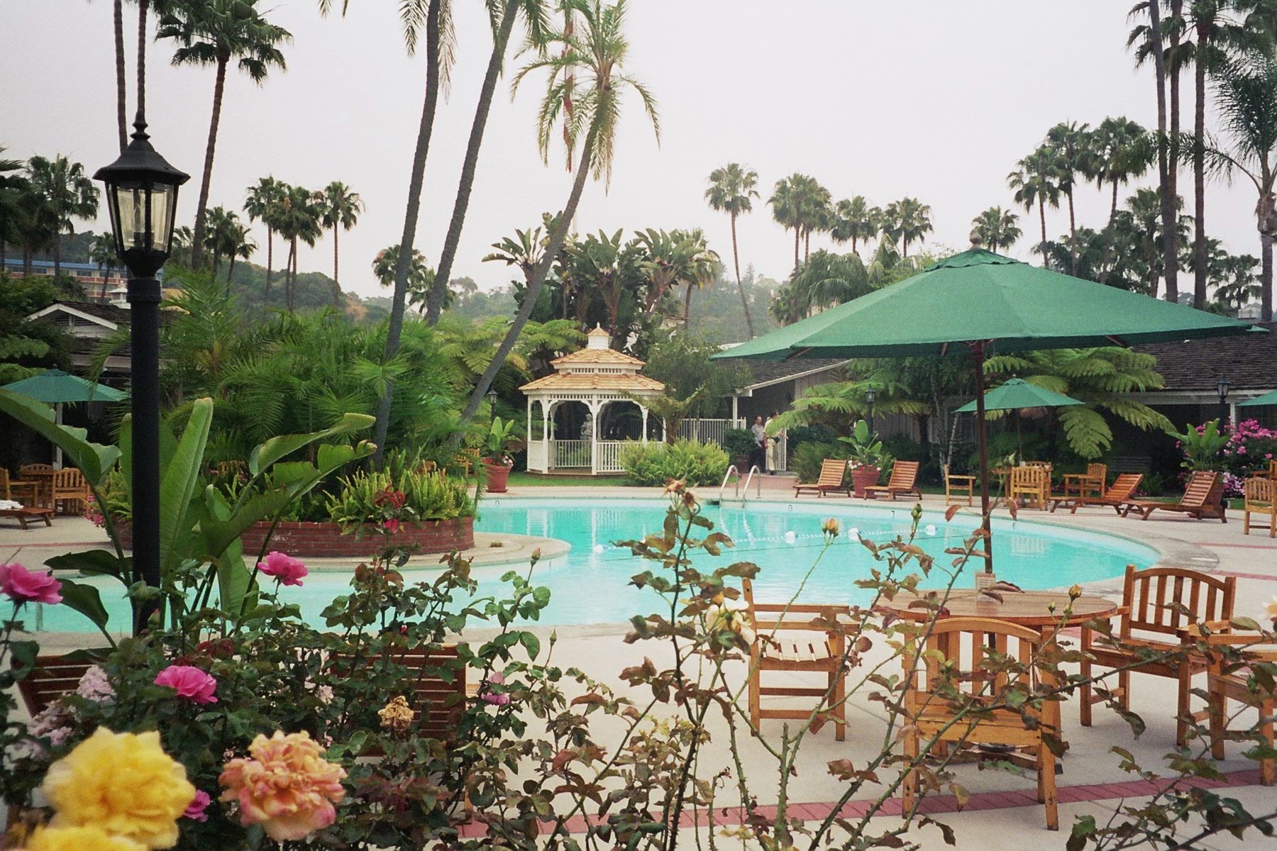
A resort (North American English) is a self-contained commercial establishment that tries to provide most of a vacationer's wants, such as food, drink, swimming, lodging, sports, entertainment, and shopping, on the premises. The term ''resort'' may be used for a hotel property that provides an array of amenities, typically including entertainment and recreational activities. A hotel is frequently a central feature of a resort, such as the Grand Hotel at Mackinac Island, Michigan. Some resorts are also condominium complexes that are timeshares or owned fractionally or wholly owned condominium. A resort is not always a commercial establishment operated by a single company, but in the late 20th century, that sort of facility became more common. In British English, "resort" means a town which people visit for holidays and days out which usually contains hotels at which such holidaymakers stay. Examples would include Blackpool and Brighton. Destination resort A destinatio ... [...More Info...] [...Related Items...] OR: [Wikipedia] [Google] [Baidu] |
Seliger (forum)
Seliger () is an educational forum ''(camp)'' held since 2005 at Lake Seliger in the Russian Tver Region (350 km from Moscow). Since 2015, it has been succeeded by a new forum organized by the Federal Agency for Youth Affairs "Rosmolodezh" on a new site, with a new name " Territory of Meanings" History The emblem of the Seliger Forum was a smiley face in a red garrison cap of the flag of the "Nashi" youth movement In 2000-2005, the first participants in this platform were activists of the Walking Together youth movement. In 2005-2008, the closed commissar camp of the youth movement "Nashi", for activists and commissars of the movement. In 2005, it was attended by about three thousand participants. The camp took place in one shift for two weeks and was divided into the following directions of movement: economic, social, tourist, mass actions. Commissars and activists of the Nashi movement from all regional and city branches gathered in the camp, shared their experiences, u ... [...More Info...] [...Related Items...] OR: [Wikipedia] [Google] [Baidu] |
Valdaysky National Park
Valdaysky National Park (russian: Валдайский национальный парк, Valdayskiy natsional'nyy park) is a national park in the north of Russia, located in Valdaysky, Okulovsky, and Demyansky Districts of Novgorod Oblast. It was established May 17, 1990. Since 2004, the National Park has the status of a UNESCO Biosphere Reserve. Valdaysky National Park, which includes the town of Valday, Lake Valdayskoye, and the northern part of Lake Seliger, is one of the most popular tourist destinations in Central Russia and has well-developed tourist infrastructure. History The area of the park in the Middle Ages belonged to the Novgorod Republic. In particular, one of the versions puts the location of the Ignach Cross, a place mentioned in the chronicles where Mongols advancing to Novgorod in 1238 turned back, inside the park limits. (The precise location is unknown). Valday was first mentioned in a chronicle in 1495. The growth of Valday was facilitated by constru ... [...More Info...] [...Related Items...] OR: [Wikipedia] [Google] [Baidu] |
Lake Baikal
Lake Baikal (, russian: Oзеро Байкал, Ozero Baykal ); mn, Байгал нуур, Baigal nuur) is a rift lake in Russia. It is situated in southern Siberia, between the federal subjects of Irkutsk Oblast to the northwest and the Republic of Buryatia to the southeast. With of water, Lake Baikal is the world's largest freshwater lake by volume, containing 22–23% of the world's fresh surface water, more than all of the North American Great Lakes combined. It is also the world's deepest lake, with a maximum depth of , and the world's oldest lake, at 25–30 million years. At —slightly larger than Belgium—Lake Baikal is the world's seventh-largest lake by surface area. It is among the world's clearest lakes. Lake Baikal is home to thousands of species of plants and animals, many of them endemic to the region. It is also home to Buryat tribes, who raise goats, camels, cattle, sheep, and horses on the eastern side of the lake, where the mean temperature var ... [...More Info...] [...Related Items...] OR: [Wikipedia] [Google] [Baidu] |
Firovsky District
Firovsky District (russian: Фи́ровский райо́н) is an administrative and municipalLaw #4-ZO district (raion), one of the thirty-six in Tver Oblast, Russia. It is located in the north of the oblast and borders with the urban-type settlement of Ozyorny in the north, Bologovsky District in the northeast, Vyshnevolotsky District in the east, Kuvshinovsky District in the south, Ostashkovsky District in the southwest, Demyansky District of Novgorod Oblast in the west, and with Valdaysky District, also of Novgorod Oblast, in the northwest. The area of the district is . Its administrative center is the urban locality (an urban-type settlement) of Firovo. Population: 9,396 ( 2010 Census); The population of Firovo accounts for 25.9% of the district's total population. Geography Almost the whole area of the district belongs to the drainage basin of the Msta River and thus to the Baltic Sea. The rivers in the northern part of the district drain into the Shlina River and it ... [...More Info...] [...Related Items...] OR: [Wikipedia] [Google] [Baidu] |
Drainage Basin
A drainage basin is an area of land where all flowing surface water converges to a single point, such as a river mouth, or flows into another body of water, such as a lake or ocean. A basin is separated from adjacent basins by a perimeter, the '' drainage divide'', made up of a succession of elevated features, such as ridges and hills. A basin may consist of smaller basins that merge at river confluences, forming a hierarchical pattern. Other terms for a drainage basin are catchment area, catchment basin, drainage area, river basin, water basin, and impluvium. In North America, they are commonly called a watershed, though in other English-speaking places, "watershed" is used only in its original sense, that of a drainage divide. In a closed drainage basin, or endorheic basin, the water converges to a single point inside the basin, known as a sink, which may be a permanent lake, a dry lake, or a point where surface water is lost underground. Drainage basins are similar ... [...More Info...] [...Related Items...] OR: [Wikipedia] [Google] [Baidu] |


.jpg)

