|
Lake Neale
Lake Neale (together with Lake Amadeus, Pitjantjatjara dialect, Pitjantjatjara: ''Pantu'' ("salt lakes")) is a salt lake in the southwest corner of the Northern Territory of Australia. It is on the north-western side of Lake Amadeus. The two lakes form part of a chain of salt lakes that stretches about , from Lake Hopkins in the west to the Finke River in the east. This drainage basin is known as the Amadeus Basin. The lake is usually a dry Salt pan (geology), salt pan, and only holds water for short periods after heavy rainfall. Lake Neale is on Aboriginal Australians, Aboriginal land, held in the Petermann Aboriginal Land Trust. The Haasts Bluff, Northern Territory, Haasts Bluff lands are nearby to the north. Description Lake Neale was named after Frank Neale, one of the pilots of an aerial expedition to accurately survey the desert regions northwest of Alice Springs in 1930. Neale flew one of the two planes that had been hired by explorer Donald George Mackay, Donald Mackay for ... [...More Info...] [...Related Items...] OR: [Wikipedia] [Google] [Baidu] |
Petermann, Northern Territory
__NOTOC__ Petermann is a locality in the Northern Territory of Australia located about south of the territory capital of Darwin City, Northern Territory, Darwin in the territory’s south-western corner adjoining the states of South Australia and Western Australia. The locality consists of the following land (from west to east) – the Petermann Aboriginal Land Trust, the Katiti Aboriginal Land Trust and the NT Portion 1798 (better known as the Uluru-Kata Tjuta National Park), the Land Settlement Aboriginal Corporation and NT Portion 6665 (better known as the Watarrka National Park), the Urrampinyi Iltjiltjarri Aboriginal Land Trust and the pastoral leases of Curtin Springs, Angas Downs and Mulga Park. The locality fully surrounds the communities of Kaltukatjara, Northern Territory, Kaltukatjara and Mutitjulu, Northern Territory, Mutitjulu, and the locality of Yulara, Northern Territory, Yulara. Petermann is named after the Petermann Ranges (Australia), Petermann Ranges, a m ... [...More Info...] [...Related Items...] OR: [Wikipedia] [Google] [Baidu] |
Aboriginal Australians
Aboriginal Australians are the various Indigenous peoples of the Australian mainland and many of its islands, such as Tasmania, Fraser Island, Hinchinbrook Island, the Tiwi Islands, and Groote Eylandt, but excluding the Torres Strait Islands. The term Indigenous Australians refers to Aboriginal Australians and Torres Strait Islanders collectively. It is generally used when both groups are included in the topic being addressed. Torres Strait Islanders are ethnically and culturally distinct, despite extensive cultural exchange with some of the Aboriginal groups. The Torres Strait Islands are mostly part of Queensland but have a separate governmental status. Aboriginal Australians comprise many distinct peoples who have developed across Australia for over 50,000 years. These peoples have a broadly shared, though complex, genetic history, but only in the last 200 years have they been defined and started to self-identify as a single group. Australian Aboriginal identity has cha ... [...More Info...] [...Related Items...] OR: [Wikipedia] [Google] [Baidu] |
Mount Unapproachable
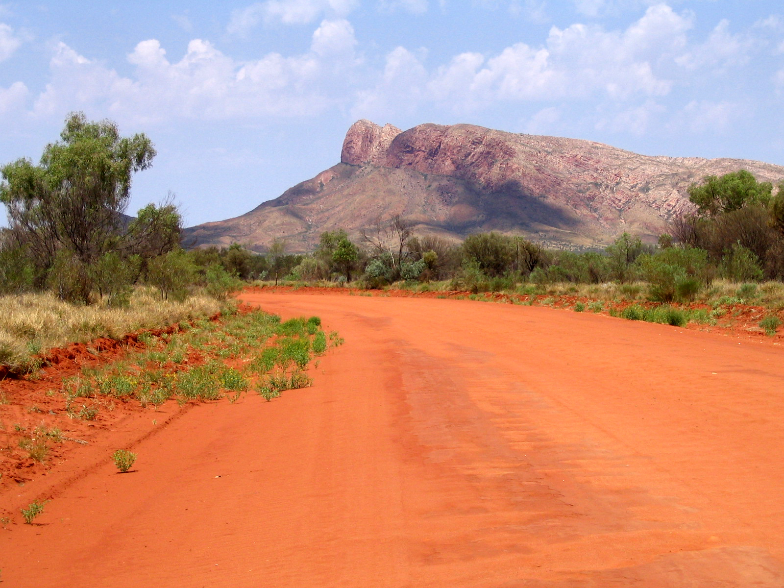
Mount Unapproachable is an isolated mountain in the Northern Territory of Australia located in the locality of Petermann on the northern side of Lake Neale in the territory's southwest. It is about above sea level. The area is remote: the nearest towns are Kaltukatjara some away, Kintore some away and Yulara away. The mountain is mostly made of sandstone. Unapproachable was named by the explorer Ernest Giles in 1872, whilst on an expedition across central Australia. He had just sighted and named Lake Amadeus, and could see the mountain rising to the west. He hoped to find water at the mountain, but was unable to approach it, as his path was blocked by the lake. Giles in fact over-estimated the size of Lake Amadeus and missed the bridge of land between Amadeus and Lake Neale. In 1889, Giles' second-in-command, William Tietkens, returned on his own expedition to survey the area. In his journal, Tietkens wrote that he first travelled to the Bloods Range, to the south of Lakes ... [...More Info...] [...Related Items...] OR: [Wikipedia] [Google] [Baidu] |
Kata Tjuta
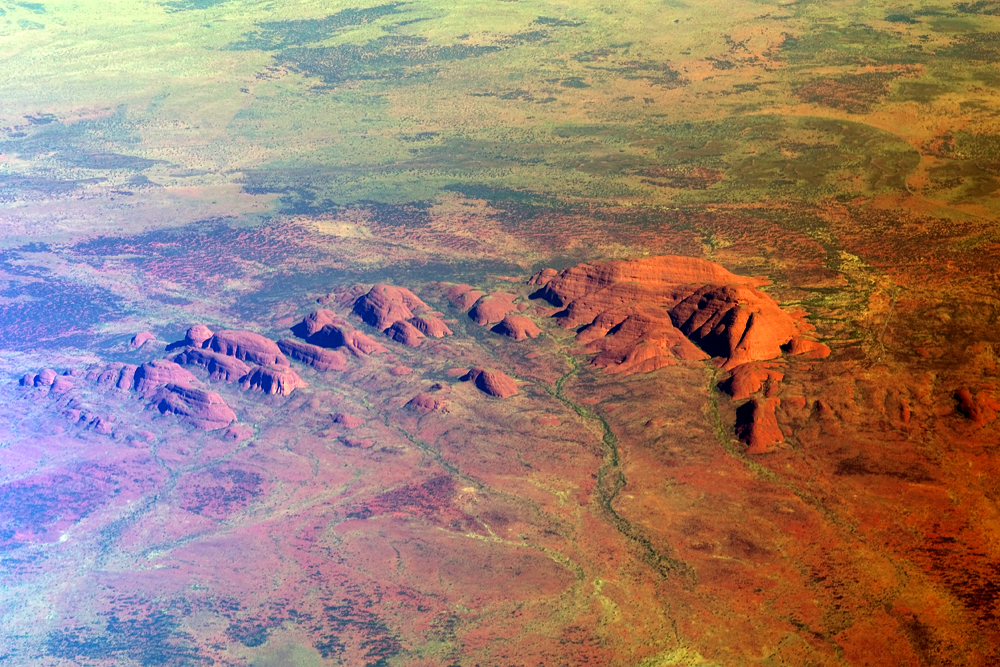
Kata Tjuṯa / The Olgas (Pitjantjatjara: , lit. 'many heads'; ) is a group of large, domed rock formations or bornhardts located about southwest of Alice Springs, in the southern part of the Northern Territory, central Australia. Uluṟu / Ayers Rock, located to the east, and Kata Tjuṯa / The Olgas form the two major landmarks within the Uluṟu-Kata Tjuṯa National Park. The park is considered sacred to the Aboriginal people of Australia. The 36 domes that make up Kata Tjuṯa / Mount Olga cover an area of are composed of conglomerate, a sedimentary rock consisting of cobbles and boulders of varying rock types including granite and basalt, cemented by a matrix of coarse sandstone. The highest dome, Mount Olga, is above sea level, or approximately above the surrounding plain higher than Uluṟu). [...More Info...] [...Related Items...] OR: [Wikipedia] [Google] [Baidu] |
Ernest Giles
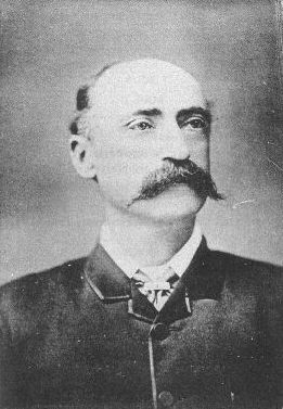
William Ernest Powell Giles (20 July 1835 – 13 November 1897), best known as Ernest Giles, was an Australian explorer who led five major expeditions to parts of South Australia and Western Australia. Early life Ernest Giles was born in Bristol, England, the eldest son of William Giles ( – 28 May 1860), a merchant, and Jane Elizabeth Giles, ''née'' Powell ( – 15 March 1879). Their family had been in comfortable circumstances but fell on hard times and emigrated to Australia. William Giles was living in North Adelaide by 1850 and Melbourne by 1853. William was later employed by Customs in Victoria, and his wife founded a successful school for girls in that colony. Giles was educated at Christ's Hospital school, Newgate, London. In 1850, at the age of 15, he emigrated to Australia, joining his parents in Adelaide. In 1852 Giles went to the Victorian goldfields, then became a clerk at the Post Office in Melbourne, and later at the County Court. Soon tiring of town life Gi ... [...More Info...] [...Related Items...] OR: [Wikipedia] [Google] [Baidu] |
White People
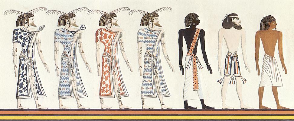
White is a racialized classification of people and a skin color specifier, generally used for people of European origin, although the definition can vary depending on context, nationality, and point of view. Description of populations as "White" in reference to their skin color predates this notion and is occasionally found in Greco-Roman ethnography and other ancient or medieval sources, but these societies did not have any notion of a White or pan-European race. The term "White race" or "White people", defined by their light skin among other physical characteristics, entered the major European languages in the later seventeenth century, when the concept of a "unified White" achieve universal acceptance in Europe, in the context of racialized slavery and unequal social status in the European colonies. Scholarship on race distinguishes the modern concept from pre-modern descriptions, which focused on physical complexion rather than race. Prior to the modern era, no Europe ... [...More Info...] [...Related Items...] OR: [Wikipedia] [Google] [Baidu] |
Lake Mackay
Lake Mackay, known as Wilkinkarra to the Indigenous Pintupi people, is the largest of hundreds of ephemeral salt lakes scattered throughout the Pilbara and northern parts of the Goldfields-Esperance region of Western Australia and the Northern Territory. It is located within the Great Sandy Desert. The lake is the largest in Western Australia and has a surface area of . Its elevation ranges between and above mean sea-level. Description Lake Mackay is the fourth largest lake in Australia. It measures approximately east-west and north-south. The darker areas of the lakebed are indicative of some form of desert vegetation or algae, some moisture within the soils of the dry lake, and the lowest elevations where pooling of water occurs. In this arid environment, salts and other minerals are carried to the surface through capillary action caused by evaporation, thereby producing the white reflective surface. Visible are various brown hills scattered across the eastern half of th ... [...More Info...] [...Related Items...] OR: [Wikipedia] [Google] [Baidu] |
Donald George Mackay
Donald George Mackay CBE (29 June 187017 September 1958) was an Australian outdoorsman, long-distance cyclist, and explorer who conducted several expeditions to the remotest areas of the Australian continent. Early life Donald George Mackay was born on 29 June 1870 at Yass, New South Wales, son of Alexander Mackay, owner of Wallendbeen station, and his wife Annie. Mackay was educated at Wallendbeen Public School and at Oaklands School, Mittagong. After a brief engineering apprenticeship he worked for his father until the latter's death in 1890. During 1890-99 Mackay travelled extensively abroad, and later prospected for gold in western New South Wales. Cycling expedition around Australia In July 1899 Mackay belatedly joined brothers Alex and Frank White to become the first men to travel around the continent of Australia on a bicycle. Mackay's 24-in. frame, 29 lb. ''DUX'' bicycle was especially strengthened to carry Mackay's weight plus his gear, which included two water cans ... [...More Info...] [...Related Items...] OR: [Wikipedia] [Google] [Baidu] |
Alice Springs
Alice Springs ( aer, Mparntwe) is the third-largest town in the Northern Territory of Australia. Known as Stuart until 31 August 1933, the name Alice Springs was given by surveyor William Whitfield Mills after Alice, Lady Todd (''née'' Alice Gillam Bell), wife of the telegraph pioneer Sir Charles Todd. Known colloquially as 'The Alice' or simply 'Alice', the town is situated roughly in Australia's geographic centre. It is nearly equidistant from Adelaide and Darwin. The area is also known locally as Mparntwe to its original inhabitants, the Arrernte, who have lived in the Central Australian desert in and around what is now Alice Springs for tens of thousands of years. Alice Springs had an urban population of 26,534 Estimated resident population, 30 June 2018. in June 2018, having declined an average of 1.16% per year the preceding five years. The town's population accounts for approximately 10 per cent of the population of the Northern Territory. The town straddles th ... [...More Info...] [...Related Items...] OR: [Wikipedia] [Google] [Baidu] |
Frank Neale
Frank Neale, AFC (14 September 1895 – 24 December 1979) was a British-born Australian aviator. Born in England, he served in the Royal Flying Corps and the Royal Air Force during the First World War, then moved to Australia in the mid-1920s to continue a notable career as a pioneer aviator. From 1925 until 1939 he flew thousands of hours covering most of Australia, and ventured overseas a number of times. At the outbreak of the Second World War he joined the Royal Australian Air Force Reserve, rising to wing commander and being awarded the Air Force Cross prior to his discharge in 1946. Early service Records in the UK National Archives show Neale's home address was Thornwood, Epping, Essex with next of kin Mrs G. Neale, his mother. His occupation prior to the First World War was Mechanical and Electrical Engineer, and his initial service during the war was in the Army Service Corps Motor Transport as a probationary second lieutenant. Neale changed to the Royal Flying Corps ( ... [...More Info...] [...Related Items...] OR: [Wikipedia] [Google] [Baidu] |
Haasts Bluff, Northern Territory
Haasts Bluff, also known as Ikuntji, is an Aboriginal Australian community in Central Australia, a region of the Northern Territory. The community is located in the MacDonnell Shire local government area, west of Alice Springs. At the 2006 census, the community, including outstations, had a population of 207. History The Haasts Bluff community takes its name from the nearby outcrop, given this name in 1872 by the explorer Ernest Giles, after the German-born New Zealand geologist, Julius von Haast. The locality was established as a Lutheran mission in 1946, and is home to Western Arrernte, Pintupi and Pitjantjatjara people. The term "Finke River Mission" was initially an alternative name for the Hermannsburg Mission, but this name was later often used to include the settlements at Haasts Bluff, Areyonga and, later, Papunya. It now refers to all Lutheran missionary activity in Central Australia since the first mission was established at Hermannsburg in 1877. Art A number of n ... [...More Info...] [...Related Items...] OR: [Wikipedia] [Google] [Baidu] |
Salt Pan (geology)
Natural salt pans or salt flats are flat expanses of ground covered with salt and other minerals, usually shining white under the sun. They are found in deserts and are natural formations (unlike salt evaporation ponds, which are artificial). A salt pan forms by evaporation of a water pool, such as a lake or pond. This happens in climates where the rate of water evaporation exceeds the rate of that is, in a desert. If the water cannot drain into the ground, it remains on the surface until it evaporates, leaving behind minerals precipitated from the salt ions dissolved in the water. Over thousands of years, the minerals (usually salts) accumulate on the surface. These minerals reflect the sun's rays (through radiation) and often appear as white areas. Salt pans can be dangerous. The crust of salt can conceal a quagmire of mud that can engulf a truck. The Qattara Depression in the eastern Sahara Desert contains many such traps which served as strategic barriers during World ... [...More Info...] [...Related Items...] OR: [Wikipedia] [Google] [Baidu] |


