 |
Lake Manzaleh
Lake Manzala ( ar, بحيرة المنزلة ''baḥīrat manzala''), also Manzaleh, is a brackish lake, sometimes called a lagoon, in northeastern Egypt on the Nile Delta near Port Said and a few miles from the ancient ruins at Tanis.Dinar, p.51 It is the largest of the northern deltaic lakes of Egypt. As of 2008 it is 47 km long and 30 km wide.Zahran, p.283 Etymology The lake's name derives from . In Middle Ages it was also known as pi-Manjōili (), translated into Greek as Xenedokhou (), thus making the modern Arabic name a translation of a Coptic one, where phonetic resemblance is only coincidental. Geography Lake Manzala is long but quite shallow. Though Lake Manzala's unaltered depth is only four to five feet, alterations to the depth were made during the construction of the Suez Canal to allow the Canal to extend 29 miles lengthwise along the lake. Its bed is soft clay. Before construction of the Suez Canal, Lake Manzala was separated from the Mediterranean ... [...More Info...] [...Related Items...] OR: [Wikipedia] [Google] [Baidu] |
 |
Nile Delta
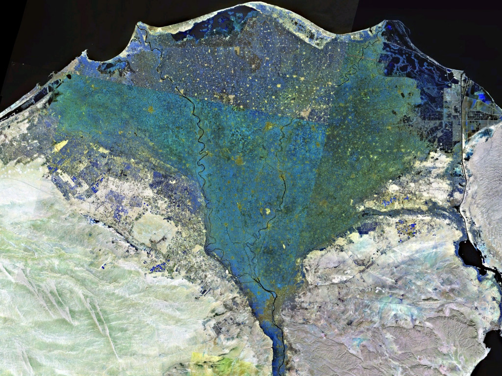
The Nile Delta ( ar, دلتا النيل, or simply , is the delta formed in Lower Egypt where the Nile River spreads out and drains into the Mediterranean Sea. It is one of the world's largest river deltas—from Alexandria in the west to Port Said in the east, it covers of Mediterranean coastline and is a rich agricultural region. From north to south the delta is approximately in length. The Delta begins slightly down-river from Cairo. Geography From north to south, the delta is approximately in length. From west to east, it covers some of coastline. The delta is sometimes divided into sections, with the Nile dividing into two main distributaries, the Damietta and the Rosetta, flowing into the Mediterranean at port cities with the same name. In the past, the delta had several distributaries, but these have been lost due to flood control, silting and changing relief. One such defunct distributary is Wadi Tumilat. The Suez Canal is east of the delta and enters ... [...More Info...] [...Related Items...] OR: [Wikipedia] [Google] [Baidu] |
 |
Port Said
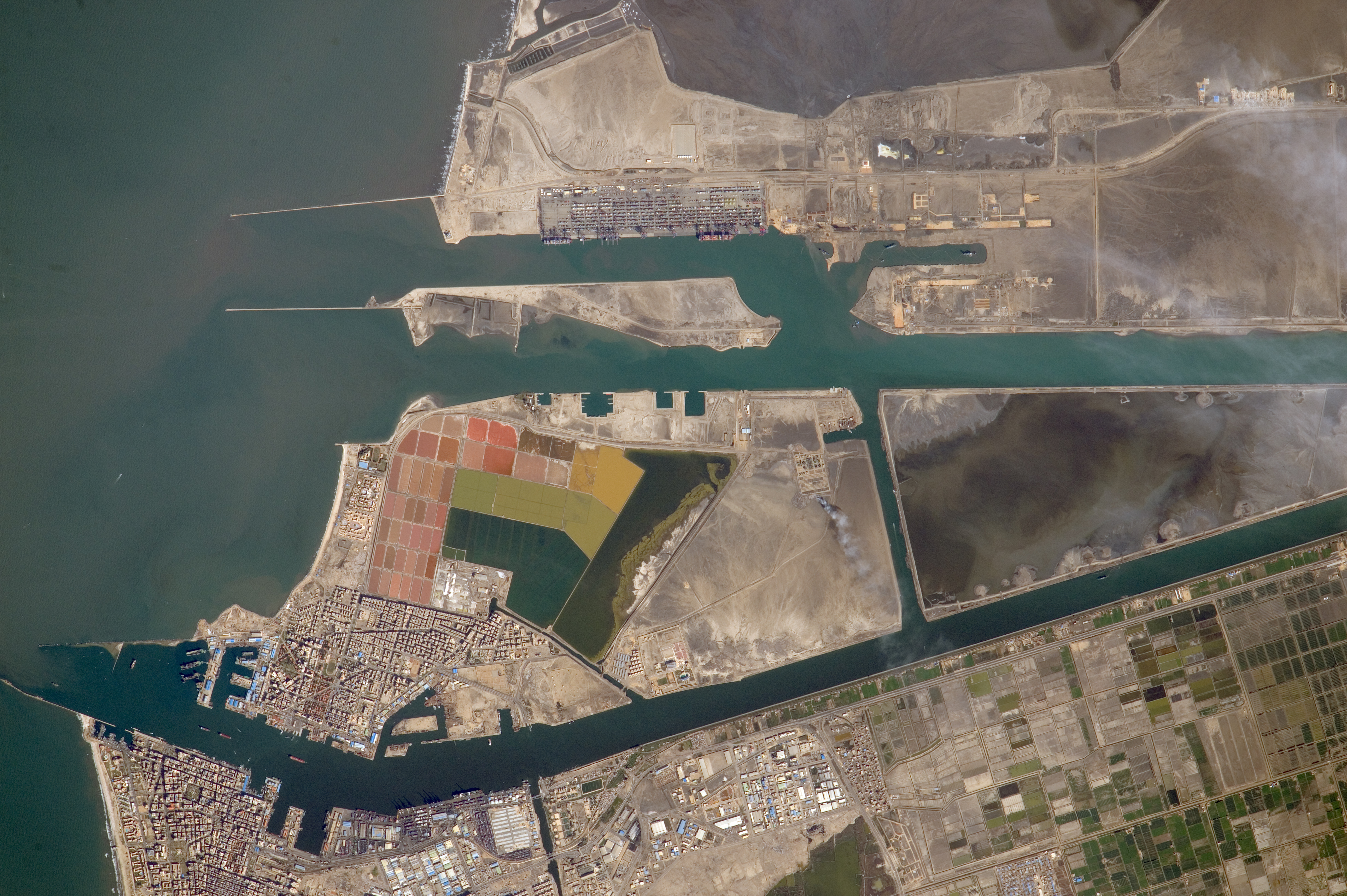
Port Said ( ar, بورسعيد, Būrsaʿīd, ; grc, Πηλούσιον, Pēlousion) is a city that lies in northeast Egypt extending about along the coast of the Mediterranean Sea, north of the Suez Canal. With an approximate population of 603,787 (2010), it is the fifth-largest city in Egypt. The city was established in 1859 during the building of the Suez Canal. There are numerous old houses with grand balconies on all floors, giving the city a distinctive look. Port Said's twin city is Port Fuad, which lies on the eastern bank of the Suez Canal. The two cities coexist, to the extent that there is hardly any town centre in Port Fuad. The cities are connected by free ferries running all through the day, and together they form a metropolitan area with over a million residents that extends both on the African and the Asian sides of the Suez Canal. The only other metropolitan area in the world that also spans two continents is Istanbul. Port Said acted as a global city si ... [...More Info...] [...Related Items...] OR: [Wikipedia] [Google] [Baidu] |
 |
Tanis, Egypt
Tanis ( grc, Τάνις or Τανέως ) or San al-Hagar ( ar, صان الحجر, Ṣān al-Ḥaǧar; egy, ḏꜥn.t ; ; cop, ϫⲁⲛⲓ or or ) is the Greek name for ancient Egyptian ''ḏꜥn.t'', an important archaeological site in the north-eastern Nile Delta of Egypt, and the location of a city of the same name. It is located on the Tanitic branch of the Nile, which has long since silted up. The first study of Tanis dates to 1798 during Napoléon Bonaparte's expedition to Egypt. Engineer Pierre Jacotin drew up a map of the site in the ''Description de l'Égypte''. It was first excavated in 1825 by Jean-Jacques Rifaud, who discovered the two pink granite sphinxes now in the Musée du Louvre, and then by François Auguste Ferdinand Mariette between 1860 and 1864, and subsequently by William Matthew Flinders Petrie from 1883 to 1886. The work was taken over by Pierre Montet from 1929 to 1956, who discovered the royal necropolis dating to the Third Intermediate Period ... [...More Info...] [...Related Items...] OR: [Wikipedia] [Google] [Baidu] |
 |
Middle Ages
In the history of Europe, the Middle Ages or medieval period lasted approximately from the late 5th to the late 15th centuries, similar to the post-classical period of global history. It began with the fall of the Western Roman Empire and transitioned into the Renaissance and the Age of Discovery. The Middle Ages is the middle period of the three traditional divisions of Western history: classical antiquity, the medieval period, and the modern period. The medieval period is itself subdivided into the Early Early may refer to: History * The beginning or oldest part of a defined historical period, as opposed to middle or late periods, e.g.: ** Early Christianity ** Early modern Europe Places in the United States * Early, Iowa * Early, Texas * Early ..., High Middle Ages, High, and Late Middle Ages. Population decline, counterurbanisation, the collapse of centralized authority, invasions, and mass migrations of tribes, which had begun in late antiquity, continued i ... [...More Info...] [...Related Items...] OR: [Wikipedia] [Google] [Baidu] |
 |
Mediterranean Sea
The Mediterranean Sea is a sea connected to the Atlantic Ocean, surrounded by the Mediterranean Basin and almost completely enclosed by land: on the north by Western and Southern Europe and Anatolia, on the south by North Africa, and on the east by the Levant. The Sea has played a central role in the history of Western civilization. Geological evidence indicates that around 5.9 million years ago, the Mediterranean was cut off from the Atlantic and was partly or completely desiccated over a period of some 600,000 years during the Messinian salinity crisis before being refilled by the Zanclean flood about 5.3 million years ago. The Mediterranean Sea covers an area of about , representing 0.7% of the global ocean surface, but its connection to the Atlantic via the Strait of Gibraltar—the narrow strait that connects the Atlantic Ocean to the Mediterranean Sea and separates the Iberian Peninsula in Europe from Morocco in Africa—is only wide. The Mediterranean ... [...More Info...] [...Related Items...] OR: [Wikipedia] [Google] [Baidu] |
|
Port Said Airport
Port Said Airport serves the city of Port Said, Egypt, at the north end of the Suez Canal. In 2011, the airport served 36,962 passengers (-5.5% vs. 2010). Modernisation The airport underwent a modernisation program with a partial inauguration in February 2011. The airport is seen to be vital for the coastal city and to sustain its industrial expansion plans. Airlines and destinations There are currently no scheduled services to and from the airport. Accidents and incidents *During a training flight on 15 January 2008, a Beech C90B King Air operated by the Nuclear Centre Survey crashed 500 meters from the airport while performing circuits, killing both the pilot and training pilot. from |
|
 |
Suez Canal
The Suez Canal ( arz, قَنَاةُ ٱلسُّوَيْسِ, ') is an artificial sea-level waterway in Egypt, connecting the Mediterranean Sea to the Red Sea through the Isthmus of Suez and dividing Africa and Asia. The long canal is a popular trade route between Europe and Asia. In 1858, Ferdinand de Lesseps formed the Suez Canal Company for the express purpose of building the canal. Construction of the canal lasted from 1859 to 1869. The canal officially opened on 17 November 1869. It offers vessels a direct route between the North Atlantic and northern Indian oceans via the Mediterranean Sea and the Red Sea, avoiding the South Atlantic and southern Indian oceans and reducing the journey distance from the Arabian Sea to London by approximately , or 10 days at to 8 days at . The canal extends from the northern terminus of Port Said to the southern terminus of Port Tewfik at the city of Suez. In 2021, more than 20,600 vessels traversed the canal (an average of 56 per d ... [...More Info...] [...Related Items...] OR: [Wikipedia] [Google] [Baidu] |
|
Lake Timsah
Lake Timsah, also known as Crocodile Lake ( ar, بُحَيْرة التِّمْسَاح); is a lake in Egypt on the Nile delta. It lies in a basin developed along a fault extending from the Mediterranean Sea to the Gulf of Suez through the Bitter Lakes region. In 1800, a flood filled the Wadi Tumilat, which caused Timsah's banks to overflow and moved water south into the Bitter Lakes about nine miles (14 km) away. In 1862, the lake was filled with waters from the Red Sea, and became part of the Suez Canal. Geography Lake Timsah lies within a depression that spans the isthmus between the Red Sea and the Mediterranean Sea. The lowest points of the depression form shallow natural lakes, of which Timsah is one. The surface area of Lake Timsah covers 5.4 square miles. Most of the lake is marshy and depth rarely exceeds 3 feet (1 metre). It has been asserted that, in ancient times, Lake Timsah was the northern terminus of the Red Sea.''The Columbia Encyclopedia'', Sixth Edi ... [...More Info...] [...Related Items...] OR: [Wikipedia] [Google] [Baidu] |
|
|
Great Bitter Lake
The Great Bitter Lake ( ar, البحيرة المرة الكبرى; transliterated: ''al-Buḥayrah al-Murra al-Kubrā'') is a large saltwater lake in Egypt that is part of the Suez Canal. Before the canal was built in 1869, the Great Bitter Lake was a fresh water lake that was fed by a distributary of the Nile. Farming was conducted at this Sea of Reeds the same way as the delta and Nile riverbanks. The British maps show a wet basin of fresh water before the Suez canal turned it in to a sea of salt. References are made to the Great Bitter Lake in the ancient Pyramid Texts. The canal connects the Great Bitter Lake to the Mediterranean Sea and the Red Sea. The canal also connects it to the Small Bitter Lake ( ar, البحيرة المرة الصغرى; transliterated: al-Buhayrah al-Murra as-Sughra). Ships traveling through the Suez Canal use the Great Bitter Lake as a "passing lane", where they can pass other ships or turn around. Salinity The salinity of the lake varies al ... [...More Info...] [...Related Items...] OR: [Wikipedia] [Google] [Baidu] |
|
 |
Fishermen In Egypt
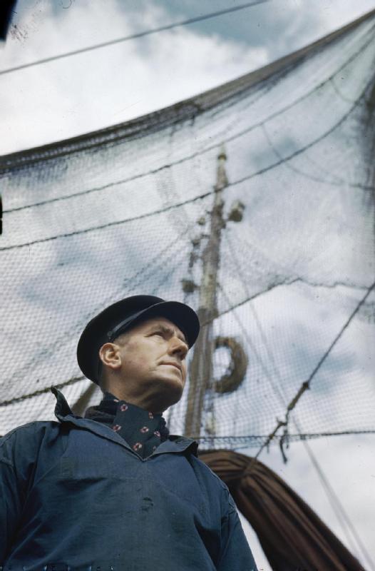
A fisher or fisherman is someone who captures fish and other animals from a body of water, or gathers shellfish. Worldwide, there are about 38 million commercial and subsistence fishers and fish farmers. Fishers may be professional or recreational. Fishing has existed as a means of obtaining food since the Mesolithic period.Early humans followed the coast BBC News articles 
History [...More Info...] [...Related Items...] OR: [Wikipedia] [Google] [Baidu] |
 |
Hectare
The hectare (; SI symbol: ha) is a non-SI metric unit of area equal to a square with 100- metre sides (1 hm2), or 10,000 m2, and is primarily used in the measurement of land. There are 100 hectares in one square kilometre. An acre is about and one hectare contains about . In 1795, when the metric system was introduced, the ''are'' was defined as 100 square metres, or one square decametre, and the hectare (" hecto-" + "are") was thus 100 ''ares'' or km2 (10,000 square metres). When the metric system was further rationalised in 1960, resulting in the International System of Units (), the ''are'' was not included as a recognised unit. The hectare, however, remains as a non-SI unit accepted for use with the SI and whose use is "expected to continue indefinitely". Though the dekare/decare daa (1,000 m2) and are (100 m2) are not officially "accepted for use", they are still used in some contexts. Description The hectare (), although not a unit of SI, ... [...More Info...] [...Related Items...] OR: [Wikipedia] [Google] [Baidu] |
 |
Lakes Of Egypt
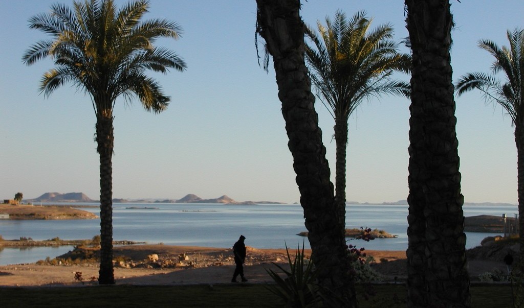
Egypt contains many lakes currently and other lakes that have vanished. Current lakes Lake Nasser A vast reservoir in southern Egypt and northern Sudan created by the damming of the Nile after the construction of the High Dam of Aswan. Manzala Lake Salt or brackish water lake. In northeastern Egypt on the Nile Delta near Port Said, Damietta, Dakahlyia and Sharqyia governorates. Maryut Lake A salt lake in northern Egypt, between Alexandria and Al-Buhira ( Beheira actually is named after it) Governorates. Lake Bardawil Salt water Lake in North Sinai Governorate. It is said that it is named after King Baldwin I of Jerusalem of the First Crusade and that he was buried there. Lake Moeris or Qaroun Lake Brackish water Lake. South River Nile Delta in Fayoum Governorate. Wadi Elrayan Lakes Brackish water Lake. In Fayoum Governorate Edko Lake Salt water lake in Al Bouhaira Governorate Toshka Lakes River water Lake. In South Western Part of Egypt. Great Bitter ... [...More Info...] [...Related Items...] OR: [Wikipedia] [Google] [Baidu] |