|
Lake Arrowhead, California
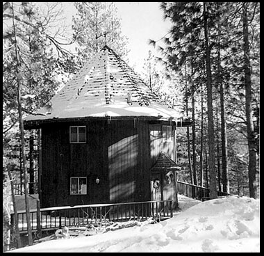
Lake Arrowhead is an unincorporated community and a census-designated place (CDP) in the San Bernardino Mountains of San Bernardino County, California, surrounded by the San Bernardino National Forest, and surrounding the eponymous Lake Arrowhead Reservoir. Lake Arrowhead is located 13 miles north east of the San Bernardino city limits. The population of the CDP was estimated at 12,424 in the 2010 census. It was formerly called "Little Bear Lake", until around 1920, when a group from Los Angeles, the Arrowhead Lake Company, bought the lake and the land surrounding it, and changed its name to Arrowhead Lake. Tourism is the primary economic generator for the area, contributing several million dollars per year to the county and providing hundreds of full-time and part-time jobs for local residents. The area is host to over 4 million visitors a year. There are 400 guest rooms in hotels, motels and bed and breakfasts, vacation cabin rentals, condos, and rustic cabin lodges and resorts ... [...More Info...] [...Related Items...] OR: [Wikipedia] [Google] [Baidu] |
Census-designated Place
A census-designated place (CDP) is a concentration of population defined by the United States Census Bureau for statistical purposes only. CDPs have been used in each decennial census since 1980 as the counterparts of incorporated places, such as self-governing cities, towns, and villages, for the purposes of gathering and correlating statistical data. CDPs are populated areas that generally include one officially designated but currently unincorporated community, for which the CDP is named, plus surrounding inhabited countryside of varying dimensions and, occasionally, other, smaller unincorporated communities as well. CDPs include small rural communities, edge cities, colonias located along the Mexico–United States border, and unincorporated resort and retirement communities and their environs. The boundaries of any CDP may change from decade to decade, and the Census Bureau may de-establish a CDP after a period of study, then re-establish it some decades later. Mo ... [...More Info...] [...Related Items...] OR: [Wikipedia] [Google] [Baidu] |
San Bernardino National Forest
The San Bernardino National Forest is a United States National Forest in Southern California encompassing of which are federal. The forest is made up of two main divisions, the eastern portion of the San Gabriel Mountains and the San Bernardino Mountains on the easternmost of the Transverse Ranges, and the San Jacinto and Santa Rosa Mountains on the northernmost of the Peninsular Ranges. Elevations range from 2,000 to 11,499 feet (600 to 3505 m). The forest includes seven wilderness areas: San Gorgonio, Cucamonga, San Jacinto, South Fork, Santa Rosa, Cahuilla Mountain and Bighorn Mountain. Forest headquarters are located in the city of San Bernardino. There are district offices in Lytle Creek, Idyllwild, and Fawnskin. This site was the filming location for ''Daniel Boone'' in 1936; part of the 1969 musical film '' Paint Your Wagon'' was shot here. Free camping is available at 47 different 'Yellow Post' campsites located throughout the forest. Geogra ... [...More Info...] [...Related Items...] OR: [Wikipedia] [Google] [Baidu] |
Crest Park, California
Crest Park is an unincorporated community in San Bernardino County, California, United States. Crest Park is located in the San Bernardino Mountains on California State Route 18 south of Lake Arrowhead. Crest Park had a post office A post office is a public facility and a retailer that provides mail services, such as accepting letters and parcels, providing post office boxes, and selling postage stamps, packaging, and stationery. Post offices may offer additional serv ... with ZIP code 92326, which opened in 1949. References San Bernardino Mountains[...More Info...] [...Related Items...] OR: [Wikipedia] [Google] [Baidu] |
Rimforest, California
Rimforest is an unincorporated community in the San Bernardino Mountains of San Bernardino County, California, United States. It is located along California State Route 18. Rimforest has a post office with ZIP code 92378, which opened in 1949. Rimforest was featured in a season 5 episode of ''Storage Wars ''Storage Wars'' (stylized as ''STORAGE WAR$'') is an American reality television competition series that airs on A&E (TV channel), A&E. It initially aired for 12 seasons, from December 1, 2010, to January 30, 2019. A 13th season premiered in ....'' References External linksRimforest on Google Maps Unincorporated communities in San Bernardino County, California Unincorporated communities in California {{SanBernardinoCountyCA-geo-stub ... [...More Info...] [...Related Items...] OR: [Wikipedia] [Google] [Baidu] |
Blue Jay, California
Blue Jay is an unincorporated community located in San Bernardino County in California. It is located in the San Bernardino Mountains, above a region of California known as the Inland Empire. It is within the San Bernardino National Forest. Blue Jay Village itself is located one mile from the southwestern bank of Lake Arrowhead. The town is a part of the Lake Arrowhead Community. Other towns in this community are Lake Arrowhead, Running Springs and Cedar Glen. History The town started as the homestead of Art and Norma Wixom. They leased a few vacation cabins and opened a store in 1914. Stoney DeMent leased the land and built a market called The Blue Jay Market in 1934. The store was named for the blue colored birds that live in the area, and this later became the name of the town built up around it. The naming of the town is something of a misnomer: the local variety of jay is actually the Steller's jay, not the closely related blue jay The blue jay (''Cyanocitta cr ... [...More Info...] [...Related Items...] OR: [Wikipedia] [Google] [Baidu] |
Cedar Glen, California
Cedar Glen, California is an unincorporated community in located in the San Bernardino National Forest resort area of San Bernardino County immediately east of Lake Arrowhead. The community lies at an elevation of 5403 ft (1647 m). The town's ZIP Code is 92321 and it lies entirely within area code 909. The nearest highway is California State Highway 173 which bisects Cedar Glen and passes through Lake Arrowhead. Demographics As of the census of 2000, there were 552 people and 590 housing units. The racial makeup of the CDP was 86.6% White, <0.1% , <0.1% Native American, 9.2% Asi ... [...More Info...] [...Related Items...] OR: [Wikipedia] [Google] [Baidu] |
Inland Empire (California)
The Inland Empire (IE) is a metropolitan area and region inland of and adjacent to coastal Southern California, centering around the cities of San Bernardino and Riverside, and bordering Los Angeles County to the west. It includes the cities of western Riverside County and southwestern San Bernardino County, and is considered to include the desert communities of the Coachella and Victor Valleys, respectively on the other sides of the San Gorgonio Pass and San Bernardino Mountains from the Santa Ana River watershed that forms the bulk of the Inland Empire; a much broader definition includes all of Riverside and San Bernardino counties. The combined land area of the counties of the Inland Empire is larger than ten U.S. states—West Virginia, Maryland, Hawaii, Massachusetts, Vermont, New Hampshire, New Jersey, Connecticut, Delaware and Rhode Island—and slightly smaller than the combined area of the five smallest U.S. states (New Hampshire through Rhode Island). Th ... [...More Info...] [...Related Items...] OR: [Wikipedia] [Google] [Baidu] |
Highland, California
Highland (and neighboring "East Highlands") is a city in San Bernardino County, California, United States. The population of the city was 53,104 as of the 2010 census, up from 44,605 at the 2000 census. The term ''Highland'' also refers to a geographical area of the city of San Bernardino (generally east of Del Rosa Avenue to the eastern city limits), and parts of unincorporated San Bernardino County. Highland is generally divided into two regions, East Highlands and Highland (Generally considered west of State Route 210, with the majority of inhabitants living east of the freeway.) Geography Highland is located at (34.118459, -117.202370). According to the United States Census Bureau, the city has a total area of 18.9 square miles (48.9 km). 18.8 square miles (48.6 km) of it is land and 0.1 square miles (0.3 km) of it (0.71%) is water. Demographics 2010 At the 2010 census Highland had a population of 53,104. The population density was . The racial makeup ... [...More Info...] [...Related Items...] OR: [Wikipedia] [Google] [Baidu] |
University Of California, Los Angeles
The University of California, Los Angeles (UCLA) is a public university, public Land-grant university, land-grant research university in Los Angeles, California. UCLA's academic roots were established in 1881 as a Normal school, teachers college then known as the southern branch of the California State Normal School (now San Jose State University, San José State University). This school was absorbed with the official founding of UCLA as the Southern Branch of the University of California in 1919, making it the second-oldest of the 10-campus University of California system (after UC Berkeley). UCLA offers 337 undergraduate and graduate degree programs in a wide range of disciplines, enrolling about 31,600 undergraduate and 14,300 graduate and professional students. UCLA received 174,914 undergraduate applications for Fall 2022, including transfers, making the school the most applied-to Higher education in the United States, university in the United States. The university is or ... [...More Info...] [...Related Items...] OR: [Wikipedia] [Google] [Baidu] |
Tourism
Tourism is travel for pleasure or business; also the theory and practice of touring, the business of attracting, accommodating, and entertaining tourists, and the business of operating tours. The World Tourism Organization defines tourism more generally, in terms which go "beyond the common perception of tourism as being limited to holiday activity only", as people "travelling to and staying in places outside their usual environment for not more than one consecutive year for leisure and not less than 24 hours, business and other purposes". Tourism can be domestic (within the traveller's own country) or international, and international tourism has both incoming and outgoing implications on a country's balance of payments. Tourism numbers declined as a result of a strong economic slowdown (the late-2000s recession) between the second half of 2008 and the end of 2009, and in consequence of the outbreak of the 2009 H1N1 influenza virus, but slowly recovered until the COV ... [...More Info...] [...Related Items...] OR: [Wikipedia] [Google] [Baidu] |


