|
Lacy's Caves
Lacy's Caves are a series of five chambers in the red sandstone cliff of the River Eden, Cumbria, River Eden, just north of Little Salkeld, Cumbria, England, near Nunnery, Cumbria, at . They are named after Lieutenant-Colonel Samuel Lacy of nearby Salkeld Hall, who commissioned their carving in the 18th century. The reason for their creation is unknown; however, they were used by Lacy for entertaining guests, and the area was originally planted with ornamental gardens. The site is a listed Regionally Important Geological Site by Eden, Cumbria, Eden District Council and public footpaths to the site are well maintained. Some of the path follows the line of a former Tramway (industrial), tramway connecting Long Meg Mine with the nearby Settle–Carlisle line. The site is close to the ancient stone circle Long Meg and Her Daughters, and is on a popular circular walk. References External links Eden District Council list of Regionally Important Geological SitesArticle on Visit Cu ... [...More Info...] [...Related Items...] OR: [Wikipedia] [Google] [Baidu] |
River Eden, Cumbria
The River Eden is a river that flows through the Eden District of Cumbria, England, on its way to the Solway Firth. Etymology The river was known to the Romans as the ''Itouna'', as recorded by the Greek geographer Claudius Ptolemaeus (Ptolemy) in the 2nd century AD. This name derives from the Celtic word ''ituna'', meaning ''water'', or ''rushing''. Thus there is no relation to the biblical Garden of Eden. Course of river The Eden rises in Black Fell Moss, Mallerstang, on the high ground between High Seat, Yorkshire Dales and Hugh Seat. Here it forms the boundary between the counties of Cumbria and North Yorkshire. Two other rivers arise in the same peat bogs here, within a kilometre of each other: the River Swale and River Ure. It starts life as Red Gill Beck, then becomes Hell Gill Beck, before turning north and joining with Ais Gill Beck to become the River Eden. (Hell Gill Force, just before it meets Ais Gill Beck, is the highest waterfall along its journey to the sea ... [...More Info...] [...Related Items...] OR: [Wikipedia] [Google] [Baidu] |
Little Salkeld
Little Salkeld is a small village and former civil parish, now in the parish of Hunsonby, in the Eden district of Cumbria, England, a few miles to the north east of Penrith. In 1931 the civil parish had a population of 91. History The manor at Little Salkeld was confirmed by King Edward I in 1292. It is believed to be the original home of the Salkeld family of landowners. Little Salkeld was formerly a township in Addingham parish, from 1866 Little Salkeld was a civil parish in its own right until it was abolished on 1 April 1934 and merged with Hunsonby and Winskill to create Hunsonby. Places of interest ''Little Salkeld Watermill'', built in 1745, is a traditional English 18th-century water mill. It is Cumbria's only watermill still in full operation. Salkeld Hall is the village's largest house; built in the 16th century incorporating earlier walls. It is privately owned. The village contains a vicarage but no church - it was built for Addingham parish church one mile ... [...More Info...] [...Related Items...] OR: [Wikipedia] [Google] [Baidu] |
Cumbria
Cumbria ( ) is a ceremonial and non-metropolitan county in North West England, bordering Scotland. The county and Cumbria County Council, its local government, came into existence in 1974 after the passage of the Local Government Act 1972. Cumbria's county town is Carlisle, in the north of the county. Other major settlements include Barrow-in-Furness, Kendal, Whitehaven and Workington. The administrative county of Cumbria consists of six districts ( Allerdale, Barrow-in-Furness, Carlisle, Copeland, Eden and South Lakeland) and, in 2019, had a population of 500,012. Cumbria is one of the most sparsely populated counties in England, with 73.4 people per km2 (190/sq mi). On 1 April 2023, the administrative county of Cumbria will be abolished and replaced with two new unitary authorities: Westmorland and Furness (Barrow-in-Furness, Eden, South Lakeland) and Cumberland ( Allerdale, Carlisle, Copeland). Cumbria is the third largest ceremonial county in England by area. It i ... [...More Info...] [...Related Items...] OR: [Wikipedia] [Google] [Baidu] |
Salkeld Hall
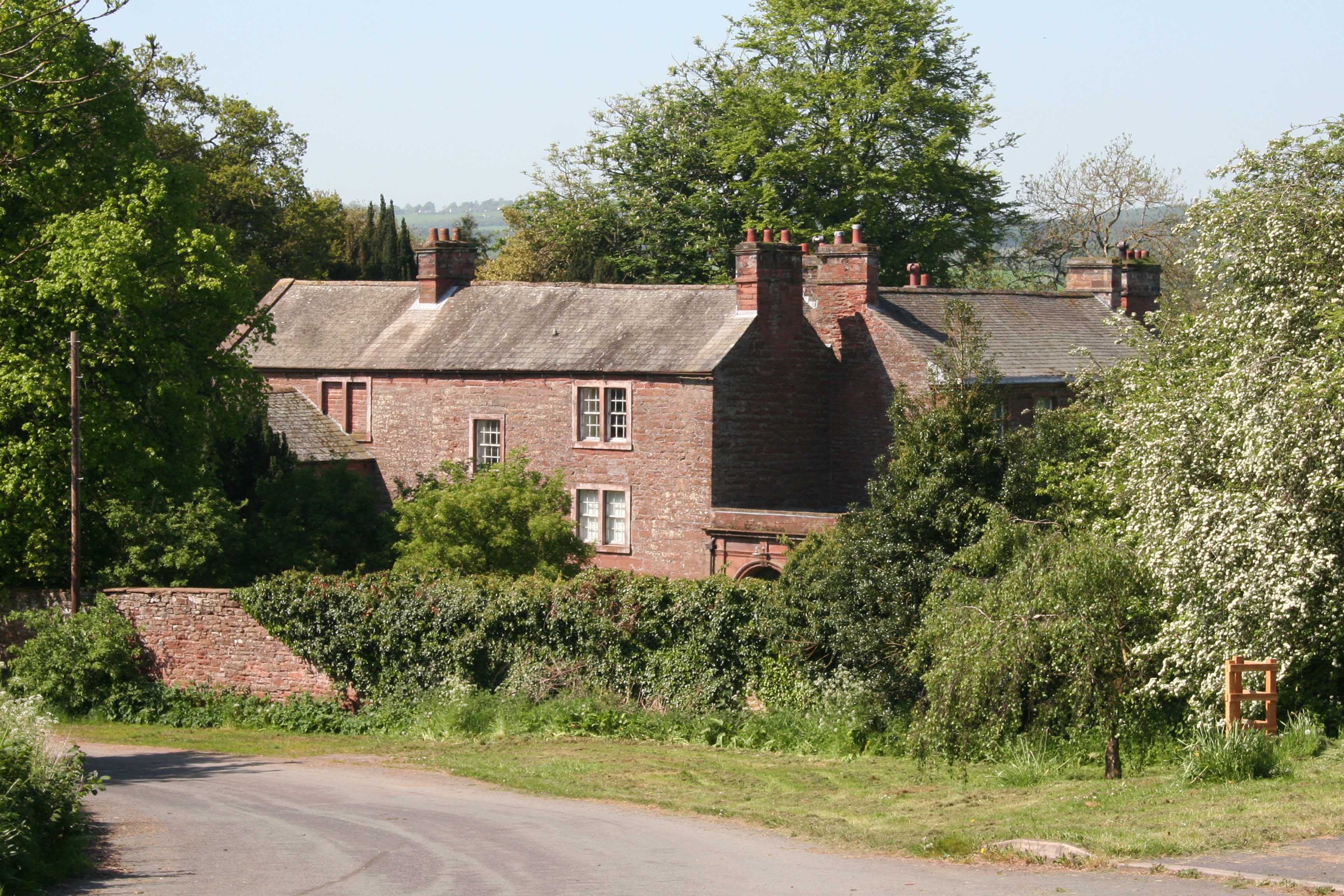
Salkeld Hall is a red sandstone Grade II* listed country house in the village of Little Salkeld, Cumbria, England and is the original residence of the Salkeld family. History The current house was constructed in the late 16th century using walls from previous building(s) that stood on the site. The oldest part of the building was dated in 1967 as being from the 14th century. The date of the first building to exist on the site is unknown; it is the potential location of an 'ancient castle'. Corby Castle in nearby Great Corby, built from similar materials in the 14th century, was also owned by the Salkeld Family. Mr George Salkeld, the last member of which to own Salkeld Hall, was forced from the house at the time of the English Civil War for a 'trifling consideration'. Ownership was passed to Colonel Cholmley, who built a new house on the site, and before the year of 1688 it became the property of Mr Charles Smallwood. His descendant, Timothy Smallwood, Esq. sold the house to Col ... [...More Info...] [...Related Items...] OR: [Wikipedia] [Google] [Baidu] |
Regionally Important Geological Site
Regionally important geological and geomorphological sites (RIGS) (also known as regionally important geological sites or, especially in Wales, regionally important geodiversity sites) are locally designated sites of local, national and regional importance for geodiversity (geology and geomorphology) in the United Kingdom and Isle of Man. RIGS may be designated for their value to Earth Science, and to Earth heritage in general, and may include cultural, educational, historical and aesthetic resources. The concept was introduced by the Nature Conservancy Council's publication ''Earth Science Conservation in Great Britain – A Strategy'' (1990). They are conserved and protected from development as a material consideration through the planning system by the Town and Country Planning Act 1990. They do not have the statutory management protection enjoyed by Sites of Special Scientific Interest (SSSIs) or Areas of Special Scientific Interest (Isle of Man). Local geological sites includ ... [...More Info...] [...Related Items...] OR: [Wikipedia] [Google] [Baidu] |
Eden, Cumbria
Eden is a Non-metropolitan district, local government district in Cumbria, England, based at Penrith Town Hall in Penrith, Cumbria, Penrith. It is named after the River Eden, Cumbria, River Eden, which flows north through the district toward Carlisle, Cumbria, Carlisle. Its population of 49,777 at the United Kingdom Census 2001, 2001 census, increased to 52,564 at the 2011 Census. A 2019 estimate was 53,253. In July 2021 it was announced that in April 2023, Cumbria will divide into two Unitary authorities of England, unitary authorities. Eden District Council will cease and its functions pass to a new authority, Westmorland and Furness, covering the current districts of Borough of Barrow-in-Furness, Barrow-in-Furness, Eden and South Lakeland. Extent The Eden District area of 2,156 sq. km (832 square miles) makes it, since 2009, the eighth largest in England and the largest non-unitary authority, unitary district. It also has the lowest population density of any district in Engla ... [...More Info...] [...Related Items...] OR: [Wikipedia] [Google] [Baidu] |
Tramway (industrial)
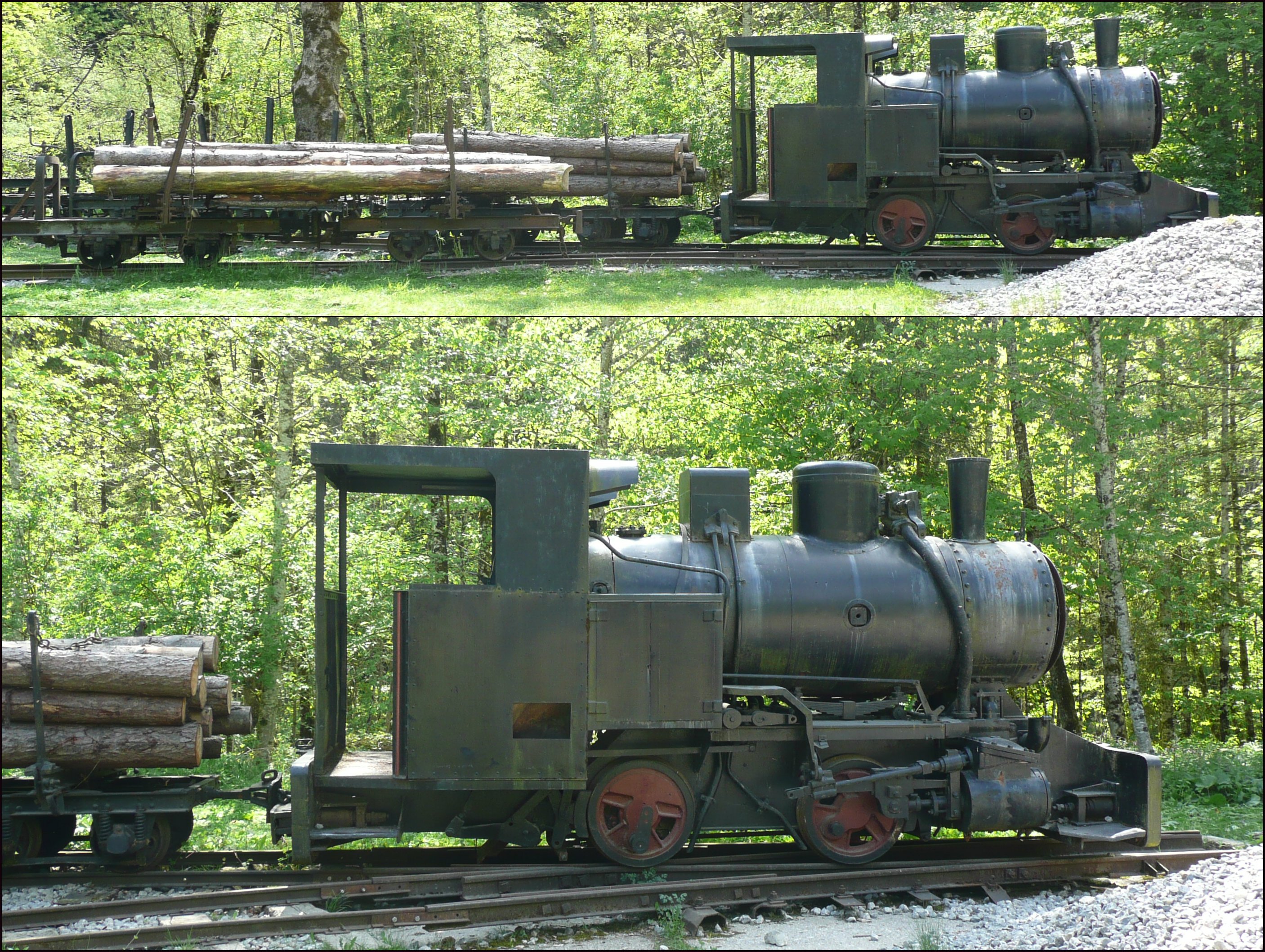
Tramways are lightly laid rail transport, railways, sometimes with the wagons or carriages moved without locomotives. Because individual tramway infrastructure is not intended to carry the weight of typical standard-gauge railway equipment, the tramways over which they operate may be built from less substantial materials. Tramways can exist in many forms; sometimes just tracks temporarily placed on the ground to transport materials around a factory, mine or quarry. Many, if not most, use narrow-gauge railway technology. The trains can be manually pushed by hand, pulled by animals (especially horses and mules), cable hauled by a stationary engine, or use small, light locomotives. The term is not in use in North America but in common use in the United Kingdom, and elsewhere, where British Railway terminology and practices had large influences on management practices, terminology, and railway cultures such as Australia, New Zealand, and those parts of Asia that consulted with Bri ... [...More Info...] [...Related Items...] OR: [Wikipedia] [Google] [Baidu] |
Long Meg Mine
Long Meg Mine is a disused gypsum mine just north of Little Salkeld, Cumbria in the area known as Cave Wood Valley. It was operated between 1880 and 1976. History The Long Meg Plaster Company Ltd. was established in 1880, driving an underground drift upon which operations commenced in 1885. In 1886 a standard gauge extension line was connected to the site from the Settle-Carlisle Railway (a distance of around 0.35 km). The workforce in this year is recorded as being 12 (all Surface), the name of the mine Long Meg Drift and agent A.K.Busby. In 1902 the workforce is recorded as being 26 (12 Underground and 14 Surface). By 1914 however this figure had dropped to 6 (4 Underground and 2 Surface) and the mine was abandoned on an unknown date in 1914/1915. The operator at this time was the Carlisle Plaster and Cement Company Ltd. The mine was re-opened in 1922 for the extraction of anhydrite by the Long Meg Plaster and Mineral Company Ltd. This was purchased in 1939 by the Brit ... [...More Info...] [...Related Items...] OR: [Wikipedia] [Google] [Baidu] |
Settle–Carlisle Line
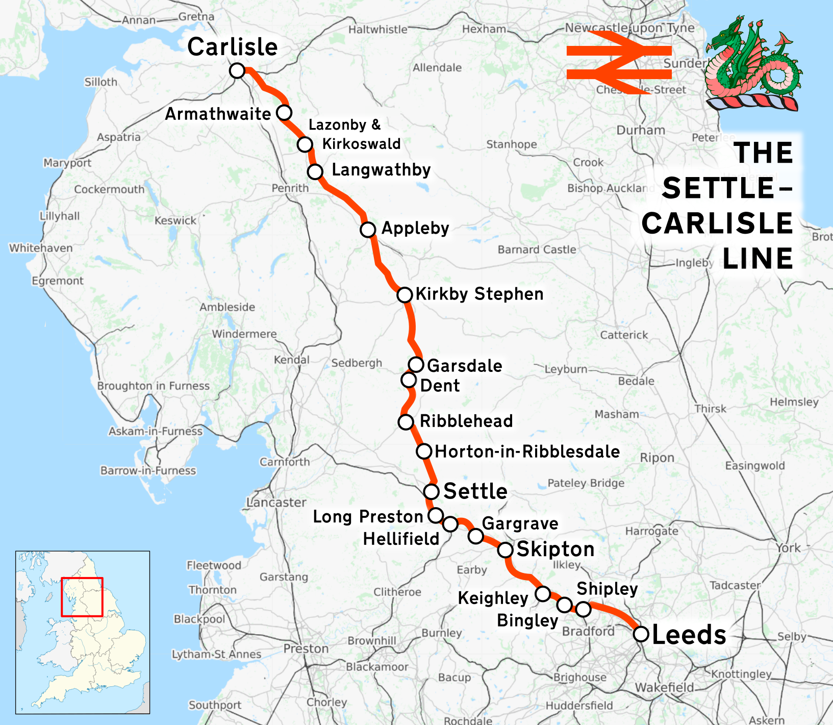
The Settle–Carlisle line (also known as the ''Settle and Carlisle'' (S&C)) is a main railway line in northern England. The route, which crosses the remote, scenic regions of the Yorkshire Dales and the North Pennines, runs between Settle Junction, on the Leeds–Morecambe line, and , near the English-Scottish borders. The historic line was constructed in the 1870s and has several notable tunnels and viaducts such as the imposing Ribblehead. The line is managed by Network Rail. All passenger services are operated by Northern apart from temporary diverted services (due to closures of the West Coast Main Line) and are part of the National Rail network. Stations serve towns such as Settle in North Yorkshire, Appleby-in-Westmorland in Cumbria and small rural communities along its route. In the 1980s, British Rail planned to close the Settle–Carlisle line. This prompted a campaign to save the line by rail groups, enthusiasts, local authorities and residents along the route. ... [...More Info...] [...Related Items...] OR: [Wikipedia] [Google] [Baidu] |
Stone Circle
A stone circle is a ring of standing stones. Most are found in Northwestern Europe – especially in Britain, Ireland, and Brittany – and typically date from the Late Neolithic and Early Bronze Age, with most being built from 3000 BC. The best known examples include those at the henge monument at Avebury, the Rollright Stones, and elements within the ring of standing stones at Stonehenge. Scattered examples exist from other parts of Europe. Later, during the Iron Age, stone circles were built in southern Scandinavia. Stone circles are usually grouped in terms of the shape and size of the stones, the span of their radius, and their population within the local area. Although many theories have been advanced to explain their use, usually related to providing a setting for ceremony or ritual, no consensus exists among archaeologists regarding their intended function. Their construction often involved considerable communal effort, including specialist tasks such as planning, quar ... [...More Info...] [...Related Items...] OR: [Wikipedia] [Google] [Baidu] |
Long Meg And Her Daughters
Long Meg and Her Daughters is a Neolithic stone circle situated north-east of Penrith near Little Salkeld in Cumbria, North West England. One of around 1,300 stone circles in the British Isles and Brittany, it was constructed as a part of a megalithic tradition that emerged during Neolithic, and continued into the Early Bronze Age. Burl 2000. p. 13. The stone circle is the third widest in England, behind Avebury in Wiltshire, and only slightly smaller than Stanton Drew in Somerset. It consists of 59 stones (of which 27 remain upright) set in an east/west oval configuration measuring 340 ft (106 m) on its long axis. There may originally have been as many as 70 stones. Long Meg herself is a 12 ft (3.6 m) high monolith of red sandstone 80 ft (25 m) to the southwest of the circle made by her Daughters. Long Meg is marked with examples of megalithic art including a cup and ring mark, a spiral, and rings of concentric circles. Infra-red aerial photography has identi ... [...More Info...] [...Related Items...] OR: [Wikipedia] [Google] [Baidu] |


.jpg)
May2005.jpg)