|
La Push, Washington
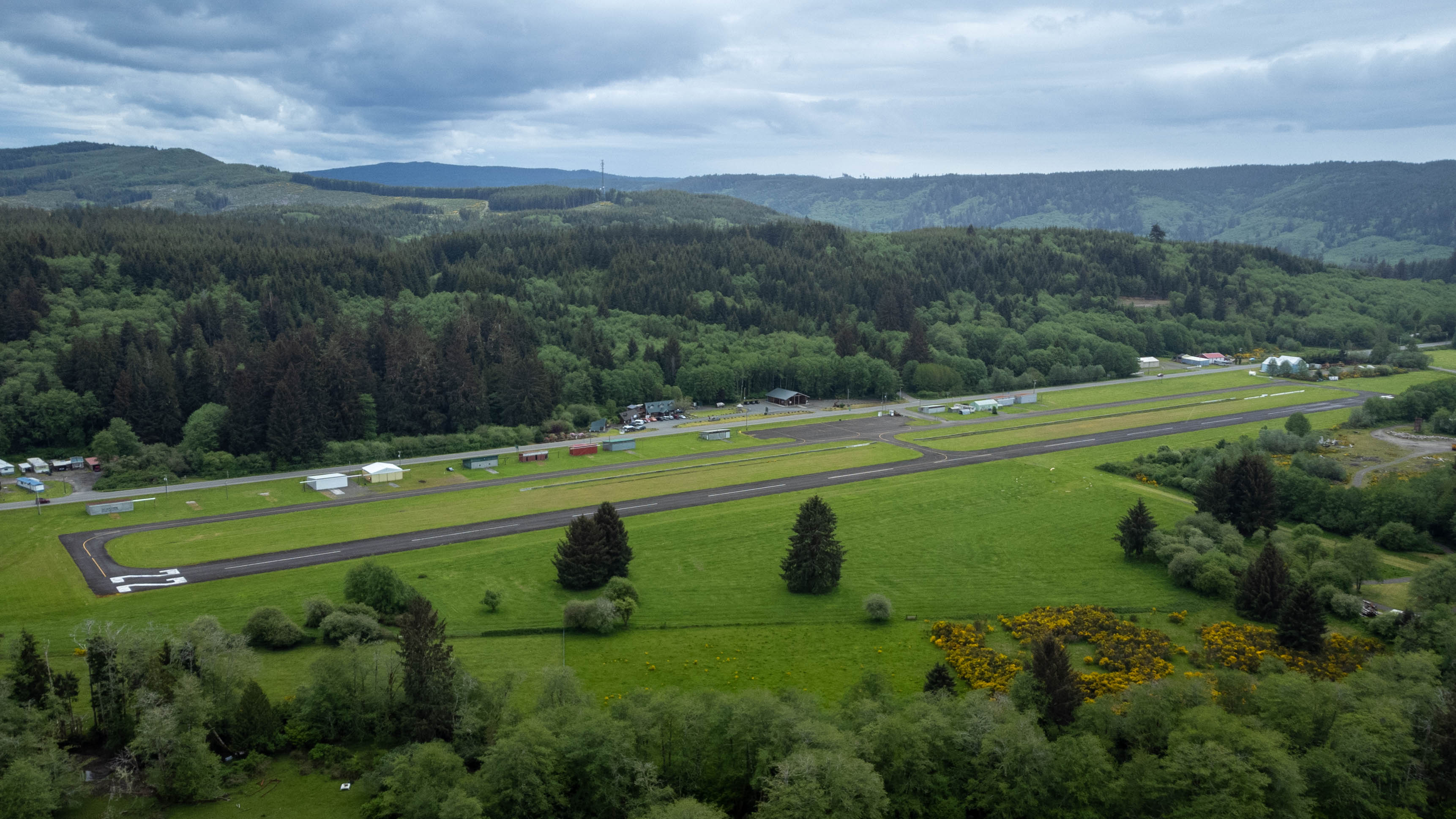
La Push is a small unincorporated community situated at the mouth of the Quillayute River in Clallam County, Washington, United States. La Push is the largest community within the Quileute Indian Reservation, which is home to the federally recognized Quileute tribe. La Push is known for its whale-watching and natural environment. The community has historically been located on the coast, however sea level rise led the community to begin managed retreat to higher grounds in 2017. Geography The name La Push is from French ''La Bouche'', meaning "The Mouth" of the Quillayute River, adapted into Chinook Jargon. Two beaches are nearby: Rialto Beach to the north of the river mouth and La Push Beach to the south. La Push has the westernmost ZIP Code in the contiguous United States, 98350. Climate La Push has a very wet oceanic climate. The climate is moderated and strongly influenced by the Pacific Ocean, which renders mild winters for a northerly latitude. Located to the west of ... [...More Info...] [...Related Items...] OR: [Wikipedia] [Google] [Baidu] |
Unincorporated Area
An unincorporated area is a region that is not governed by a local municipal corporation. Widespread unincorporated communities and areas are a distinguishing feature of the United States and Canada. Most other countries of the world either have no unincorporated areas at all or these are very rare: typically remote, outlying, sparsely populated or List of uninhabited regions, uninhabited areas. By country Argentina In Argentina, the provinces of Chubut Province, Chubut, Córdoba Province (Argentina), Córdoba, Entre Ríos Province, Entre Ríos, Formosa Province, Formosa, Neuquén Province, Neuquén, Río Negro Province, Río Negro, San Luis Province, San Luis, Santa Cruz Province, Argentina, Santa Cruz, Santiago del Estero Province, Santiago del Estero, Tierra del Fuego Province, Argentina, Tierra del Fuego, and Tucumán Province, Tucumán have areas that are outside any municipality or commune. Australia Unlike many other countries, Australia has only local government in Aus ... [...More Info...] [...Related Items...] OR: [Wikipedia] [Google] [Baidu] |
Suquamish
The Suquamish () are a Lushootseed-speaking Native American people, located in present-day Washington in the United States. They are a southern Coast Salish people. Today, most Suquamish people are enrolled in the federally recognized Suquamish Tribe, a signatory to the 1855 Treaty of Point Elliott. Chief Seattle, the famous leader of the Suquamish and Duwamish Tribes for which the City of Seattle is named, signed the Point Elliot Treaty on behalf of both Tribes. The Suquamish Tribe owns the Port Madison Indian Reservation. Language and culture Suquamish people traditionally speak a dialect of Lushootseed, which belongs to the Salishan language family. Like many Northwest Coast indigenous peoples pre- European contact, the Suquamish enjoyed the rich bounty of land and sea west of the Cascade Mountains. They fished for salmon and harvested shellfish in local waters and Puget Sound. The cedar tree provided fiber used to weave waterproof clothing and beautiful utilitarian items ... [...More Info...] [...Related Items...] OR: [Wikipedia] [Google] [Baidu] |
Chief Seattle
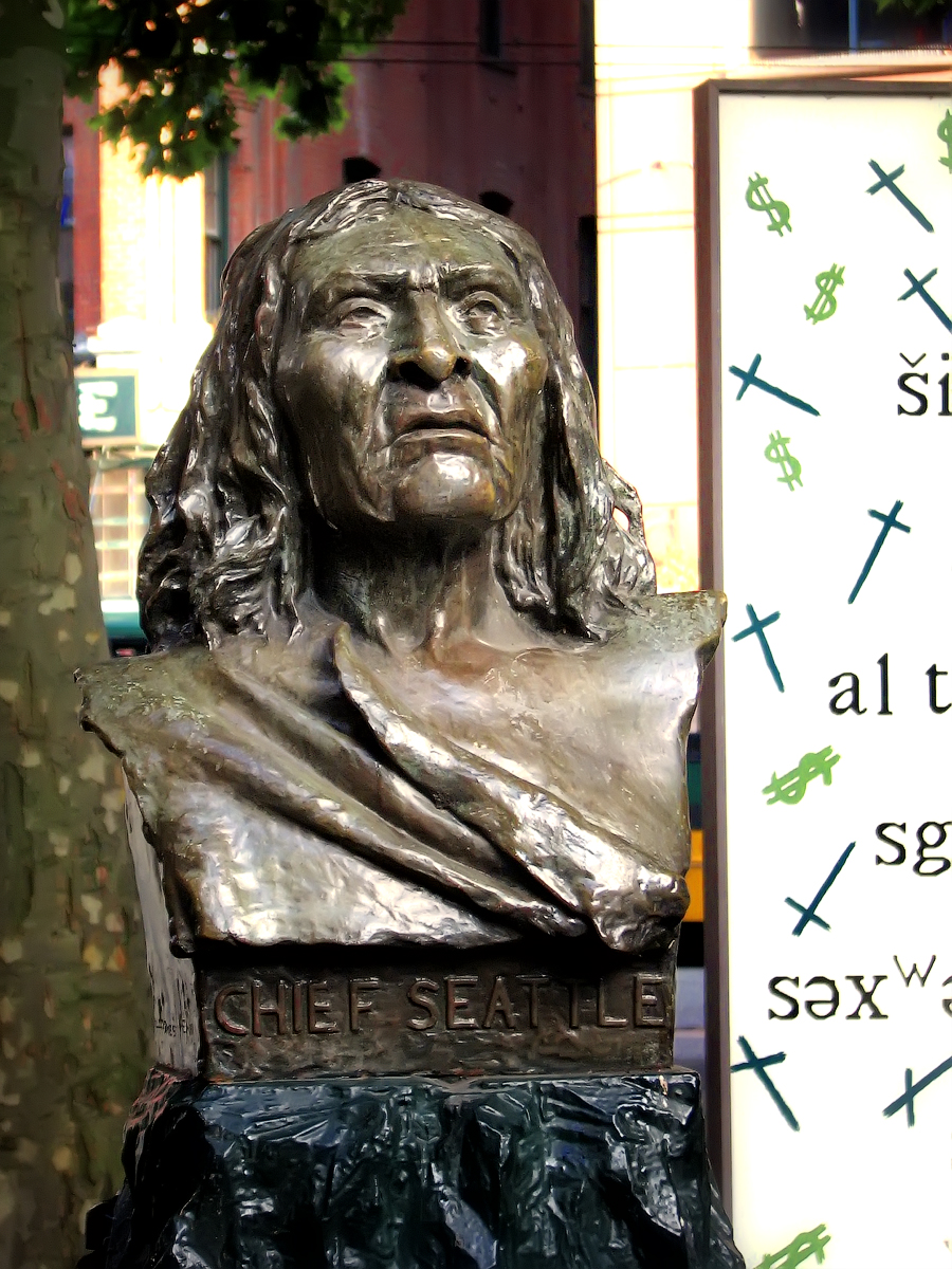
Chief Seattle ( – June 7, 1866) was a Suquamish and Duwamish chief. A leading figure among his people, he pursued a path of accommodation to white settlers, forming a personal relationship with "Doc" Maynard. The city of Seattle, in the U.S. state of Washington, was named after him. A widely publicized speech arguing in favour of ecological responsibility and respect of Native Americans' land rights had been attributed to him. The name Seattle is an Anglicization of the modern Duwamish conventional spelling Si'ahl, equivalent to the modern Lushootseed spelling ''siʔaɫ'' and also rendered as Sealth, Seathl or See-ahth. Biography Seattle's mother Sholeetsa was dxʷdəwʔabš (Duwamish) and his father Shweabe was chief of the suq̓ʷabš (Suquamish). Seattle was born some time between 1780 and 1786 on Blake Island, Washington. One source cites his mother's name as Wood-sho-lit-sa.* The Duwamish tradition is that Seattle was born at his mother's village of ''stukw'' o ... [...More Info...] [...Related Items...] OR: [Wikipedia] [Google] [Baidu] |
Quimper Peninsula
The Quimper Peninsula is a narrow peninsula forming the most northeastern extent of the Olympic Peninsula of Washington state in the northwestern United States of America. The peninsula is named after the Peruvian-born Spanish explorer Manuel Quimper who, in command of , charted the north and south coasts of the Strait of Juan de Fuca during the summer of 1790. The Spanish had given the name Quimper to today's New Dungeness Bay, which George Vancouver had renamed New Dungeness. In 1838 Charles Wilkes gave the peninsula the name Dickerson, but the U.S. Coast Survey renamed it with Quimper's name. The Quimper Peninsula is defined by Discovery Bay to the west, the Strait of Juan de Fuca to the north, and Port Townsend Bay to the east. From the isthmus it extends approximately seven miles to the north-northwest and then curves to the northeast for another four miles before terminating at Point Wilson. For most of its length the width is less than four miles. This peninsula forms the ... [...More Info...] [...Related Items...] OR: [Wikipedia] [Google] [Baidu] |
Chimakum
The Chimakum, also spelled Chemakum and Chimacum are a near extinct Native American people (known to themselves as Aqokúlo and sometimes called the Port Townsend Indians), who lived in the northeastern portion of the Olympic Peninsula in Washington state, between Hood Canal and Discovery Bay until their virtual extinction in 1902. Their primary settlements were on Port Townsend Bay, on the Quimper Peninsula, and Port Ludlow Bay to the south. Today Chimakum people are enrolled in three federally recognized tribes: the Skokomish, Jamestown S'Klallam, and Port Gamble S'Klallam tribes, although lineage is not traceable at present. Population The Chimakum population was estimated at 400 in 1780 and 90 in 1855. The Census of 1910 enumerated just three, according to the census of Franz Boas. The three remaining tribe members spoke only broken Chimakum language. In the present day there are people who identify as Chimakums or descendants of Chimakums. Language The Chemakum lang ... [...More Info...] [...Related Items...] OR: [Wikipedia] [Google] [Baidu] |
Makah People
The Makah (; Klallam: ''màq̓áʔa'')Renker, Ann M., and Gunther, Erna (1990). "Makah". In "Northwest Coast", ed. Wayne Suttles. Vol. 7 of '' Handbook of North American Indians'', ed. William C. Sturtevant. Washington, D.C.: Smithsonian Institution, pg. 429 are an indigenous people of the Pacific Northwest Coast living in Washington, in the northwestern part of the continental United States. They are enrolled in the federally recognized ''Makah Indian Tribe of the Makah Indian Reservation''. Linguistically and ethnographically, they are closely related to the Nuu-chah-nulth and Ditidaht peoples of the West Coast of Vancouver Island, who live across the Strait of Juan de Fuca in British Columbia, Canada. Reservation The Makah Indian Tribe own the Makah Indian Reservation on the northwest tip of the Olympic Peninsula; it includes Tatoosh Island. They live in and around the town of Neah Bay, Washington, a small fishing village. The Makah people refer to themselves as ''Kw ... [...More Info...] [...Related Items...] OR: [Wikipedia] [Google] [Baidu] |
Forks, Washington
Forks, also previously known as the unincorporated town of Quillayute, is a city in southwest Clallam County, Washington, United States. The population was 3,335 at the 2020 census. It is named after the forks in the nearby Quillayute, Bogachiel, Calawah, and Sol Duc rivers. For many years, the city's economy was fueled by the local timber industry. More recently it has drawn tourism related to the novel series ''Twilight'' and films of the same name, set in Forks. With recent declines in the timber industry, Forks has relied on the nearby Clallam Bay Corrections Center and Olympic Corrections Center as sources of jobs. Forks is a popular destination for sport fishers who fish for salmon and rainbow trout in nearby rivers. It is also supported by visitors to Olympic National Park. History Territory of the Quileute Native Americans Forks was once inhabited by the Quileute Native American tribe, before they ceded their territory. In 1889 a reservation was created nea ... [...More Info...] [...Related Items...] OR: [Wikipedia] [Google] [Baidu] |
Olympic Mountains
The Olympic Mountains are a mountain range on the Olympic Peninsula of the Pacific Northwest of the United States. The mountains, part of the Pacific Coast Ranges, are not especially high – Mount Olympus is the highest at ; however, the eastern slopes rise out of Puget Sound from sea level and the western slopes are separated from the Pacific Ocean by the low-lying wide Pacific Ocean coastal plain. The western slopes are the wettest place in the 48 contiguous states. Most of the mountains are protected within the bounds of Olympic National Park and adjoining segments of the Olympic National Forest. The mountains are located in western Washington in the United States, spread out across four counties: Clallam, Grays Harbor, Jefferson and Mason. Physiographically, they are a section of the larger Pacific Border province, which is in turn a part of the larger Pacific Mountain System. Geography The Olympics have the form of a cluster of steep-sided peaks surrounded by heavily ... [...More Info...] [...Related Items...] OR: [Wikipedia] [Google] [Baidu] |
Oceanic Climate
An oceanic climate, also known as a marine climate, is the humid temperate climate sub-type in Köppen classification ''Cfb'', typical of west coasts in higher middle latitudes of continents, generally featuring cool summers and mild winters (for their latitude), with a relatively narrow annual temperature range and few extremes of temperature. Oceanic climates can be found in both hemispheres generally between 45 and 63 latitude, most notably in northwestern Europe, northwestern America, as well as New Zealand. Precipitation Locations with oceanic climates tend to feature frequent cloudy conditions with precipitation, low hanging clouds, and frequent fronts and storms. Thunderstorms are normally few, since strong daytime heating and hot and cold air masses meet infrequently in the region. In most areas with an oceanic climate, precipitation comes in the form of rain for the majority of the year. However, some areas with this climate see some snowfall annually during winter. M ... [...More Info...] [...Related Items...] OR: [Wikipedia] [Google] [Baidu] |
Contiguous United States
The contiguous United States (officially the conterminous United States) consists of the 48 adjoining U.S. states and the Federal District of the United States of America. The term excludes the only two non-contiguous states, Alaska and Hawaii (also the last ones admitted to the Union), and all other offshore insular areas, such as American Samoa, Guam, the Northern Mariana Islands, Puerto Rico, and the U.S. Virgin Islands. The colloquial term "Lower48" is used also, especially in relation to just Alaska (Hawaii is farther south). The related but distinct term continental United States includes Alaska (which is also on the continent of North America but separated from the 48 states by British Columbia and Yukon of Canada), but excludes the Hawaiian Islands and all U.S. territories in the Caribbean and the Pacific. The greatest distance (on a great-circle route) entirely within the contiguous U.S. is 2,802 miles (4,509 km), between Florida and the State of Washington; th ... [...More Info...] [...Related Items...] OR: [Wikipedia] [Google] [Baidu] |


