|
L Taraval
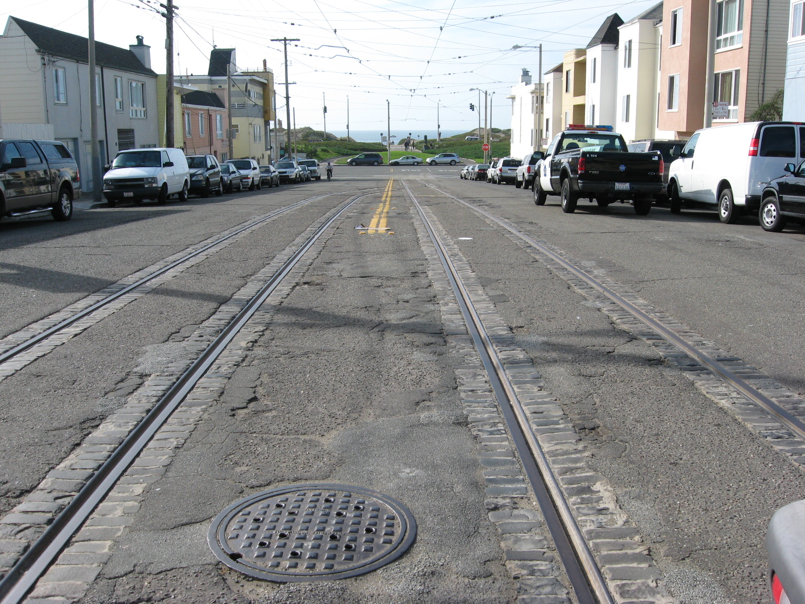
The L Taraval is a light rail line of the Muni Metro system in San Francisco, California, mainly serving the Parkside District. The line is currently suspended and replaced by buses through the end of 2024 for a road improvement project along Taraval Street. Route description The line begins at Wawona and 46th Avenue station (near the San Francisco Zoo), which is on a one-way loop on Vicente Street, 47th Avenue, Wawona Street, and 46th Avenue. It runs north on 46th Avenue to Taraval Street, then runs east on Taraval Street to 15th Avenue. The line then runs south one block on 15th Avenue, then east on Ulloa Street to West Portal station, where it tags along with the other Muni Metro lines towards Embarcadero. Operation Prior to the COVID-19 pandemic, the L Taraval operated seven days a week, with train service beginning at 5 a.m. weekdays, 6 a.m. Saturdays, and 8 a.m. Sundays. Trains ran until 12:30 a.m, with daytime headways between 6 and 9 minutes. Service is provided ... [...More Info...] [...Related Items...] OR: [Wikipedia] [Google] [Baidu] |
Taraval And 40th Avenue Station
Taraval and 40th Avenue is a light rail stop on the Muni Metro L Taraval line, located in the Neighborhoods in San Francisco, Parkside neighborhood of San Francisco, California. The station opened with the second section of the L Taraval line on January 14, 1923. Service Since August 2020, service along the route is temporarily being provided by buses to allow for the construction of improvements to the L Taraval line. The project is expected to wrap up in 2024. The stop is served by the and bus routes, which provide service along the L Taraval line during the early morning and late night hours respectively when trains do not operate. Reconstruction Like many stations on the line, Taraval and 40th Avenue has no platforms; trains stop at marked poles before the cross street, and passengers cross travel lanes to board. In March 2014, Muni released details of the proposed implementation of their Transit Effectiveness Project (later rebranded MuniForward), which included a vari ... [...More Info...] [...Related Items...] OR: [Wikipedia] [Google] [Baidu] |
Taraval And 19th Avenue Station
Taraval and 19th Avenue is a light rail stop on the Muni Metro L Taraval line, located in the Parkside neighborhood of San Francisco, California. The stop opened with the first section of the L Taraval line on April 12, 1919. Service Since August 2020, service along the route is temporarily being provided by buses to allow for the construction of improvements to the L Taraval line. The project is expected to wrap up in 2024. The stop is also served by routes , (limited stop rapid service), (overnight service), plus the and bus routes, which provide service along the L Taraval line during the early morning and late night hours respectively when trains do not operate. Planned changes Like many stations on the line, 19th Avenue has no platforms; trains stop at marked poles before the cross street, and passengers cross travel lanes to board. In March 2014, Muni released details of the proposed implementation of their Transit Effectiveness Project (later rebranded MuniForwa ... [...More Info...] [...Related Items...] OR: [Wikipedia] [Google] [Baidu] |
Fisherman's Wharf, San Francisco
Fisherman's Wharf is a neighborhood and popular tourist attraction in San Francisco, California. It roughly encompasses the northern waterfront area of San Francisco from Ghirardelli Square or Van Ness Avenue east to Pier 35 or Kearny Street. The F Market streetcar runs through the area, the Powell-Hyde cable car line runs to Aquatic Park, at the edge of Fisherman's Wharf, and the Powell-Mason cable car line runs a few blocks away. History San Francisco's Fisherman's Wharf gets its name and neighborhood characteristics from the city's early days of the mid to later 1800s when Italian immigrant fishermen came to the city to take advantage of the influx of population due to the gold rush. Most of the Italian immigrant fishermen settled in the North Beach area close to the wharf and fished for the local delicacies and dungeness crab. From then until the present day the wharf remained the center of operations for San Francisco's fishing fleet. Despite its redevelopment into a tour ... [...More Info...] [...Related Items...] OR: [Wikipedia] [Google] [Baidu] |
Transit Signal Priority
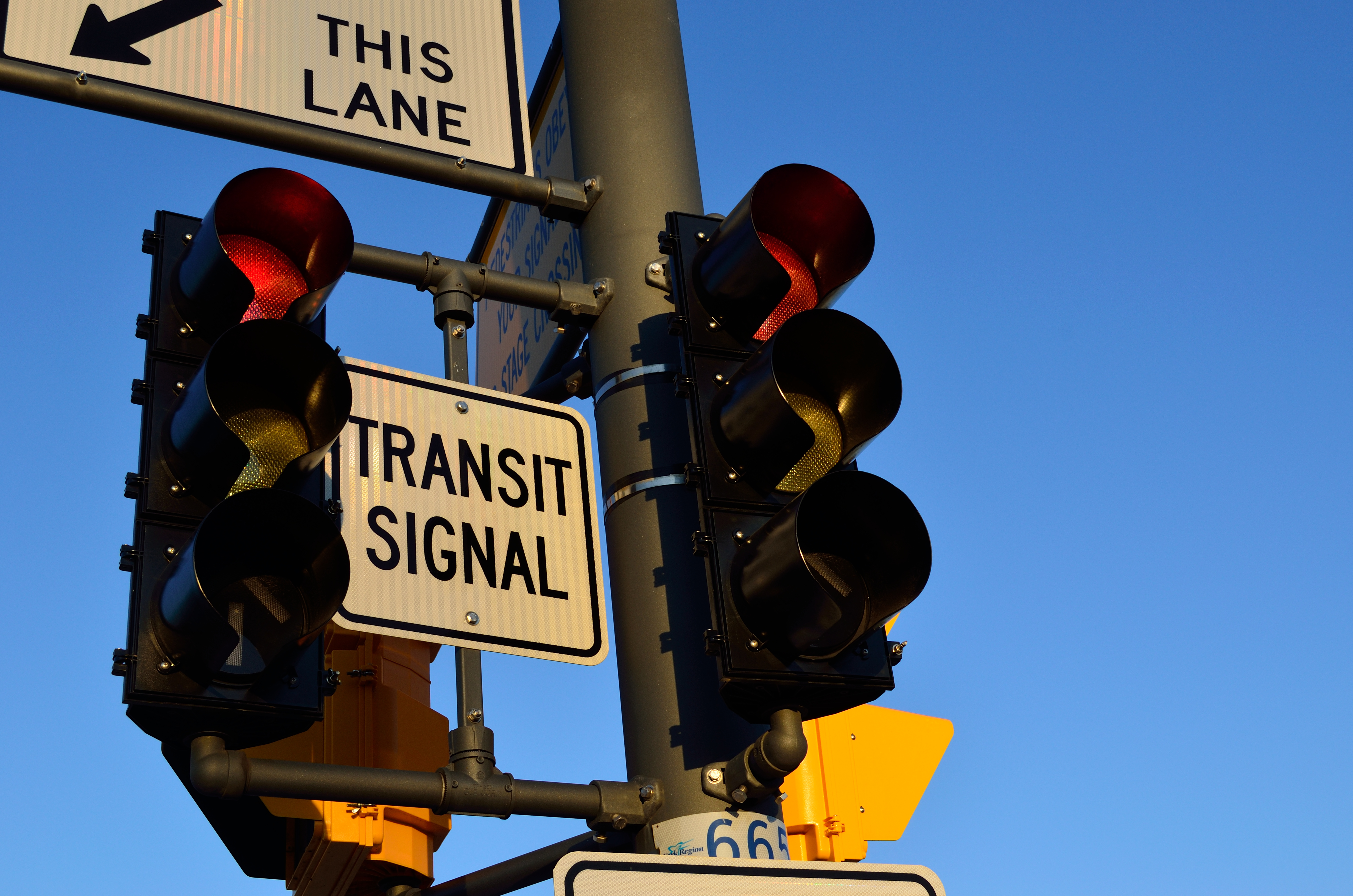
Bus priority or transit signal priority (TSP) is a name for various techniques to improve service and reduce delay for mass transit vehicles at intersections (or junctions) controlled by traffic signals. TSP techniques are most commonly associated with buses, but can also be used along tram/streetcar or light rail lines, especially those that mix with or conflict with general vehicular traffic. Techniques Transit signal priority techniques can generally be classified as "active" or "passive". Passive TSP techniques typically involve optimizing signal timing or coordinating successive signals to create a “green wave” for traffic along the transit line's route. Passive techniques require no specialized hardware (such as bus detectors and specialized traffic signal controllers) and rely on simply improving traffic for ''all'' vehicles along the transit vehicle's route. Active TSP techniques rely on detecting transit vehicles as they approach an intersection and adjusting t ... [...More Info...] [...Related Items...] OR: [Wikipedia] [Google] [Baidu] |
Transit-only Lane
A bus lane or bus-only lane is a lane restricted to buses, often on certain days and times, and generally used to speed up public transport that would be otherwise held up by traffic congestion. The related term busway describes a roadway completely dedicated for use by buses. Bus lanes are a key component of a high-quality bus rapid transit (BRT) network, improving bus travel speeds and reliability by reducing delay caused by other traffic. A dedicated bus lane may occupy only part of a roadway which also has lanes serving general automotive traffic; in contrast to a transit mall which is a pedestrianized roadway also served by transit. History The first bus lane is often erroneously attributed to Chicago, where in 1939 Sheridan Road was installed with reversible lanes north of Foster Avenue. The setup consisted of three-lanes towards the peak direction (south in the morning; north in the evening), and one contraflow lane. None of the lanes exclusively carried buses, bu ... [...More Info...] [...Related Items...] OR: [Wikipedia] [Google] [Baidu] |
Interurban Press
Interurban Press was a small, privately owned American publishing company, specializing in books about streetcars, other forms of rail transit and railroads in North America, from 1943MacDougall, Kent (May 19, 1983). "Books Ring Bell With Devotees: Publisher Specializes in History of Trolleys". ''Los Angeles Times'', p. 1. until 1993.Ryll, Thomas (November 29, 1994). "Felida man tracks light rail" (profile of retired Interurban Press owner Mac Sebree). ''The Columbian'', p. A3. It was based in the Los Angeles area, and specifically in Glendale, California after 1976. Although its primary focus was on books, it also published three magazines starting in the 1980s, along with videos and calendars. At its peak, the company employed 10 people and generated about $2 million in business annually. Origins Originally named Interurbans, the company developed out of a mimeographed newsletter first distributed by its founder, Ira L. Swett, in 1943. The ''Interurbans News Letter'' was ... [...More Info...] [...Related Items...] OR: [Wikipedia] [Google] [Baidu] |
Twin Peaks Tunnel
The Twin Peaks Tunnel is a light rail/streetcar tunnel in San Francisco, California. The tunnel runs under Twin Peaks and is used by the K Ingleside/T Third Street, M Ocean View and S Shuttle lines of the Muni Metro system. The eastern entrance to the tunnel is located at the west end of the Market Street subway near the intersection of Market and Castro streets in the Castro neighborhood, and the western entrance is located at West Portal Avenue and Ulloa Street in the West Portal neighborhood, named for the tunnel. There are three stations along the tunnel, West Portal at the western entrance, Forest Hill near the middle, and the now disused Eureka Valley near the eastern end. History Plans for a tunnel extending from Market Street under Twin Peaks were first presented at the Merchants' Association banquet in May 1909; A. W. Scott Jr. spoke on the need for the tunnel to open up the western part of San Francisco to development, as "40,000 San Franciscans lived across t ... [...More Info...] [...Related Items...] OR: [Wikipedia] [Google] [Baidu] |
World War II
World War II or the Second World War, often abbreviated as WWII or WW2, was a world war that lasted from 1939 to 1945. It involved the vast majority of the world's countries—including all of the great powers—forming two opposing military alliances: the Allies and the Axis powers. World War II was a total war that directly involved more than 100 million personnel from more than 30 countries. The major participants in the war threw their entire economic, industrial, and scientific capabilities behind the war effort, blurring the distinction between civilian and military resources. Aircraft played a major role in the conflict, enabling the strategic bombing of population centres and deploying the only two nuclear weapons ever used in war. World War II was by far the deadliest conflict in human history; it resulted in 70 to 85 million fatalities, mostly among civilians. Tens of millions died due to genocides (including the Holocaust), starvation, ma ... [...More Info...] [...Related Items...] OR: [Wikipedia] [Google] [Baidu] |
Transbay Terminal
The San Francisco Transbay Terminal was a transportation complex in San Francisco, California, United States, roughly in the center of the rectangle bounded north–south by Mission Street and Howard Street, and east–west by Beale Street and 2nd Street in the South of Market area of the city. It opened on January 14, 1939 as a train station and was converted into a bus depot in 1959. The terminal mainly served San Francisco's downtown and Financial District, as transportation from surrounding communities of the Bay Area terminated there such as: Golden Gate Transit buses from Marin County, AC Transit buses from the East Bay, and SamTrans buses from San Mateo County. Long-distance buses from beyond the Bay Area such as Greyhound and Amtrak also served the terminal. Several bus lines of the San Francisco Municipal Railway connected with the terminal. It closed on August 7, 2010, to make way for the construction of the replacement facility, the Transbay Transit Center, and assoc ... [...More Info...] [...Related Items...] OR: [Wikipedia] [Google] [Baidu] |
San Francisco Ferry Building
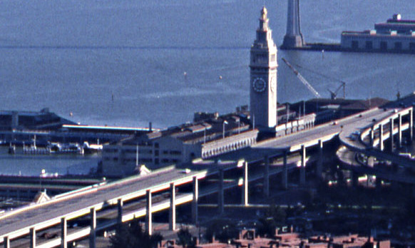
The San Francisco Ferry Building is a terminal for ferries that travel across the San Francisco Bay, a food hall and an office building. It is located on The Embarcadero in San Francisco, California and is served by Golden Gate Ferry and San Francisco Bay Ferry routes. On top of the building is a clock tower with four clock dials, each in diameter, which can be seen from Market Street, a main thoroughfare of the city. Designed in 1892 by American architect A. Page Brown in the Beaux-Arts style, the ferry building was completed in 1898. At its opening, it was the largest project undertaken in the city up to that time. One of Brown's design inspirations for the clock tower may have been the current 16th-century iteration of the 12th-century Giralda bell tower in Seville, Spain. The entire length of the building on both frontages is based on an arched arcade. With decreased use since the 1950s, after bridges were constructed to carry transbay traffic and most streetcar r ... [...More Info...] [...Related Items...] OR: [Wikipedia] [Google] [Baidu] |
K Ingleside
The K Ingleside is a light rail line of the Muni Metro system in San Francisco, California. It mainly serves the West Portal and Ingleside neighborhoods. The line opened on February 3, 1918, and was the first line to use the Twin Peaks Tunnel. Route description At West Portal station, inbound K Ingleside trains become T Third Street trains. The line follows West Portal Avenue to Saint Francis Circle, where it then runs on its own right-of-way in the median of Junipero Serra Boulevard to Ocean Avenue. The K then follows Ocean Avenue until it reaches Balboa Park station, where it circles around the Metro yard at San Jose and Geneva Avenue, with the actual terminal stop alongside the station. Operation The K Ingleside begins service at 5 a.m. on weekdays, 6 a.m. Saturdays and 8 a.m. Sundays, with the end of service occurring around 12:30 a.m. each night. Weekday daytime headways are 10 minutes. Weekend daytime headways are 12 minutes. Service is provided by overnight Owl ... [...More Info...] [...Related Items...] OR: [Wikipedia] [Google] [Baidu] |


