|
Kénogami Lake
Kenogami lake is a long lake in the Saguenay–Lac-Saint-Jean region of south-central Quebec, Canada. Situated at an altitude of , the lake is long and deep. "Kénogami" means "long lake" in the Montagnais dialect and was originally used to refer to Kenogami Lake, Ontario. It is situated in the Laurentian Highlands north of the Saint Lawrence River, into which it drains via the Saguenay River through the Chicoutimi and Aux-Sables Rivers. The lake is fed by dozens of small rivers coming from the Laurentian Highlands. The three principal being the Pikauba, Cyriac and Aux-Ecorces Rivers. The towns on its shores include Lac-Kénogami, and Hébertville station. The area around the lake is served on the east side by route 175 (boulevard Talbot); on the north side by the Kénogami road, the Route des Bâtisseurs and the Saint-Dominique street in Jonquière. A few secondary roads have been built in the area for the needs of hydroelectricity, forestry, recreational tourism ... [...More Info...] [...Related Items...] OR: [Wikipedia] [Google] [Baidu] |
Saguenay, Quebec
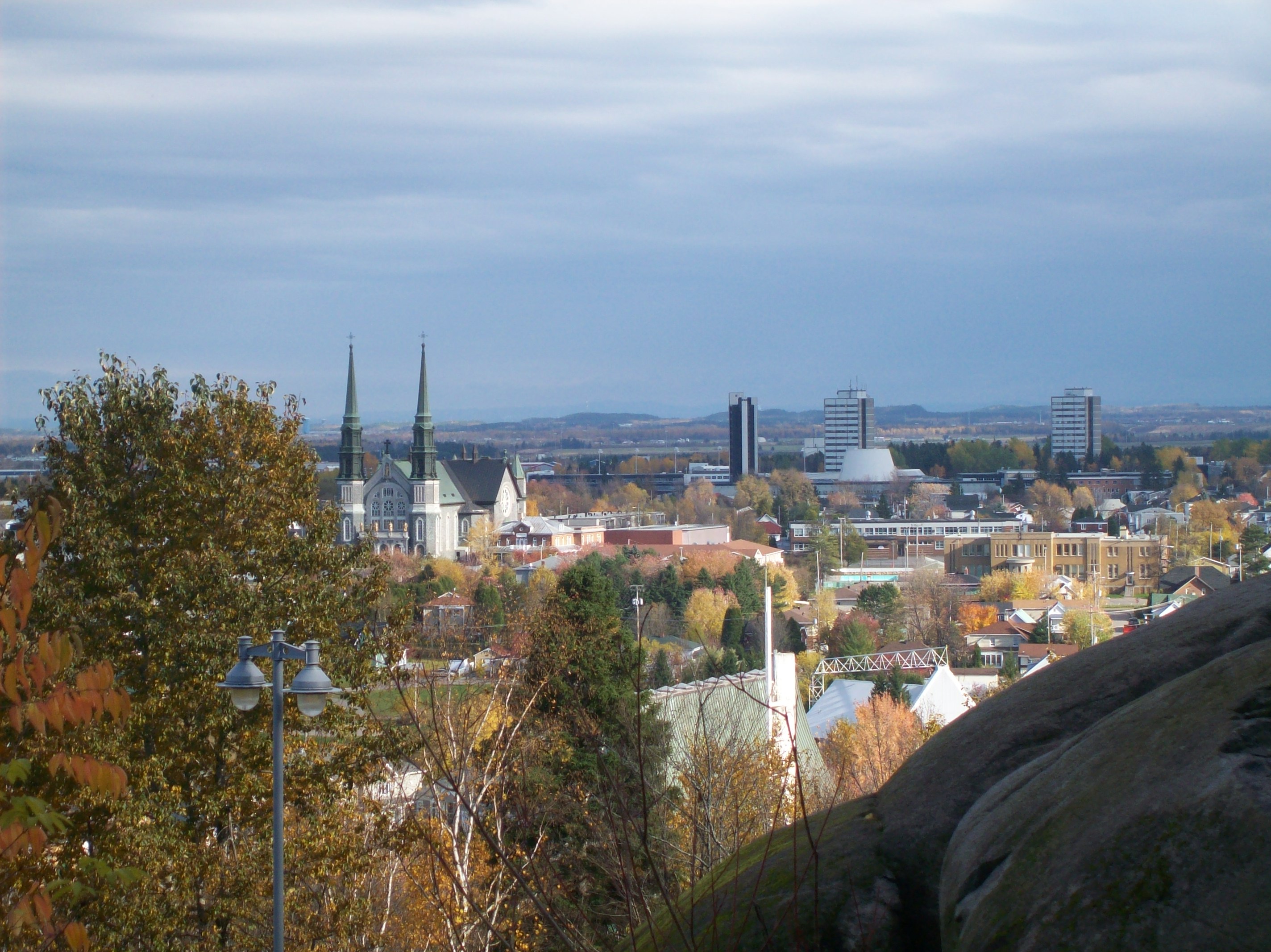
Saguenay ( , , ) is a city in the Saguenay–Lac-Saint-Jean region of Quebec, Canada, on the Saguenay River, about north of Quebec City by overland route. It is about upriver and northwest of Tadoussac, located at the confluence with the St. Lawrence River. It was formed in 2002 by merging the cities of Chicoutimi and Jonquière and the town of La Baie, Quebec, La Baie. Chicoutimi was founded by French colonists in 1676. The city of Saguenay constitutes a territory equivalent to a regional county municipality (TE); its geographical code is 941. Together with the regional county municipality of Le Fjord-du-Saguenay Regional County Municipality, Le Fjord-du-Saguenay, it forms the Census geographic units of Canada, census division (CD) of Le Saguenay-et-son-Fjord (94). The mayor of Saguenay since 2021 is Julie Dufour. Prior to its use as the name of the city, the term "the Saguenay" or (less commonly) "Saguenay Valley" had already been used for the whole Saguenay River region (se ... [...More Info...] [...Related Items...] OR: [Wikipedia] [Google] [Baidu] |
Laurentian Highlands
The Laurentian Upland (or Laurentian Highlands) is a physiographic region which, when referred to as the "Laurentian Region" or the Grenville geological province, is recognized by Natural Resources Canada as one of five provinces of the larger Canadian Shield physiographic division. The United States Geological Survey recognizes the Laurentian Upland as the larger general upland area of the Canadian Shield. Geography The Laurentian Region, as recognized by Natural Resources Canada, is part of the plateau and dissected southern rim of the Canadian Shield in the province of Québec. It is a western extension of the Laurentian Mountains, and continues across the Ottawa Valley into Ontario as the Opeongo Hills. Viewed from the valleys of the Ottawa and St. Lawrence Rivers, the south-facing escarpments of the Shield give the appearance of mountains 500–800 meters high; looking across the plateau, the relief is more moderate and subdued. These scarps mark the dramatic southern ed ... [...More Info...] [...Related Items...] OR: [Wikipedia] [Google] [Baidu] |
Laterrière, Quebec
Laterrière is a community in the Saguenay–Lac-Saint-Jean region of Quebec and a former municipality. It is part of the merged city of Saguenay, Quebec Saguenay ( , , ) is a city in the Saguenay–Lac-Saint-Jean region of Quebec, Canada, on the Saguenay River, about north of Quebec City by overland route. It is about upriver and northwest of Tadoussac, located at the confluence with the St. .... Laterrière was founded by Jean-Baptiste Honorat in 1846. References * * * * External links *Mémoires d'un village : Laterrière, Saguenay, 1900–1960. Livre disponible, en texte intégral, dans Les Classiques des sciences sociales, avec l'autorisation de l'auteur Neighbourhoods in Saguenay, Quebec Former municipalities in Quebec Former cities in Quebec {{Quebec-geo-stub ... [...More Info...] [...Related Items...] OR: [Wikipedia] [Google] [Baidu] |
Hébertville
Hébertville is a municipality in Quebec, Canada. History Hébertville was founded in 1849 and is named for the priest Nicolas-Tolentin Hébert (1810-1888), the son of Jean-Baptiste Hébert, a Patriot representative jailed in Montreal in 1837. It was the first establishment to be colonised in the Lac Saint-Jean area. This municipality offered a future development near the Aulnaies Falls, situated at the heart of the village. At this location, saw and flour mills were constructed to provide work and food for the first inhabitants. See also * List of municipalities in Quebec __FORCETOC__ Quebec is the second-most populous province in Canada with 8,501,833 residents as of 2021 and is the largest in land area at . For statistical purposes, the province is divided into 1,282 census subdivisions, which are m ... References External links Municipalities in Quebec Incorporated places in Saguenay–Lac-Saint-Jean {{Quebec-geo-stub ... [...More Info...] [...Related Items...] OR: [Wikipedia] [Google] [Baidu] |
Rivière Aux Sables (Saguenay River)
Au Sable River or variants may refer to: Canada *Ausable River (Lake Huron), Ontario *Aux Sables River (Spanish River), Ontario *Rivière aux Sables (Saguenay River), in Saguenay-Lac-Saint-Jean, Quebec United States *Au Sable River (Michigan) *Ausable River (New York), also known as "AuSable River" See also * Sauble River (other) * Au Sable (other) {{geodis ... [...More Info...] [...Related Items...] OR: [Wikipedia] [Google] [Baidu] |
Rivière Aux Écorces (Pikauba River)
Rivière aux Écorces (English: Bark River) may refer to: * Rivière aux Écorces (Pikauba River), a tributary of the Pikauba River, in Saguenay-Lac-Saint-Jean, Quebec, Canada * Rivière aux Écorces North-East The rivière aux Écorces North-East is a tributary of the rivière aux Écorces, flowing in the unorganized territories of Lac-Jacques-Cartier, the La Côte-de-Beaupré Regional County Municipality, in the administrative region of Capitale-Nat ..., a tributary of the rivière aux Écorces, in Lac-Jacques-Cartier, La Côte-de-Beaupré Regional County Municipality, Capitale-Nationale, Quebec, Canada * Rivière aux Écorces du Milieu, a tributary of the rivière aux Écorces, in Lac-Jacques-Cartier, La Côte-de-Beaupré Regional County Municipality, Capitale-Nationale, Quebec, Canada {{Disambiguation ... [...More Info...] [...Related Items...] OR: [Wikipedia] [Google] [Baidu] |
Cyriac River
The Rivière Cyriac (also The Cyriac) is a freshwater tributary feeding the Kenogami Lake, flowing in: * Capitale-Nationale: in the unorganized territory of Lac-Pikauba, in the MRC of Charlevoix Regional County Municipality; * Saguenay-Lac-Saint-Jean: in the unorganized territory of Lac-Ministuk, in the Le Fjord-du-Saguenay Regional County Municipality. The Cyriac River crosses the Laurentides Wildlife Reserve. The Cyriac river valley is directly served by the route 175; other secondary forest roads have been developed in the sector for forestry and recreational tourism activities. Forestry is the primary economic activity in the sector; recreational tourism, second. The surface of the Cyriac River is usually frozen from the end of November to the beginning of April, however the safe circulation on the ice is generally done from mid-December to the end of March. Geography The main watersheds near the Cyriac river are: * north side: Kenogami Lake, Jean-Guy stream, rivière ... [...More Info...] [...Related Items...] OR: [Wikipedia] [Google] [Baidu] |
Pikauba River
The Pikauba River is a tributary of Kenogami Lake, flowing in the province of Quebec in Canada, in the administrative regions of: * Capitale-Nationale: in the unorganized territory of Lac-Pikauba, in the Charlevoix Regional County Municipality; * Saguenay-Lac-Saint-Jean: in the unorganized territory of Lac-Ministuk, in the Le Fjord-du-Saguenay Regional County Municipality. This river crosses the Laurentides Wildlife Reserve. The Pikauba River Valley is mainly accessible via the route 169 and the route 175 (connecting Quebec (city) and Chicoutimi). Other secondary forest roads have been developed in the area for forestry and recreational tourism activities. The Pikauba River and Pikauba Lake have enjoyed a considerable reputation among hunters and fishermen since the end of the 19th century. Throughout the region, trout abounded and caribou hunting was once very popular. The surface of the Pikauba River is usually frozen from late November to early April, however safe ... [...More Info...] [...Related Items...] OR: [Wikipedia] [Google] [Baidu] |
Laurentides Wildlife Reserve
Réserve faunique des Laurentides (), also known by its former name of parc des Laurentides, is a wildlife reserve in Quebec, Canada, located between Quebec City and the Saguenay–Lac-Saint-Jean region. This reserve is part of the network of wildlife reserves of Quebec (Canada) managed by the Ministry of Energy and Natural Resources (Quebec) and the Société des établissements de plein air du Québec. It is located halfway between Saguenay and Quebec. The territory of the reserve () has over 2000 lakes and many summits of over 1000 meters. The reserve is known by outdoor enthusiasts for hunting and fishing. History Parc des Laurentides was created in 1895 as a forest reserve and as a recreational area for the public. In 1981, two large parcels were split off to become Jacques-Cartier National Park in the south and the Grands-Jardins National Park in the east, while the remaining territory was established as a wildlife reserve. The Jesuit trail, the first road to cross ... [...More Info...] [...Related Items...] OR: [Wikipedia] [Google] [Baidu] |
Jonquière
Jonquière (; ; 2021 population: 60,250) is a borough (arrondissement) of the city of Saguenay in the Saguenay–Lac-Saint-Jean region of Quebec, Canada. It is located on the Saguenay River, near the borough of Chicoutimi. History Jonquière was founded in 1847 by Marguerite Belley, who came from La Malbaie to settle on the Rivière aux Sables. It was named after Jacques-Pierre de Taffanel de la Jonquière, Marquis de la Jonquière, governor of New France from 1749 to 1752. Growth came from the construction of pulp and paper mills at the beginning of the 20th century. Between 1925 and 1928, the world's largest aluminum plant was built along with the city Arvida (then a separate town). In 1942, to supply power to the plant, Alcan built a hydroelectric station at Shipshaw that was the largest in the world at that time. Jonquière, Arvida, and Kénogami were amalgamated into a single city, Jonquière, in 1975. Jonquière was the host city for the Quebec Games in the winter of ... [...More Info...] [...Related Items...] OR: [Wikipedia] [Google] [Baidu] |
Quebec Route 175
Route 175 is a major north–south highway on both sides of the St. Lawrence River in Quebec, Canada. Its southern terminus is in Saint-Lambert-de-Lauzon, Quebec, Saint-Lambert-de-Lauzon at the junction of Quebec Route 218, Route 218 and its northern terminus is in Saguenay, Quebec, Saguenay at the junction of Quebec Route 172, Route 172, in the former city of Chicoutimi. Route 175 crosses the Saint Lawrence River on the Quebec Bridge, and a little further north of downtown Quebec City, it merges with Quebec Autoroute 73, Autoroute 73 for about 30 km before continuing through the Laurentides Wildlife Reserve as a two-lane divided highway in Stoneham-et-Tewkesbury, Stoneham. Part of Route 175 is built to autoroute (Quebec), autoroute standards; the major part of that autoroute portion, also known as ''Autoroute Laurentienne'', overlap (road), overlaps Autoroute 73. However the southern extremity of Autoroute Laurentienne, which is not part of A-73, is also designated as Autor ... [...More Info...] [...Related Items...] OR: [Wikipedia] [Google] [Baidu] |


