|
Kwahu Plateau
The Kwahu Plateau is a long plateau in southern Ghana. It consists of the uplifted southern edge of the Volta River Basin. It forms the main watershed of Ghana, separating rivers in the Volta River system from rivers in the western half of Ghana which flows into the Atlantic Ocean (Birim, Pra, Ankobra). The plateau has an average elevation of 1,500 feet and its highest point is Mount Akmawa at 2,586 feet. The plateau is dissected by several valleys and is marked by towering peaks. To the south it borders dense forest country, which it shields from the harmattan The Harmattan is a season in West Africa that occurs between the end of November and the middle of March. It is characterized by the dry and dusty northeasterly trade wind, of the same name, which blows from the Sahara over West Africa into the ... winds of the interior. Cacao cultivation has been introduced in the west, through which traditional trade routes lead to the Atlantic; vegetable cultivation is stressed in t ... [...More Info...] [...Related Items...] OR: [Wikipedia] [Google] [Baidu] |
Ghana
Ghana (; tw, Gaana, ee, Gana), officially the Republic of Ghana, is a country in West Africa. It abuts the Gulf of Guinea and the Atlantic Ocean to the south, sharing borders with Ivory Coast in the west, Burkina Faso in the north, and Togo in the east.Jackson, John G. (2001) ''Introduction to African Civilizations'', Citadel Press, p. 201, . Ghana covers an area of , spanning diverse biomes that range from coastal savannas to tropical rainforests. With nearly 31 million inhabitants (according to 2021 census), Ghana is the List of African countries by population, second-most populous country in West Africa, after Nigeria. The capital and List of cities in Ghana, largest city is Accra; other major cities are Kumasi, Tamale, Ghana, Tamale, and Sekondi-Takoradi. The first permanent state in present-day Ghana was the Bono state of the 11th century. Numerous kingdoms and empires emerged over the centuries, of which the most powerful were the Kingdom of Dagbon in the north and ... [...More Info...] [...Related Items...] OR: [Wikipedia] [Google] [Baidu] |
Volta River
The Volta River is the main river system in the West African country of Ghana. It flows south into Ghana from the Bobo-Dioulasso highlands of Burkina Faso. The main parts of the river are the Black Volta, the White Volta, and the Red Volta. In the northwest, the Black Volta forms the international borders between the Ivory Coast, Ghana, and Burkina Faso. The Volta flows southward along the Akwapim-Togoland highlands, and it empties into the Atlantic Ocean at the Gulf of Guinea at Ada Foah. It has a smaller tributary river, the Oti, which enters Ghana from Togo in the east. The Volta River has been dammed at Akosombo for the purpose of generating hydroelectricity. The reservoir named Lake Volta stretches from Akosombo Dam in the south to the northern part of the country, and is the largest man-made reservoir by area in the world. Volta was named by the Portuguese, meaning twist or turn. The country of Burkina Faso was formerly called Upper Volta, after the river. The reserv ... [...More Info...] [...Related Items...] OR: [Wikipedia] [Google] [Baidu] |
Atlantic Ocean
The Atlantic Ocean is the second-largest of the world's five oceans, with an area of about . It covers approximately 20% of Earth's surface and about 29% of its water surface area. It is known to separate the " Old World" of Africa, Europe and Asia from the "New World" of the Americas in the European perception of the World. The Atlantic Ocean occupies an elongated, S-shaped basin extending longitudinally between Europe and Africa to the east, and North and South America to the west. As one component of the interconnected World Ocean, it is connected in the north to the Arctic Ocean, to the Pacific Ocean in the southwest, the Indian Ocean in the southeast, and the Southern Ocean in the south (other definitions describe the Atlantic as extending southward to Antarctica). The Atlantic Ocean is divided in two parts, by the Equatorial Counter Current, with the North(ern) Atlantic Ocean and the South(ern) Atlantic Ocean split at about 8°N. Scientific explorations of the A ... [...More Info...] [...Related Items...] OR: [Wikipedia] [Google] [Baidu] |
Harmattan
The Harmattan is a season in West Africa that occurs between the end of November and the middle of March. It is characterized by the dry and dusty northeasterly trade wind, of the same name, which blows from the Sahara over West Africa into the Gulf of Guinea. The name is related to the word in the Twi language. The temperature is cold in most places, but can also be hot in certain places, depending on local circumstances. The Harmattan blows during the dry season, which occurs during the months with the lowest sun. In this season the subtropical ridge of high pressure stays over the central Sahara and the low-pressure Intertropical Convergence Zone (ITCZ) stays over the Gulf of Guinea. On its passage over the Sahara, the Harmattan picks up fine dust and sand particles (between 0.5 and 10 microns). It is also known as the "doctor wind", because of its invigorating dryness compared with humid tropical air. Effects This season differs from winter, because it is characterized ... [...More Info...] [...Related Items...] OR: [Wikipedia] [Google] [Baidu] |
Cocoa Bean
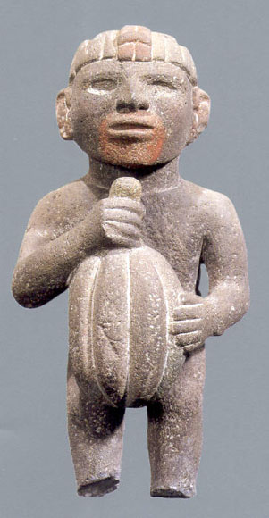
The cocoa bean (technically cocoa seed) or simply cocoa (), also called the cacao bean (technically cacao seed) or cacao (), is the dried and fully fermented seed of ''Theobroma cacao'', from which cocoa solids (a mixture of nonfat substances) and cocoa butter (the fat) can be extracted. Cocoa beans are the basis of chocolate, and Mesoamerican foods including tejate, an indigenous Mexican drink that also includes maize, and pinolillo, a similar Nicaraguan drink made from a cornmeal & cocoa powder. Etymology The word ''cocoa'' comes from the Spanish word , which is derived from the Nahuatl word . The Nahuatl word, in turn, ultimately derives from the reconstructed Proto-Mixe–Zoquean word ''kakawa''. Used on its own, the term ''cocoa'' may also mean: * Hot cocoa, the drink more known as ''hot chocolate'' Terms derived from ''cocoa'' include: * Cocoa paste, ground cocoa beans: the mass is melted and separated into: ** Cocoa butter, a pale, yellow, edible fat ** Cocoa s ... [...More Info...] [...Related Items...] OR: [Wikipedia] [Google] [Baidu] |
Landforms Of Ghana
A landform is a natural or anthropogenic land feature on the solid surface of the Earth or other planetary body. Landforms together make up a given terrain, and their arrangement in the landscape is known as topography. Landforms include hills, mountains, canyons, and valleys, as well as shoreline features such as bays, peninsulas, and seas, including submerged features such as mid-ocean ridges, volcanoes, and the great ocean basins. Physical characteristics Landforms are categorized by characteristic physical attributes such as elevation, slope, orientation, stratification, rock exposure and soil type. Gross physical features or landforms include intuitive elements such as berms, mounds, hills, ridges, cliffs, valleys, rivers, peninsulas, volcanoes, and numerous other structural and size-scaled (e.g. ponds vs. lakes, hills vs. mountains) elements including various kinds of inland and oceanic waterbodies and sub-surface features. Mountains, hills, plateaux, and plains are the fo ... [...More Info...] [...Related Items...] OR: [Wikipedia] [Google] [Baidu] |


.jpg)