|
Kvinnherad Municipality
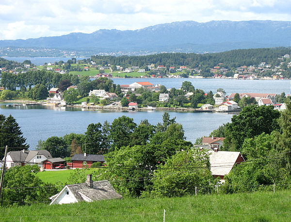
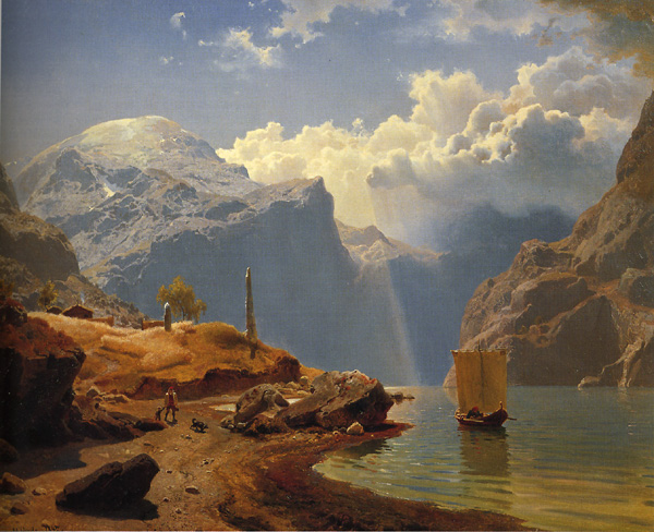
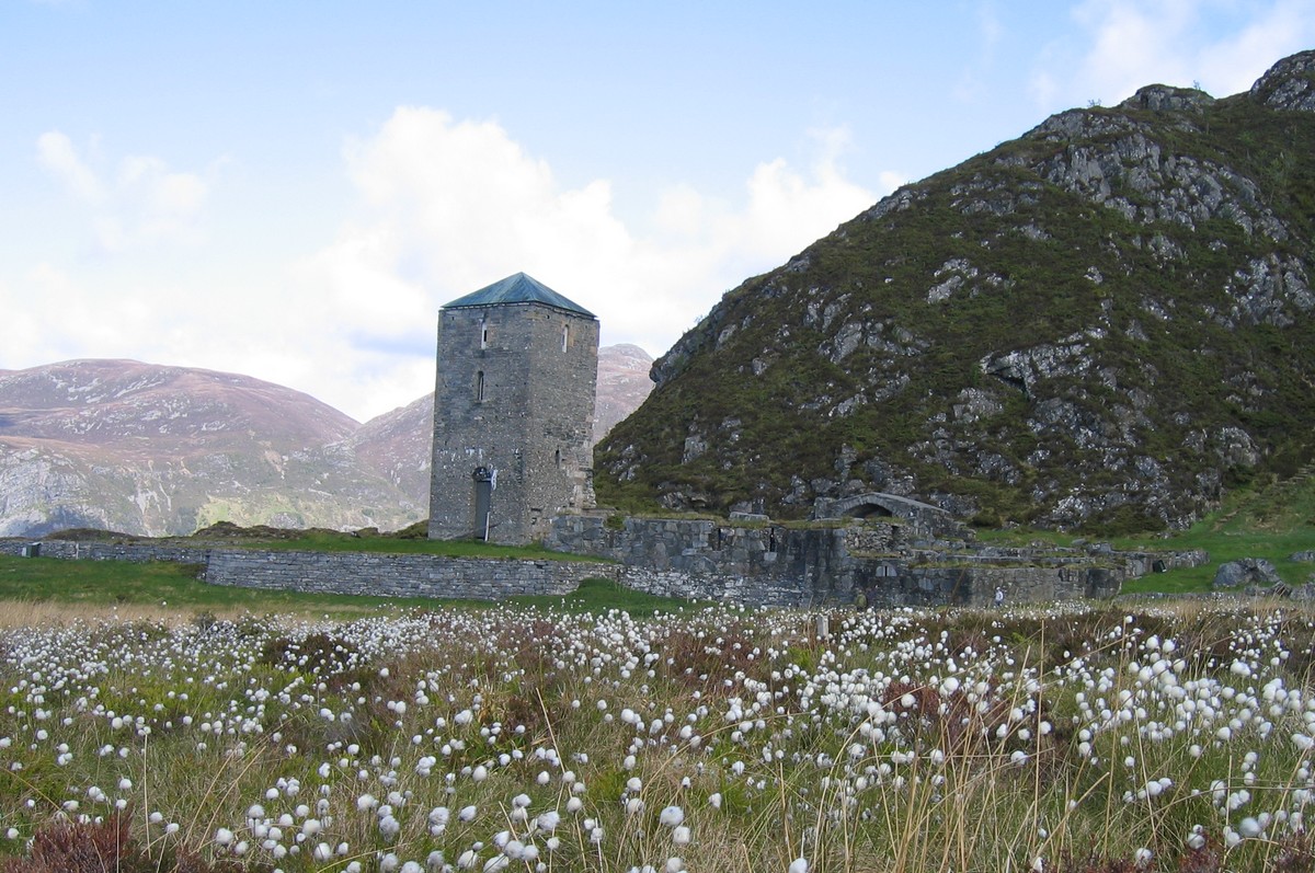
Kvinnherad is a municipality in Vestland county, Norway. It is located in the traditional district of Sunnhordland, along the Hardangerfjorden. The municipality was the 5th in size in former Hordaland county. The administrative centre of the municipality is the village of Rosendal. The largest village is Husnes, with about 6,000 people living in or near the village. Other villages include Ænes, Åkra, Dimmelsvik, Eidsvik, Hatlestrand, Herøysund, Høylandsbygd, Ølve, Sæbøvik, Sundal, Sunde, Uskedal, and Valen. The municipality is the 104th largest by area out of the 356 municipalities in Norway. Kvinnherad is the 94th most populous municipality in Norway with a population of 13,017. The municipality's population density is and its population has decreased by 2.3% over the previous 10-year period. In the southern part of Kvinnherad you will find the typical fjord landscape of western Norway. The areas of Mauranger and Rosendal are said to have about the most beauti ... [...More Info...] [...Related Items...] OR: [Wikipedia] [Google] [Baidu] |
Husnes
Husnes is the largest village in Kvinnherad municipality in Vestland county, Norway. The village is located on the southern shore of the Hardangerfjorden on the Folgefonna peninsula, about south of the village of Herøysund and immediately north of the villages of Sunde and Valen. The lake Onarheimsvatnet lies along the southwestern part of the village between Husnes and Sunde. The village has a population (2019) of 2,189 and a population density of . When the neighboring villages of Sunde and Valen are included, the entire urban area includes just under 4,500 people. Husnes is centered on the huge factory owned by ''Hydro'', formerly Sør-Norge Aluminium, and the village has become the center of commerce and education in Kvinnherad municipality, as well as the site of Husnes Church. The government of Kvinnherad has at times proposed that Husnes become the new administrative centre of Kvinnherad which usually sparks debate in the municipality. Industry and commerce ... [...More Info...] [...Related Items...] OR: [Wikipedia] [Google] [Baidu] |
Herøysund
Herøysund is a village in Kvinnherad municipality in Vestland county, Norway. The village is located on the southeastern shore of the Hardangerfjorden, about half-way between the villages of Husnes (to the south) and Uskedal (to the north). The village has a population (2019) of 506 and a population density Population density (in agriculture: standing stock or plant density) is a measurement of population per unit land area. It is mostly applied to humans, but sometimes to other living organisms too. It is a key geographical term.Matt RosenberPopul ... of . References Villages in Vestland Kvinnherad {{Vestland-geo-stub ... [...More Info...] [...Related Items...] OR: [Wikipedia] [Google] [Baidu] |
Glacier
A glacier (; ) is a persistent body of dense ice that is constantly moving under its own weight. A glacier forms where the accumulation of snow exceeds its Ablation#Glaciology, ablation over many years, often Century, centuries. It acquires distinguishing features, such as Crevasse, crevasses and Serac, seracs, as it slowly flows and deforms under stresses induced by its weight. As it moves, it abrades rock and debris from its substrate to create landforms such as cirques, moraines, or fjords. Although a glacier may flow into a body of water, it forms only on land and is distinct from the much thinner sea ice and lake ice that form on the surface of bodies of water. On Earth, 99% of glacial ice is contained within vast ice sheets (also known as "continental glaciers") in the polar regions, but glaciers may be found in mountain ranges on every continent other than the Australian mainland, including Oceania's high-latitude oceanic island countries such as New Zealand. Between lati ... [...More Info...] [...Related Items...] OR: [Wikipedia] [Google] [Baidu] |
Folgefonna
Folgefonna is a collective term for three plateau glaciers in the Hardanger region of Vestland county, Norway. They are located on the Folgefonna peninsula in the municipalities of Ullensvang, Kvinnherad, and Etne. The three glaciers are: * Nordre (northern) Folgefonna, with an area of * Midtre (central) Folgefonna, with an area of * Søndre (southern) Folgefonna, with an area of , making it the third largest glacier in the mainland of Norway. In total, Folgefonna covers about (measured in 2006). On 14 May 2005, Folgefonna National Park was established, protecting the glaciers and the surrounding areas. The glacier is home to a summer skiing resort, located on its northern region. The largest outflow glaciers from Folgefonna are Blomstølskardbreen, Bondhusbreen, and Buarbreen. Since around 1960, Blomstølskardbreen on the southern end of Folgefonna has changed very little. Bondhusbreen and Buerbreen further north were growing in the 1990s, but have been retreating since the ... [...More Info...] [...Related Items...] OR: [Wikipedia] [Google] [Baidu] |
Hardanger
Hardanger is a traditional district in the western part of Norway, dominated by the Hardangerfjord and its inner branches of the Sørfjorden and the Eid Fjord. It consists of the municipalities of Ullensvang, Eidfjord, Ulvik and Kvam, and is located inside the county of Vestland. The area is dominated by the vast Hardangervidda plateau in the east and the large Folgefonna glacier on the central Folgefonna peninsula. The district was selected as the millennium site for the old Hordaland county. In the early Viking Age, before Harald Fairhair, Hardanger was a petty kingdom with its capital at Kinsarvik. Etymology The Old Norse form of the name was ''Harðangr''. The first element is derived from the ethnonym '' hǫrðar'', or from ''harðr'' meaning "hard" (referring to wind and weather). The last element is ''angr'' "tight fjord" (the name originally belonged to the fjord, now called Hardangerfjord). Agriculture The region is one of Norway's most important sources of fruit ... [...More Info...] [...Related Items...] OR: [Wikipedia] [Google] [Baidu] |
Mauranger
Mauranger is the northernmost district of Kvinnherad municipality in Vestland county, Norway. The district is centered on the Maurangsfjorden on the western side of the vast Folgefonna glacier. Mauranger consists of the villages of Sundal, Austrepollen, Nordrepollen, and Gjetingsdalen. The scenery is characterised by its closeness to Folgefonna, several valleys, and precipitous mountainsides. The main industries in Mauranger are tourism, agriculture, fish farming and power production. The Mauranger area was historically isolated by the mountains, glaciers, and the fjord, with the only access by boat, and more recently one small road running along the coastline. Then in 2001, the Folgefonna Tunnel opened, connecting Mauranger to the neighboring town of Odda on the eastern side of the Folgefonna glacier. This has made Mauranger more accessible, and it has led to an increase in tourism. Mauranger was made even more accessible in 2012 with the opening of the Jondal Tunnel connecti ... [...More Info...] [...Related Items...] OR: [Wikipedia] [Google] [Baidu] |
Western Norway
Western Norway ( nb, Vestlandet, Vest-Norge; nn, Vest-Noreg) is the region along the Atlantic coast of southern Norway. It consists of the counties Rogaland, Vestland, and Møre og Romsdal. The region has no official or political-administrative function. The region has a population of approximately 1.4 million people. The largest city is Bergen and the second-largest is Stavanger. Historically the regions of Agder, Vest-Telemark, Hallingdal, Valdres, and northern parts of Gudbrandsdal have been included in Western Norway. Western Norway, as well as other parts of historical regions of Norway, shares a common history with Denmark, the Faroe Islands and Iceland and to a lesser extent the Netherlands and Britain. For example, the Icelandic horse is a close relative of the Fjord horse and both the Faroese and Icelandic languages are based on the Old West Norse. In early Norse times, people from Western Norway became settlers at the Western Isles in the Northern Atla ... [...More Info...] [...Related Items...] OR: [Wikipedia] [Google] [Baidu] |
Population Density
Population density (in agriculture: standing stock or plant density) is a measurement of population per unit land area. It is mostly applied to humans, but sometimes to other living organisms too. It is a key geographical term.Matt RosenberPopulation Density Geography.about.com. March 2, 2011. Retrieved on December 10, 2011. In simple terms, population density refers to the number of people living in an area per square kilometre, or other unit of land area. Biological population densities Population density is population divided by total land area, sometimes including seas and oceans, as appropriate. Low densities may cause an extinction vortex and further reduce fertility. This is called the Allee effect after the scientist who identified it. Examples of the causes of reduced fertility in low population densities are * Increased problems with locating sexual mates * Increased inbreeding Human densities Population density is the number of people per unit of area, usuall ... [...More Info...] [...Related Items...] OR: [Wikipedia] [Google] [Baidu] |
Valen, Kvinnherad
Valen is a village in Kvinnherad municipality in Vestland county, Norway. The village is located on the mainland coast overlooking the island of Halsnøy to the south. The undersea Halsnøy Tunnel connects Halsnøy island to the mainland just to the west of Valen, in the neighboring village of Sunde. The village has a shop, a kindergarten and primary school, and a mental hospital. There is also a horseback riding center, a marina, and Valen Church. The village of Valen is grouped together with the neighboring village of Sunde by Statistics Norway which calls it the Sunde/Valen "urban area". The urban area has a population (2019) of 2,272 and a population density Population density (in agriculture: standing stock or plant density) is a measurement of population per unit land area. It is mostly applied to humans, but sometimes to other living organisms too. It is a key geographical term.Matt RosenberPopul ... of . References Villages in Vestland Kvinnherad {{ ... [...More Info...] [...Related Items...] OR: [Wikipedia] [Google] [Baidu] |
Uskedal
Uskedal or Uskedalen is a village in Kvinnherad municipality in Vestland county, Norway. The village is located in a small valley along the southern shore of the Hardangerfjorden, about southwest of the village of Dimmelsvik and about east of the village of Herøysund. The village is the site of Uskedalen Church. The village has a population (2019) of 766 and a population density of . Media gallery Uskedalen03.jpg, View of the harbour Utstilling og dans 1915.jpg, 1915 Exhibition in Uskedal Hermetikkfabrikken brenn.jpg, Burning of the cannery Uskedalen kyrkje.jpg, Uskedal Church Uskedal or Uskedalen is a village in Kvinnherad municipality in Vestland county, Norway. The village is located in a small valley along the southern shore of the Hardangerfjorden, about southwest of the village of Dimmelsvik and about east of ... References Villages in Vestland Kvinnherad {{Vestland-geo-stub ... [...More Info...] [...Related Items...] OR: [Wikipedia] [Google] [Baidu] |
Sunde, Kvinnherad
Sunde is a village in Kvinnherad municipality in Vestland county, Norway. The village is located along the Hardangerfjorden, just north of the island of Halsnøya. The northern entrance to the Halsnøy Tunnel is located in Sunde. The large urban village of Husnes lies just to the north of Sunde, on the other end of the lake Onarheimsvatnet. The village of Sunde is grouped together with the neighboring village of Valen (to the east) by Statistics Norway which calls it the Sunde/Valen "urban area". The urban area has a population (2019) of 2,272 and a population density Population density (in agriculture: standing stock or plant density) is a measurement of population per unit land area. It is mostly applied to humans, but sometimes to other living organisms too. It is a key geographical term.Matt RosenberPopul ... of . References Villages in Vestland Kvinnherad {{Vestland-geo-stub ... [...More Info...] [...Related Items...] OR: [Wikipedia] [Google] [Baidu] |
Sundal
Sundal or Sunndal is the largest village in the Mauranger district of Kvinnherad municipality in Vestland county, Norway. The village is located on the southern shore of the Maurangsfjorden, south of Nordrepollen and Gjetingsdalen. The village of Austrepollen lies to the east of Sunndal. It sits in a deep valley, with steep mountains surrounding it on three sides. The Bondhusbreen glacier is located at the southern end of the valley. The village has been a centre of tourism for over 150 years. There are about 70 inhabitants in the village, which has a camping ground, a shop, and an inn. At the end of the 19th century, German and English tourists travelled to Sundal to experience the great nature including the nearby Folgefonna glacier, and the small Bondhusbreen arm which reaches into the valley towards Sundal. Today, the nearby Folgefonna National Park Folgefonna National Park ( no, Folgefonna nasjonalpark) is a national park in Vestland county, Norway. The park is loca ... [...More Info...] [...Related Items...] OR: [Wikipedia] [Google] [Baidu] |


