|
Kosasthalaiyar River
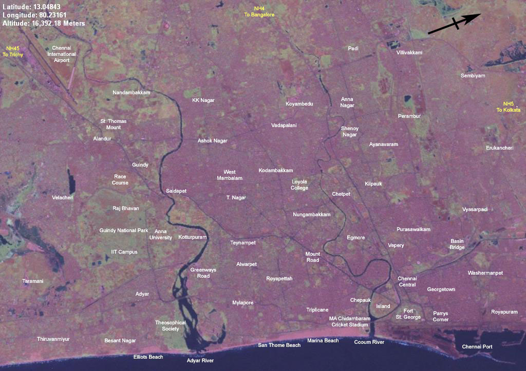
Kosasthalaiyar River, also known as Kortalaiyar, is one of the three rivers that flow in the Chennai metropolitan area. The river and its course Kosasthalaiyar is long and originates near Pallipattu in Thiruvallur district and drains into the Bay of Bengal. Its northern tributary Nagari river originates in Chitoor district of Andhra Pradesh and joins the main river in the backwaters of Poondi reservoir. Its catchment area is spread over Vellore, Chitoor, North Arcot, Thiruvallur and Chennai districts. It has a catchment area in North Arcot District where it branches near Kesavaram Anicut and this tributary flows to the Chennai city as Cooum River, while the main river flows to the Poondi reservoir. From Poondi reservoir, the river flows through Thiruvallur District, enters the Chennai metropolitan area, and joins the sea at Ennore Creek. The river has 9 check dams. There are two check dams across the river at Tamaraipakkam and Vallur. The excess discharge in the river is c ... [...More Info...] [...Related Items...] OR: [Wikipedia] [Google] [Baidu] |
Chennai Metropolitan Area
The Greater Chennai Metropolitan Area, or simply the Chennai Metropolitan Area (CMA), is the third-most populous metropolitan area in India, the 22nd-most in Asia, and the 40th-most in the world. The CMA consists of the core city of Chennai, which is coterminous with the Chennai district, and its suburbs in Kanchipuram (except Uthiramerur taluk), Chengalpattu (except Madurantakam and Cheyyur taluks), Thiruvallur (except Pallipattu, RK Pet and parts of Tiruttani taluks), and Ranipet (parts of Arakkonam taluk) districts. The Chennai Metropolitan Development Authority (CMDA) is the nodal agency that handles town planning and development within the metro area. Since 1974, an area encompassing around the city has been designated as the CMA and the CMDA has been designated as the authority to plan the growth of the city and the area around it. But in October 2022 the area of CMA was expanded five-fold to . Economy Recent estimates of the economy of the Chennai metropolitan a ... [...More Info...] [...Related Items...] OR: [Wikipedia] [Google] [Baidu] |
Ennore Creek
Ennore Creek is a backwater located in Ennore, Chennai along the Coromandel Coast of the Bay of Bengal. It is located in the zone comprising lagoons with salt marshes and backwaters, submerged under water during high tide and forming an arm of the sea with the opening to the Bay of Bengal at the creek. The zone is spread over an area of 4 km2, and the creek covers an area of 2.25 km2. It is located 20 km north of the city centre and 2.6 km south of the Ennore Port, and the creek area stretches 3 km into the sea and 5 km along the coast. The creek is nearly 400 m wide, elongated in northeast–southwest direction and merging with the backwater bodies. Once a flourishing mangrove swamp, the creek has been degraded to patches in the fringes mainly due to human activities in the region. The depth of the creek varies from 1 to 2 m and is shallow near the mouth. The north–south trending channels of the creek connect it with the Pulicat La ... [...More Info...] [...Related Items...] OR: [Wikipedia] [Google] [Baidu] |
Geography Of Chennai
Chennai is located at on the southeast coast of India and in the northeast corner of Tamil Nadu. It is located on a flat coastal plain known as the Eastern Coastal Plains. The city has an average elevation of , its highest point being . Chennai is 2,184 kilometres (1,357 mi) south of Delhi, 1,337 kilometres (831 mi) southeast of Mumbai, and 1,679 kilometers (1,043 mi) southwest of Kolkata by road. Geology The geology of Chennai comprises mostly clay, shale and sandstone. The city is classified into three regions based on geology, sandy areas, clayey areas and hard-rock areas. Sandy areas are found along the river banks and the coasts. Clayey regions cover most of the city. Hard rock areas are Guindy, Velachery, Adambakkam and a part of Saidapet. In sandy areas such as Tiruvanmiyur, Adyar, Kottivakkam, Santhome, George Town, Tondiarpet and the rest of coastal Chennai, rainwater run-off percolates very quickly. In clayey and hard rock areas, rainwater percolates slowly, but it ... [...More Info...] [...Related Items...] OR: [Wikipedia] [Google] [Baidu] |
Water Management In Chennai
The coastal city of Chennai has a metropolitan population of 10.6 million as per 2019 census. As the city lacks a perennial water source, catering the water requirements of the population has remained an arduous task. On 18 June 2019, the city's reservoirs ran dry, leaving the city in severe crisis. Although three rivers flow through the metropolitan region and drain into the Bay of Bengal, Chennai has historically relied on annual monsoon rains to replenish its water reservoirs since the rivers are polluted with sewage. With the population increasing over the decades, the city has faced water supply shortages, and its ground water levels have been depleted. An earlier Veeranam Lake project aimed at augmenting the city's water supply failed. However, the New Veeranam project, which became operational in September 2004, has greatly reduced dependency on distant sources. In recent years, heavy and consistent monsoon rains and rainwater harvesting (RWH) by Chennai Metro Water at its ... [...More Info...] [...Related Items...] OR: [Wikipedia] [Google] [Baidu] |
Cooum River
The Cooum river, or simply Koovam, is one of the shortest classified rivers draining into the Bay of Bengal. This river is about in length, flowing in the city of Chennai (urban part) and the rest in rural part. The river is highly polluted in the urban area (Chennai). Along with the Adyar River running parallel to the south and the Kosasthalaiyar River, the river trifurcates the city of Chennai and separates Northern Chennai from Central Chennai. It is also sometimes known as Thiruvallikenni river Its source is in a place by the Kesavaram Anaicut built across Kallar river in Vellore district adjoining Chennai district. From its origin in the Kesavaram village to Thandurai (Pattabiram), Thiruverkadu Anaikat, the river remains unpolluted. Beyond this, the river is highly polluted till its mouth in the Bay of Bengal. In Chennai district, the river flows through three corporation zones—Kilpauk, Nungambakkam and Triplicane—for a total length of . Owing to intensive use ... [...More Info...] [...Related Items...] OR: [Wikipedia] [Google] [Baidu] |
Srisailam Dam
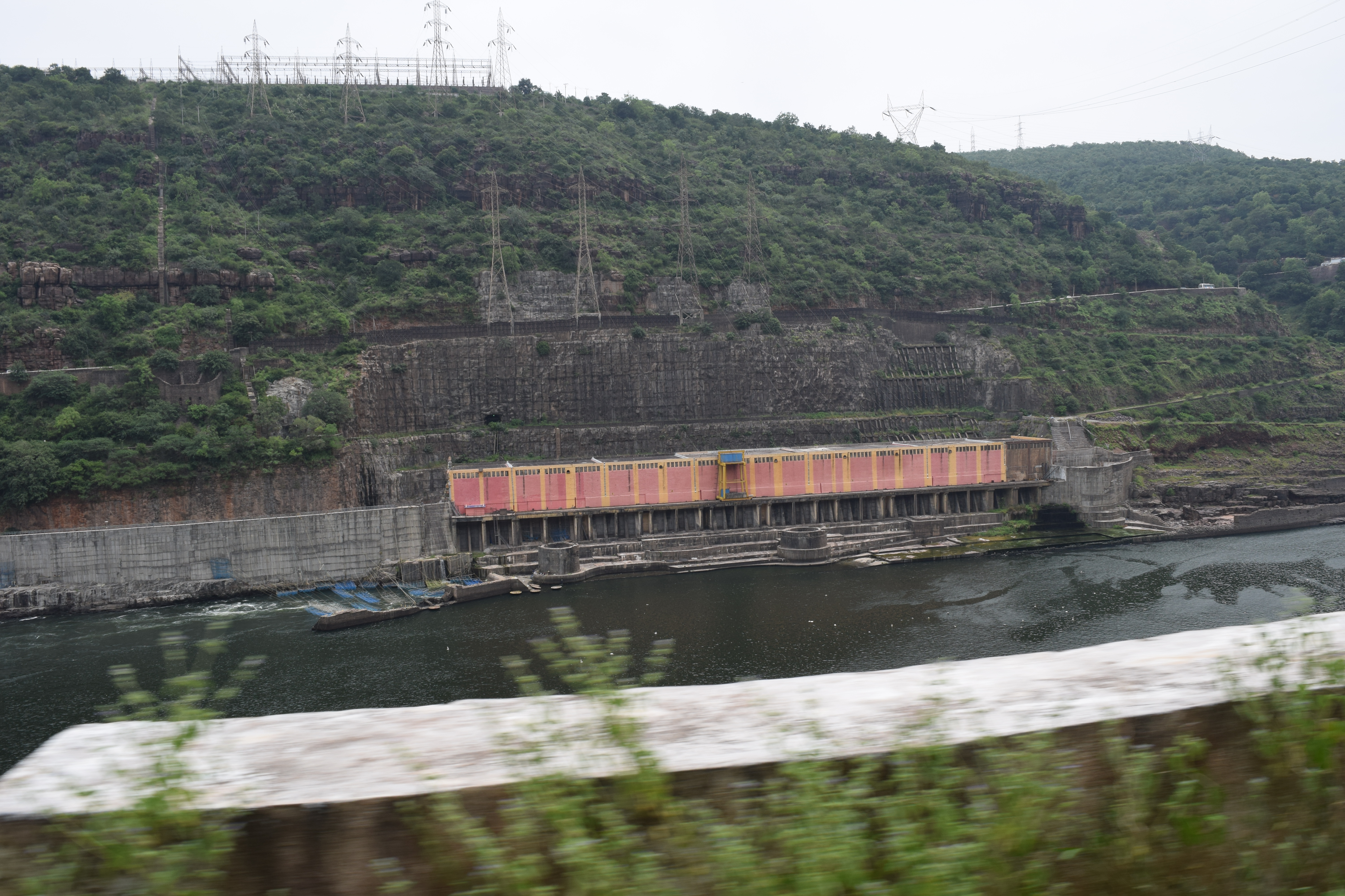
The Srisailam Dam is constructed across the Krishna River in Nagarkurnool district , Telangana and Nandyal district, Andhra Pradesh near Srisailam temple town and is the 2nd largest capacity working hydroelectric station in India. The dam was constructed in a deep gorge in the Nallamala Hills in between Kurnool and Nagarkurnool districts, above sea level. It is long, maximum height and has crest gates. It has a reservoir of . Project has an estimated live capacity to hold 178.74 Tmcft at its full reservoir level of MSL. It's gross storage capacity is 6.116 cubic kms (216 tmc ft). The minimum draw down level (MDDL) of the reservoir is at MSL from its river sluice gates and corresponding dead storage is 3.42 Tmcft. The left bank underground power station houses reversible Francis-pump turbines for pumped-storage operation (each Turbine can pump 200 cumecs) and the right bank semi under ground power station houses Francis-turbine generators. Tail pond dam/weir lo ... [...More Info...] [...Related Items...] OR: [Wikipedia] [Google] [Baidu] |
Galeru Nagari Sujala Sravanthi Project
Galeru Nagari Sujala Sravanthi Project or GNSS project is an irrigation project in Kadapa and Chitoor districts of Andhra Pradesh Andhra Pradesh (, abbr. AP) is a state in the south-eastern coastal region of India. It is the seventh-largest state by area covering an area of and tenth-most populous state with 49,386,799 inhabitants. It is bordered by Telangana to the .... It is envisaged to irrigate in two phases besides providing drinking water facilities to villages and towns en route the canal alignment. The main canal, Gandikota, Vamikonda and Sarvarajasagar reservoirs are under construction. The scheme envisages drawl of 40 TMC surplus flood waters of river Krishna from the foreshore of Srisailam Reservoir through Srisailam Right Bank Canal (SRBC) system up to Gorakallu Reservoir and thereafter through an independent flood flow canal to feed nine storage reservoirs en route and utilize the stored water for irrigation during the Rabi season. The project constru ... [...More Info...] [...Related Items...] OR: [Wikipedia] [Google] [Baidu] |
Minjur
Minjur is a town located in the outskirts of North Chennai, India. It is located in the Thiruvallur district in the Indian state of Tamil Nadu. Minjur is called 'Vada Kanchi' meaning North Kanchipuram. The town has two famous temples for Shiva and Vishnu, similar to Kanchipuram. The neighbourhood is served by Minjur railway station of the Chennai Suburban Railway Network. Geography Minjur is located at . It has an average elevation of 11 metres (36 feet). With Ponneri as its north, Cholavaram as its west, Manali New Town, Manali and Thiruvottiyur as its south, it is situated about 25 km from north of Chennai and well connected to that city with roadways and railways. Minjur is a well-developed town which comprises more than 20 villages around it with most villages underdeveloped in terms of roads, schools, and other amenities. Minjur belongs to Ponneri taluk. Demographics India census, Minjur had a population of 23,947. Males constitute 50% of the popul ... [...More Info...] [...Related Items...] OR: [Wikipedia] [Google] [Baidu] |
Pallipattu
Pallipattu is a town in Tamil Nadu and a border town located between the Chittoor District of Andhra Pradesh and Tiruvallur District of Tamil Nadu . It is known for its rich and fertile agricultural lands and is blessed with the flowing of river, from west to east, named 'Kusasthalai'. Geography Pallipat is located at . It has an average elevation of 154 metres (505 feet). Demographics India census, Pallipattu had a population of 10012Males constitute 50% of the population and females 50%. Pallipattu has an average literacy rate of 71%, higher than the national average of 59.5%: male literacy is 79%, and female literacy is 63%. Politics The Andhra Pradesh and Madras Alteration of Boundaries Act, enacted in 1959 by the Parliament of India under the provisions of article 3 of the constitution, went into effect from 1 April 1960. Under the act, Tirutani taluk and Pallipattu sub-taluk of the Chittoor district of Andhra Pradesh were transferred to Madras State in exchan ... [...More Info...] [...Related Items...] OR: [Wikipedia] [Google] [Baidu] |


