|
Koonoomoo
Koonoomoo is a town in northern Victoria, Australia. The town is located in the Shire of Moira local government area, north of the state capital, Melbourne on the Goulburn Valley Highway, near the Murray River. At the , Koonoomoo had a population of 255. The town is probably best known for its strawberry farms and the Big Strawberry, part of an Australian trend to build large roadside attractions. Also it is home to the Cobram State Forest which attracts many visitors. Koonoomoo had a Post Office only for a brief period in 1917. Nearby Mywee Post Office to the west on the Shepparton railway line The Tocumwal railway line (also known as the Shepparton line) is a gauge railway line in Victoria, Australia. The line runs between the border town of Tocumwal in New South Wales to Southern Cross, Melbourne. The line is utilised by various pas ... was open between 1911 and 1974. On 21 March 2013 the town was struck by a violent EF4 tornado. References External links * ... [...More Info...] [...Related Items...] OR: [Wikipedia] [Google] [Baidu] |
Australia's Big Things
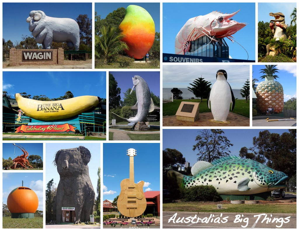
The big things of Australia are large structures, some of which are novelty architecture and some are sculptures. There are estimated to be over 230 such objects around the country. There are big things in every state and territory in continental Australia. Most big things began as tourist traps found along major roads between destinations. The big things have become something of a cult phenomenon, and are sometimes used as an excuse for a road trip, where many or all big things are visited and used as a backdrop to a group photograph. Many of the big things are considered works of folk art and have been heritage-listed, though others have come under threat of demolition. List of big things (by state or territory) Australian Capital Territory New South Wales Northern Territory Queensland South Australia Tasmania Victoria Western Australia In popular culture *The London production of '' Priscilla, Queen of the Desert: the Musical'' references the Big Prawn ... [...More Info...] [...Related Items...] OR: [Wikipedia] [Google] [Baidu] |
Cobram, Victoria
Cobram is a town in the Australian state of Victoria. It is on the Murray River which forms the border between Victoria and New South Wales. Cobram along with the nearby towns of Numurkah and Yarrawonga is part of Shire of Moira and is the administrative centre of the council. Its twin town of Barooga is located on the north side of the Murray River. Surrounding Cobram are a number of orchards, dairy farms and wineries. At the 2016 census, Cobram had a population of 6,014. Material was copied from this source, which is available under Creative Commons Attribution 4.0 International License Barooga's population is currently 1,817. Material was copied from this source, which is available under Creative Commons Attribution 4.0 International License History Aboriginals, although they had disappeared from the area prior to European settlement, were believed to inhabit the stretch of region bound by the Murray River from Tocumwal to the east of Cobram and south as far as the Broken C ... [...More Info...] [...Related Items...] OR: [Wikipedia] [Google] [Baidu] |
Towns In Victoria (Australia)
This is a list of locality names and populated place names in the state of Victoria, Australia, outside the Melbourne metropolitan area. It is organised by region from the south-west of the state to the east and, for convenience, is sectioned by Local Government Area (LGA). Localities are bounded areas recorded on VICNAMES, although boundaries are the responsibility of each council. Many localities cross LGA boundaries, some being partly within three LGAs, but are listed here once under the LGA in which the major population centre or area occurs. The Office of Geographic Names (OGN), led by the Registrar of Geographic Names, administers the naming or renaming of localities (as well as roads, and other features) in Victoria, and maintains the Register of Geographic Names, referred as the VICNAMES register, pursuant to the ''Geographic Place Names Act 1998''. The OGN has issued the mandatory ''Naming rules for places in Victoria, Statutory requirements for naming roads, features ... [...More Info...] [...Related Items...] OR: [Wikipedia] [Google] [Baidu] |
Strathmerton, Victoria
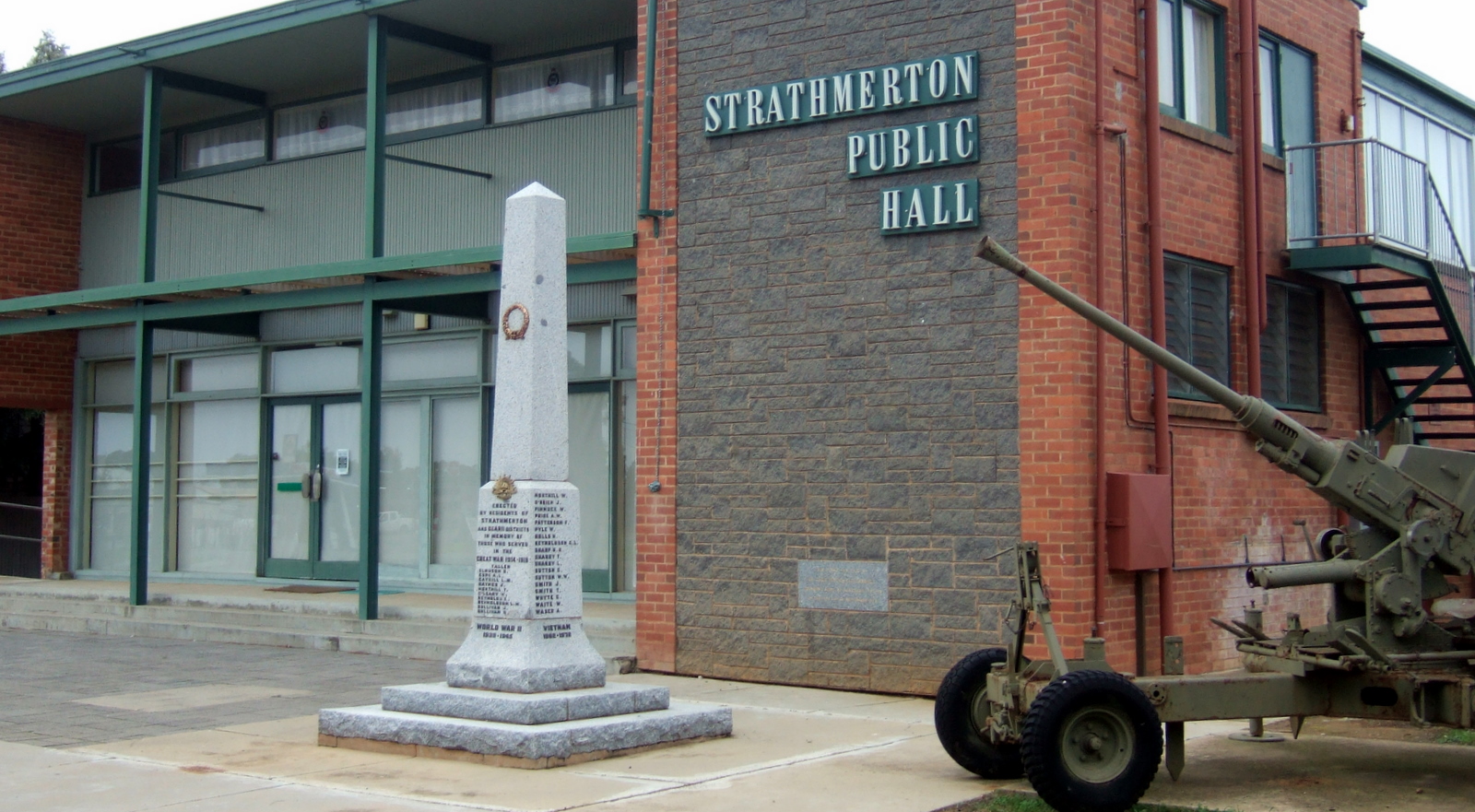
Strathmerton is a town in Victoria, Australia. It is located in the Shire of Moira local government area on the Murray Valley Highway and Goulburn Valley Highway, about west of Cobram. At the , Strathmerton had a population of 1072. History Strathmerton Post Office opened on 1 September 1879. In 1888 on the arrival of the railway a Strathmerton Township Post Office opened near the station. In 1891 this was renamed Strathmerton. The local railway station was opened on the railway to Cobram in 1888, with the line to Tocumwal opened in 1905. The last regular passenger service was in 1993. Before road changes, Strathmerton was known as the intersection of the Goulburn Valley Highway and the Murray Valley Highway and was the northernmost town directly north of Melbourne still in Victoria. The Kraft factory in Strathmerton was acquired by Bega Cheese in December 2008 with Bega claiming that production will double in the following five years. Today The town is served by the Strat ... [...More Info...] [...Related Items...] OR: [Wikipedia] [Google] [Baidu] |
Mywee, Victoria
Mywee (signifying "a well") is a locality in northern Victoria, Australia. It is in the local government area of Shire of Moira Moira Shire Council is a Local Government Area in the Northern Victoria Region of Victoria, Australia. Located in the north-east part of the state, it covers an area of . As at June 2021 the population was 30,018. It includes the towns of Cobra .... Mywee was also known as "Sheepwash Creek". There is a closed railway station named Mywee Railway Station on the Tocumwal Railway Line. Mywee post office opened on 1 November 1911, and closed on 30 September 1974. Mywee state school now closed, opened 1894 and rebuilt July 10, 1944. References External links Towns in Victoria (Australia) Towns in Goulburn Valley Shire of Moira {{Hume-geo-stub ... [...More Info...] [...Related Items...] OR: [Wikipedia] [Google] [Baidu] |
Goulburn Valley Highway
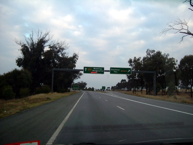
Goulburn Valley Highway is a highway located in Victoria, Australia. The section north of the Hume Freeway is part of the Melbourne to Brisbane National Highway (together with Hume Freeway) and is the main link between these two cities as well as a major link between Victoria and inland New South Wales. It is also the most direct route between Melbourne and the major regional centre of Shepparton in Victoria (via the Hume Freeway). Route The highway roughly follows the course of the Goulburn River, a tributary of the Murray River. The Highway serves the fruit and vegetable growing areas of the Goulburn Valley in Victoria, one of Australia's most productive agricultural regions. The highway runs from Eildon to Seymour as a two lane single carriageway sealed road with shoulders. The section from the Hume Freeway to Arcadia via Nagambie has been fully converted into a dual carriageway and has been renamed as the Goulburn Valley Freeway. The freeway upgrade has made sections of the ... [...More Info...] [...Related Items...] OR: [Wikipedia] [Google] [Baidu] |
Yarroweyah, Victoria
Yarroweyah ( ) is a town in northern Victoria, Australia. The town is located in the Shire of Moira local government area, north of the state capital, Melbourne and west of Cobram. The town is situated near the intersection of Kenny Road, Kokoda Road and the Murray Valley Highway. At the , Yarroweyah and the surrounding area had a population of 548. History Yarroweyah Post Office opened on 1 January 1882. In 1888 it was renamed Yarroweyah South when a new Yarroweyah post office opened to the north. This latter office closed in 1976. After World War II, an extensive soldier settlement area was established to the south of Yarroweyah. The north–south roads built in the area were named after theatres of war, and the east–west roads after generals etc. (e.g. Tobruk, Labuan, Macarthur). For over a century, area residents drilled individual wells to supply their water needs. In 2003 it was proposed to create a municipal distribution system; the residents approved the proposal, an ... [...More Info...] [...Related Items...] OR: [Wikipedia] [Google] [Baidu] |
Shire Of Moira
Moira Shire Council is a Local Government Area in the Northern Victoria Region of Victoria, Australia. Located in the north-east part of the state, it covers an area of . As at June 2021 the population was 30,018. It includes the towns of Cobram, Nathalia, Numurkah, Tungamah and Yarrawonga. It was formed in 1994 from the amalgamation of the Shire of Cobram, Shire of Nathalia, Shire of Numurkah, and parts of the Shire of Tungamah and Shire of Yarrawonga. The Shire is governed and administered by the Moira Shire Council; its seat of local government and administrative centre is located at the council headquarters in Cobram, it also has a service centre located in Yarrawonga. The Shire is named after the county of Moira, of which the LGA occupies the northern part. Moira Shire Council is currently the subject of a Commission of Enquiry by the Victorian State Government due to ongoing concerns with cultural and governance issues. In April 2022 a Municipal Monitor was appointed d ... [...More Info...] [...Related Items...] OR: [Wikipedia] [Google] [Baidu] |
Electoral District Of Ovens Valley
The electoral district of Ovens Valley is an electoral district of the Victorian Legislative Assembly in Australia. It was created in the redistribution of electoral boundaries in 2013, and came into effect at the 2014 state election. It largely covers areas from the abolished district of Murray Valley, centering on the city of Wangaratta. It includes the towns of Yarrawonga, Cobram, and other towns in the local government areas of Moira, Wangaratta, and Alpine. The abolished seat of Murray Valley was held by Nationals MP Tim McCurdy Timothy Logan McCurdy (born 16 January 1963) is an Australian politician. He has been a member of the Victorian Legislative Assembly since 2010, representing Murray Valley until 2014 and Ovens Valley thereafter. He was the shadow minister fo ..., who retained the new seat at the 2014 election. Members Election results References External links District profile from the Victorian Electoral Commission Ovens Valley, Electoral ... [...More Info...] [...Related Items...] OR: [Wikipedia] [Google] [Baidu] |
Melbourne
Melbourne ( ; Boonwurrung/Woiwurrung: ''Narrm'' or ''Naarm'') is the capital and most populous city of the Australian state of Victoria, and the second-most populous city in both Australia and Oceania. Its name generally refers to a metropolitan area known as Greater Melbourne, comprising an urban agglomeration of 31 local municipalities, although the name is also used specifically for the local municipality of City of Melbourne based around its central business area. The metropolis occupies much of the northern and eastern coastlines of Port Phillip Bay and spreads into the Mornington Peninsula, part of West Gippsland, as well as the hinterlands towards the Yarra Valley, the Dandenong and Macedon Ranges. It has a population over 5 million (19% of the population of Australia, as per 2021 census), mostly residing to the east side of the city centre, and its inhabitants are commonly referred to as "Melburnians". The area of Melbourne has been home to Aboriginal ... [...More Info...] [...Related Items...] OR: [Wikipedia] [Google] [Baidu] |
Shepparton Railway Line
The Tocumwal railway line (also known as the Shepparton line) is a gauge railway line in Victoria, Australia. The line runs between the border town of Tocumwal in New South Wales to Southern Cross, Melbourne. The line is utilised by various passenger and freight trains serving the northern suburbs of Melbourne and northern regions of Victoria. History The Melbourne and Essendon Railway Company opened the first section of the Tocumwal railway line from North Melbourne to Essendon in 1860. Following its take over by the Victorian Government in 1867, the line was extended to Tallarook and Mangalore in 1872. A line was built from Mangalore to Toolamba and Shepparton in 1880 and extended to Numurkah in 1881, Strathmerton in 1905 and connecting with the New South Wales Government Railways at Tocumwal at a break-of-gauge in 1908. Passenger services to Tocumwal ended on 8 November 1975 with the last train operated by T class diesel locomotive T324 and passenger carriages 3AS - ... [...More Info...] [...Related Items...] OR: [Wikipedia] [Google] [Baidu] |
Garden Strawberry
The garden strawberry (or simply strawberry; ''Fragaria × ananassa'') is a widely grown hybrid species of the genus ''Fragaria'', collectively known as the strawberries, which are cultivated worldwide for their fruit. The fruit is widely appreciated for its characteristic aroma, bright red color, juicy texture, and sweetness. It is consumed in large quantities, either fresh or in such prepared foods as jam, juice, pies, ice cream, milkshakes, and chocolates. Artificial strawberry flavorings and aromas are also widely used in products such as candy, soap, lip gloss, perfume, and many others. The garden strawberry was first bred in Brittany, France, in the 1750s via a cross of ''Fragaria virginiana'' from eastern North America and ''Fragaria chiloensis'', which was brought from Chile by Amédée-François Frézier in 1714. Cultivars of ''Fragaria'' × ''ananassa'' have replaced, in commercial production, the woodland strawberry (''Fragaria vesca''), which was the first strawber ... [...More Info...] [...Related Items...] OR: [Wikipedia] [Google] [Baidu] |


