|
Kolekole Beach Park
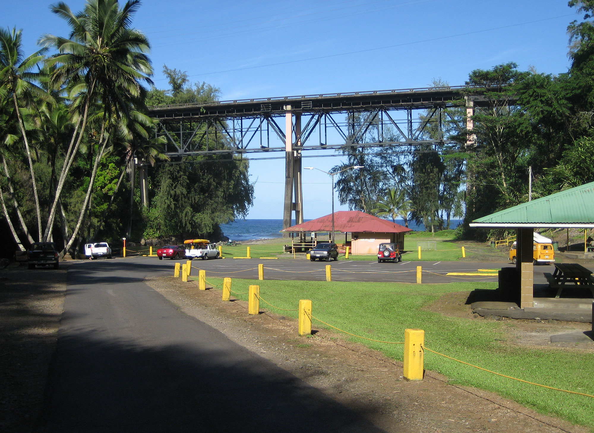
Kolekole Beach Park is a Hawaii county park on the island of Hawaii. , it is currently closed due to lead contamination found in the soil of the lawn areas. It will remain closed as further testing is done. The park is about downstream from Akaka Falls, with an additional waterfall on the Kaahakini stream that drops directly from a small cliff into the main Kolekole Stream as it forms an estuary at the ocean. The stream passes through a rainforest containing several varieties of orchids. The stream flows about U.S. Geological Survey. National Hydrography Dataset high-resolution flowline dataThe National Map, accessed April 28, 2011 from an elevation of about on the eastern slope of Mauna Kea (at coordinates ) to sea level. The Hawaii Belt Road (state route 19) passes over the park on a high bridge. The park is located in the South Hilo District at coordinates near the 14 mile marker. The name ''Kolekole'' means "raw or scarred" in the Hawaiian language. Camping is allowe ... [...More Info...] [...Related Items...] OR: [Wikipedia] [Google] [Baidu] |
Hawaii Belt Road Over Kolek
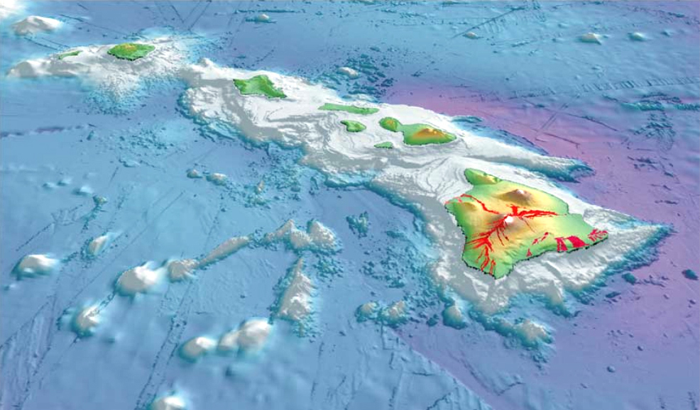
Hawaii ( ; haw, Hawaii or ) is a state in the Western United States, located in the Pacific Ocean about from the U.S. mainland. It is the only U.S. state outside North America, the only state that is an archipelago, and the only state geographically located within the tropics. Hawaii comprises nearly the entire Hawaiian archipelago, 137 volcanic islands spanning that are physiographically and ethnologically part of the Polynesian subregion of Oceania. The state's ocean coastline is consequently the fourth-longest in the U.S., at about . The eight main islands, from northwest to southeast, are Niihau, Kauai, Oahu, Molokai, Lānai, Kahoolawe, Maui, and Hawaii—the last of these, after which the state is named, is often called the "Big Island" or "Hawaii Island" to avoid confusion with the state or archipelago. The uninhabited Northwestern Hawaiian Islands make up most of the Papahānaumokuākea Marine National Monument, the United States' largest protec ... [...More Info...] [...Related Items...] OR: [Wikipedia] [Google] [Baidu] |
Hawaii Belt Road
The Hawaii Belt Road is a modern name for the Māmalahoa Highway and consists of Hawaii state Routes 11, 19, and 190 that encircle the Island of Hawaii. The southern section, between Hilo and Kailua-Kona is numbered as Route 11. The section between Hilo and Waimea is Route 19. Between Waimea and Kailua-Kona, the road is split in two: the original "mauka" route (now Route 190) and a "makai" Route 19, completed in 1975, which serves as access to the Kona and Kohala Coast resorts. In the Hawaiian language, ''mauka'' means "towards the mountain" and ''makai'' means "towards the sea". These terms are commonly used in travel directions. Parts of the southern half of the Hawaii Belt Road were known during the Territorial days as the Kaū Belt Road. The names "Hawaii Belt Road" and "Māmalahoa Highway" refer to the road system that encircles the entire island; many sections are also referenced by local names. History Māmalahoa Highway was named for the royal decree by King Kameham ... [...More Info...] [...Related Items...] OR: [Wikipedia] [Google] [Baidu] |
Protected Areas Of Hawaii (island)
Hawaii ( ; haw, Hawaii or ) is a state in the Western United States, located in the Pacific Ocean about from the U.S. mainland. It is the only U.S. state outside North America, the only state that is an archipelago, and the only state geographically located within the tropics. Hawaii comprises nearly the entire Hawaiian archipelago, 137 volcanic islands spanning that are physiographically and ethnologically part of the Polynesian subregion of Oceania. The state's ocean coastline is consequently the fourth-longest in the U.S., at about . The eight main islands, from northwest to southeast, are Niihau, Kauai, Oahu, Molokai, Lānai, Kahoolawe, Maui, and Hawaii—the last of these, after which the state is named, is often called the "Big Island" or "Hawaii Island" to avoid confusion with the state or archipelago. The uninhabited Northwestern Hawaiian Islands make up most of the Papahānaumokuākea Marine National Monument, the United States' largest protected are ... [...More Info...] [...Related Items...] OR: [Wikipedia] [Google] [Baidu] |
1946 Aleutian Islands Earthquake
The 1946 Aleutian Islands earthquake occurred near the Aleutian Islands, Alaska on April 1, 1946. The shock had a moment magnitude () of 8.6, a tsunami magnitude of 9.3, and a surface-wave magnitude () of only 7.4, and a maximum Mercalli intensity of VI (''Strong''). It resulted in 165–173 casualties and over $26 million in damage. The seafloor along the fault was elevated, triggering a Pacific-wide tsunami with multiple destructive waves at heights ranging from . The tsunami obliterated the Scotch Cap Lighthouse on Unimak Island, Alaska among others, and killed all five lighthouse keepers. Despite the destruction to the Aleutian Island Unimak, the tsunami had almost an imperceptible effect on the Alaskan mainland. Tectonic setting The Aleutian Islands are a group of 14 large and 55 smaller volcanic islands situated between mainland Alaska and Kamchatka. They are situated along the Aleutian Trench as they were formed by the active subduction of the oceanic Pacific plate unde ... [...More Info...] [...Related Items...] OR: [Wikipedia] [Google] [Baidu] |
Sugarcane
Sugarcane or sugar cane is a species of (often hybrid) tall, Perennial plant, perennial grass (in the genus ''Saccharum'', tribe Andropogoneae) that is used for sugar Sugar industry, production. The plants are 2–6 m (6–20 ft) tall with stout, jointed, fibrous stalks that are rich in sucrose, which accumulates in the Plant stem, stalk internodes. Sugarcanes belong to the grass family, Poaceae, an economically important flowering plant family that includes maize, wheat, rice, and sorghum, and many forage crops. It is native to the warm temperate and tropical regions of India, Southeast Asia, and New Guinea. The plant is also grown for biofuel production, especially in Brazil, as the canes can be used directly to produce ethyl alcohol (ethanol). Grown in tropical and subtropical regions, sugarcane is the world's largest crop by production quantity, totaling 1.9 billion tonnes in 2020, with Brazil accounting for 40% of the world total. Sugarcane accounts for 79% of sug ... [...More Info...] [...Related Items...] OR: [Wikipedia] [Google] [Baidu] |
Hamakua
Hāmākua is a district on the northeast coast of Hawaii (island), Hawaii's Big Island, administered by the Hawaii County, Hawaii, County of Hawaii in the state of Hawaii, Hawaii. It is also the name given for the coastline in the region, the "Hāmākua Coast". Description Hāmākua's coast is approximately long, along the Pacific Ocean around , ending at Waipio Valley, Waipio Valley and the uninhabited Waimanu Valley. The term Hāmākua Coast is used loosely to describe the region between Hilo, Hawaii, Hilo and Waipio, although the modern Hāmākua zoning district begins north of Laupāhoehoe, Hawai'i, Laupāhoehoe and west of 'Ō'ōkala, Hawaii, Ōōkala. The rainfall due to the prevailing northeasterly tropical trade winds produces steep erosional valleys and cliffs, showing evidence of frequent landslides. The lush vegetation and lack of sandy beaches contrasts sharply with other regions of the island. The dominating geographic feature in Hāmākua is the volcanic mountain ... [...More Info...] [...Related Items...] OR: [Wikipedia] [Google] [Baidu] |
Hilo, Hawaii
Hilo () is a census-designated place (CDP) and the largest settlement in Hawaii County, Hawaii, United States, which encompasses the Island of Hawaii. The population was 44,186 according to the 2020 census. It is the fourth-largest settlement in the state of Hawaii and largest settlement in the state outside of Oahu. Hilo is the county seat of the County of Hawaii and is in the District of South Hilo. The city overlooks Hilo Bay and has views of two shield volcanoes, Mauna Loa, an active volcano, and Mauna Kea, a dormant volcano. Mauna Kea is the site of some of the world's most important ground-based astronomical observatories. The Hilo bay-front has been destroyed by tsunamis twice. The majority of human settlement in Hilo stretches from Hilo Bay to Waiākea-Uka, on the flanks of the volcanoes. Hilo is home to the University of Hawaii at Hilo, ʻImiloa Astronomy Center, as well as the Merrie Monarch Festival, a week-long celebration, including three nights of competition, of ... [...More Info...] [...Related Items...] OR: [Wikipedia] [Google] [Baidu] |
Truss Bridge
A truss bridge is a bridge whose load-bearing superstructure is composed of a truss, a structure of connected elements, usually forming triangular units. The connected elements (typically straight) may be stressed from tension, compression, or sometimes both in response to dynamic loads. The basic types of truss bridges shown in this article have simple designs which could be easily analyzed by 19th and early 20th-century engineers. A truss bridge is economical to construct because it uses materials efficiently. Design The nature of a truss allows the analysis of its structure using a few assumptions and the application of Newton's laws of motion according to the branch of physics known as statics. For purposes of analysis, trusses are assumed to be pin jointed where the straight components meet, meaning that taken alone, every joint on the structure is functionally considered to be a flexible joint as opposed to a rigid joint with strength to maintain its own shape, and th ... [...More Info...] [...Related Items...] OR: [Wikipedia] [Google] [Baidu] |
Hawaiian Language
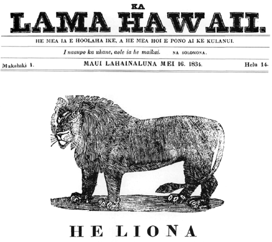
Hawaiian (', ) is a Polynesian language of the Austronesian language family that takes its name from Hawaii, the largest island in the tropical North Pacific archipelago where it developed. Hawaiian, along with English, is an official language of the US state of Hawaii. King Kamehameha III established the first Hawaiian-language constitution in 1839 and 1840. For various reasons, including territorial legislation establishing English as the official language in schools, the number of native speakers of Hawaiian gradually decreased during the period from the 1830s to the 1950s. Hawaiian was essentially displaced by English on six of seven inhabited islands. In 2001, native speakers of Hawaiian amounted to less than 0.1% of the statewide population. Linguists were unsure if Hawaiian and other endangered languages would survive. Nevertheless, from around 1949 to the present day, there has been a gradual increase in attention to and promotion of the language. Public Hawaiian-langua ... [...More Info...] [...Related Items...] OR: [Wikipedia] [Google] [Baidu] |
Hilo District, Hawaii
Hilo is a moku or district on the Big Island of Hawaiʻi in the State of Hawaii, U.S.A. In the current system of administration of Hawaiʻi County, the moku of Hilo is divided into North Hilo District (''Hilo ‘Akau'') and South Hilo District (''Hilo Hema''). Hilo is located on the eastern, windward side of the island, enjoying abundance of rainfall, and therefore includes the island's most populated town, also called Hilo. North Hilo District In the District of North Hilo, there are, along Hawaii State Highway 19 from north to south, the following unincorporated towns and localities: * ʻŌʻōkala * Laupāhoehoe and the Train Museum * Ninole and others. Inland, along State Highway 200, are: * Mauna Kea mountain road and Puu Huluhulu and others. South Hilo District In the District of South Hilo, there are, along State Highway 19, the following unincorporated towns and localities: * Honomu and the Akaka Falls * Pepeekeo * Wainaku * Hilo Bay, the Wailuku River ... [...More Info...] [...Related Items...] OR: [Wikipedia] [Google] [Baidu] |
Mauna Kea
Mauna Kea ( or ; ; abbreviation for ''Mauna a Wākea''); is a dormant volcano on the island of Hawaii. Its peak is above sea level, making it the highest point in the state of Hawaii and second-highest peak of an island on Earth. The peak is about higher than Mauna Loa, its more massive neighbor. Mauna Kea is unusually topographically prominent for its height: its wet prominence is fifteenth in the world among mountains, at ; its dry prominence of is second in the world, only after Mount Everest This dry prominence is greater than Mount Everest's height above sea level of , and some authorities have labelled Mauna Kea the tallest mountain in the world, from its underwater base. It is about one million years old and thus passed the most active shield stage of life hundreds of thousands of years ago. In its current post-shield state, its lava is more viscous, resulting in a steeper profile. Late volcanism has also given it a much rougher appearance than its neighboring v ... [...More Info...] [...Related Items...] OR: [Wikipedia] [Google] [Baidu] |
Hawaii County, Hawaii
Hawaii County ( haw, Kalana o Hawaiʻi) (officially known as the County of Hawaii) is a county in the U.S. state of Hawaii in the Hawaiian Islands. It is coextensive with the Island of Hawaii, often called the "Big Island" to distinguish it from the state as a whole. The 2020 Census population was 200,629. The county seat is Hilo. There are no incorporated cities in Hawaii County (see Hawaii Counties). The Hilo Micropolitan Statistical Area includes all of Hawaii County. Hawaii County has a mayor–council form of government. Hawaii County is the largest county in the state in terms of geography. The mayor of Hawaii County is Mitch Roth, who took office in 2020. Legislative authority is vested in a nine-member Hawaii County Council. Hawaii County is one of seven counties in the United States to share the same name as the state they are in (the other six are Arkansas County, Idaho County, Iowa County, New York County, Oklahoma County, and Utah County, Utah, Utah County). ... [...More Info...] [...Related Items...] OR: [Wikipedia] [Google] [Baidu] |


