|
Kivu Lake
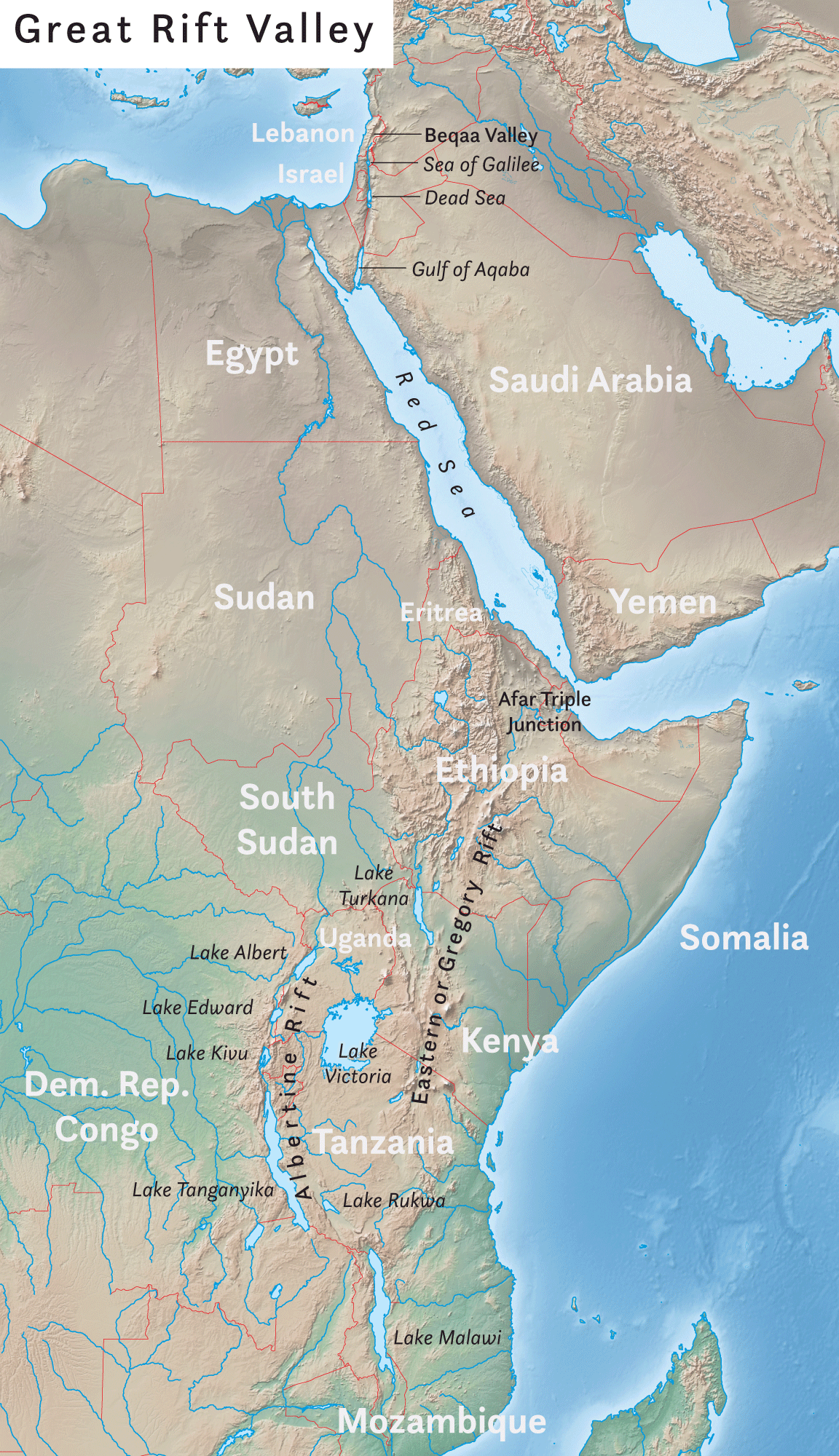
Lake Kivu is one of the African Great Lakes. It lies on the border between the Democratic Republic of the Congo and Rwanda, and is in the Albertine Rift, the western branch of the East African Rift. Lake Kivu empties into the Ruzizi River, which flows southwards into Lake Tanganyika. Geography Lake Kivu is approximately long and at its widest. Its irregular shape makes measuring its precise surface area difficult; it has been estimated to cover a total surface area of some , making it Africa's eighth largest lake. The surface of the lake sits at a height of above sea level. This lake has a chance of suffering a limnic eruption every 1000 years. The lake has a maximum depth of and a mean depth of , making it the world's eighteenth deepest lake by maximum depth, and the ninth deepest by mean depth. Some or 58 percent of the lake's waters lie within DRC borders. The lake bed sits upon a rift valley that is slowly being pulled apart, causing volcanic activity in the area. Th ... [...More Info...] [...Related Items...] OR: [Wikipedia] [Google] [Baidu] |
Rift Valley Lakes
The Rift Valley lakes are a series of lakes in the East African Rift valley that runs through eastern Africa from Ethiopia in the north to Malawi in the south, and includes the African Great Lakes in the south. These include some of the world's oldest lakes, deepest lakes, largest lakes by area, and largest lakes by volume. Many are freshwater ecoregions of great biodiversity, while others are alkaline "soda lakes" supporting highly specialised organisms. The Rift Valley lakes are well known for the evolution of at least 800 cichlid fish species that live in their waters. More species are expected to be discovered. The World Wide Fund for Nature has designated these lakes as one of its Global 200 priority ecoregions for conservation. Geology Lake Malawi and Lake Tanganyika have formed in the various valleys of the East African Rift zone. Ecology Lake Kivu's "still waters ... hide another face: dissolved within are billions of cubic meters of flammable methane and more stil ... [...More Info...] [...Related Items...] OR: [Wikipedia] [Google] [Baidu] |
Limnic Eruption
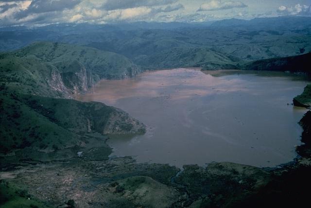
A limnic eruption, also known as a lake overturn, is a very rare type of natural disaster in which dissolved carbon dioxide () suddenly erupts from deep lake waters, forming a gas cloud capable of suffocating wildlife, livestock, and humans. A limnic eruption may also cause tsunami or seiche as the rising displaces water. Scientists believe earthquakes, volcanic activity, and other explosive events can serve as triggers for limnic eruptions. Lakes in which such activity occurs are referred to as limnically active lakes or exploding lakes. Some features of limnically active lakes include: * -saturated incoming water * A cool lake bottom indicating an absence of direct volcanic interaction with lake waters * An upper and lower thermal layer with differing saturations * Proximity to areas with volcanic activity Investigations of the Lake Monoun and Lake Nyos casualties led scientists to classify limnic eruptions as a distinct type of disaster event, even though they can be indirect ... [...More Info...] [...Related Items...] OR: [Wikipedia] [Google] [Baidu] |
Lake Monoun
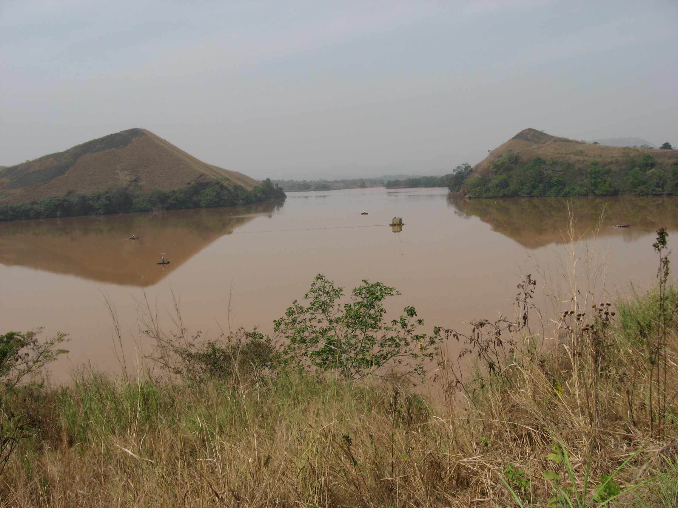
Lake Monoun is a crater lake ( maar) in West Province, Cameroon, that lies in the Oku Volcanic Field. On August 15, 1984, a limnic eruption occurred at the lake, which resulted in the release of a large amount of carbon dioxide () that killed 37 people. At first, the deaths remained unexplained, and causes such as terrorism were suspected. Further investigation and a similar event two years later at Lake Nyos led to the currently accepted explanation. Disaster Several people reported hearing a loud noise on August 15, 1984, around 22:30. A gas cloud reportedly emanated from a crater in the eastern part of the lake. The resulting deaths of residents in a low-lying area are believed to have occurred between 03:00 and dawn. The victims were said to have skin burns, which reports later clarified as "skin damage" such as discoloration. Survivors reported that the whitish, smoke-like cloud smelled bitter and acidic. Vegetation was flattened around the eastern part of the lake, ... [...More Info...] [...Related Items...] OR: [Wikipedia] [Google] [Baidu] |
Lake Nyos
Lake Nyos ( ) is a crater lake in the Region of Cameroon, located about northwest of Yaoundé, the capital. Nyos is a deep lake high on the flank of an inactive volcano in the Oku volcanic plain along the Cameroon line of volcanic activity. A volcanic dam impounds the lake waters. A pocket of magma lies beneath the lake and leaks carbon dioxide () into the water, changing it into carbonic acid. Nyos is one of only three lakes known to be saturated with carbon dioxide in this way, and therefore prone to limnic eruptions (the others being Lake Monoun, also in Cameroon, and Lake Kivu in the Democratic Republic of Congo and Rwanda). In 1986, possibly as the result of a landslide, Lake Nyos suddenly emitted a large cloud of , which suffocated 1,746 people and 3,500 livestock in nearby towns and villages, the most notable one being Chah, which was abandoned after the incident. Though not completely unprecedented, it was the first known large-scale asphyxiation caused b ... [...More Info...] [...Related Items...] OR: [Wikipedia] [Google] [Baidu] |
Fresh Water
Fresh water or freshwater is any naturally occurring liquid or frozen water containing low concentrations of dissolved salts and other total dissolved solids. Although the term specifically excludes seawater and brackish water, it does include non- salty mineral-rich waters such as chalybeate springs. Fresh water may encompass frozen and meltwater in ice sheets, ice caps, glaciers, snowfields and icebergs, natural precipitations such as rainfall, snowfall, hail/ sleet and graupel, and surface runoffs that form inland bodies of water such as wetlands, ponds, lakes, rivers, streams, as well as groundwater contained in aquifers, subterranean rivers and lakes. Fresh water is the water resource that is of the most and immediate use to humans. Water is critical to the survival of all living organisms. Many organisms can thrive on salt water, but the great majority of higher plants and most insects, amphibians, reptiles, mammals and birds need fresh water to survive. Fresh ... [...More Info...] [...Related Items...] OR: [Wikipedia] [Google] [Baidu] |
Gisenyi
Gisenyi, historically rendered as Kisenyi, is a city in Rubavu district in Rwanda's Western Province. Gisenyi is contiguous with Goma, the city across the border in the Democratic Republic of the Congo. Overview The city features a resort on the shores of Lake Kivu, with several hotels and three sandy beaches. The area is also known for water sports. The northern shore of the lake on which Goma and Gisenyi lie is a flat plain featuring lava formations from the eruptions of nearby Mount Nyiragongo. In contrast to Goma, Gisenyi escaped the lava flows of both the 1977 and the 2002 eruptions, which destroyed between 15 and 40% of the former. The centre of Gisenyi lies by foothills at the northeast corner of the lake, and low-density expansion is taking place in the hills, which are expected to be safe from future eruptions. Gisenyi is also home to Bralirwa, which manufactures various local beers — Primus, Mützig, Amstel and Guinness — as well as a range of Coca-Cola–brand ... [...More Info...] [...Related Items...] OR: [Wikipedia] [Google] [Baidu] |
Sake, DRC
Sake is a town in the Democratic Republic of the Congo in the eastern province of North Kivu. It is located at the northwestern extremity of Lake Kivu, 25 km (15 mi) west-northwest of Goma on National Road No. 2,DR Congo: Volcano - IRIN: 23-Jan-02 , IRIN via cidi.org, 23 January 2006 at the edge of the volcanic plains in the bottom of the , at an elevation of about 1500 m. The western |
Virunga National Park
, iucn_category = II , iucn_ref = , location = Democratic Republic of the Congo , map = Democratic Republic of the Congo , relief = 1 , coordinates = , area = , established = , nearest_city = Goma , photo =Virunga National Park-107997.jpg , photo_caption = , governing_body = Institut Congolais pour la Conservation de la Nature , website = , administrator =Emmanuel de Merode , embedded1 = , embedded2 = , visitation_num = , visitation_year = Virunga National Park is a national park in the Albertine Rift Valley in the eastern part of the Democratic Republic of the Congo. It was created in 1925. In elevation, it ranges from in the Semliki River valley to in the Rwenzori Mountains. From north to south it extends approximately , largely along the international borders with Uganda and Rwanda in the east. It covers an area of . Two active volcanoes are located in the park, Mount Nyiragongo and Nyamuragira. They have significantly shaped the national park's dive ... [...More Info...] [...Related Items...] OR: [Wikipedia] [Google] [Baidu] |
List Of Islands In Lakes
A lake island is any landmass within a lake. It is a type of inland island. Lake islands may form a lake archipelago. Formation Lake islands may form in numerous ways. They may occur through a build-up of sedimentation as shoals, and become true islands through changes in the level of the lake. They may have been originally part of the lake's shore, and been separated from it by erosion, or they may have been left as pinnacles when the lake formed through a raising in the level of a river or other waterway (either naturally, or artificially through the damming of a river or lake). On creation of a glacial lake a moraine can form an island. They may also have formed through earthquake, meteor, or volcanic activity. In the latter case, crater or caldera islands exist, with new volcanic prominences in lakes formed in the craters of larger volcanoes. Other lake islands include ephemeral beds of floating vegetation, and islands artificially formed by human activity. Volcanic crat ... [...More Info...] [...Related Items...] OR: [Wikipedia] [Google] [Baidu] |
Volcanic Activity
Volcanism, vulcanism or volcanicity is the phenomenon of eruption of molten rock (magma) onto the surface of the Earth or a solid-surface planet or moon, where lava, pyroclastics, and volcanic gases erupt through a break in the surface called a vent. It includes all phenomena resulting from and causing magma within the crust or mantle of the body, to rise through the crust and form volcanic rocks on the surface. Magmas, that reach the surface and solidify, form extrusive landforms. Volcanic processes Magma from the mantle or lower crust rises through the crust towards the surface. If magma reaches the surface, its behavior depends on the viscosity of the molten constituent rock. Viscous (thick) magma produces volcanoes characterised by explosive eruptions, while non-viscous (runny) magma produce volcanoes characterised by effusive eruptions pouring large amounts of lava onto the surface. In some cases, rising magma can cool and solidify without reaching the surface. Instea ... [...More Info...] [...Related Items...] OR: [Wikipedia] [Google] [Baidu] |
.jpg)


