|
Kinchela Boys' Home
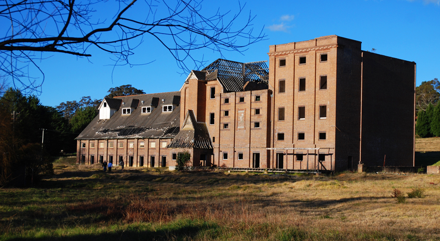
Kinchela Aboriginal Boys' Training Home is a heritage-listed former Aboriginal Boys' Training Home at 2054 South West Rocks Road, Kinchela, Kempsey Shire, New South Wales, Australia. It was built from 1924 to 1970. It is also known as Kinchela Boys' Home and the Aboriginal Mission School. The property is owned by Kempsey Local Aboriginal Land Council. It was added to the New South Wales State Heritage Register on 17 February 2012. The site was also recognised in 2022 by the World Monuments Watch. History Background Historically Aboriginal children were separated from their families from the earliest days of the colony. Governor Macquarie established the first Native Institution in Parramatta as early as 1814 and in 1823 another Native Institution was started in Blacktown (Blacktown Native Institution Site). Both these institutions were considered failures, one reason being that once parents realised their children wouldn't be allowed to come home, they wouldn't give t ... [...More Info...] [...Related Items...] OR: [Wikipedia] [Google] [Baidu] |
Kinchela, New South Wales
Kinchela is a village in the Mid North Coast region of New South Wales, Australia, on land traditionally owned by the Dungutti people. It is best known as the location of the infamous Kinchela Boys Home. The village is named after Kinchela Creek, which in turn may have been named after John Kinchela, Attorney General of New South Wales who arrived at Sydney in 1831. The Kinchela Aboriginal Reserve was gazetted in 1883, Kinchela was gazetted as a village in 1885 or 1886, and in 1892 an Aboriginal school was established at Pelican Island, near Kinchela. Kinchela Boys Home Kinchela Boys Home was established by the Aboriginal Protection Board in 1924 and absorbed the Aboriginal school. The home was intended for Aboriginal children who were removed from their families as part of the process of 'assimilating' them into white Australian society. The victims of this process eventually became known as the Stolen Generation. Kinchela Boys Home housed between 400 and 600 boys between 1924 an ... [...More Info...] [...Related Items...] OR: [Wikipedia] [Google] [Baidu] |
Darlington Point
Darlington Point is a small town on the banks of the Murrumbidgee River in the Riverina district of western New South Wales, Australia. It is part of the Murrumbidgee Council local government area. The centre of town is four kilometres from the Sturt Highway, along Kidman Way. Darlington Point is south-west of Sydney and south of Griffith. At the , Darlington Point had a population of 1,030. History Pastoral runs The first pastoral run near present-day Darlington Point, on the north bank of the Murrumbidgee, was taken up in 1844 by John Peter; he named the run "Cuba" after the Aboriginal word for a locally-common Acacia tree. On the south bank John Peter also leased the "Tubbo" run, a property he had formed in the 1850s by the amalgamation of several runs. The site where the township later developed was a crossing-place over the Murrumbidgee River used by stockmen and teamsters. The Surveyor Townshend laid out reserves near the crossing-place during the ... [...More Info...] [...Related Items...] OR: [Wikipedia] [Google] [Baidu] |
Dawn (magazine)
''Dawn'' was an Australian magazine created by the New South Wales Aborigines Welfare Board and aimed at Aboriginal Australians. It ran monthly from January 1952 until December 1968. Two issues were published in 1969, before the disbanding of the Aboriginal Welfare Board led to the publication ceasing. In 1953, E. J. Morgan, manager of Moree Aboriginal Station, wrote of the beneficial effects that the magazine had had on the Aboriginal people, including a better attitude towards the board and less interest in Communism. He reported that it was very popular and he felt that ''Dawn'' had "broken through the apathetic acceptance of their humble state, stimulated their self-respect, and their urge to achieve recognition in the general community", through reading about Aboriginal people who had achieved success in sports and other walks of life. It was described by Superintendent A. W. G. Lipscomb, Superintendent of the board, as a successful experiment: The magazine was rela ... [...More Info...] [...Related Items...] OR: [Wikipedia] [Google] [Baidu] |
Macleay River
The Macleay River is a river that spans the Northern Tablelands and Mid North Coast districts of New South Wales, Australia. Course and features Formed by the confluence of the Gara River, Salisbury Waters and Bakers Creek, the Macleay River rises below Blue Nobby Mountain, east of Uralla within the Great Dividing Range. The river flows in a meandering course generally east by south, joined by twenty-six tributaries including the Apsley, Chandler, and Dyke rivers and passing through a number of spectacular gorges and waterfalls in Cunnawarra National Park and Oxley Wild Rivers National Park, before reaching its mouth at the Tasman Sea, near South West Rocks. The river descends over its course. The river flows through the town of Kempsey. At the river is traversed by the Pacific Highway via the Macleay River Bridge (Dhanggati language: ''Yapang gurraarrbang gayandugayigu''). At the time of its official opening in 2013, the bridge was the longest road bridge in Australi ... [...More Info...] [...Related Items...] OR: [Wikipedia] [Google] [Baidu] |
State Archives And Records Authority Of New South Wales
The State Archives and Records Authority of New South Wales (commonly known as State Archives and Records NSW) is the archives and records management authority of the Government of New South Wales in Australia. It can trace its history back to the establishment of the office of Colonial Secretary and Registrar of the Records of New South Wales in 1821.''Colonial Secretary Agency Details'' State Records New South Wales. Accessed 12 January 2008. However, in the early years of the Colony's history, little attention was paid to the management and preservation of non-current public records. This was mainly because the government of the day was fully ... [...More Info...] [...Related Items...] OR: [Wikipedia] [Google] [Baidu] |
Singleton, New South Wales
Singleton is a town on the banks of the Hunter River in New South Wales, Australia. Singleton is 197 km (89 mi) north-north-west of Sydney Sydney ( ) is the capital city of the state of New South Wales, and the most populous city in both Australia and Oceania. Located on Australia's east coast, the metropolis surrounds Sydney Harbour and extends about towards the Blue Mountain ..., and 70 km (43 mi) north-west of Newcastle, New South Wales, Newcastle. At June 2018, Singleton had an urban population of 16,346. Estimated resident population, 30 June 2018. Singleton's main urban area includes the town centre, Singleton Heights, Dunolly, Darlington, The Retreat, Wattle Ponds and Hunterview. Surrounding rural villages include Broke, New South Wales, Broke, Camberwell, New South Wales, Camberwell, Jerrys Plains, New South Wales, Jerrys Plains, Goorangoola/Greenlands, Belford, New South Wales, Belford and Lower Belford. Singleton is located on the north-eas ... [...More Info...] [...Related Items...] OR: [Wikipedia] [Google] [Baidu] |
Arakoon, New South Wales
Arakoon is an eastern suburb of the town of South West Rocks in Kempsey Shire, New South Wales, Australia. At the , Arakoon had a population of 420 people. Arakoon was the original settlement of the town of South West Rocks. The settlement was later moved to the present location, where better land conditions for building were available. The area today is home to a small number of houses, a cafe, a caravan park and the Trial Bay Gaol. Heritage listings Arakoon has a number of heritage-listed sites, including: * Cardwell Street: Trial Bay Gaol Trial Bay Gaol is a heritage-listed former public works prison and internment camp at Cardwell Street, Arakoon, Kempsey Shire, New South Wales, Australia. The property is owned by the NSW National Parks and Wildlife Service. It was added to th ... * Lighthouse Road: Smoky Cape Lighthouse References External links * For photos of the area see thSouth West Rocks Photo Gallery Towns in New South Wales Coastal towns in New S ... [...More Info...] [...Related Items...] OR: [Wikipedia] [Google] [Baidu] |
John Bowlby
Edward John Mostyn Bowlby, CBE, FBA, FRCP, FRCPsych (; 26 February 1907 – 2 September 1990) was a British psychologist, psychiatrist, and psychoanalyst, notable for his interest in child development and for his pioneering work in attachment theory. A ''Review of General Psychology'' survey, published in 2002, ranked Bowlby as the 49th most cited psychologist of the 20th century. Family background Bowlby was born in London to an upper-middle-income family. He was the fourth of six children and was brought up by a nanny in the British fashion of his class at that time: the family hired a nanny who was in charge of raising the children, in a separate nursery in the house.Van Dijken, S. (1998). John Bowlby: His Early Life: A Biographical Journey into the Roots of Attachment Theory. London: Free Association Books Nanny Friend took care of the infants and generally had two other nursemaids to help her. Bowlby was raised primarily by nursemaid Minnie who acted as a mother figur ... [...More Info...] [...Related Items...] OR: [Wikipedia] [Google] [Baidu] |
Department Of Education (New South Wales)
The New South Wales Department of Education, a department of the Government of New South Wales, is responsible for the delivery and co-ordination of early childhood, primary school, secondary school, vocational education, adult, migrant and higher education in the state of New South Wales, Australia. The department was previous known as the Department of Education and Training (DET) between December 1997 and April 2011, and the Department of Education and Communities (DEC) between April 2011 and July 2015. The department's powers are principally drawn from the . Structure The head of the department is its secretary, presently Georgina Harrisson. The secretary reports to the Minister for Education and Early Learning, currently The Hon. Sarah Mitchell ; supported by the Minister for Skills and Training, currently The Hon. Alister Henskens . Ultimately the ministers are responsible to the Parliament of New South Wales. With a budget of more than A$8 billion, and over 2, ... [...More Info...] [...Related Items...] OR: [Wikipedia] [Google] [Baidu] |
Mittagong
Mittagong () is a town located in the Southern Highlands of New South Wales, Australia, in Wingecarribee Shire. The town acts as the gateway to the Southern Highlands when coming from Sydney. Mittagong is situated at an elevation of . The town is close to Bowral, Berrima, Moss Vale and the Northern Villages such as Yerrinbool and Colo Vale. Moreover, Mittagong is home to many wineries of the Southern Highlands which has been a recent growing wine and cellar door region. Geography The town lies between three small mountain reserves, Mount Alexandra above sea level, Mount Gibraltar above sea level and Ninety Acre Hill (part of the greater Gibbergunyah Reserve) above sea level. Popular among locals and visitors is a small man made lake, Lake Alexandra, that feeds into the nearby Nattai River. Lookouts are available at all three reserves for viewing. Lookouts on Mount Gibraltar include Bowral Lookout, Mittagong Lookout and Mount Jellore Lookout. Lookouts on Mount Alexand ... [...More Info...] [...Related Items...] OR: [Wikipedia] [Google] [Baidu] |
Bomaderry, New South Wales
Bomaderry (locally known as "Bommo") is a town in the Shoalhaven council district area of New South Wales, Australia. At the , it had a population of 8,718 people. It is on the north shore of the Shoalhaven River, across the river from Nowra, the major town of the City of Shoalhaven, of which Bomaderry is locally regarded as being a suburb of the city. History Bomaderry township was opened in 1882. It was previously part of the Shoalhaven Estate owned by David Berry whose brother Alexander Berry had built a road to the area in 1858. When David died in 1889 the estate was sold in portions. The subdivision plans for Bomaderry are shown. In 1893 the railway was extended to Bomaderry and the town began to grow from this time. One of the first houses in Bomaderry was Lynburn which still exists today. It was built in 1895 by the architect Howard Joseland for Jane Morton, the widow of Henry Gordon Morton, the manager of the Shoalhaven Estate. A photo shortly after its construction i ... [...More Info...] [...Related Items...] OR: [Wikipedia] [Google] [Baidu] |
National Day Of Mourning
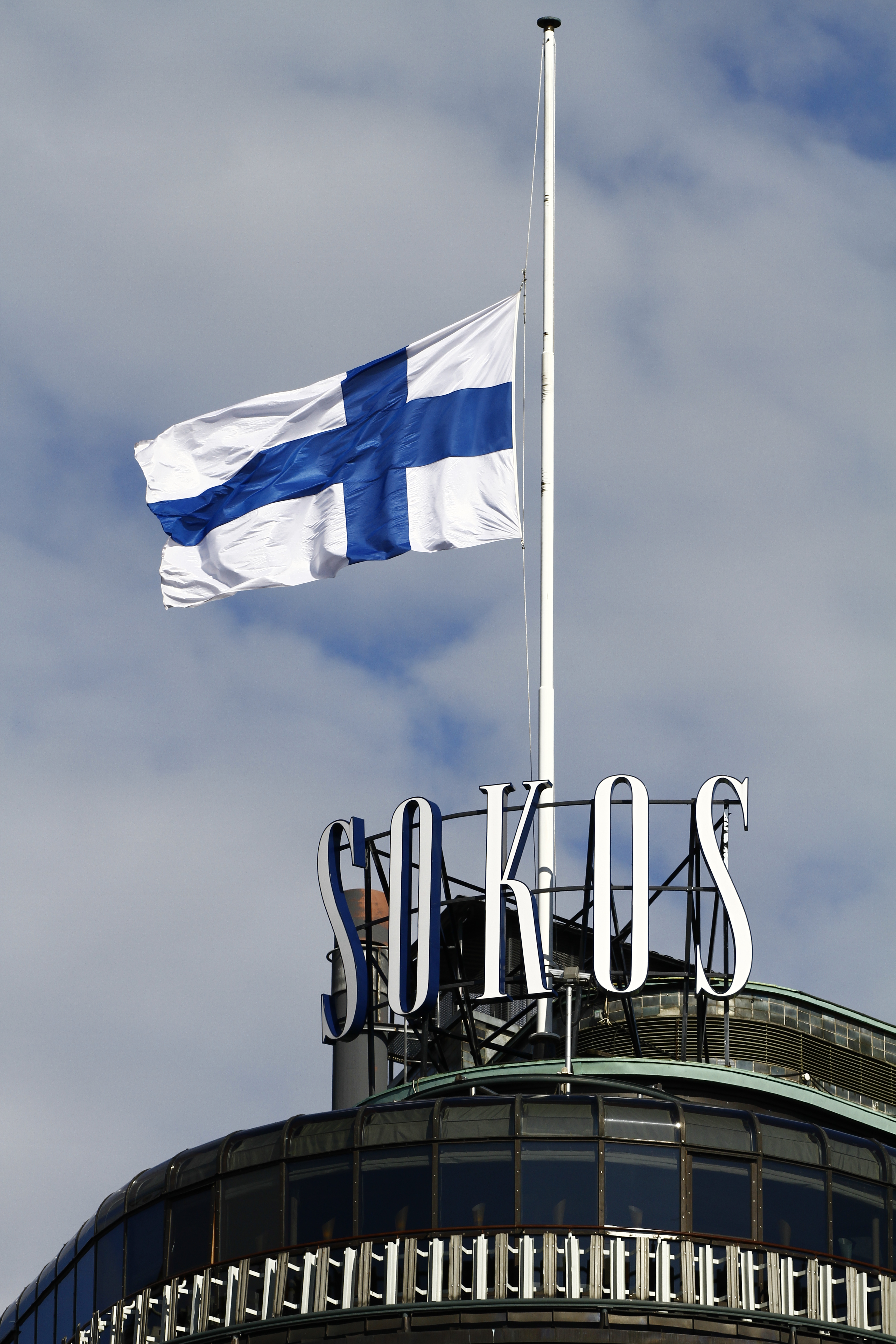
A national day of mourning is a day or days marked by mourning and memorial activities observed among the majority of a country's populace. They are designated by the national government. Such days include those marking the death or funeral of a renowned individual or individuals from that country or elsewhere or the anniversary of such a death or deaths, the anniversaries of a significant natural or man-made disaster occurring either in the country or another country, wartime commemorations or in memory of the victims of a terrorist attack. Flying a national or military flag of that country at half-mast is a common symbol. List The following are lists for national days of mourning across the world: * Before 2000 * 2000–2019 * 2020–present Selected list of figures recognized State officials * A National Day of Mourning is typically declared for Presidents of the United States, usually on the day of their funerals. Beginning with John F. Kennedy, these days are also ... [...More Info...] [...Related Items...] OR: [Wikipedia] [Google] [Baidu] |


