|
Khantau
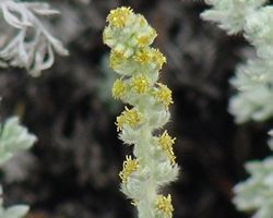
Khantau ( kz, Хантау; russian: Горы Хантау) is a massif located in Jambyl Region, Kazakhstan. Khantau (village), Khantau village, Moiynkum District, lies to the west of the NW slopes. There are ancient petroglyphs in the mountains. Geography The Khantau massif is part of the northern section of the Aitau, a northern prolongation of the Chu-Ili Range. It is located to the south of the southeastern end of the Mayzharylgan. It extends from northwest to southeast for about . The Aksuyek river has its sources in the range.Google Earth The average elevation of the hills in the Khantau is between and . The highest point of the massif is high Mount Sunkar, which is also the highest summit of the Aitau Range.''ATAMEKEN Geographical Encyclopedia.'' / General ed. B. O. Jacob. - Almaty: "Kazakh Encyclopedia", 2011. - 648 pages. ISBN 9965-893-70-5 Flora The terrain is gray and cut by deep ravines in places. The range slopes are covered mainly by Artemisia (plant), ''Art ... [...More Info...] [...Related Items...] OR: [Wikipedia] [Google] [Baidu] |
Khantau (village)
Khantau () is a village located in the Moiynkum District, Zhambyl Region, Kazakhstan. It is the head of Khantau rural district (КАТО code — 315649100). Demographics According to the 2009 Kazakhstan census, the town has a population of 978 (480 men and 498 women). As of 1999, the town had a population of 925 (468 men and 457 women). Geography The town is located near the western slopes of the Khantau massif, part of the Aitau range, to the south of Mirny (Kazakhstan), Mirny and to the east of Moiynkum, the district capital.Google Earth. Climate References Populated places in Jambyl Region {{Kazakhstan-geo-stub ... [...More Info...] [...Related Items...] OR: [Wikipedia] [Google] [Baidu] |
Mount Sunkar
Sunkar ( kk, Сұңқар) is a mountain in Moiynkum District, Jambyl Region, Kazakhstan. Geography Sunkar rises in the northern flank of the Khantau massif, the northern section of the Aitau, part of the Chu-Ili Range. With an elevation , it is the highest summit of the range.''Kazakhstan National Encyclopedia'' / Ch. ed. B.O. Jakyp. — Almaty: « Kazakh encyclopedia» ZhSS, 2011. ISBN 9965-893-64-0(T.Z.),ISBN 9965-893-19-5 See also *Geography of Kazakhstan References {{reflist External linksЧу-Илийские горы - Алматы Chu-Ili Range Mountains of Kazakhstan ... [...More Info...] [...Related Items...] OR: [Wikipedia] [Google] [Baidu] |
Sunkar
Sunkar ( kk, Сұңқар) is a mountain in Moiynkum District, Jambyl Region, Kazakhstan. Geography Sunkar rises in the northern flank of the Khantau massif, the northern section of the Aitau, part of the Chu-Ili Range. With an elevation , it is the highest summit of the range.''Kazakhstan National Encyclopedia'' / Ch. ed. B.O. Jakyp. — Almaty: « Kazakh encyclopedia» ZhSS, 2011. ISBN 9965-893-64-0(T.Z.),ISBN 9965-893-19-5 See also *Geography of Kazakhstan Kazakhstan is located in Central Asia (with 14% of the country in Eastern Europe). With an area of about Kazakhstan is more than twice the combined size of the other four Central Asian states and 60% larger than Alaska. The country borders Turkmen ... References {{reflist External linksЧу-Илийские горы - Алматы Chu-Ili Range Mountains of Kazakhstan ... [...More Info...] [...Related Items...] OR: [Wikipedia] [Google] [Baidu] |
Chu-Ili Range
The Chu-Ili Range ( kk, Шу-Іле таулары) is a range of mountains in Kazakhstan. Administratively it is part of the Almaty Region, Almaty and Zhambyl Region, Zhambyl regions. The M36 Highway (Kazakhstan), M36 Highway skirts the range along its northeastern flank.Google Earth Geography The Chu-Ili Range is ancient and heavily eroded. It is part of the Trans-Ili Alatau, a northern extension of the Tian Shan. It begins to the north of Otar (village), Otar, west of the Kurty, one of the main tributaries of the Ili (river), Ili river, and stretches in a roughly northwestern direction for less than . The Chu River flows to the west of the range and to the northeast stretches the Taukum desert of the Balkhash-Alakol Basin. The highest point of the range is Anyrakay (Аңырақай), a high summit. Aytau is a subrange in the northern section. Its highest point is high Mount Sunkar, Sunkar, located in the Khantau Massif, right to the east of Khantau village. The Maizharylga ... [...More Info...] [...Related Items...] OR: [Wikipedia] [Google] [Baidu] |
Sentinel-2
Sentinel-2 is an Earth observation mission from the Copernicus Programme that systematically acquires optical imagery at high spatial resolution (10 m to 60 m) over land and coastal waters. The mission is currently a constellation with two satellites, Sentinel-2A and Sentinel-2B; a third satellite, Sentinel-2C, is currently undergoing testing in preparation for launch in 2024. The mission supports a broad range of services and applications such as agricultural monitoring, emergencies management, land cover classification or water quality. Sentinel-2 has been developed and is being operated by the European Space Agency, and the satellites were manufactured by a consortium led by Airbus Defence and Space in Friedrichshafen. Overview The Sentinel-2 mission has the following key characteristics: * Multi-spectral data with 13 bands in the visible, near infrared, and short wave infrared part of the spectrum * Systematic global coverage of land surfaces from 56° S to 84°&nb ... [...More Info...] [...Related Items...] OR: [Wikipedia] [Google] [Baidu] |
Moiynkum District
Moiynkum ( kk, Мойынқұм ауданы, ) is a district of Jambyl Region in south-eastern Kazakhstan. The administrative center of the district is the auyl of Moiynkum. Geography The district is named after the Moiynkum Desert. Parts of it are in the lower basin of the Chu river, as well as by :Lake Balkhash. Lakes Kashkanteniz and Karakol are located in the district.Google Earth Google Earth is a computer program that renders a 3D computer graphics, 3D representation of Earth based primarily on satellite imagery. The program maps the Earth by superimposition, superimposing satellite images, aerial photography, and geog .... References Districts of Kazakhstan Jambyl Region {{Kazakhstan-geo-stub ... [...More Info...] [...Related Items...] OR: [Wikipedia] [Google] [Baidu] |
Geography Of Kazakhstan
Kazakhstan is located in Central Asia (with 14% of the country in Eastern Europe). With an area of about Kazakhstan is more than twice the combined size of the other four Central Asian states and 60% larger than Alaska. The country borders Turkmenistan, Uzbekistan, and Kyrgyzstan to the south; Russia to the north; Russia and the Caspian Sea to the west; and China's Xinjiang Uygur Autonomous Region to the east. Topography and drainage There is considerable topographical variation within Kazakhstan. The highest point is the top of the mountain Khan Tengri, on the Kyrgyz border in the Tian Shan range, with an elevation of above sea level; the lowest point is the bottom of the Karagiye depression at below sea level, in the Mangystau province east of the Caspian Sea. Most of the country lies at between above sea level, but Kazakhstan's Caspian shore includes some of the lowest elevations on Earth. The peak Khan Tengri in the Tian Shan Mountains (and on the border with Kyrgyzstan a ... [...More Info...] [...Related Items...] OR: [Wikipedia] [Google] [Baidu] |
Artemisia (plant)
''Artemisia'' () is a large, diverse genus of plants with between 200 and 400 species belonging to the daisy family Asteraceae. Common names for various species in the genus include mugwort, wormwood, and sagebrush. ''Artemisia'' comprises hardy herbaceous plants and shrubs, which are known for the powerful chemical constituents in their essential oils. ''Artemisia'' species grow in temperate climates of both hemispheres, usually in dry or semiarid habitats. Notable species include '' A. vulgaris'' (common mugwort), '' A. tridentata'' (big sagebrush), '' A. annua'' (sagewort), '' A. absinthium'' (wormwood), ''A. dracunculus'' (tarragon), and '' A. abrotanum'' (southernwood). The leaves of many species are covered with white hairs. Most species have strong aromas and bitter tastes from terpenoids and sesquiterpene lactones, which discourage herbivory, and may have had a selective advantage. The small flowers are wind-pollinated. ''Artemisia'' species are ... [...More Info...] [...Related Items...] OR: [Wikipedia] [Google] [Baidu] |
Almaty
Almaty (; kk, Алматы; ), formerly known as Alma-Ata ( kk, Алма-Ата), is the List of most populous cities in Kazakhstan, largest city in Kazakhstan, with a population of about 2 million. It was the capital of Kazakhstan from 1929 to 1936 as an Kazakh Autonomous Soviet Socialist Republic, autonomous republic as part of the Soviet Union, then from 1936 to 1991 as a Kazakh Soviet Socialist Republic, union republic and finally from 1991 as an independent state to 1997 when the government relocated the capital to Astana, Akmola (renamed Astana in 1998, Nur-Sultan in 2019, and back to Astana in 2022). Almaty is still the major commercial, financial, and cultural centre of Kazakhstan, as well as its most populous and most cosmopolitan city. The city is located in the mountainous area of southern Kazakhstan near the border with Kyrgyzstan in the foothills of the Trans-Ili Alatau at an elevation of 700–900 m (2,300–3,000 feet), where the Large and Small Almatinka rivers r ... [...More Info...] [...Related Items...] OR: [Wikipedia] [Google] [Baidu] |
Petroglyphs
A petroglyph is an image created by removing part of a rock surface by incising, picking, carving, or abrading, as a form of rock art. Outside North America, scholars often use terms such as "carving", "engraving", or other descriptions of the technique to refer to such images. Petroglyphs are found worldwide, and are often associated with prehistoric peoples. The word comes from the Greek prefix , from meaning "stone", and meaning "carve", and was originally coined in French as . Another form of petroglyph, normally found in literate cultures, a rock relief or rock-cut relief is a relief sculpture carved on "living rock" such as a cliff, rather than a detached piece of stone. While these relief carvings are a category of rock art, sometimes found in conjunction with rock-cut architecture, they tend to be omitted in most works on rock art, which concentrate on engravings and paintings by prehistoric or nonliterate cultures. Some of these reliefs exploit the rock's na ... [...More Info...] [...Related Items...] OR: [Wikipedia] [Google] [Baidu] |


