|
Kenley
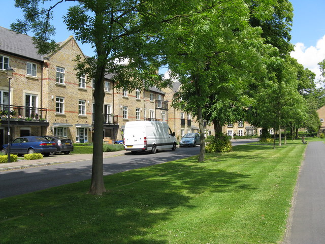
Kenley is an area within the London Borough of Croydon. Prior to its incorporation into Greater London in 1965 it was in the historic county of Surrey. It is situated south of Purley, east of Coulsdon, north of Caterham and Whyteleafe and west of Sanderstead, and south of Charing Cross. At the 2011 Census, Kenley had a population of 14,966. Kenley was part of the administrative county of Surrey prior to the creation of Greater London in 1965. Significant portions of the area lie within the Metropolitan Green Belt. In particular, the south of the area is dominated by the open green spaces of Kenley Common and Kenley Aerodrome. History A comprehensive history of Kenley is found in the Bourne Society's 'Kenley Village History'. Suburban development For centuries, Kenley was part of Coulsdon Manor which covered the whole area now known as Coulsdon, Old Coulsdon, Purley and Kenley. As with most of this area, Kenley was primarily farm land, with a few big houses and their es ... [...More Info...] [...Related Items...] OR: [Wikipedia] [Google] [Baidu] |
RAF Kenley
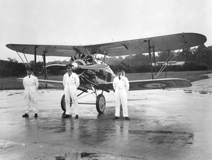
The former Royal Air Force Station Kenley, more commonly known as RAF Kenley was an airfield station of the Royal Flying Corps in the First World War and the RAF in the Second World War. It played a significant role during the Battle of Britain as one of the three RAF stations specifically tasked with the defence of London. It is located near Kenley on the edge of Greater London. The site remains in use with the Ministry of Defence, as Kenley Airfield. History Its main active phase commenced in 1917, and ceased in 1959 when RAF Fighter Command left the aerodrome. RAF Kenley now hosts 615 Volunteer Gliding Squadron (VGS), a Unit within the RAF 2 Flying Training School (2 FTS). RAF Kenley is classed as a Government aerodrome and is regulated by the Military Aviation Authority (MAA); as such, all flying operations are governed by military regulations and safety standards. An Aerodrome Operator (AO) is appointed in accordance with MAA regulations, whose role is to actively mana ... [...More Info...] [...Related Items...] OR: [Wikipedia] [Google] [Baidu] |
Purley, London
Purley is an area of the London Borough of Croydon in London, England, south of Charing Cross, with a history going back at least 800 years. It was originally granted as an estate from holdings at Sanderstead and until as a district of Surrey and then, with neighbouring Coulsdon, as an urban district that became an electoral ward of the London Borough of Croydon, becoming part of the ceremonial county of London, in 1965. In 2018 the Purley ward was divided into two: Purley and Woodcote, and Purley Oaks and Riddlesdown. Purley is a suburban area of South London, and the quintessential suburban environment has been referenced in fictional and popular culture, most notably as the setting for the long running Terry and June sitcom. Purley had a population of about 14,000 in 2011. History Toponymy The name derives from an estate, mentioned in about 1200 when it was deeded to one William de Pirelea, son of Osbert de Pirelea by the abbot of St. Peter’s monastery near Winchester ... [...More Info...] [...Related Items...] OR: [Wikipedia] [Google] [Baidu] |
Whyteleafe
Whyteleafe is a village in the district of Tandridge, Surrey, England, with a few streets falling inside the London Borough of Croydon. The village, in a dry valley of the North Downs, has three railway stations (on two parallel lines). Neighbouring villages and towns include Woldingham, Caterham, Coulsdon, Warlingham, and Kenley. To the west are Kenley Aerodrome, Kenley Common (owned by the Corporation), Coxes Wood, and Blize Wood. To the east are Riddlesdown, the Dobbin and Marden Park. The churchyard contains graves of airmen who died during WWII, stationed at RAF Kenley nearby. The village forms part of the Greater London Built-up Area. History The village name comes from the distinctive white underside of the whitebeam trees growing in the area. In 1855 Nathaniel Glover purchased White Leaf field and George Henry Drew later completed the building that was called "White Leafe House". By 1881 the surrounding area had become known as "Whiteleafe". As with Kenley the hist ... [...More Info...] [...Related Items...] OR: [Wikipedia] [Google] [Baidu] |
Croydon South (UK Parliament Constituency)
Croydon South is a constituency created in 1974 and represented in the House of Commons of the UK Parliament since 2015 by Chris Philp, a Conservative. Political history In 1974, the original Croydon South constituency created in 1918 was renamed Croydon Central and the current Croydon South was created from the northwestern part of East Surrey, covering Purley and Coulsdon, which had become parts of Greater London in 1965. Since its creation, the constituency has been represented by three Conservative MPs. Sir William Clark, who had represented East Surrey since 1970, won the new seat in February 1974, and held it until his retirement in 1992. His successor, Sir Richard Ottaway, then held the seat until 2015, when he stood down and was succeeded by Chris Philp. Boundary changes have been minor and the 2015 result made the seat the 145th safest of the Conservative Party's 331 seats by percentage of majority. At the 2015 general election, it was one of the Conservatives ... [...More Info...] [...Related Items...] OR: [Wikipedia] [Google] [Baidu] |
Coulsdon
Coulsdon (, traditionally pronounced ) is a town in south London, England, within the London Borough of Croydon, in the ceremonial county of Greater London since 1965. Prior to this it was part of the historic county of Surrey. History The location forms part of the North Downs. The hills contain chalk and flint. A few dry valleys with natural underground drainage merge and connect to the main headwater of the River Wandle, as a winterbourne (stream), so commonly called "the Bourne". Although this breaks onto the level of a few streets when the water table is exceptionally high, the soil is generally dry. The depression and wind gap has been a natural route way across the Downs for early populations. Fossil records exist from the Pleistocene period (about 4,000,000 years ago) There is evidence of human occupation from the Neolithic period, Iron Age,Volume 9 of the Bourne Society's Local History Records (1970) Anglo-Saxon, Bronze Age, Roman and Medieval *675. Frithwald, an Eal ... [...More Info...] [...Related Items...] OR: [Wikipedia] [Google] [Baidu] |
Caterham
Caterham () is a town in the Tandridge District of Surrey, England. The town is administratively divided into two: Caterham on the Hill, and Caterham Valley, which includes the main town centre in the middle of a dry valley but rises to equal heights to the south. The town lies close to the A22, from Guildford and south of Croydon, in an upper valley cleft into the dip slope of the North Downs. Caterham on the Hill is above the valley to the west. History An encampment on the top of White Hill, in Caterham Valley south of Caterham School, between Bletchingley and the town centre is called ''The Cardinal's Cap'' which was excavated and inspected in designating it a Scheduled Ancient Monument. With close ramparts forming two or more lines, archaeologists describe the fort as a "large multivallate hillfort at War Coppice Camp". The town lies within the Anglo-Saxon feudal division of Tandridge hundred. Post Norman Conquest Caterham's church of St Lawrence is of No ... [...More Info...] [...Related Items...] OR: [Wikipedia] [Google] [Baidu] |
London Borough Of Croydon
The London Borough of Croydon () is a London borough in south London, part of Outer London. It covers an area of . It is the southernmost borough of London. At its centre is the historic town of Croydon from which the borough takes its name; while other urban centres include Coulsdon, Purley, South Norwood, Norbury, New Addington and Thornton Heath. Croydon is mentioned in Domesday Book, and from a small market town has expanded into one of the most populous areas on the fringe of London. The borough is now one of London's leading business, financial and cultural centres, and its influence in entertainment and the arts contribute to its status as a major metropolitan centre. Its population is 386,710, making it the second largest London borough and fifteenth largest English district. The borough was formed in 1965 from the merger of the County Borough of Croydon with Coulsdon and Purley Urban District, both of which had been within Surrey. The local authority, Croydo ... [...More Info...] [...Related Items...] OR: [Wikipedia] [Google] [Baidu] |
Hammond Innes
Ralph Hammond Innes (15 July 1913 – 10 June 1998) was a British novelist who wrote over 30 novels, as well as works for children and travel books. Biography Innes was born in Horsham, Sussex, and educated at Feltonfleet School, Cobham, Surrey where he was head boy and later at Cranbrook School in Kent. He left in 1931 to work as a journalist, initially with the ''Financial News''. ''The Doppelganger'', his first novel, was published in 1937. In WWII, he served in the Royal Artillery, eventually rising to the rank of Major. During the war, his first books were published, including '' Wreckers Must Breathe'' (1940), ''The Trojan Horse'' (1940) and ''Attack Alarm'' (1941), the last of which was based on his experiences as an anti-aircraft gunner during the Battle of Britain at RAF Kenley. After being demobilized in 1946, he worked full-time as a writer, achieving multiple early successes. His novels are known for a fine attention to accurate detail in descriptions of places, suc ... [...More Info...] [...Related Items...] OR: [Wikipedia] [Google] [Baidu] |
Douglas Bader
Group Captain Sir Douglas Robert Steuart Bader, (; 21 February 1910 – 5 September 1982) was a Royal Air Force flying ace during the Second World War. He was credited with 22 aerial victories, four shared victories, six probables, one shared probable and 11 enemy aircraft damaged. Bader joined the RAF in 1928, and was commissioned in 1930. In December 1931, while attempting some aerobatics, he crashed and lost both his legs. Having been on the brink of death, he recovered, retook flight training, passed his check flights and then requested reactivation as a pilot. Although there were no regulations applicable to his situation, he was retired against his will on medical grounds. After the outbreak of the Second World War in 1939, however, Douglas Bader returned to the RAF and was accepted as a pilot. He scored his first victories over Dunkirk during the Battle of France in 1940. He then took part in the Battle of Britain and became a friend and supporter of Air Vice Marshal Tr ... [...More Info...] [...Related Items...] OR: [Wikipedia] [Google] [Baidu] |
Battle Of Britain
The Battle of Britain, also known as the Air Battle for England (german: die Luftschlacht um England), was a military campaign of the Second World War, in which the Royal Air Force (RAF) and the Fleet Air Arm (FAA) of the Royal Navy defended the United Kingdom (UK) against large-scale attacks by Nazi Germany's air force, the Luftwaffe. It was the first major military campaign fought entirely by air forces."92 Squadron – Geoffrey Wellum." ''Battle of Britain Memorial Flight'' via ''raf.mod.uk.''. Retrieved: 17 November 2010, archived 2 March 2009. The British officially recognise the battle's duration as being from 10 July until 31 October 1940, which overlaps the period of large-scale night attacks known as |
Sanderstead
Sanderstead is a village and medieval-founded church parish at the southern end of Croydon in south London, England, within the London Borough of Croydon, and formerly in the historic county of Surrey, until 1965. It takes in Purley Downs and Sanderstead Plantation, an area of woodland that includes the second- highest point in London. Sanderstead sits above a dry valley at the edge of the built-up area of Greater London. Cementing its secular identity from the late 19th century until abolition in 1965 it had a civil parish council. The community had a smaller farming-centred economy until the mid 19th century. All Saints' Church's construction began in about 1230 followed by great alterations and affixing of monuments including a poem attributed to John Dryden, the first Poet Laureate nationally; it is protected under UK law as Grade I listed. Sanderstead station is at the foot of the dry valley and has frequent, fast trains to East Croydon, connected to a range of London te ... [...More Info...] [...Related Items...] OR: [Wikipedia] [Google] [Baidu] |
Luftwaffe
The ''Luftwaffe'' () was the aerial-warfare branch of the German ''Wehrmacht'' before and during World War II. Germany's military air arms during World War I, the ''Luftstreitkräfte'' of the Imperial Army and the '' Marine-Fliegerabteilung'' of the Imperial Navy, had been disbanded in May 1920 in accordance with the terms of the 1919 Treaty of Versailles which banned Germany from having any air force. During the interwar period, German pilots were trained secretly in violation of the treaty at Lipetsk Air Base in the Soviet Union. With the rise of the Nazi Party and the repudiation of the Versailles Treaty, the ''Luftwaffe''s existence was publicly acknowledged on 26 February 1935, just over two weeks before open defiance of the Versailles Treaty through German rearmament and conscription would be announced on 16 March. The Condor Legion, a ''Luftwaffe'' detachment sent to aid Nationalist forces in the Spanish Civil War, provided the force with a valuable testing grou ... [...More Info...] [...Related Items...] OR: [Wikipedia] [Google] [Baidu] |


