|
Kegelman Air Force Auxiliary Field
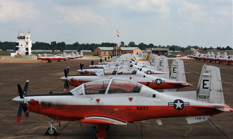
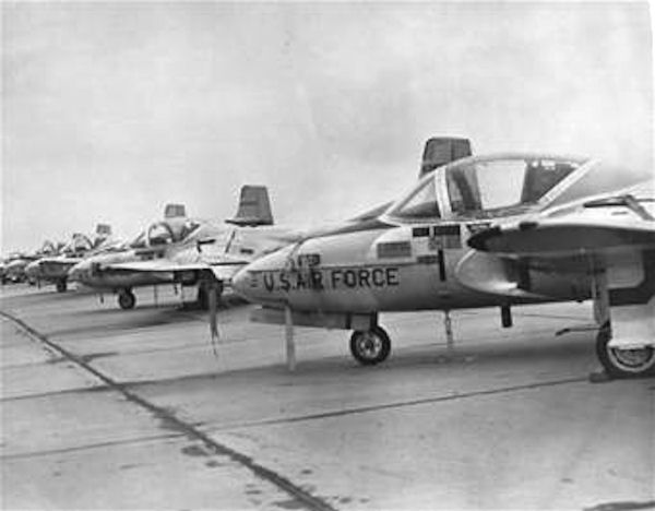
Kegelman Air Force Auxiliary Field is located near the Salt Plains National Wildlife Refuge in Alfalfa County, Oklahoma, across the Great Salt Plains Lake, east of Cherokee, Oklahoma in the United States. The field has one runway, a fire station, personnel offices and a NEXRAD tower, which is used for weather forecasting for both the military and civilian entities. It is located on . Currently, Kegelman AFAF is a sub-base of Vance Air Force Base under the control of the 71st Flying Training Wing (71 FTW). The airfield was previously administered by Will Rogers Field, Clovis Army Air Field, Woodward Army Air Field, and Liberal Army Airfield prior to the U.S. Air Force becoming an independent service in 1947. Vance AFB student pilots and instructor pilots use the airfield to practice landings in T-6A Texan II aircraft, and refer to the field with the callsign "Dogface". The installation was first known as the Great Salt Plains Auxiliary Field, but was renamed Kegelman in 1949. I ... [...More Info...] [...Related Items...] OR: [Wikipedia] [Google] [Baidu] |
Cherokee, Oklahoma
Cherokee is the largest city within, and county seat of, Alfalfa County, Oklahoma, United States. The population was 1,476 at the 2020 census, a decline of 1.5 percent from 2010. History Settlement and founding After the land opening of 1893, developers wanted to attract railroads to build through the former Cherokee Outlet to transport the large wheat crops to markets. The Kansas and Oklahoma Construction Company, through its subsidiary the Cherokee Investment Company, bought along its route, platted the town which it named Cherokee, and held a sale of lots on February 9, 1901. Cherokee officially incorporated in July 1901. Two years later, the Kansas City, Mexico and Orient Railroad (later owned by the Atchison, Topeka and Santa Fe Railway) constructed a line through Cherokee. To gain access to the railroad, residents of the nearby community of Erwin, which already had a post office by that name, relocated to Cherokee. Erwin then ceased to exist and Cherokee took its pla ... [...More Info...] [...Related Items...] OR: [Wikipedia] [Google] [Baidu] |
NEXRAD
NEXRAD or Nexrad (Next-Generation Radar) is a network of 160 high-resolution S-band Doppler weather radars operated by the National Weather Service (NWS), an agency of the National Oceanic and Atmospheric Administration (NOAA) within the United States Department of Commerce, the Federal Aviation Administration (FAA) within the Department of Transportation, and the U.S. Air Force within the Department of Defense. Its technical name is WSR-88D (''Weather Surveillance Radar, 1988, Doppler''). NEXRAD detects precipitation and atmospheric movement or wind. It returns data which when processed can be displayed in a mosaic map which shows patterns of precipitation and its movement. The radar system operates in two basic modes, selectable by the operator – a slow-scanning ''clear-air mode'' for analyzing air movements when there is little or no activity in the area, and a ''precipitation mode'', with a faster scan for tracking active weather. NEXRAD has an increased emphasis on autom ... [...More Info...] [...Related Items...] OR: [Wikipedia] [Google] [Baidu] |
El Reno High School
El Reno High School is a set of school buildings in El Reno, Oklahoma. Architectural history El Reno High School, located at 407 South Choctaw, is a -story horizontally massed, detached building (two stories over raised basement). Measuring 175 feet east–west and 132 feet north–south, the building is oriented in an east–west direction, with the main (1911) entrance facing west on South Choctaw. The school is located in a mixed-use area, with residential areas to the west and southwest, and commercial areas to the north and east. The building was constructed in two phases. The west half, or El Reno High School proper, constructed in 1911, was designed by the Oklahoma City firm of Layton and Smith, Oklahoma's premier architects and designers of the Oklahoma State Capitol as well as many public schools. The east half, originally built for junior high school classes, was designed by an unknown architect and was constructed in 1925–1926. In style, the El Reno High School ... [...More Info...] [...Related Items...] OR: [Wikipedia] [Google] [Baidu] |
El Reno, Oklahoma
El Reno is a city in and county seat of Canadian County, Oklahoma, United States. As of the 2020 census, the city population was 16,989, marking a change of 1.55% from 16,729, recorded in the 2010 census. The city was begun shortly after the 1889 land rush and named for the nearby Fort Reno.Cynthia Savage, "El Reno." ''Encyclopedia of Oklahoma History and Culture''. Retrieved October 10, 2013. It is located in , about west of downtown Oklahoma City. History The land of Canadian County belonged to the historic |
Callsign
In broadcasting and radio communications, a call sign (also known as a call name or call letters—and historically as a call signal—or abbreviated as a call) is a unique identifier for a transmitter station. A call sign can be formally assigned by a government agency, informally adopted by individuals or organizations, or even cryptographically encoded to disguise a station's identity. The use of call signs as unique identifiers dates to the landline railroad telegraph system. Because there was only one telegraph line linking all railroad stations, there needed to be a way to address each one when sending a telegram. In order to save time, two-letter identifiers were adopted for this purpose. This pattern continued in radiotelegraph operation; radio companies initially assigned two-letter identifiers to coastal stations and stations onboard ships at sea. These were not globally unique, so a one-letter company identifier (for instance, 'M' and two letters as a Marconi station ... [...More Info...] [...Related Items...] OR: [Wikipedia] [Google] [Baidu] |
T-6A Texan II
The Beechcraft T-6 Texan II is a single-engine turboprop aircraft built by the Raytheon Aircraft Company (Textron Aviation since 2014). A trainer aircraft based on the Pilatus PC-9, the T-6 has replaced the United States Air Force's Cessna T-37B Tweet and the United States Navy's T-34C Turbo Mentor. The T-6A is used by the United States Air Force for basic pilot training and Combat Systems Officer (CSO) training, the United States Navy and United States Marine Corps for primary Naval Aviator training and primary and intermediate Naval Flight Officer (NFO) training, and by the Royal Canadian Air Force (CT-156 Harvard II designation), Greek Air Force, Israeli Air Force (with the "Efroni" nickname), and Iraqi Air Force for basic flight training. The T-6B is the primary trainer for U.S. student naval aviators (SNAs). The T-6C is used for training by the Mexican Air Force, Royal Air Force, Royal Moroccan Air Force, and the Royal New Zealand Air Force. Design and development The ... [...More Info...] [...Related Items...] OR: [Wikipedia] [Google] [Baidu] |
Cannon AFB
Cannon Air Force Base is a United States Air Force base, located approximately southwest of Clovis, New Mexico. It is under the jurisdiction of Air Force Special Operations Command (AFSOC). The host unit at Cannon is the 27th Special Operations Wing (27 SOW), which activated on 1 October 2007. The 27 SOW plans and executes specialized and contingency operations using advanced aircraft, tactics and air refueling techniques to infiltrate, exfiltrate and resupply special operations forces (SOF) and provide intelligence, surveillance and reconnaissance and close air support in support of SOF operations. A variety of special operations aircraft are stationed at Cannon, including the AC-130W Stinger II, AC-130J Ghostrider, MC-130J Commando II, MQ-9 Reaper, CV-22 Osprey and U-28 Draco. History Cannon Air Force Base is named in honor of General John K. Cannon (1892–1955). The history of the base began in the late 1920s, when a civilian passenger facility, Portair Field, was est ... [...More Info...] [...Related Items...] OR: [Wikipedia] [Google] [Baidu] |
Vance Air Force Base
Vance Air Force Base is a United States Air Force base located in southern Enid, Oklahoma, about north northwest of Oklahoma City. The base is named after local World War II hero and Medal of Honor recipient, Lieutenant Colonel Leon Robert Vance Jr. The host unit at Vance is the 71st Flying Training Wing (71 FTW), which is a part of Air Education and Training Command (AETC). The commander of the 71 FTW is Colonel Jay Johnson. The vice-commander is Colonel Charles Schuck and the command chief is Chief Master Sergeant Brandon Smith. History World War II Construction began on 12 July 1941 for a cost of $4,034,583. Army Air Corps Project Officer, Major Henry W. Dorr supervised the construction and developed the basic pilot training base. In 1941, for the sum of $1 a year, this land was leased from the city of Enid to the federal government as a site for a pilot training field, and on November 21 the base was officially activated. The installation was without a name but was gen ... [...More Info...] [...Related Items...] OR: [Wikipedia] [Google] [Baidu] |
Great Salt Plains Lake
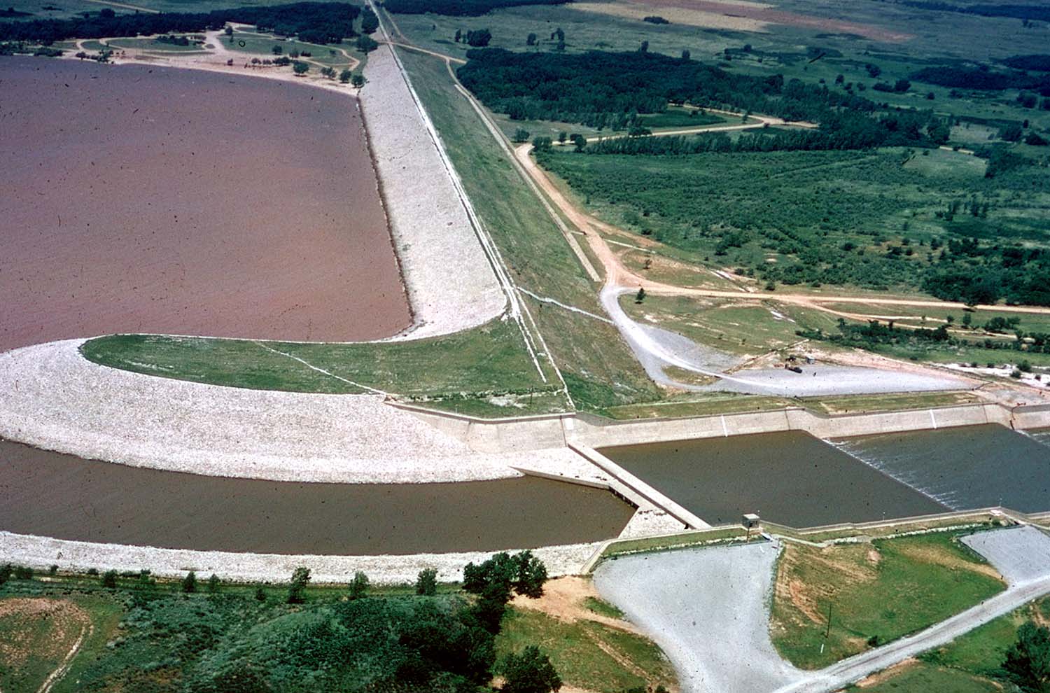
Great Salt Plains Lake is a reservoir located within the Salt Plains National Wildlife Refuge in Alfalfa County, Oklahoma in the United States named because of the salt flats in the area and for the Salt Fork Arkansas River, which is dammed to form the lake. It is notable for the variety of birds that are attracted to Ralstin Island (not open to the public) and also for the selenite crystals that can be collected along the shoreline. Recent droughts, most notably that of 2011, have had an adverse effect on the future of the lake. Physical description A study made in 1931 for the United States Army Corps of Engineers proposed building a flood control dam in the Great Salt Plains area. Congress authorized its construction in 1936. Design studies began in 1937 and the Corps broke ground for construction in September 1938. The dam was completed in July 1941, with a water capacity of . The lake covers and has of shoreline. The average depth is . The saline content is reportedly one-fo ... [...More Info...] [...Related Items...] OR: [Wikipedia] [Google] [Baidu] |
Oklahoma
Oklahoma (; Choctaw language, Choctaw: ; chr, ᎣᎧᎳᎰᎹ, ''Okalahoma'' ) is a U.S. state, state in the South Central United States, South Central region of the United States, bordered by Texas on the south and west, Kansas on the north, Missouri on the northeast, Arkansas on the east, New Mexico on the west, and Colorado on the northwest. Partially in the western extreme of the Upland South, it is the List of U.S. states and territories by area, 20th-most extensive and the List of U.S. states and territories by population, 28th-most populous of the 50 United States. Its residents are known as Oklahomans and its capital and largest city is Oklahoma City. The state's name is derived from the Choctaw language, Choctaw words , 'people' and , which translates as 'red'. Oklahoma is also known informally by its List of U.S. state and territory nicknames, nickname, "Sooners, The Sooner State", in reference to the settlers who staked their claims on land before the official op ... [...More Info...] [...Related Items...] OR: [Wikipedia] [Google] [Baidu] |
Alfalfa County, Oklahoma
Alfalfa County is a county located in the U.S. state of Oklahoma. As of the 2010 census, the population was 5,642. The county seat is Cherokee. Alfalfa County was formed at statehood in 1907 from Woods County. The county is named after William H. "Alfalfa Bill" Murray, the president of the Oklahoma Constitutional Convention and ninth governor of Oklahoma. He was instrumental creating the county from the original, much larger Woods county.Dianna Everett, "Alfalfa County," ''Encyclopedia of Oklahoma History and Culture''. Accessed January 19, 2016. History Early history |
Salt Plains National Wildlife Refuge
The Salt Plains National Wildlife Refuge is part of the United States system of national wildlife refuges. It is located in Alfalfa County in northern Oklahoma, north of Jet (pop. 230), along Great Salt Plains Lake, which is formed by a dam on the Salt Fork of the Arkansas River. The refuge was established March 26, 1930, by executive order of President Herbert Hoover, and contains of protected land as habitat to about 312 species of birds and 30 species of mammals. It was designated a national natural landmark in June 1983. Refuge description The Salt Plains were a favorite hunting ground for American Indians. Bison and other game came to the area to eat the salt and the heavily wooded and well-watered area along the Salt Fork River was like an oasis in the surrounding grassland of the Great Plains. Salt Plains refuge is divided into almost equal areas of nonvegetated salt flat, open water, and vegetated land. Marshes, woods, grasslands, and croplands dot the refuge. M ... [...More Info...] [...Related Items...] OR: [Wikipedia] [Google] [Baidu] |


