|
Kaytitinga Falls
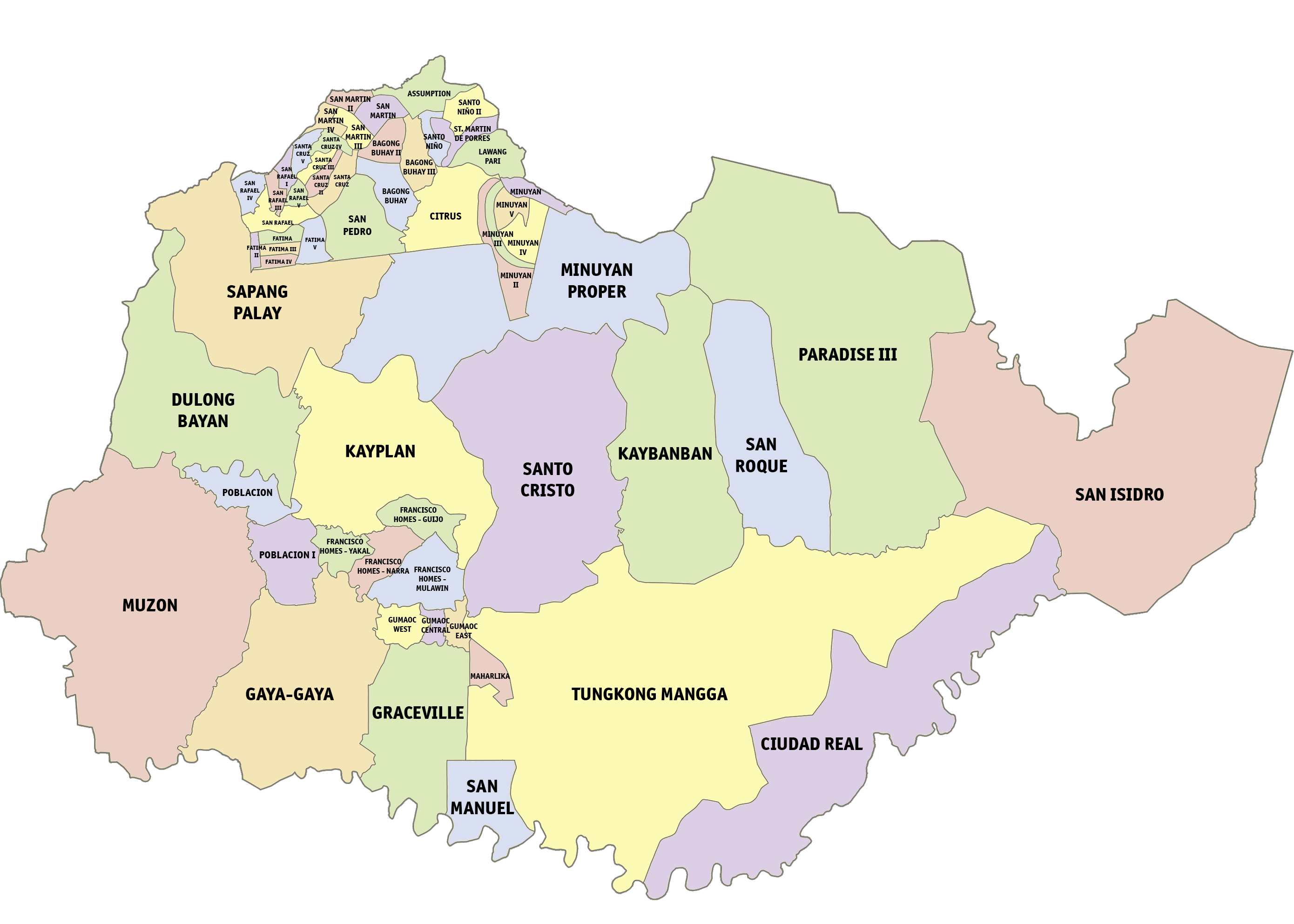
Kaytitinga Falls is located in San Jose del Monte, Bulacan, Philippines. It can be reached via 1 hour trekking. Area Profile and Description Kaytitinga Falls can be found in barangay of San Isidro. Kaytitinga falls consists of a three-level falls. Barangay San Isidro is located at the easternmost part of the city. It is a one-hour drive away from the municipal hall of the city. The forest wherein the kaytitinga falls is located is very vast and spacious and the beauty of the nature has been preserved. The forest is rich in biodiversity like different kinds of trees, plants and brooks. The way to Kaytitinga Falls is not well-developed that leads to non-accessibility of the trail. There are also no public toilets or showers in the area. Some indigenous people, the Dumagats, live in the place, a sign that the culture there is still preserved and they act as the protectors of their own natural habitat. In 2017, Congresswoman Florida Robes introduced a bill to the Philippine ... [...More Info...] [...Related Items...] OR: [Wikipedia] [Google] [Baidu] |
San Jose Del Monte
San Jose del Monte, officially the City of San Jose del Monte (abbreviated as SJDM or CSJDM; fil, Lungsod ng San Jose del Monte), is a 1st class component city in the province of Bulacan, Philippines. According to the 2020 census, it has a population of 651,813 people, making it the largest local government unit within the province of Bulacan and Central Luzon and the 18th most populated city in the Philippines. The City of San Jose del Monte, has proclaimed as a highly-urbanized city on December 4, 2020, by the virtue of Proclamation No. 1057, signed by President Rodrigo Duterte and shall take effect after the ratification in a plebiscite. Located in the southeast of the province, it is bordered by the city of Caloocan in Metro Manila to the south, by the town of Rodriguez, Rizal to the east, the towns of Santa Maria and Marilao to the west and Norzagaray to the north. The city is home to some of the biggest resettlement areas in the Philippines like the Sapang Palay rese ... [...More Info...] [...Related Items...] OR: [Wikipedia] [Google] [Baidu] |
Bulacan
Bulacan, officially the Province of Bulacan ( tl, Lalawigan ng Bulacan), is a province in the Philippines located in the Central Luzon region. Its capital is the city of Malolos. Bulacan was established on August 15, 1578, and part of the Metro Luzon Urban Beltway Super Region. It has 569 barangays in 20 municipalities and four component cities (Baliuag, Malolos the provincial capital, Meycauayan, and San Jose del Monte). Bulacan is located immediately north of Metro Manila. Bordering Bulacan are the provinces of Pampanga to the west, Nueva Ecija to the north, Aurora and Quezon to the east, and Metro Manila and Rizal to the south. Bulacan also lies on the north-eastern shore of Manila Bay. In the 2020 census, Bulacan had a population of 3,708,890 people, the most populous in Central Luzon and the third most populous in the Philippines, after Cebu and Cavite. Bulacan's most populated city is San Jose del Monte, the most populated municipality is Santa Maria while the least po ... [...More Info...] [...Related Items...] OR: [Wikipedia] [Google] [Baidu] |
Philippines
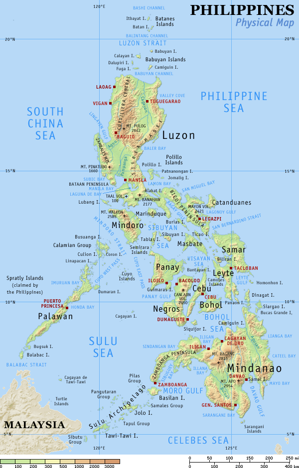
The Philippines (; fil, Pilipinas, links=no), officially the Republic of the Philippines ( fil, Republika ng Pilipinas, links=no), * bik, Republika kan Filipinas * ceb, Republika sa Pilipinas * cbk, República de Filipinas * hil, Republika sang Filipinas * ibg, Republika nat Filipinas * ilo, Republika ti Filipinas * ivv, Republika nu Filipinas * pam, Republika ning Filipinas * krj, Republika kang Pilipinas * mdh, Republika nu Pilipinas * mrw, Republika a Pilipinas * pag, Republika na Filipinas * xsb, Republika nin Pilipinas * sgd, Republika nan Pilipinas * tgl, Republika ng Pilipinas * tsg, Republika sin Pilipinas * war, Republika han Pilipinas * yka, Republika si Pilipinas In the recognized optional languages of the Philippines: * es, República de las Filipinas * ar, جمهورية الفلبين, Jumhūriyyat al-Filibbīn is an archipelagic country in Southeast Asia. It is situated in the western Pacific Ocean and consists of around 7,641 islands t ... [...More Info...] [...Related Items...] OR: [Wikipedia] [Google] [Baidu] |
Forest
A forest is an area of land dominated by trees. Hundreds of definitions of forest are used throughout the world, incorporating factors such as tree density, tree height, land use, legal standing, and ecological function. The United Nations' Food and Agriculture Organization (FAO) defines a forest as, "Land spanning more than 0.5 hectares with trees higher than 5 meters and a canopy cover of more than 10 percent, or trees able to reach these thresholds ''in situ''. It does not include land that is predominantly under agricultural or urban use." Using this definition, '' Global Forest Resources Assessment 2020'' (FRA 2020) found that forests covered , or approximately 31 percent of the world's land area in 2020. Forests are the predominant terrestrial ecosystem of Earth, and are found around the globe. More than half of the world's forests are found in only five countries (Brazil, Canada, China, Russia, and the United States). The largest share of forests (45 percent) are in th ... [...More Info...] [...Related Items...] OR: [Wikipedia] [Google] [Baidu] |
Biodiversity
Biodiversity or biological diversity is the variety and variability of life on Earth. Biodiversity is a measure of variation at the genetic (''genetic variability''), species (''species diversity''), and ecosystem (''ecosystem diversity'') level. Biodiversity is not distributed evenly on Earth; it is usually greater in the tropics as a result of the warm climate and high primary productivity in the region near the equator. Tropical forest ecosystems cover less than 10% of earth's surface and contain about 90% of the world's species. Marine biodiversity is usually higher along coasts in the Western Pacific, where sea surface temperature is highest, and in the mid-latitudinal band in all oceans. There are latitudinal gradients in species diversity. Biodiversity generally tends to cluster in hotspots, and has been increasing through time, but will be likely to slow in the future as a primary result of deforestation. It encompasses the evolutionary, ecological, and cultural ... [...More Info...] [...Related Items...] OR: [Wikipedia] [Google] [Baidu] |
Indigenous People
Indigenous peoples are culturally distinct ethnic groups whose members are directly descended from the earliest known inhabitants of a particular geographic region and, to some extent, maintain the language and culture of those original peoples. The term ''Indigenous'' was first, in its modern context, used by Europeans, who used it to differentiate the Indigenous peoples of the Americas from the Europeans, European settlers of the Americas and from the African diaspora, Sub-Saharan Africans who were brought to the Americas as Slavery, enslaved people. The term may have first been used in this context by Thomas Browne, Sir Thomas Browne in 1646, who stated "and although in many parts thereof there be at present swarms of ''Negroes'' serving under the ''Spaniard'', yet were they all transported from ''Africa'', since the discovery of ''Columbus''; and are not indigenous or proper natives of ''America''." Peoples are usually described as "Indigenous" when they maintain traditions ... [...More Info...] [...Related Items...] OR: [Wikipedia] [Google] [Baidu] |
Dumagat People
Dumagat literally means "sea-faring" or "from the sea" in Philippine languages. Dumagat may also refer to: Ethnic groups * Dumagat people (also spelled Dumaget), a subgroup of Aeta people in Luzon, Philippines *Dumagat ("sea people"), an informal term for the coastal Visayan people in Mindanao to contrast them from inland Lumad people. the Agta in the provinces of Rizal, Bulacan, Nueva Ecija, Quezon, Aurora, Nueva Vizcaya, Isabela, Cagayan, Abra, Camarines Norte, and Camarines Sur have called themselves “Agta,” which means “human” in their native language (Ancestral Domain 2014, 3; Bennagen 1977, 35). Languages *Umiray Dumaget language Umiray Dumaget Agta is an Aeta language spoken in southern Luzon Island, Philippines. Location Umiray Dumaget is spoken along the Pacific coast of eastern Luzon, Philippines from just south of Baler, Aurora to the area of Infanta, Quezon, and ... * Remontado Dumagat language * Casiguran Dumagat language See also * Dinagat (disamb ... [...More Info...] [...Related Items...] OR: [Wikipedia] [Google] [Baidu] |
Philippine House Of Representatives
The House of Representatives of the Philippines ( fil, Kapulungan ng mga Kinatawan ng Pilipinas, italic=unset, ''Kamara'' or ''Kamara de Representantes'' from the Spanish language, Spanish word ''cámara'', meaning "chamber") is the lower house of Congress of the Philippines, Congress, the bicameral legislature of the Philippines, with the Senate of the Philippines as the upper house. The lower house is usually called Congress, although the term collectively refers to both houses. Members of the House are officially styled as ''representative'' (''kinatawan'') and sometimes informally called ''congressmen'' or ''congresswomen'' (''mga kongresista'') and are elected to a three-year term. They can be re-elected, but cannot serve more than three consecutive terms except with an interruption of one term like the senate. Around eighty percent of congressmen are district representatives, representing a particular geographical area. The 19th Congress has 253 Congressional districts of ... [...More Info...] [...Related Items...] OR: [Wikipedia] [Google] [Baidu] |
List Of Protected Areas Of The Philippines
This is a list of protected areas of the Philippines administered by the Department of Environment and Natural Resources (DENR)'s Biodiversity Management Bureau under the National Integrated Protected Areas System (NIPAS) Act of 1992. As of 2020, there are 244 protected areas in the Philippines covering a total area of about – 15.4% of the Philippines' total area. History The first important legislation that formed the basis of the current system of national parks and protected areas in the Philippines is Act No. 648, enacted in 1903 by the Philippine Commission. This act authorized the civil governor to "reserve for civil public purposes, and from sale or settlement, any part of the public domain not appropriated by law for special public purposes." A total of eight national reserves had been established on July 26, 1904, pursuant to this law. These are the Lamao Forest Reserve in Bataan, Mariquina Reserve in Rizal, Angat River Reserve in Bulacan, Caliraya Falls Reserv ... [...More Info...] [...Related Items...] OR: [Wikipedia] [Google] [Baidu] |
Waterfalls Of The Philippines
A waterfall is a point in a river or stream where water flows over a vertical drop or a series of steep drops. Waterfalls also occur where meltwater drops over the edge of a tabular iceberg or ice shelf. Waterfalls can be formed in several ways, but the most common method of formation is that a river courses over a top layer of resistant bedrock before falling on to softer rock, which erodes faster, leading to an increasingly high fall. Waterfalls have been studied for their impact on species living in and around them. Humans have had a distinct relationship with waterfalls for years, travelling to see them, exploring and naming them. They can present formidable barriers to navigation along rivers. Waterfalls are religious sites in many cultures. Since the 18th century they have received increased attention as tourist destinations, sources of hydropower, andparticularly since the mid-20th centuryas subjects of research. Definition and terminology A waterfall is generally d ... [...More Info...] [...Related Items...] OR: [Wikipedia] [Google] [Baidu] |
Landforms Of Bulacan
A landform is a natural or anthropogenic land feature on the solid surface of the Earth or other planetary body. Landforms together make up a given terrain, and their arrangement in the landscape is known as topography. Landforms include hills, mountains, canyons, and valleys, as well as shoreline features such as bays, peninsulas, and seas, including submerged features such as mid-ocean ridges, volcanoes, and the great ocean basins. Physical characteristics Landforms are categorized by characteristic physical attributes such as elevation, slope, orientation, stratification, rock exposure and soil type. Gross physical features or landforms include intuitive elements such as berms, mounds, hills, ridges, cliffs, valleys, rivers, peninsulas, volcanoes, and numerous other structural and size-scaled (e.g. ponds vs. lakes, hills vs. mountains) elements including various kinds of inland and oceanic waterbodies and sub-surface features. Mountains, hills, plateaux, and plains are the fou ... [...More Info...] [...Related Items...] OR: [Wikipedia] [Google] [Baidu] |


.jpg)