|
Kayonza (district)
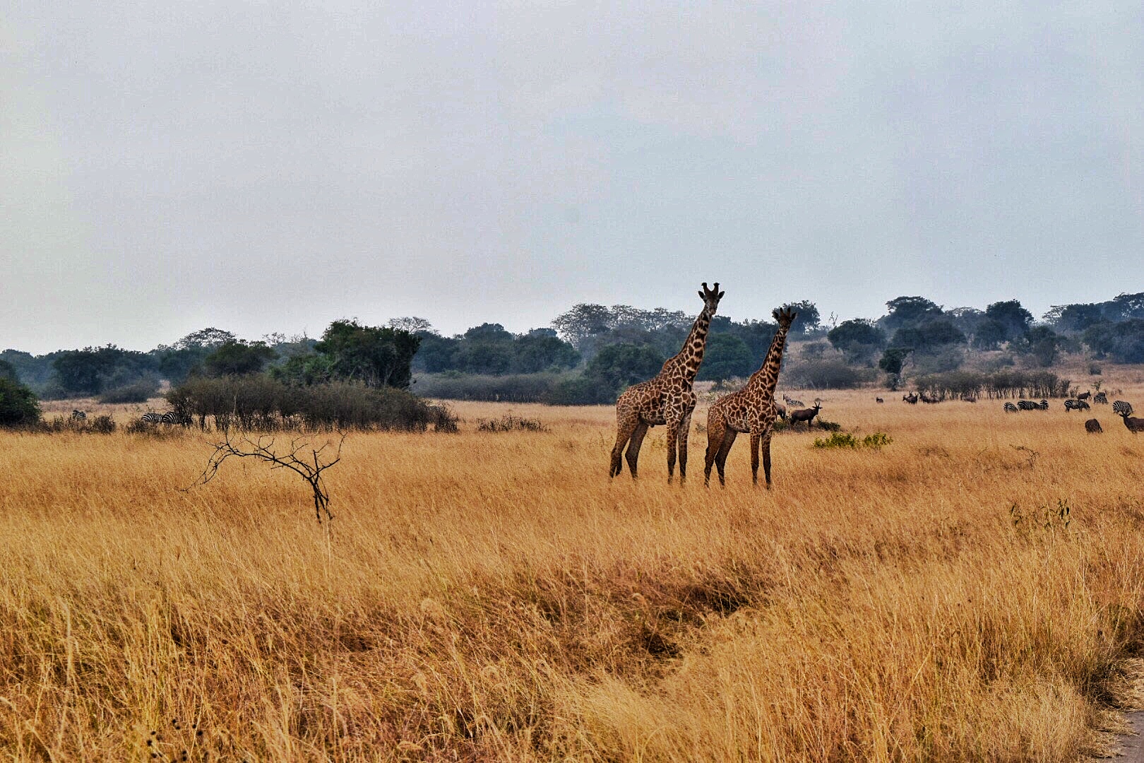
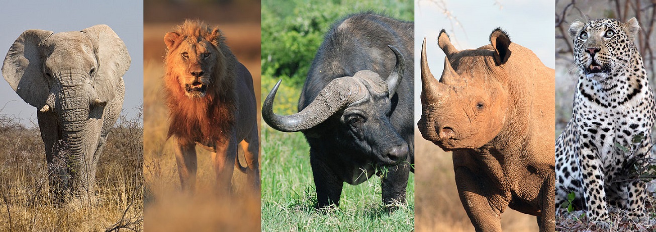
Kayonza is a district (''akarere'') located in Eastern Province, Rwanda. Its capital is Mukarange.The population of Kayonza District is projected to 344,157 people in 2012, living in 12 sectors (''imirenge''): Gahini, Kabare, Kabarondo, Mukarange, Murama, Murundi, Mwiri, Ndego, Nyamirama, Rukara, Ruramira and Rwinkwavu., and 50 cells and 421 Villages (Imidugudu). Akagera National Park Kayonza is the home of Akagera National Park Akagera National Park is a protected area in eastern Rwanda covering along the international border with Tanzania. It was founded in 1934 and includes savannah, montane and swamp habitats. The park is named for the Kagera River which flows alo ..., a popular tourist destination for safaris. Since the import of 7 lions in 2015, from the Phinda Game Reserve and Tembe Elephant Park, in South Africa, Akagera is home to all of the ' Big Five' animals. As of 2019, there are around 25 lions. Banks * KCB BANK RWANDA LTD Kayonza Branch * BANK OF KIGA ... [...More Info...] [...Related Items...] OR: [Wikipedia] [Google] [Baidu] |
District
A district is a type of administrative division that, in some countries, is managed by the local government. Across the world, areas known as "districts" vary greatly in size, spanning regions or counties, several municipalities, subdivisions of municipalities, school district, or political district. By country/region Afghanistan In Afghanistan, a district (Persian ps, ولسوالۍ ) is a subdivision of a province. There are almost 400 districts in the country. Australia Electoral districts are used in state elections. Districts were also used in several states as cadastral units for land titles. Some were used as squatting districts. New South Wales had several different types of districts used in the 21st century. Austria In Austria, the word is used with different meanings in three different contexts: * Some of the tasks of the administrative branch of the national and regional governments are fulfilled by the 95 district administrative offices (). The area a dis ... [...More Info...] [...Related Items...] OR: [Wikipedia] [Google] [Baidu] |
Rwanda
Rwanda (; rw, u Rwanda ), officially the Republic of Rwanda, is a landlocked country in the Great Rift Valley of Central Africa, where the African Great Lakes region and Southeast Africa converge. Located a few degrees south of the Equator, Rwanda is bordered by Uganda, Tanzania, Burundi, and the Democratic Republic of the Congo. It is highly elevated, giving it the soubriquet "land of a thousand hills", with its geography dominated by mountains in the west and savanna to the southeast, with numerous lakes throughout the country. The climate is temperate to subtropical, with two rainy seasons and two dry seasons each year. Rwanda has a population of over 12.6 million living on of land, and is the most densely populated mainland African country; among countries larger than 10,000 km2, it is the fifth most densely populated country in the world. One million people live in the Capital city, capital and largest city Kigali. Hunter-gatherers settled the territory in the St ... [...More Info...] [...Related Items...] OR: [Wikipedia] [Google] [Baidu] |
Eastern Province, Rwanda
Eastern Province ( rw, Intara y'Iburasirazuba; french: Province de l'Est; nl, Oostelijke Provincie) is the largest, the most populous and the least densely populated of Rwanda's five provinces. It was created in early January 2006 as part of a government decentralization program that re-organized the country's local government structures. It has seven districts: Bugesera, Gatsibo, Kayonza, Ngoma, Kirehe, Nyagatare and Rwamagana. The capital city of the Eastern Province is Rwamagana. The Eastern Province comprises the former provinces of Kibungo and Umutara, most of Kigali Rural, and part of Byumba. The Akagera National Park is situated is this province. History It is not known when the territory of present day Rwanda was first inhabited, but it is thought that humans moved into the area following the last ice age either in the Neolithic period, around ten thousand years ago, or in the long humid period which followed, up to around 3000 BC.Briggs and Booth 2006 p6 A ... [...More Info...] [...Related Items...] OR: [Wikipedia] [Google] [Baidu] |
Sectors Of Rwanda
Sectors (Kinyarwanda: ''Imirenge'', sing. ''umurenge'', French: ''Secteurs'') are the third level administrative subdivision in Rwanda. The Provinces of Rwanda are subdivided into 30 district A district is a type of administrative division that, in some countries, is managed by the local government. Across the world, areas known as "districts" vary greatly in size, spanning regions or counties, several municipalities, subdivisions o ...s (Rwanda: ''uturere'', sing. ''akarere''). Each district is in turn divided into sectors. There are 416 Sectors. This entire administrative structure is undergoing a process of decentralisation – devolving greater authority to local governments and municipalities – following an administrative reorganisation begun in 2002. Ministry of Local Government, Government of Rwanda, ... [...More Info...] [...Related Items...] OR: [Wikipedia] [Google] [Baidu] |
Gahini
Gahini is a village and sector in Kayonza District, Eastern Province, Rwanda. It is situated on a hill, at an altitude of 1,520 metres (4,990 ft) above sea-level, close to the eastern edge of Lake Muhazi and by road from the capital, Kigali. The village is the centre of one of the nine dioceses of the Eglise Episcopale au Rwanda, the Anglican church of Rwanda, and one of the four Rwandan sites chosen by the Church Missionary Society, who built a large mission, hospital and schools in the village. History Little is known of Gahini in pre-colonial times, but under German and Belgian rule the village became an important transport junctionKatharine Makower (1999) ''The Coming of the Rain'', p. 56. Paternoster Press. linking the lake with the north-south and eastbound roads. From 1922 the area was temporarily under British control as part of the surveying process for the proposed Cape-Cairo railway, which enabled Doctors Leonard Sharp and Zoe Stanley Smith of the Church ... [...More Info...] [...Related Items...] OR: [Wikipedia] [Google] [Baidu] |
Kabarondo
Kabarondo is a town in the Republic of Rwanda. Location Kabarondo is located in Kayonza District, Eastern Province. It is in the southeastern part of Rwanda, along the main road (RN3) from Kigali in Rwanda, to Nyakasanza, in Tanzania. Kabarondo is approximately by road southeast of Kigali, the capital and largest city of Rwanda. The coordinates of Kabarondo are:2°00'38.0"S, 30°33'27.0"E (Latitude:-2.010556; Longitude:30.557500). Points of interest The following points of interest are found in or near Kabarondo: * Offices of Kabarondo Town Council * Kabarondo Central Market * Kabarondo Boys Centre - Established in 2010 by the Streets Ahead Children's Centre Association and the Property Professionals Breakfast Club SACCA. * Kabarondo Vocational Training Centre * Kabarondo Taxi Park See also * List of banks in Rwanda This is a list of banks in Rwanda ; Commercial banks # Guaranty Trust Bank (Rwanda) plc - commonly referred to as GTBank Rwanda #Bank of Kigali # I&M Bank ( ... [...More Info...] [...Related Items...] OR: [Wikipedia] [Google] [Baidu] |
Akagera National Park
Akagera National Park is a protected area in eastern Rwanda covering along the international border with Tanzania. It was founded in 1934 and includes savannah, montane and swamp habitats. The park is named for the Kagera River which flows along its eastern boundary feeding into Lake Ihema and several smaller lakes. The complex system of lakes and linking papyrus swamps makes up over a third of the park, which is the largest protected wetland in Eastern-Central Africa. History Akagera National Park was founded in 1934 by the Belgian government, which at the time occupied Rwanda. The park was large and was known for its biodiversity. Akagera used to have a large population of African wild dogs. At one point, it was known as the 'Parc aux Lycaons' and wild dogs were so abundant, that the Belgian government considered them a pest. However, a disease epidemic diminished the population and the last wild dogs were seen in 1984.Vande weghe, Jean Pierre: ''Akagera: Land of water, gr ... [...More Info...] [...Related Items...] OR: [Wikipedia] [Google] [Baidu] |
Big Five Game
In Africa, the Big Five game animals are the lion, leopard, black rhinoceros, African bush elephant, and African buffalo. They are examples of charismatic megafauna, featuring prominently in popular culture, and are among the most famous of Africa's large animals. The term was coined by big-game hunters, and refers to the five most difficult animals in Africa to hunt on foot but is now more widely used by game viewing tourists and safari tour operators. The 1990 and later releases of South African rand banknotes feature a different big-five animal on each denomination. Countries where all can be found include Angola, Botswana, Zambia, Uganda, Namibia, South Africa, Kenya, Tanzania, Zimbabwe, Mozambique, Eswatini, the Democratic Republic of the Congo, Rwanda and Malawi. Species Elephant The African bush elephant (''Loxodonta africana'') and African forest elephant (''Loxodonta cyclotis'') are the largest land-based animals. Elephants are herbivores with thick, almost hairles ... [...More Info...] [...Related Items...] OR: [Wikipedia] [Google] [Baidu] |


