|
Karnal District
Karnal district is one of the 22 districts of Haryana state in North India which constitutes the National Capital Region (NCR) of the country. The city of Karnal is a part of the National Capital Region (NCR) and is the administrative headquarters of the district. As it lies on National highway 44 (old NH-1), it has a well connected transport system to the nearby major cities like Delhi and Chandigarh. Karnal District is also well connected via railways. Karnal Junction lies on Delhi-Kalka line and major trains stops at this station. The district headquarter also has a small aerodrome known as karnal airport. Sub-Divisions The Karnal district is headed by an IAS officer of the rank of Deputy Commissioner (DC) who is the chief executive officer of the district. The district is divided into 4 sub-divisions, each headed by a Sub-Divisional Magistrate (SDM): Karnal, Indri, Assandh and Gharaunda. Revenue tehsils The above 4 sub-divisions are divided into 5 revenue tehsils, n ... [...More Info...] [...Related Items...] OR: [Wikipedia] [Google] [Baidu] |
List Of Districts Of Haryana
Haryana, with 22 districts, is a States and territories of India, state in the North India, northern region of India and is the nation's List of states and union territories of India by population, eighteenth most populous. The state borders with Punjab (India), Punjab and Himachal Pradesh to the north and Rajasthan to the west and south. The river Yamuna defines its eastern border with Uttar Pradesh. Haryana also surrounds Delhi on three sides, forming the northern, western and southern borders of Delhi. Consequently, a large area of Haryana is included in the National Capital Region (India), National Capital Region. Chandigarh is the capital of Punjab and Haryana jointly. History On 1 November 1966 Haryana was constituted as a separate state with seven districts, according to the partition plan of the then East Punjab. The seven districts were Rohtak, Jind, Hisar (city), Hisar, Mahendragarh, Gurgaon, Karnal, Ambala. The partition was based on the linguistic demographics and w ... [...More Info...] [...Related Items...] OR: [Wikipedia] [Google] [Baidu] |
Karnal (Lok Sabha Constituency)
Karnal Lok Sabha constituency, in Karnal district, is one of the 10 Lok Sabha (parliamentary) constituencies in Haryana state in northern India. Assembly segments At present, Karnal Lok Sabha constituency comprises Nine Vidhan Sabha (legislative assembly) constituencies. These are: Members of Parliament ^ by-poll Election Results See also * Karnal district * Panipat district * List of Constituencies of the Lok Sabha The Lok Sabha, the lower house of the Parliament of India, is made up of Members of Parliament ( MPs). Each MP, represents a single geographic constituency. There are currently 543 constituencies while maximum seats will fill up to 550 (after ar ... References {{coord, 29.7, 77.0, display=title Lok Sabha constituencies in Haryana Karnal district ... [...More Info...] [...Related Items...] OR: [Wikipedia] [Google] [Baidu] |
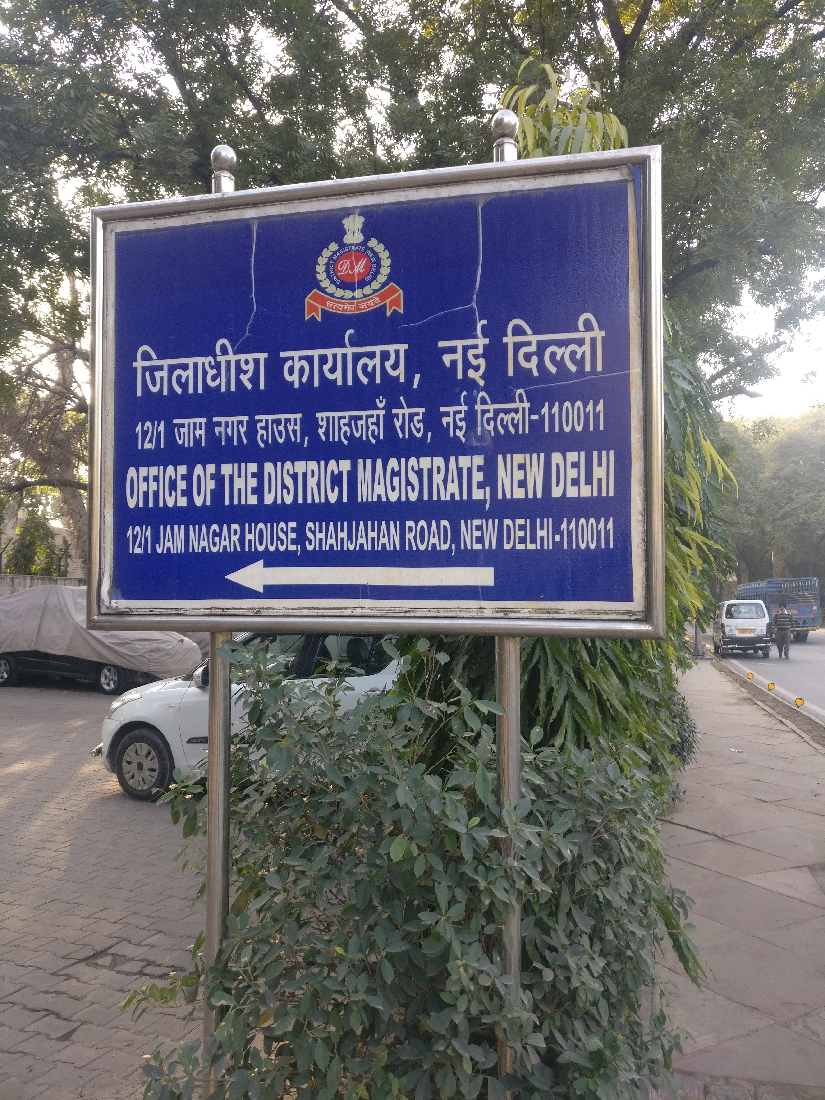
District Magistrate
A District Collector-cum-District Magistrate (also known as Deputy Commissioner in some states) is an All India Service officer of the Indian Administrative Service (IAS) cadre who is responsible for ''land revenue collection'', ''canal revenue collection'' and ''law & order maintenance'' of a ''District''. ''District Collector (DC) cum District Magistrate (DM)'' come under the general supervision of divisional commissioners wherever the latter post exists. India has 748 districts as of 2021. History The current district administration in India is a legacy of the British Raj, with the ''Collector cum District Magistrate'' being the chief administrative officer of the District. Warren Hastings introduced the office of the District Collector in the Judicial Plan of 1772. By the Judicial Plan of 1774 the office of the Collector cum District Magistrate was temporarily renamed Diwan. The name, Collector, derived from their being head of the revenue organization (tax collec ... [...More Info...] [...Related Items...] OR: [Wikipedia] [Google] [Baidu] |
Karnal Airport
Karnal Aerodrome is being operated as a pilot training institute owned and operated by Haryana Institute of Civil Aviation (HICA) under guidance of Civil Aviation Department, Government of Haryana. The flying school is spread over an area of 104 acres and is situated about 3 km east of Karnal in the state of Haryana, India. Karnal Flying Club was established in the year 1967 by the Civil Aviation Department of Haryana and is one of the bases of Haryana Institute of Civil Aviation (HICA). Other than this, the airfield is often used by Haryana Government as well as VIP charter aircraft and helicopters. History In 1948, first airstrip was built in Haryana when Ambala Air Force Station was established. In 1967, Karnal Air Strip was set up. The Karnal Flying Club has been running at this airfield since 1967 year . In 2012, The (DGCA) approved the Haryana state government's plans to develop the Airport to operate Domestic Passenger Services in August 2013. Karnal Aerodrom ... [...More Info...] [...Related Items...] OR: [Wikipedia] [Google] [Baidu] |
Delhi–Kalka Line
The Delhi–Kalka line is a railway line connecting Delhi and . It connects to the UNESCO World Heritage Site Kalka–Shimla Railway. History The Delhi–Panipat–Ambala–Kalka line was opened in 1891. The -wide narrow-gauge Kalka–Shimla Railway was constructed by Delhi–Panipat–Ambala–Kalka Railway Company and opened for traffic in 1903. In 1905 the line was regauged to -wide narrow gauge. Electrification Sabjimandi (Delhi)–Panipat–Karnal sector was electrified in 1992–1995, Karnal–Kurukshetra sector in 1995–96, Kurukshetra–Ambala in 1996–98, Ambala–Chandigarh in 1998–99 and Chandigarh–Kalka in 1999–2000. Loco sheds Ambala has a diesel loco shed for minor maintenance of WDS-4 shunters. The locos are sent to Shakurbasti for major maintenance or repairs. Kalka has a narrow-gauge diesel shed for the maintenance of ZDM-3 and ZDM-5 narrow-gauge diesel locos. Speed limits The Delhi–Panipat–Ambala–Kalka line is classified as a ‘Group B� ... [...More Info...] [...Related Items...] OR: [Wikipedia] [Google] [Baidu] |
Karnal Railway Station
Karnal railway station (station code: KUN), at an altitude of above mean sea level, is a class "A" station on Delhi–Kalka line, located in Karnal district of Haryana state of India. Built in 1892 by the British Raj, it is one of the oldest stations in India which also holds the title of country's National Heritage Site. It is under Delhi railway division (DRD) of Northern Railway zone (NR) of the Indian Railways (IR). History In 1891, the Delhi–Panipat–Ambala–Kalka line was opened. In 1892, Karnal station was built during the British Raj. From 1800 to 1845, Karnal was a British cantonment. The vintage historical Karnal railway station is located on the DUK route. Future projects In July 2021, the union government approved the Karnal-Yamunanagar line. After the construction of this new rail line, Karnal railway station will become a railway junction via new Greenfield Karnal–Yamuna Nagar railway line via Indri, Ladwa, Radaur, Daamla, Jagadhari Workshop railway s ... [...More Info...] [...Related Items...] OR: [Wikipedia] [Google] [Baidu] |
Chandigarh
Chandigarh () is a planned city in India. Chandigarh is bordered by the state of Punjab to the west and the south, and by the state of Haryana to the east. It constitutes the bulk of the Chandigarh Capital Region or Greater Chandigarh, which also includes the adjacent Satellite city, satellite cities of Panchkula and Mohali. It is located 260 km (162 miles) north of New Delhi and 229 km (143 miles) southeast of Amritsar. Chandigarh is one of the earliest planned cities in post-independence India and is internationally known for its architecture and urban design. The master plan of the city was prepared by Swiss-French architect Le Corbusier, which built upon earlier plans created by the Polish architect Maciej Nowicki (architect), Maciej Nowicki and the American planner Albert Mayer (planner), Albert Mayer. Most of the government buildings and housing in the city were designed by a team headed by Le Corbusier, Jane Drew and Maxwell Fry. Chandigarh's Chandigarh Capitol ... [...More Info...] [...Related Items...] OR: [Wikipedia] [Google] [Baidu] |
Delhi
Delhi, officially the National Capital Territory (NCT) of Delhi, is a city and a union territory of India containing New Delhi, the capital of India. Straddling the Yamuna river, primarily its western or right bank, Delhi shares borders with the state of Uttar Pradesh in the east and with the state of Haryana in the remaining directions. The NCT covers an area of . According to the 2011 census, Delhi's city proper population was over 11 million, while the NCT's population was about 16.8 million. Delhi's urban agglomeration, which includes the satellite cities of Ghaziabad, Faridabad, Gurgaon and Noida in an area known as the National Capital Region (NCR), has an estimated population of over 28 million, making it the largest metropolitan area in India and the second-largest in the world (after Tokyo). The topography of the medieval fort Purana Qila on the banks of the river Yamuna matches the literary description of the citadel Indraprastha in the Sanskrit ... [...More Info...] [...Related Items...] OR: [Wikipedia] [Google] [Baidu] |
National Highway 44 (India)
National Highway 44 (NH 44) is a major north–south National Highway in India and is the longest in the country. It passes through the Union Territory of Jammu and Kashmir, in addition to the states of Punjab, Haryana, Delhi, Uttar Pradesh, Rajasthan, Madhya Pradesh, Maharashtra, Telangana, Andhra Pradesh, Karnataka, and Tamil Nadu. It came into being by merging seven national highways, in full or part, starting with the Jammu-Srinagar National Highway (former NH 1A) from Srinagar in Jammu and Kashmir, former NH 1 in Punjab and Haryana ending at Delhi, part of former NH 2 starting from Delhi and ending at Agra, former NH 3 (popularly known as Agra-Bombay National Highway) from Agra to Gwalior, former NH 75 and former NH 26 to Jhansi, and former NH 7 via Lakhnadon, Seoni, Nagpur, Hinganghat, Adilabad, Nirmal, Hyderabad, Kurnool, Anantapur,Chikkaballapur, Bangalore, Hosur, Krishnagiri, Dharmapuri, Salem, Namakkal, Karur, Dindigul, Madurai, Virudhunagar and Tirunelve ... [...More Info...] [...Related Items...] OR: [Wikipedia] [Google] [Baidu] |
National Capital Region (India)
The National Capital Region (NCR) is a planning region centred upon the National Capital Territory (NCT) of Delhi in India. It encompasses Delhi and several districts surrounding it from the states of Haryana, Uttar Pradesh and Rajasthan. The NCR and the associated National Capital Region Planning Board (NCRPB) were created in 1985 to plan the development of the region and to evolve ''harmonized policies for the control of land-uses and development of infrastructure'' in the region. Prominent cities of NCR include Delhi, Faridabad, Ghaziabad, Gurugram, and Noida. The NCR is a ''rural-urban'' region, with a population of over 46,069,000 and an urbanisation level of 62.6%. As well as the cities and towns, the NCR contains ecologically sensitive areas like the Aravalli ridge, forests, wildlife and bird sanctuaries. The Delhi Extended Urban Agglomeration, a part of the NCR, had an estimated GDP of $370 billion (measured in terms of GDP PPP) in 2015–16. History The National Cap ... [...More Info...] [...Related Items...] OR: [Wikipedia] [Google] [Baidu] |
North India
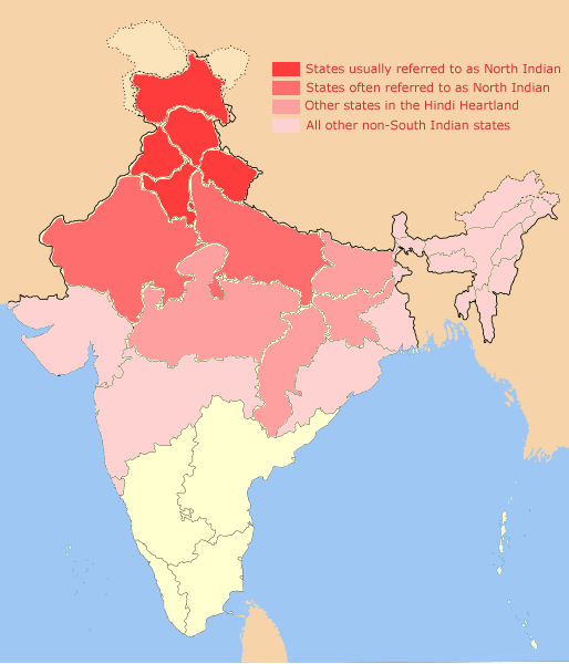
North India is a loosely defined region consisting of the northern part of India. The dominant geographical features of North India are the Indo-Gangetic Plain and the Himalayas, which demarcate the region from the Tibetan Plateau and Central Asia. The term North India has varying definitions. The Ministry of Home Affairs in its Northern Zonal Council Administrative division included the states of Haryana, Himachal Pradesh, Punjab and Rajasthan and Union Territories of Chandigarh, Delhi, Jammu and Kashmir and Ladakh. The Ministry of Culture in its ''North Culture Zone'' includes the state of Uttarakhand but excludes Delhi whereas the Geological Survey of India includes Uttar Pradesh and Delhi but excludes Rajasthan and Chandigarh. Other states sometimes included are Bihar, Gujarat, Jharkhand, Madhya Pradesh and West Bengal. North India has been the historical centre of the Mughal Empire, the Delhi Sultanate and the British Indian Empire. It has a diverse culture, and includ ... [...More Info...] [...Related Items...] OR: [Wikipedia] [Google] [Baidu] |


